WVclimo
-
Posts
5,480 -
Joined
-
Last visited
Content Type
Profiles
Blogs
Forums
American Weather
Media Demo
Store
Gallery
Everything posted by WVclimo
-
My yard hit 90 also. Way too early for this.
-
Pouring big snowflakes and windy. 36 degrees and falling fast.
- 1,093 replies
-
- 5
-

-
- severe
- thunderstorms
- (and 1 more)
-
Heavy downpour. No wind or thunder. Looks like the severe stuff is just to the southeast of me with those warned cells.
-
Changeover happening here. Sleet and some snowflakes mixing in.
-
30 degree drop in 4 hours. Now 42 with rain and wind.
-
That is just the perfect end to a season of suck here.
-
66 in Oakland. 46 in Hagerstown.
-
Had some heavy rain in the last hour. Now getting thunder and lightning with the next batch about to move in.
-
I was living in the metro area then, but this area had a 20" season. I haven't approached that total for the past 5 winters. So, bring it !
-
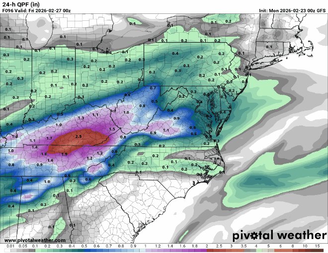
12/2 - 0.7” 12/14- 0.4” 1/1 - 0.3” 1/18- 0.1” 1/25- 8.5" 2/6- 0.1" 2/7- 0.2" 2/22- 0.7" 3/2- 0.5" total- 11.5"
-
Outta gas and Outta Time: Early March Winter Storm finale
WVclimo replied to Ji's topic in Mid Atlantic
0.5" here. 9th measurable snowfall of the winter, and the 8th one below 1 inch. -
Outta gas and Outta Time: Early March Winter Storm finale
WVclimo replied to Ji's topic in Mid Atlantic
Finally getting a few flakes. 30 degrees. -
Outta gas and Outta Time: Early March Winter Storm finale
WVclimo replied to Ji's topic in Mid Atlantic
26/13 and partly cloudy. -
I'm at 11" here. Only 3 of the last 20 winters I've been in WV have had less snow than that in an entire season. I'm with you on the heating bills, but I still love the cold.
-
I think I have an idea where this is headed.
-
This has to change sometime, right ?? 2025-26: 11.0" 2024-25: 17.2” 2023-24: 15.7” 2022-23: 5.3” 2021-22: 15.2”
-
I started several varieties of peppers at the beginning of this month. Like you, I'm thinking of keeping at least some of them in pots. Also started tomatoes, and some flowers from seed. Have herbs, lettuces and onions ready to go in the ground in a few weeks. Peas right behind those. Hope we get some rain this year for a change, and not all at once.
-
Berkeley County, WV schools just announced a two-hour delay for tomorrow. Not because of the half-inch of snow we got today that didn't stick to any pavement, but because of an 8:00 p.m. update they received from NWS suggesting the possibility of a "flash freeze."
-
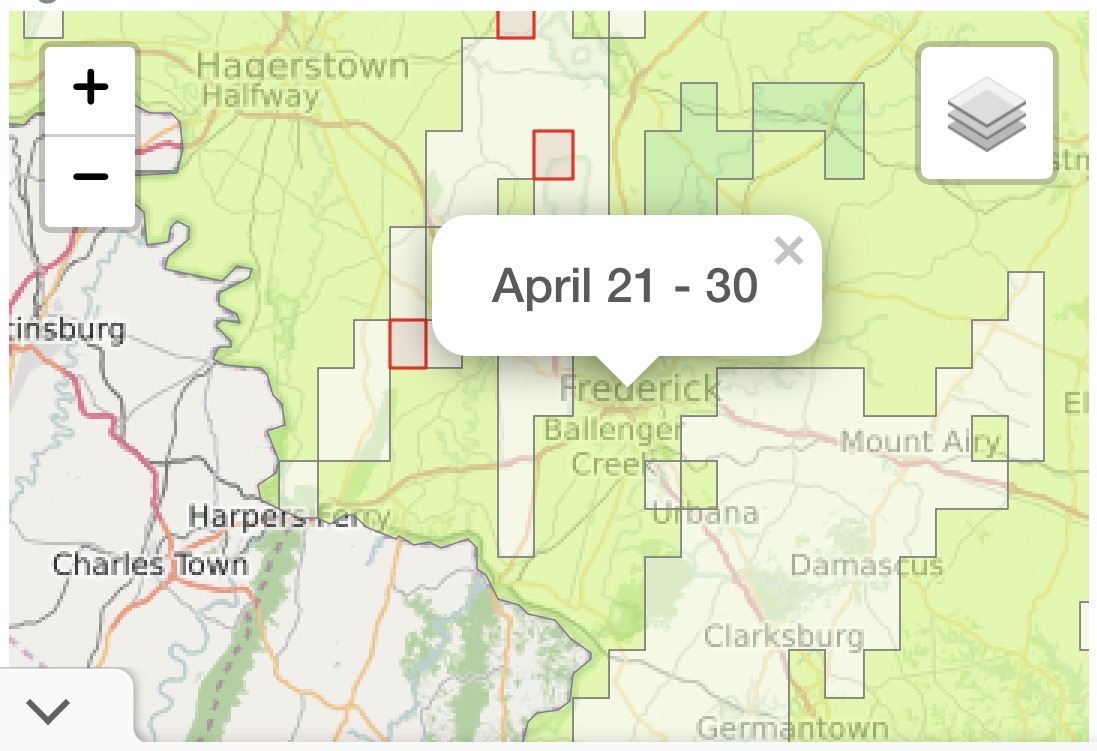
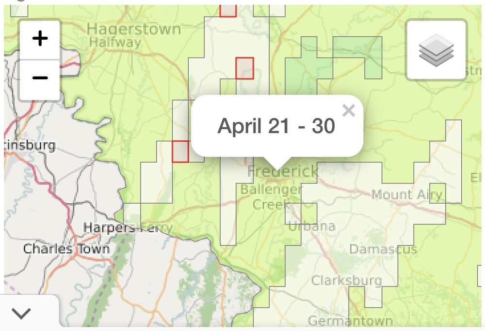
Plant Maps has the average last frost date for your area between April 21-30. I never feel safe putting peppers in the ground before May 15.
-
Winds have picked up out of the northwest and some flurries have redeveloped. My son is at a friend's house 3 miles east of here and says he has heavy snow there. That's a pretty close miss.
-
Pretty sure after today, I will have the lowest total in our subforum. 12/2 - 0.7” 12/14- 0.4” 1/1 - 0.3” 1/18- 0.1” 1/25- 8.5" 2/6- 0.1" 2/7- 0.2" 2/22- 0.7" total- 11.0"
-
Snow has ended here, just as the WSW goes into effect.. barring any back building, will finish with less than an inch.
-
Just did a six-hour sweep of the board. 0.7" which matches my second largest snowfall of the season.
-
Surprised by the temps there. I've been under a persistent band all morning, and I guess that's how I've been able to stay at 33 degrees at 500'
-
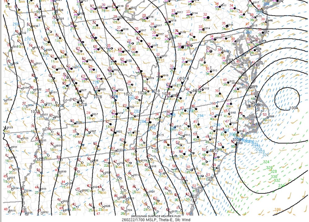
Starting to see better pressure falls off of the coast.