

Blizzwalker
-
Posts
94 -
Joined
-
Last visited
Content Type
Profiles
Blogs
Forums
American Weather
Media Demo
Store
Gallery
Everything posted by Blizzwalker
-
Probably bust -- snow mixing in last half hour just NW Middletown at 750 ft. Temp has dropped from 38 to 34 in 3 1/2 hours (Wunderground station nearby). Snow appearing a bit earlier than the 11 pm forecast by nws. We may still get 6 inches up here, which wouldn't be a bust for noaa's recent call.
-
Seeing the NW thread red, clicking on it and finding a lengthy leaf discussion ---All part of the fun of a lively (and botanically sensitive) weather forum...
-
About 2300 ft. I did saturate the blue a bit.
-
At Sams Point near Ellenville last Monday. Snow was found.
3-6-23.thumb.jpg.3be395c817d59b7e90818909da086218.jpg)
-
Snowing moderately just NW of Middletown. NOAA said flip over to snow supposed to be around 10-- flipped at about 7 PM. About 1/2 inch (?).
-
Sounds correct. Denali in winter, at 20,000 ft, gets the winds well over 100 mph, plus further north. The book "Minus 148" by Art Davidson describes the first winter ascent of Denali in 1967. Did they have accurate means of temp measurement ? -- doubtful. Was it colder than Mt Washington tonite ? Almost certainly. Art and 2 others had to stay in a snow cave they dug at 18000 ft for 3 days until 150 mph winds subsided.
-
Some get refreshed by cola, others by beer. Good to have diverse viewpoints. But there is objective predicting, then there is cheerleading against the collective sentiments of a snow enthusiast group.
-
And it had snowed for me-- not everyone is snowless.
-
It's not about accuracy of prediction -- it's about systematic bias-- in an unpopular direction.
-
You don't get it. Systematically, you deliver every possible bit of info suggesting it won't snow, while ignoring info suggesting snow. You have a far greater command of meteorology than me and I respect your knowledge. But don't expect a good reaction from a forum that looks forward to snow
-
NW Orange Drama-- In last half hour west of Middletown, surface temps must have dropped. Snow had changed from wet to fluffy, breeze has picked up, and snow sticking on streets.
-
Minisink area, west of Middletown. Good snow area (not now...). That would be areas of Slate Hill, Greenville, Waywayanda, Otisville, etc.
-
.1 inch front end thump here west of Middletown....
-
Chasing snow... 10 days ago near Blackhead Mt in Catskills.
-
Many of us on this board feel similarly. I know I feel a definite lowering of mood when it is excessively warm and snowless in winter. After all, it is a weather site and most of us look forward to winter being wintry. I wasn't always this way. I believe it is a learned behavior--- the improved technology allowing better tracking (sometimes), and beautiful graphics has combined with the aesthetics of snow and ice to weave a beguiling winter web around me. Seeing that Euro run with the right colors proves to be a dopamine saturated reward. The drama of storms also contributes. (unless like recent western NY extremes where lives are lost) In January --dry ground and 48 with no storms calls for prozac.
-
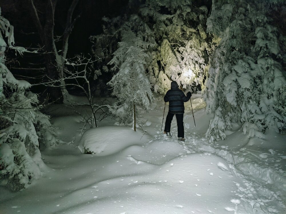
I'm going backpacking in the Catskills for 3 days tomorrow. There's going to be so much snow that even with snowshoes don't know if I will make a summit... Good antidote for this sh..t, I mean nonsense. I WILL see snow !!
-
Like everyone, was getting hopes up for 12/22. "Unreal pattern", "Perfect set-up", "Textbook KU 500", etc. Now, I feel let down-- but not as much as I used to. After decades, I'm getting better at appreciating tracking but not so invested that I'm a victim of the bipolar swings. It hurts when the mega-storm evaporates-- but let us not forget the times that even in marginal patterns we can have big events emerge rather unexpectedly....hope something comes up.
-
12/15 - 12/16 Coastal/Winter Storm & Observations
Blizzwalker replied to Northof78's topic in New York City Metro
What happened to the NAM's seeing the warm layer for the 84 corridor and points south ? I know that 10:1 maps are giving inflated numbers on the southern edge, given this setup, but same models were predicting much less in Orange co several runs ago. As others have mentioned,there seems to be a modest trend. -
Forgot about Snowpiercer. I Think a lot of people on this board would love a train thru perpetual snow. Might get a whale of a Greenland block by dimming the sun ! But what happens to the MJO ??
-
Below is interesting article on feasibility of deliberately spreading particles in the stratosphere to stop global warming. I am not an advocate of this idea, but do think it noteworthy that it's being reluctantly considered. Maybe this should be in climate thread, but I wanted to share in the sub-forum I am familiar with. Dimming the Sun to Cool the Planet Is a Desperate Idea, Yet We're Inching Toward It. The scientists who study solar geoengineering don’t want anyone to try it. But climate inaction is making it more likely. https://www.newyorker.com/news/annals-of-a-warming-planet/dimming-the-sun-to-cool-the-planet-is-a-desperate-idea-yet-were-inching-toward-it/amp
-
Around 5 PM. Every year I get "saturated"with taking so many leaf pix, and every year I find myself doing it again. Kind of an Autumn addiction.
-
some foliage at the Bashakill nature preserve near Middletown
-
Not happy to hear this. I'm going hiking near there today on the ridge north of Wurtsboro. I'll keep a lookout for smoke...
-
There is empirical prediction...Then there is wishcasting. Wishcasting goes both ways... We should recognize it in ourselves-if we're going to call it out in others...
-
NOAA at 315 PM reduced my winter storm watch for Middletown (Orange Co) from 4-8 to 3-6. This, when globals and some mesos have increased snow amounts. Are they weighting NAM and some other mesos more?


3-6-23.jpg.e8776de4b2f8087c2c81d23ae6d1cd85.jpg)

