high risk
-
Posts
3,240 -
Joined
-
Last visited
Content Type
Profiles
Blogs
Forums
American Weather
Media Demo
Store
Gallery
Everything posted by high risk
-
Yes, most guidance had a modest chunk of the huge predicted rainfalls for PA occurring tonight.
-
You may be on to something here. I wasn't worrying too much about the late night threat due to what I thought would be a lack of instability, but even though it's somewhat of an outlier, the HRRR has a modest shear/instability combo here towards morning.
-
I'm WAY more worried about the TOR potential in the DC-Baltimore corridor than I am about flooding. That said, I think it's worth noting that while the major flooding potential is going to be in PA/WV/western MD tomorrow, there will absolutely be potential for FLASH flooding in the DC-Baltimore region. It's going to be a roughly 6 hour period late tomorrow with several bands of convection (with potential for TORs) that will have torrential rainfall. I can certainly see some localized 3-4" totals that will create major problems for the evening rush hour. Things will be worse if the warm advection rain later tonight ends up overperforming, which is always a possibility in this type of environment.
-
But that's not what the guidance shows. There is a lot of consensus that much of the area along and southeast of an IAD-FDK line will stay mostly dry tomorrow until the convection rolls in during the mid to late afternoon.
-
Interesting to see whether SPC will add a 10% TOR contour in the upcoming day 2 outlook. There is probably just enough uncertainty in the exact area to draw a 10 to make them wait until tomorrow to better define a higher threat area, but the setup as currently progged may support greater than a 5% TOR outlook. If you're looking for TORs, you can't ask for much more in this setup than what's currently shown: a dry slot keeping us dry through a big chunk of Wednesday, allowing surface heating to maximize instability ahead of strong forcing and strengthening wind fields at the right time of day.
-
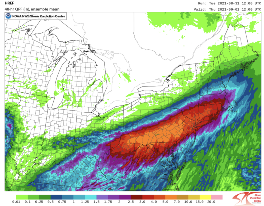
Any chance you looked at the max by accident? That image matches your description. The mean isn't that aggressive for DC and areas right along I-95:
-

2021 Mid-Atlantic Severe Weather - General Discussion
high risk replied to Kmlwx's topic in Mid Atlantic
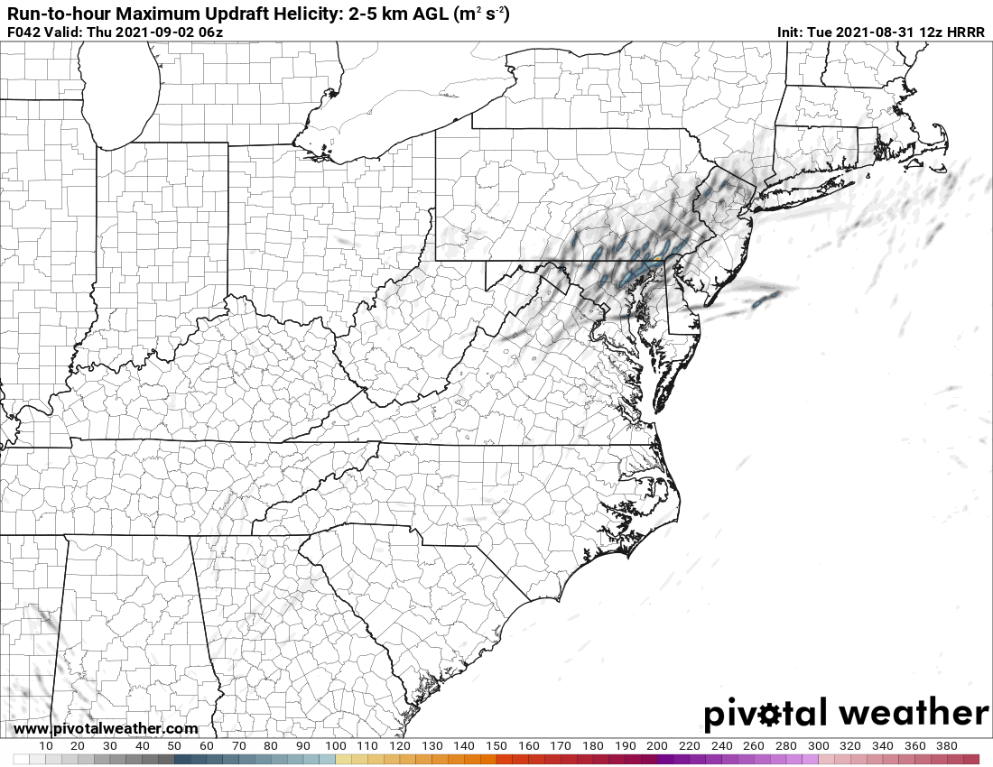
I'm in on SVR. I'm not in on widespread flooding rains until you get further north and northwest, although there will be isolated local flooding where recent heavy rains have occurred. Right now, guidance shows most of Wednesday being dry which will allow for some heating for sure. We then get some bands of convection arrive later in the day, with perhaps some moderate instability and likely strengthening low-level wind fields. If some of the more aggressive guidance is correct, these won't be little spin-ups in a big shield of rain; these will be legitimate supercells embedded in intense convective bands. This UH image from the 12z HRRR would warrant a potential ENH for tornadoes: There are plenty of ways that this could fail, and we often fail here, but this setup has *potential* to be a big deal if we legitimately heat up tomorrow. As for the rain, there could be some sneaky higher totals tonight, and those bands tomorrow evening will have torrential rainfall, but the heaviest rain will overall be too progressive, and the periods of intense rain will overall be relatively short-lived until you go further north.
-
2021 Mid-Atlantic Severe Weather - General Discussion
high risk replied to Kmlwx's topic in Mid Atlantic
I'm quite intrigued as well. The track to our northwest would allow for some heating before the main convective band arrives later in the day. -
Increasing signal in the guidance this morning for widespread showers and storms this afternoon for those east of the Potomac, especially for northern/northeast MD. Models have had limited handle on the precip so far (to be kind), so I'm not totally sure how much I buy it, although radar seems to suggest that this scenario is plausible.
-
2021 Mid-Atlantic Severe Weather - General Discussion
high risk replied to Kmlwx's topic in Mid Atlantic
one last tornado warning on the MD/PA border, near @mappy -
2021 Mid-Atlantic Severe Weather - General Discussion
high risk replied to Kmlwx's topic in Mid Atlantic
A few cells popping up in western Montgomery and near Culpepper. HRRR shows a strong line (or line with embedded supercells?) moving through DC and points north after dinner time. -
2021 Mid-Atlantic Severe Weather - General Discussion
high risk replied to Kmlwx's topic in Mid Atlantic
The box is going to be justified, but in terms of tornado threat across MD, the earlier arrival of storms may limit that potential a bit, as the best low-level shear won't arrive until later in the afternoon. -
2021 Mid-Atlantic Severe Weather - General Discussion
high risk replied to Kmlwx's topic in Mid Atlantic
Yeah, but those HRRR low dew points that we usually see are due to mixing, and even the HRRR can't overmix a tropical air mass like this. -
2021 Mid-Atlantic Severe Weather - General Discussion
high risk replied to Kmlwx's topic in Mid Atlantic
NAM Nest seems to be an outlier with its very sparse coverage of cells this afternoon. -
2021 Mid-Atlantic Severe Weather - General Discussion
high risk replied to Kmlwx's topic in Mid Atlantic
Oddly, the 00z NAM nest had better parameters but fewer storms than shown in previous runs. HRRR and HiRes Window ARW still look impressive. -
2021 Mid-Atlantic Severe Weather - General Discussion
high risk replied to Kmlwx's topic in Mid Atlantic
They stuck w the MRGL..... -
2021 Mid-Atlantic Severe Weather - General Discussion
high risk replied to Kmlwx's topic in Mid Atlantic
Curious to see what SPC does here with the updated day 2 outlook in 20 minutes. I think there is enough in the 12z CAMs today to go with a SLGT (5% TOR) in roughly a Farmville, PA to Williamsport, PA corridor (~80 miles on either side), but I wouldn't be shocked if they want until tomorrow morning to upgrade either. -
2021 Mid-Atlantic Severe Weather - General Discussion
high risk replied to Kmlwx's topic in Mid Atlantic
Is it really a "surprise" when the models show discrete rotating cells 2 days in advance, and SPC puts us in an initial Day 2 MRGL with potential for a later upgrade? -
Agreed, but really hoping that area to the southwest doesn't pivot hard to the northeast. Even with a lull, it would get really bad if that moves over the areas that have already been drowned this evening.
-
2021 Mid-Atlantic Severe Weather - General Discussion
high risk replied to Kmlwx's topic in Mid Atlantic
Still very intrigued by Wednesday. Still some fail scenarios: best storms stay north in PA, best wind fields are further west, instability is lacking..... but some of the CAM solutions are quite good in terms of discrete cells and show some impressive low-level shear. -
2021 Mid-Atlantic Severe Weather - General Discussion
high risk replied to Kmlwx's topic in Mid Atlantic
I was just coming in to post the same thing. The NAM/NAM3 and extrapolated HRRR and some of the HiResWindows look very interesting for Wednesday. Hodographs look impressive, and this certainly gets our attention:
-
Very concerned about the areas that got crushed last night for the week ahead. Multiple chances for more large rain totals this week, perhaps as soon as very late tonight.
-
I don't know what to think about the overnight. Several of the 00z CAMs bring some heavy rain up through DC and even to those of us further north, but I'm not sure if they really have a handle on everything. Perhaps they're misplacing the ongoing convection too far north? That said, the outflow surging north out of southern MD makes me think that things could erupt further north in the next couple of hours.
-
2021 Mid-Atlantic Severe Weather - General Discussion
high risk replied to Kmlwx's topic in Mid Atlantic
Tuesday and Wednesday each yielded a surprisingly high number of SVR reports in this area. There were certainly a couple of particularly notable cells with higher-end swaths of damage, but the coverage of reports was still impressive. But I agree that high CAPE and moderate DCAPE are more than compensating for very weak shear. I'd certainly be surprised if we didn't get at least one round of TC remnants up this way in the next 6-8 weeks. -
2021 Mid-Atlantic Severe Weather - General Discussion
high risk replied to Kmlwx's topic in Mid Atlantic
It's probably just my fading memory, but I can't recall such an extremely active week like this with so little shear.