ILSNOW
-
Posts
1,644 -
Joined
-
Last visited
Content Type
Profiles
Blogs
Forums
American Weather
Media Demo
Store
Gallery
Everything posted by ILSNOW
-
18z NAM coming in hot
-
Nice to see the folks in the Florida Panhandle getting in on the snow.
-
-
Winter 2024-25 Medium/Long Range Discussion
ILSNOW replied to michsnowfreak's topic in Lakes/Ohio Valley
-
When was the last time the models were this locked in 5 days in advance with little deviation. If this was a Chicago storm the models would be all over the place. best of luck to everyone south and east!!!
-
Hopefully get a 1/2 inch of lake effect sunday night to push us over 6 for the season!!!!!!
-
Winter 2024-25 Medium/Long Range Discussion
ILSNOW replied to michsnowfreak's topic in Lakes/Ohio Valley
Dont give up we will have our traditional 5-7 days of winter sometime in late Jan/early Feb!!!!!!! -
-
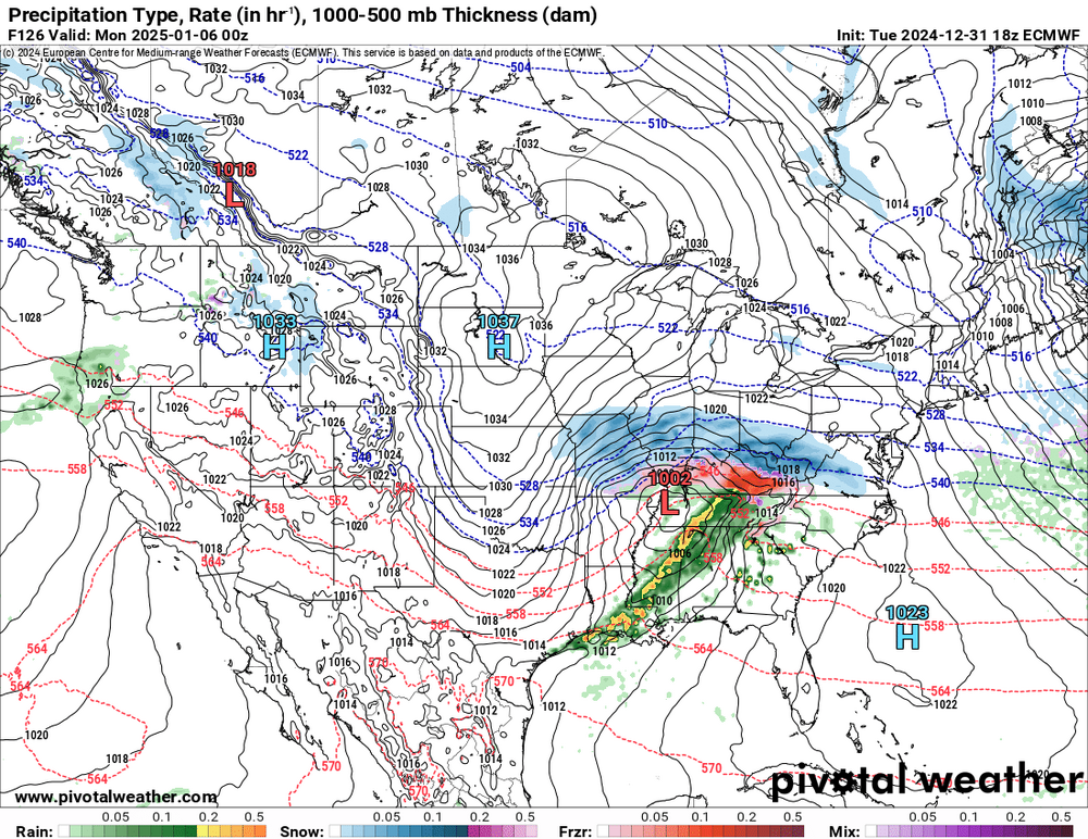
18z Euro
-
-
Winter 2024-25 Medium/Long Range Discussion
ILSNOW replied to michsnowfreak's topic in Lakes/Ohio Valley
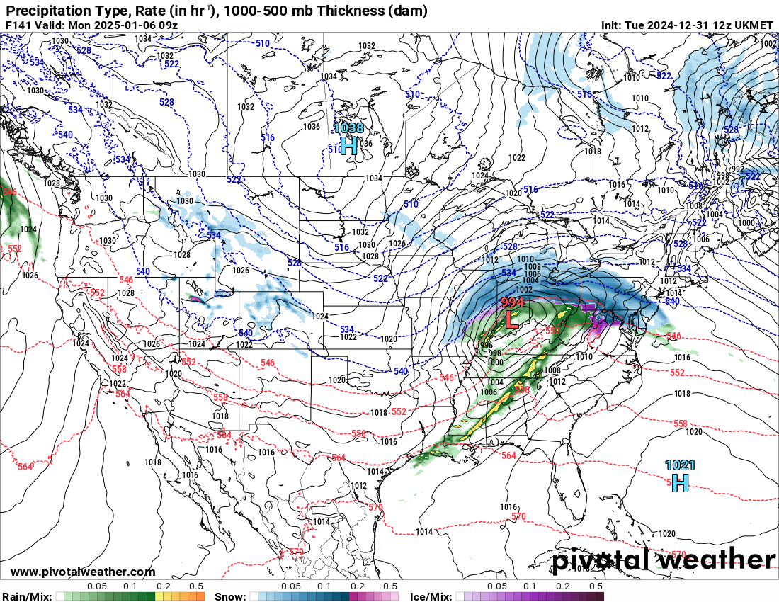
12z UKMET still North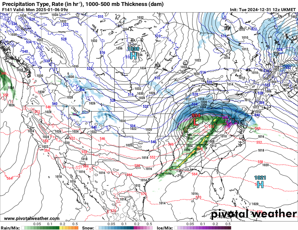
-
Winter 2024-25 Medium/Long Range Discussion
ILSNOW replied to michsnowfreak's topic in Lakes/Ohio Valley
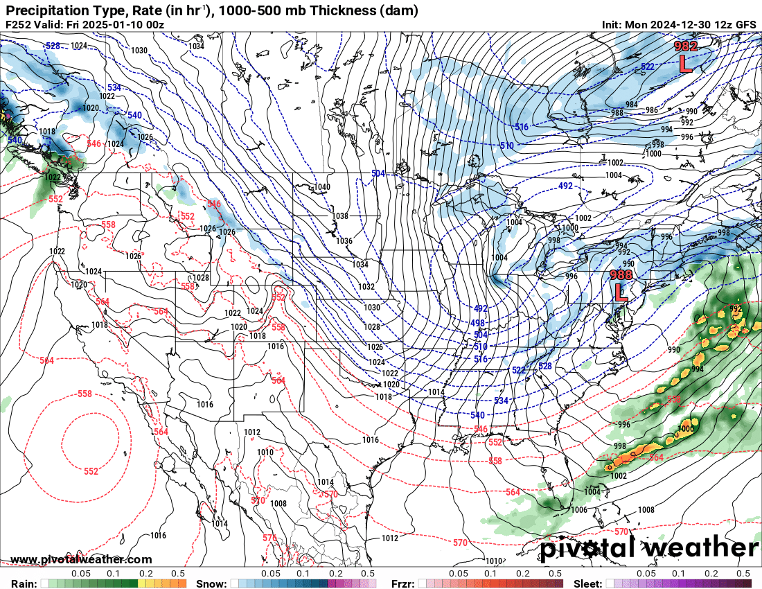
only 18 more runz of the GFS to go!!!! -
Winter 2024-25 Medium/Long Range Discussion
ILSNOW replied to michsnowfreak's topic in Lakes/Ohio Valley
GFS thinks it is going to get a "little cold". l © 2015-2024 pivotalweather.com, All Rights Reserved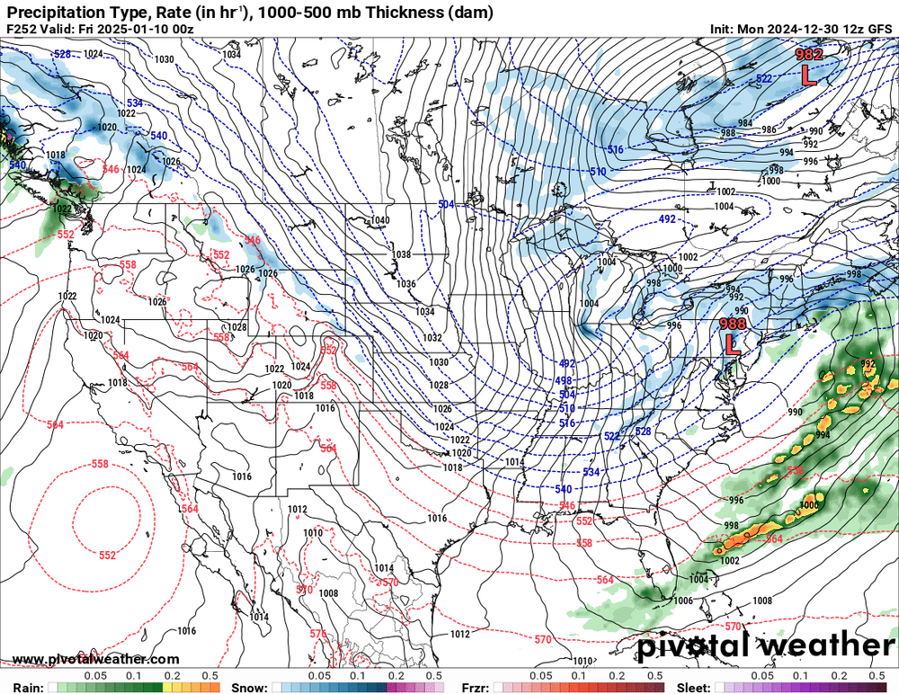
-
Winter 2024-25 Medium/Long Range Discussion
ILSNOW replied to michsnowfreak's topic in Lakes/Ohio Valley
12z Euro has a nice little snowstorm for North Carolina. -
Winter 2024-25 Medium/Long Range Discussion
ILSNOW replied to michsnowfreak's topic in Lakes/Ohio Valley
As stated by the pros probably not going to happen but -
Winter 2024-25 Medium/Long Range Discussion
ILSNOW replied to michsnowfreak's topic in Lakes/Ohio Valley
hoping to be there as well GO BUCKS!!!! -
Winter 2024-25 Medium/Long Range Discussion
ILSNOW replied to michsnowfreak's topic in Lakes/Ohio Valley
18z GFS is trying to whiten up some of our futures -
Chicago NWS UPDATE... Issued at 1127 AM CST Thu Nov 21 2024 Just a note on forecast expectations into this afternoon. Recent reports indicate up to 3" of snow in Lake and Cook Counties, with moderate to heavy snow continuing to fall, including 1/4 mile visibility at KMDW as of this writing. Also seeing less than 1/4 mile visibilty at KGYY and KIGQ. A look well upstream shows primarily snow hanging on up until central Wisconsin, where the transition to light rain and drizzle has taken place from a combination of warming temps and decreasing cloud ice. The overall trend is a slower rise in temps over the next couple hours and correspondingly the ptype transition taking a bit longer as well. Warming cloud tops punching south from southeast Wisconsin will steadily diminish snowfall rates into the Chicago metro, and then bring the anticipated changeover to light rain and drizzle in the 2-3pm timeframe. While snow will hang on a bit longer than earlier forecasts, little (up to a couple tenths) to no additional accumulation is expected after noon for most of the Chicago metro. Thus, not currently seeing any reason to change the advisory end time of 1pm.
-
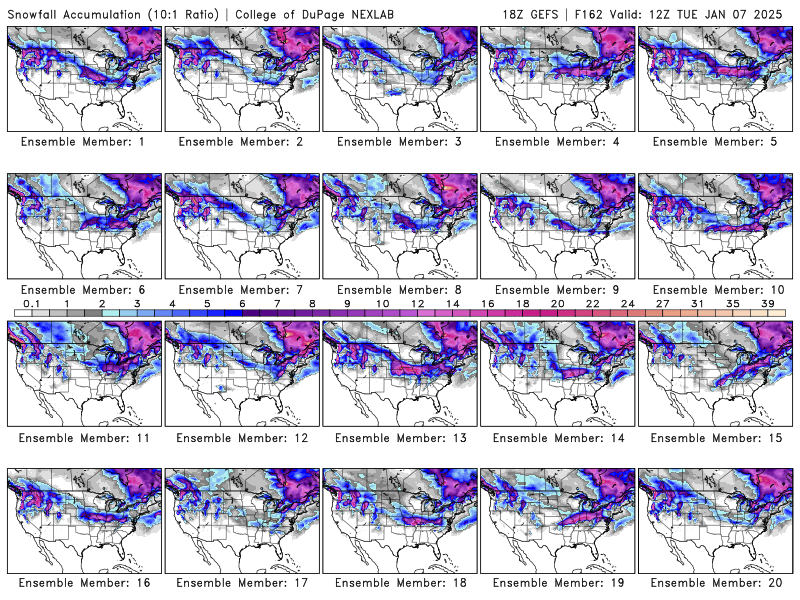
I will take the RGEM for $1000 please
-
the 12z HRRR Alek snow
-
Winter 2023/24 Medium/Long Range Discussion
ILSNOW replied to Chicago Storm's topic in Lakes/Ohio Valley
Is there any hope for us here in the midwest or more of the same to be expected? This is from the snowmonger Joe Bastardi!!!! Monster stratwarm going on right now Lets see what that means for March 10-April 10 ( target response period) -
Winter 2023/24 Medium/Long Range Discussion
ILSNOW replied to Chicago Storm's topic in Lakes/Ohio Valley
Looking forward to the late March snowstorm where we get 3-6 inches that melts away in less than 24 hours. This winter (take away 7-10 days in Jan) has been horrific and I truly can’t remember the last time we had a during the day. -
Winter 2023/24 Medium/Long Range Discussion
ILSNOW replied to Chicago Storm's topic in Lakes/Ohio Valley
here is the 1st one nice 1017 low moving thru IL -
Winter 2023/24 Medium/Long Range Discussion
ILSNOW replied to Chicago Storm's topic in Lakes/Ohio Valley
next chance at snow is on 372 hour 18z GFS -
not sure how good the GFS is with freezing rain 12z