

ILSNOW
-
Posts
1,644 -
Joined
-
Last visited
Content Type
Profiles
Blogs
Forums
American Weather
Media Demo
Store
Gallery
Everything posted by ILSNOW
-
Winter 2025-26 Medium/Long Range Discussion
ILSNOW replied to michsnowfreak's topic in Lakes/Ohio Valley
Chicago NWS on Lake Effect There has not been much change in the recent guidance. High pressure will build across the northern Plains Thursday night into Friday as an upper level low moves across the local area Friday into Friday night. This will setup convergence over Lake Michigan with a band of lake effect snow developing Thursday night, possibly into northwest IN at first, then spreading west into far northeast IL Friday morning, then moving back east into northwest IN Friday evening and then possibly moving back into northeast IL Saturday morning. While these overall trends remain on track, the earliest snow would begin is still 48+ hours away and while lake effect is challenging, there can be even more uncertainty when its pointed into northeast IL. While it remains a bit early for specifics, if a lake effect band does develop, periods of heavy snow will be possible across far northwest IN and far northeast IL with several inches of snow possible. -
Winter 2025-26 Medium/Long Range Discussion
ILSNOW replied to michsnowfreak's topic in Lakes/Ohio Valley
Alek= Lake effect king -
Winter 2025-26 Medium/Long Range Discussion
ILSNOW replied to michsnowfreak's topic in Lakes/Ohio Valley
what did u end up with yesterday -
Winter 2025-26 Medium/Long Range Discussion
ILSNOW replied to michsnowfreak's topic in Lakes/Ohio Valley
GFS had no snow in chicago where over 6 inches of lake induced/lake effect has happened so far. -
1/24-1/25 Major Winter Storm - S. IL, IN, and OH
ILSNOW replied to A-L-E-K's topic in Lakes/Ohio Valley
Izzi Lake enhanced snow has overperformed overnight with totals of 4-7" observed near Lake Michigan in Cook County. Snow to liquid ratios have been on the order of 25-40:1 with the lake enhanced snow. Guidance depicts a strengthening low level convergence axis this morning with similar moisture and instability profiles, which would favor a consolidation from a multibanded structure to a single band or two of more intense lake enhanced snow. Given the expectation that heavy lake enhanced snowfall with rates around or just over an inch per hour will continue across Cook County the remainder of the morning and into at least the early afternoon, opted to upgrade Cook County to a winter storm warning. Additional snowfall of 2-5" seems likely near the lake, which on top of the already 4-7" that has fallen should leave snowfall totals near the lake in the 6-12" range. -
1/24-1/25 Major Winter Storm - S. IL, IN, and OH
ILSNOW replied to A-L-E-K's topic in Lakes/Ohio Valley
923 AM CST Sun Jan 25 2026 ILZ103>105-252200- /O.UPG.KLOT.WW.Y.0005.000000T0000Z-260126T0000Z/ /O.NEW.KLOT.WS.W.0002.260125T1523Z-260125T2200Z/ Northern Cook-Central Cook-Southern Cook- Including the cities of Park Forest, Des Plaines, Schaumburg, Evanston, Chicago, Calumet City, Oak Forest, Lemont, Orland Park, Oak Park, Palatine, Cicero, La Grange, Northbrook, and Oak Lawn 923 AM CST Sun Jan 25 2026 ...WINTER STORM WARNING IN EFFECT UNTIL 4 PM CST THIS AFTERNOON... * WHAT...Snow...heavy at times. Additional snow accumulations 2 to 5 inches, heaviest near Lake Michigan. Storm total snowfall ranging 2 to 4 inches northwestern Cook County to 6 to 12 inches near the lake. Snowfall rates around 1 inch per hour are expected with the more intense lake effect snow bands. * WHERE...Central Cook, Northern Cook, and Southern Cook Counties -
1/24-1/25 Major Winter Storm - S. IL, IN, and OH
ILSNOW replied to A-L-E-K's topic in Lakes/Ohio Valley
yep it comes in waves snows hard for a bit and then nothing -
1/24-1/25 Major Winter Storm - S. IL, IN, and OH
ILSNOW replied to A-L-E-K's topic in Lakes/Ohio Valley
looks to me that the Milwaukee Lake effect band is now reached Waukegan and will merge with the Lake enhancement of southern Lake and Cook County. -
1/24-1/25 Major Winter Storm - S. IL, IN, and OH
ILSNOW replied to A-L-E-K's topic in Lakes/Ohio Valley
Chicago NWS update With increasing low-level convergence forced by stronger easterly flow through the night, would have to think that the lake effect snow band should have more success moving inland with time, even if just for a few miles. Based on the current trajectory and west/northwestward drift of the snow band, areas near and north of Evanston appear most in line to see the lake effect snow overnight. After daybreak, the expectation is for the snow band to pivot back southeastward across northeastern Illinois during the morning hours and into northwestern Indiana during the afternoon as the low-level wind field backs along the backside of the departing storm system. -
1/24-1/25 Major Winter Storm - S. IL, IN, and OH
ILSNOW replied to A-L-E-K's topic in Lakes/Ohio Valley
RAP -
1/24-1/25 Major Winter Storm - S. IL, IN, and OH
ILSNOW replied to A-L-E-K's topic in Lakes/Ohio Valley
You think they drift west enough to make it on shore? -
1/24-1/25 Major Winter Storm - S. IL, IN, and OH
ILSNOW replied to A-L-E-K's topic in Lakes/Ohio Valley
Izzi Forecast on track with no meaningful changes to previous forecast for the approaching winter storm. I am concerned that lake effect snow could overperform a bit very late tonight into Sunday morning over northeast IL and into northern Lake Co Indiana Sunday afternoon, but confidence is a bit too low to justify an upgrade to a winter storm warning at this time. Large winter storm is slowly approaching the area this afternoon though very dry antecedent air mass is taking some time to saturate from top down. WSR-88D imagery does suggests that the low level dry air is being eroded and expect areas of light snow and flurries to begin making it to the surface soon. Light snow will likely continue tonight, especially south of I-80. Most of the ascent tonight appears to be the result of upper level divergence in the right entrance region of developing upper level jet streak over the western Great Lakes. As such, strongest upward vertical velocities (UVVs) are progged to be above 600 mb, well above the very deep DGZ where weak UVVs are progged to be neutral or even weak subsidence. This suggests that predominant snow type for most of tonight will be smaller flake size and resultant lower snow:liquid ratio (SLR). Nudged the forecast SLR down some, but possibly still too high if the snow tonight is mostly pixie dust and low SLR. Confidence wasn`t high enough to make any big adjustments to snowfall totals, but that is something the evening shift will need to look at for the first half of the event tonight. By early Sunday morning, we start to get into an area of coupled jets with some strengthening mid-level frontogenesis. This could result in a period of stronger UVVs below 600mb and closer to the DGZ. This may produce heavier snowfall rates Sunday morning where larger dendrites result in higher SLRs, at least in mesoscale band(s). The system snow should end from west to east from mid afternoon Sunday through early evening. One wildcard will be the lake enhanced snow late tonight into Sunday. While there will be a strong frontal inversion between 800-850mb through the duration of the event, limiting the depth of the lake induced convective instability. While the depth of the instability looks to be rather shallow, the instability below the inversion will be quite strong with lake-850mb delta T values around 20C. This should result in very strong ascent below the inversion, the majority of which will be smack dab in the middle of the DGZ. I am concerned that seeder-feeder process from strong synoptic ascent above 600mb could result in a band of intense lake effect snow embedded within an area of lighter snow and flurries. Wouldn`t be surprised to see snowfall rates >=1" per hour with the lake enhanced snow Sunday morning into NE IL, gradually shifting into NW IN Sunday afternoon. Certainly a play for totals solidly over 6" into northeast IL if the lake enhancement really gets going, but confidence isn`t high enough to justify an upgrade to a warning at this time. Will be something that later shifts will need to closely watch. Intensity of the lake effect should begin to decrease Sunday evening as it loses seeder-feeder with synoptic snows shifting east of the area. Inversion heights are progged to come up a bit Sunday evening, so did maintain likely pops for LES across northeast IN Sunday evening. By late Sunday evening the LES threat should push east of Porter County, so the midnight expiration time for the winter weather advisory looks good for Lake/Porter Counties. -
1/24-1/25 Major Winter Storm - S. IL, IN, and OH
ILSNOW replied to A-L-E-K's topic in Lakes/Ohio Valley
-
1/24-1/25 Major Winter Storm - S. IL, IN, and OH
ILSNOW replied to A-L-E-K's topic in Lakes/Ohio Valley
current virga radar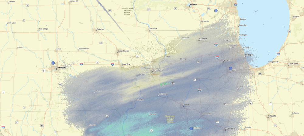
-
1/24-1/25 Major Winter Storm - S. IL, IN, and OH
ILSNOW replied to A-L-E-K's topic in Lakes/Ohio Valley
12z Euro -
1/24-1/25 Major Winter Storm - S. IL, IN, and OH
ILSNOW replied to A-L-E-K's topic in Lakes/Ohio Valley
for chicago peeps from Milwaukee NWS Confidence is increasing that a lake effect snow band will come onshore early Sunday morning into Sunday afternoon. If the snow band comes ashore, moderate to heavy rates are possible from Milwaukee southward. Models are indicating more confidence in impacts to Lake Michigan counties (specifically Milwaukee metro southward) during the early morning to midday hours Sunday. With lake temperatures near 3 degrees C and 850 mb temperatures between negative 15 and negative 20 degrees C, more than enough convective potential exists for moderate to heavy snowfall rates (up to 1 inch per hour) if the central portions of the band make it onshore. There is still the chance that high pressure will win out over the developing northeast flow, and therefore still possible that only trace snow showers will make it onshore. However, the forecasted strength of the developing low to the south would make that solution less likely based on the preliminary model data this morning. Alek is going to clean up -
1/24-1/25 Major Winter Storm - S. IL, IN, and OH
ILSNOW replied to A-L-E-K's topic in Lakes/Ohio Valley
latest from Chicago Main focus is on a synoptic accumulating snow system Saturday afternoon through Sunday. Some questions remain with exact snow amounts especially into the Chicago metro area where some lake- enhancement is likely. Expectation is that we`ll end up with a general 3-6" accumulation across the southeast third to half of the cwa, and potentially parts of the Chicago metro where lake- enhancement occurs, with a sharp gradient to lower amounts farther to the northwest. Details of where exactly this gradient lays out will need further refinement, and thus in collaboration with neighbors to the east and west have held off on headline issuance just yet. However, we do anticipate the need for a winter weather advisory for southeast parts of the forecast area and near the lake as the footprint is further narrowed down. Furthermore, a deepening layer of northeasterly low-level flow is likely to producing some degree of lake- enhancement into parts of the Chicago metro area, possibly with an additional small footprint of 3-5" amounts there (perhaps locally 5-6"). -
1/24-1/25 Major Winter Storm - S. IL, IN, and OH
ILSNOW replied to A-L-E-K's topic in Lakes/Ohio Valley
odds of happening prolly like 13% -
1/24-1/25 Major Winter Storm - S. IL, IN, and OH
ILSNOW replied to A-L-E-K's topic in Lakes/Ohio Valley
This is supposed to replace the NAM (what is it smoking) -
Winter 2025-26 Short Range Discussion
ILSNOW replied to SchaumburgStormer's topic in Lakes/Ohio Valley
Milwaukee on possible lake effect If the meso vort over the southern basin advects a few lake effect snow bands toward the western coast, there will be a chance for a couple inches of snow when everything is all said and done. This would then be multiple hours of LES and lake enhancement. Southeastern Wisconsin including, Racine, Kenosha, Milwaukee and maybe eastern Waukesha are the mostly likely areas to be impacted by any LES or lake enhanced snow. This area is fairly broad, but there is uncertainty on how far inland this would move. Now the caveat that comes with any LES system, will it or will it not move inland. In the event that this all stays off shore this AFD will be for naught as we may get a dusting from the shortwave trough. On the other hand if the worse happens and we get multiple LES bands moving inland, then there could be some decent snow totals. A real hit or bust forecast. -
1/24-1/25 Major Winter Storm - S. IL, IN, and OH
ILSNOW replied to A-L-E-K's topic in Lakes/Ohio Valley
Desperate holding out for 3-4 lake induced flakes on Sunday. -
1/24-1/25 Major Winter Storm - S. IL, IN, and OH
ILSNOW replied to A-L-E-K's topic in Lakes/Ohio Valley
From our friends at BAM Weather (I know many dont care for them) Upon deep dives hi-res US models are overdoing the strength of the high pressure in the northern plains. It stems from the GFS as these hi-res models are all inner nested versions of the GFS. This can make all the difference in the world for these fringe locations of snow/sleet/ice/rain! Summed up? ECMWF/GDPS/UKMET is the answer. Thoughts?? -
i believe he is referring to this after next weekends coastal
-
down to -11
-
1/24-1/25 Major Winter Storm - S. IL, IN, and OH
ILSNOW replied to A-L-E-K's topic in Lakes/Ohio Valley
UKMET brings snow north compared to 12z X


