CAPE
-
Posts
36,279 -
Joined
-
Last visited
Content Type
Profiles
Blogs
Forums
American Weather
Media Demo
Store
Gallery
Everything posted by CAPE
-
26
-
30 here now. Maybe upper 20s?
-
A chilly 37 approaching 9pm. Should be below freezing tonight with light winds and clear skies. Nearly ideal radiational cooling conditions. Looks like a decent chilly rain event tomorrow night.
-
It's insane that Harbaugh and EDC continue to believe that this guy is the best they have at the position. He will get Lamar killed and rob Henry of big runs. If they really think he is 'the guy', the GM and HC should be fired. We have a natural guard named Ben Cleveland who plays solid whenever he gets the chance, but is in the Harbaugh doghouse because he isnt 'impressive' in practice. Practice? We talkin bout, practice?
-
No idea. I never look at 45 day snow maps lol.
-
Well yeah, in general the extended products suggest we may have a shot at seeing actual flakes in Dec. A rarity lately. Hopefully it will at least be on the cold side.
-
A 7 day snow map is barely worth a piss lol. These maps are nothing more than a wild ass guess. Posting them is silly, but I guess it's fun?
-
Damn Denver is legit. Not completely sure about the QB but their defense is awesome. 4 game lead on the Chiefs, who now have the same record as the Ravens.
-
Raven's D has become respectable lately. The offense has plenty of work to do- and it should start with benching Faalele. How long has everyone said this lol. Lamar is clearly not healthy. He almost never runs anymore.
-
Its rarely pretty against the Browns. And HOLY FUCK the winning TD! An actual creative play by Monkon!
-
Either he is hurt or Monkon is a dope.
-
I don't get the play calls inside the 10. Is Lamar not a threat to run at all anymore? Something is off.
-
The root of the problem is the interior OL, and EDC and Harbaugh should be made to pay for sticking with 2 subpar guards. Calling Ben Cleveland????
-
I hate rooting for this team
-
LOL
-
Wasn't the greatest pass, but he should have caught it. Lamar is off today. He never runs anymore. I guess his hammy/knee are holding him back. Otherwise Monkon is also a candidate to be fired.
-
That's usually how it happens when they lose. Beat themselves. They are pretty good at it.
-
Inexcusable special teams gaffes. Gifts.
-
Justice Hill is inactive. That should mean increased touches for Keaton Mitchell. Given how poor the Ravens OG play has been- and the Browns standout DL, Henry will probably find it difficult to get going. Mitchell has the combo of quickness and speed that can make the difference. He damn well better be a big part of the game plan.
-
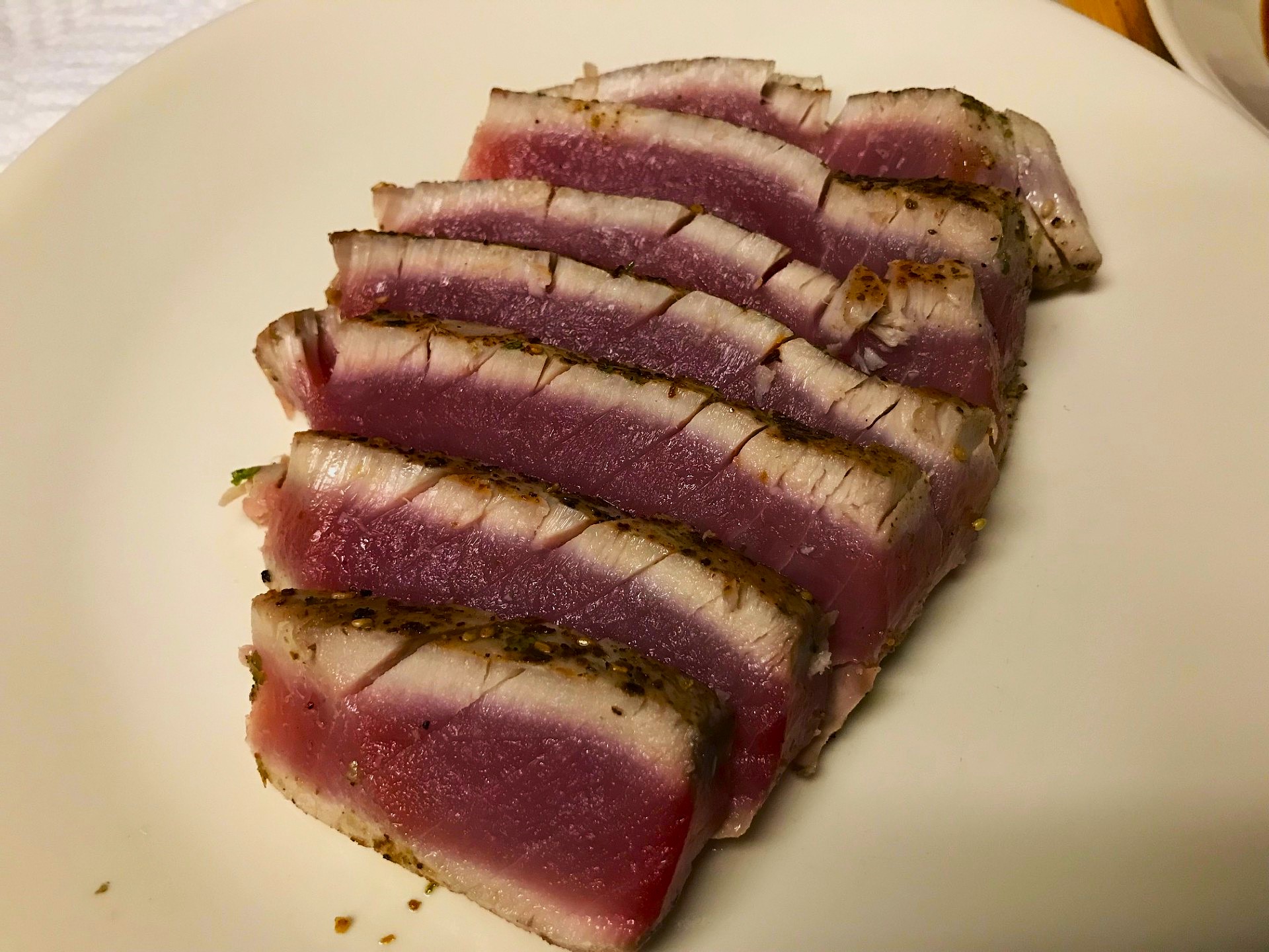
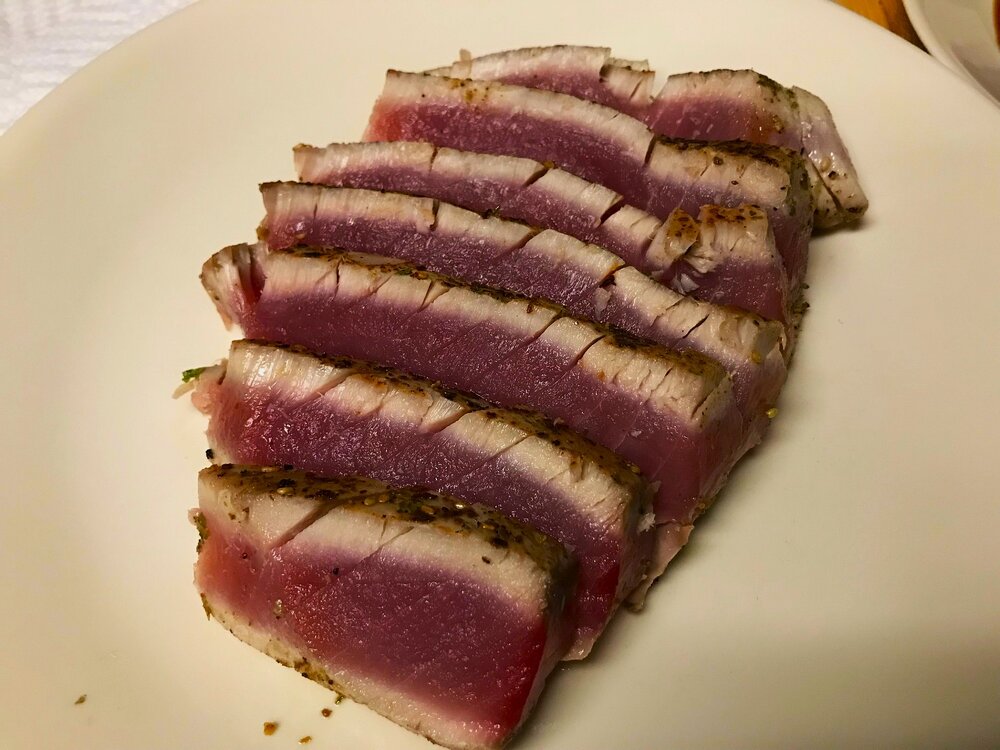
Fresh Bluefin Tuna. Paid 14 bucks. Imagine what this would have cost in a restaurant. Seasoned with salt, pepper, and Japanese Seven spice. Fuck yeah.
-
There could easily be some error at this range in the exact positioning/orientation of the long wave features. I wouldn't call it a can kick but given the currently advertised position of the Pac trough and the downstream ridge over AK towards D15, its not hard to imagine a western US trough for a time at the beginning of Dec.
-
Always hard to tell with you lol. The point stands.
-
I need this in my life. Triple Decadence World Wide Stout 4pk, 12 fl. oz. Bottles Raise a glass to 30 years of off-centered innovation with Dogfish Head’s Triple Decadence World Wide Stout. This 15% ABV imperial stout is aged in wood barrels from three iconic barrel-aged brews: our Palo Santo Marron Ale and Let’s Get Lost Whiskey along with Sam Adams’ Utopias. With notes of rich coffee, vanilla, and warming sweetness, this limited release ale offers a port-like depth and a full-bodied finish. It’s bold, complex, and brewed to age. Just like the journey it celebrates..
-
Click bait. WB CFS is useless. That's a single run. That model is volatile af and changes like the wind. Only somewhat useful when averaged over several runs. If you look at it on Tropical Tidbits it is the average of the last 12 runs.
-
Latest edition of the Euro Weeklies continues to advertise a favorable h5 look for early Dec( and beyond fwiw).
- 827 replies
-
- 15
-

-

-

-