CAPE
-
Posts
36,279 -
Joined
-
Last visited
Content Type
Profiles
Blogs
Forums
American Weather
Media Demo
Store
Gallery
Everything posted by CAPE
-
It was pretty unlikely that they would start off 1-5, but they did. The OL is what it is but if Lamar is getting back to full health he can mask some of that mess, and if the defense continues to play respectable or better, they can win the next 3. Packers on the road is the toughest one on paper, but they are a bit beat up and can be inconsistent.
-
15 Second morning in a row Let the warm up begin.
-
lol why ask? Sometimes you need to consider the source and just move on.
-
No. Wrong BAM.
-
High of 26. Forecast high was 30. Currently 25 and cloudy. Looks like it wants to snow.
-
12/5: 1.3" 12/14: 1.8" T: 3.1"
-
Good winter but that storm sucked here. 4-5 inches of snow then changed to rain in a heartbeat. A mini version of March 93. Amped storms that hug the coast/track just inland, esp with no blocking, never work out over here.
-
They are a young team overachieving a bit. Won 10 in a row! Law of averages. They will lose another one. Also its the last home game for the Ravens and they have already guaranteed themselves a losing record at home- should be pissed off about that. Last 2 at Packers and at Steelers. Bottom line is they need them all to guarantee the playoffs.
-
Defense was excellent. Need to see that continue. Win the next 3 and the win the division. Easier said than done though.
-
He needs to stop taking the sacks though. Just throw it away!
-
One of the best for sure.
-
Wow. Haven't seen a drive like that in forever.
-
Ridiculous. Gaslighting the fans like we are dumb fucks and cant see what's actually happening.
-
Trees look even more incredible against the blue skies. Branches still snow covered with the cold temps and weak sun.
-
How many of Lamar's picks lately have been the fault of the receivers? And then there are all the would be TDs that weren't.. Hello Likely, Flowers? Crazy how skewed his stats are and it becomes fodder for all the haters. He hasn't been his best for sure and injuries are a part of that, but his stats lately are much worse because his receivers and OL have betrayed him. That's it, throw it to HOPKINS
-
Really looking forward to the Rams-Lions game. Love watching a well coached team that plays sound football and wins, that being the Rams. Stafford is so good. Incredible at age 37 and with his chronic back issues. Lions are teetering and really need this one.
-
I have really lost interest in this team. Just have it on in the background out of habit.
-
Not much melting going on with temps falling into the mid 20s and that low mid Dec sun.
-
But Faaleleleleleleeeeeee is GOOOD!
-
The Ravens are already yellowing my snow. This offense is so fucking bad, mostly because of a terrible OL.
-
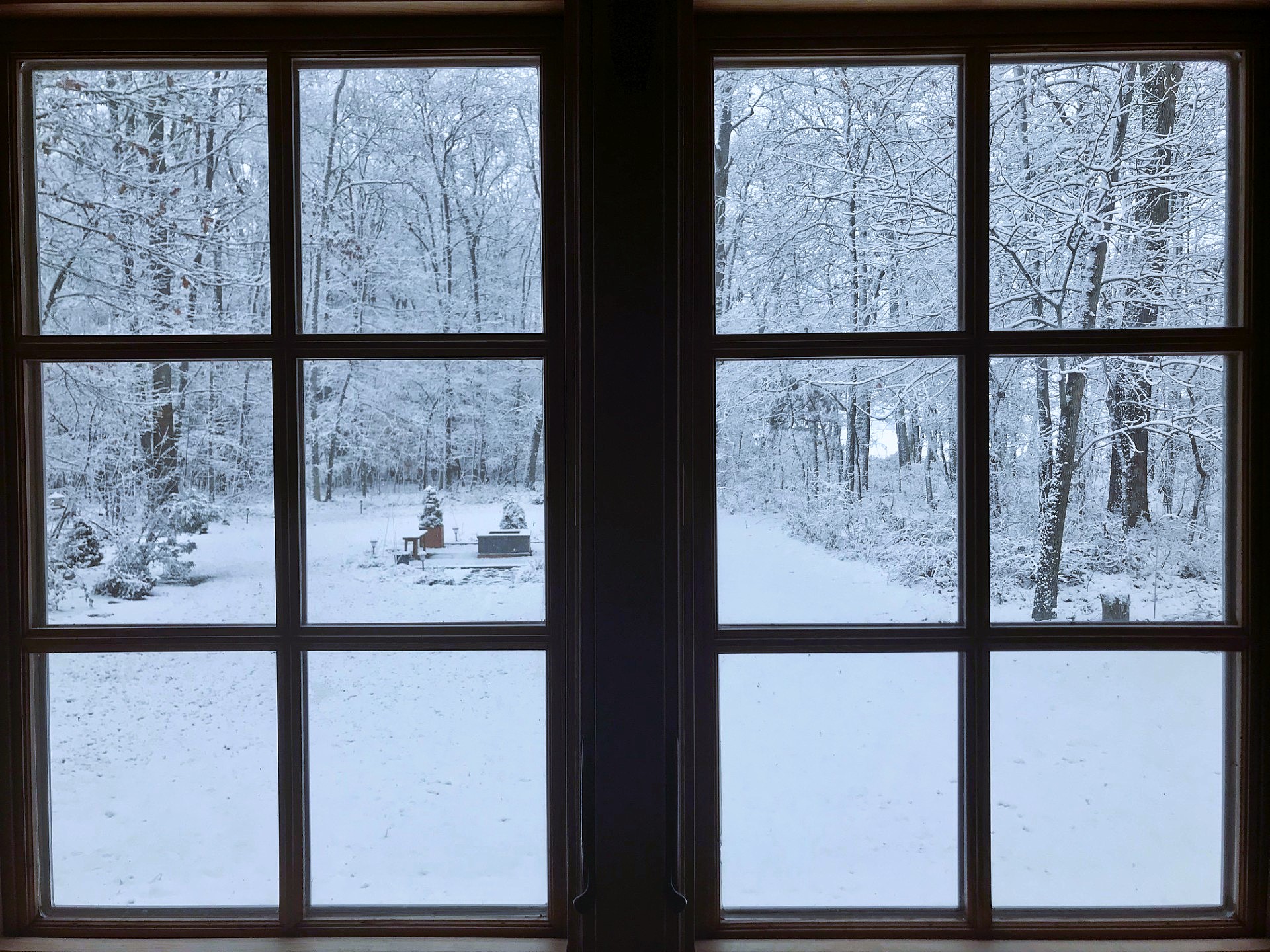
Picture doesnt do it justice. Crappy old iPhone camera through window panes lol. Doesn't capture all the detail and how vivid it looks.
-
Kitchen window view

-
1.7" otg in my measurement area. Ridgley Mesonet(3 miles SW) reporting a snow depth of 1.9"
-
The trees look spectacular. Temp down to 30. Too bad the snow is about done.