

CAPE
-
Posts
36,279 -
Joined
-
Last visited
Content Type
Profiles
Blogs
Forums
American Weather
Media Demo
Store
Gallery
Everything posted by CAPE
-
All I can do is laugh. I'll admit this place is entertaining.
-
GFS wins!!
-
HNY. Guess what? Weather is changeable in the midlatitudes. Crazy shit huh?
-
Up your way, probably a good bet regardless of which model is more correct.
-
Quite the battle between the Euro and the GFS as to the outcome. Its either a nothing burger or a light 1-3" event for at least parts of the region.
-
0z GFS continues to keep the NS and SS energy completely separated with no sharpness to the NS shortwave, so no dice.
-
HB and HNY! Great way to celebrate both, along with some drinkies.
-
One of the best ever. Top 10. HOF. Not quite as good now, but still damn good and even with Lamar on track to start, they better pound the rock.
-
12/5: 1.3" 12/14: 1.8" 12/31: 0.2" T: 3.3"
-
I did 2 ways. Freaking delicious.
-
Who do we trust more here? Love those Brits.
-
Yes, and sharper, plus partial phasing. GFS is flatter and weaker with the surface low and doesnt draw in enough cold air because of the lack of interaction/sharpness with the shortwave.
-
Easy to see why the Euro has a more favorable outcome than the GFS looking upstairs-
-
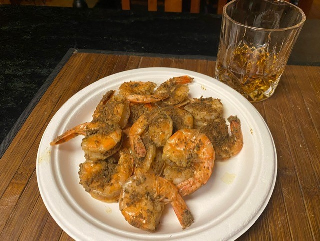
Have fun! I never go out on NYE anymore- its one of those 'amateur hour' holidays. Staying home, safe and partying with some friends, making some good food, tonight featuring shrimp prepared multiple ways.
-
Precip creeping northward each run. Problem is the temps are very marginal. The crappy pacific is winning over the NA, AS MODELED on the GFS/GEFS. We shall see.
-
Yeah there is a bit of snow for the lower eastern shore verbatim.
-
The long term trend with the model guidance is our friend. What model at range depicted a cold and decently snowy December? Weren't we supposed to have temps in the 50s and 60s from Xmas to the end of the month? I had snow this morning with temps in the low 20s lol. This has been happening since mid August. Not concerned. Atmospheric memory and shit.
-
Lamar was a full participant in practice today. LFG! Lets just hope Monken doesnt think this is a signal to go pass happy again. Pound the fucking rock first and foremost. Do that and some big downfield pass plays will be available. Problem is he has shown no ability/patience to do this all season, unless Huntley-who is a limited downfield passer- has started the game. (ofc they won both easily by running).
-
Its been pretty impressively cold, much colder than the model guidance continued to indicate at range. Sound familiar? Been happening since mid August lol. Why I'm not worried going forward.
-
He sharing his good stuff with ya?
-
Sounds fun! We will be expecting some pictures.
-
I went back and looped the radar and that band really blossomed right overhead. Based on the returns it would have been coming down moderately. It then weakened as it moved east. I was in exactly the right spot lol.
-
I guess it nailed it over this way lol
-
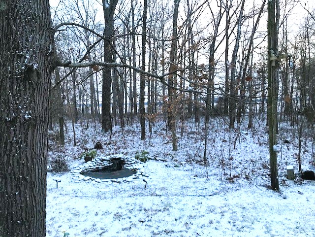
23 with snow covered ground. Solid coating.
-
Well, just woke up and looked outside and it effing snowed! Looks like maybe a quarter inch. That was totally unexpected.
- 161 replies
-
- 21
-

-


