

CAPE
-
Posts
36,851 -
Joined
-
Last visited
Content Type
Profiles
Blogs
Forums
American Weather
Media Demo
Store
Gallery
Everything posted by CAPE
-
About to pop this open.
-
You have a place near Canaan now right? Pretty good bet if you wake up there on Friday lol.
-
What, you had doubts that it would trend towards the new King?
-
Look at h7 and h85 vorticity and you can see where the potential is for a bit of a heavier stripe but this thing is a fast mover so probably advisory level event for the majority if not all of the region.
-
Have not paid much attention but looks like a quick hitting 2-4, with a bit of banding potential probably closer to the coast as indicated on the GFS and the 6z Euro. Skinny jack zone of up to 6 somewhere maybe.
-
7.2 at 7am, so a low of 7. Don't think it will drop more lol.
-
Temps drop like a rock here with snow cover and clear skies. Zero UHI influence and not near the water.
-
Nice to know we can still drop below 20 with ideal radiational cooling conditions and a nice snowpack. Wasn't sure after last winter.
-
Mount Holly's take on late week- The main focus is on the Thursday night into Friday time period. A potent but fast moving low pressure system should develop in the southeastern U.S. and progress off the coast around NC/VA. With this track, our region is in the favored location for mostly snow (though depending on how close the center of the low stays to our coast, there may be a brief period of rain or sleet at the start of precipitation. Models came into better agreement with the track of this low (as compared to yesterday when some models were still showing a weak/surpressed system), however there remain some timing differences. Most guidance seems to be in agreement that this will be a quick impact (no more than 12 hours of precip), but there is question if it will be from late Thursday night through mid day Friday, or be primarily during the day Friday. The storm system is not yet fully within the period for our snow amount forecast, so we will have more details on that later today.
-

Mid-Atlantic forum winter 2021/22 snow totals thread
CAPE replied to North Balti Zen's topic in Mid Atlantic
1/3/22- 9.5" -
^Might be time for the SE to get in on the fun.
-
Looking ahead, this period as advertised looks really interesting. EPS very similar.
-
9 here currently at 5am.
-
This setup is a bit more tenuous imo, so we will see. More of a mixed precip threat for eastern areas, but for now it looks mostly confined to right along the immediate coast.
-
For the people who live for the snowfall maps-
-
Still have the place in southern DE? 10" or so there.
-
PNS- Snowfall reports from Mount Holly. Surprised Easton was that low. https://www.wrh.noaa.gov/total_forecast/getprod.php?new&prod=XXXPNSPHI&wfo=phi
-
I'll be in the Harpers Ferry area.
-
9.5" total Current temp is 27.5 Tomorrow morning I head west to the nearby mountains where I am guessing there is little to no snow lol.
-
Temp is 29 here.
-
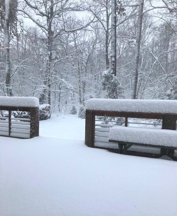
Obligatory deck pic from about an hour ago. Around 8".
-
Last hour or so has been meh. Just a steady light snow. Was expecting some banding late morning/early afternoon but has not materialized. Curious to know how much snow has fallen south and east of here. Radar has looked more impressive.
-
About to take another trip out to knock snow off trees and shrubs I care about lol.


