All Activity
- Past hour
-
 WxWiz will do his best to apply "english" to the risk areas to nudge them closer to CT!
 -
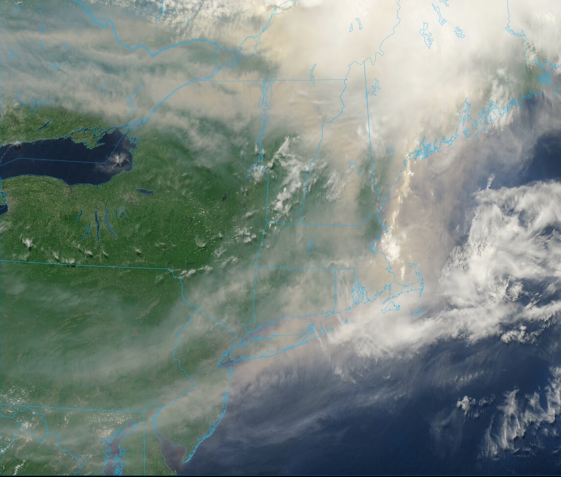
 The smoke has moved here. Sun tried and failed to work about noon, and by 1:30 we had that same dingy yellow/brown that dendrite posted. The only thicker smoke I can recall was when I was working at a forest fire. No 90s here; possibly not even 80s.
 -
 12z Euro/GFS both pushing the bounds of credibility with that (apparently) unconstrained trough depth around the 21s/22nd ... The indexes have an unusually amplified +PNA numerically signaled in that time range, so some sort of anomaly is okay but ... egads! doesn't have to -3.5 SD, either. I guess in order to balance the hemisphere for all that French rage the models have to hang their asses over somewhere to make the world fair.. lol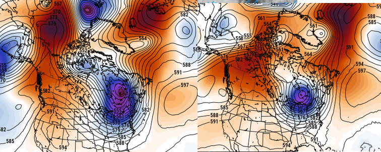
-
The watch now would not be for the big stuff later I think. Marginal svr is psbl this aftn in cntrl/nrn ME. The tor box would be later for far nrn VT/NH, and NW ME.
-
Dual pol makes it easier w/ the TDS. It really narrows things down and gives confidence, so the NWS may be more inclined to send a survey to the area(s) despite the remote location, And now we have drones to scout out areas that are not accessible by road/foot. And I think at times if a strong TDS is present in a very remote area, the NWS will count that as a tor even if no survey or ground reports.
-
 whoops... Not the first time a part of Maine has been in 10% tor, first time for 10% hatched. But this is the farthest north for 10%. @Winter Wizard I think posted a map a page or two back showing the data from Iowa St
 -
Stranger things have happened! How about this from July 1987? I think I will be a 2.5 mi wide F4 and cross the Continental Divide! https://www.tornadotalk.com/teton-wilderness-wy-tornado-july-21-1987/
-
@CoastalWx post earlier about watching southwest of where SPC has is looking good. Hourly runs of the HRRR are beginning to get a bit more aggressive with activity back across upstate NY, northern VT, and norther NH. Stuff may even get closer to central VT/NH. May see a southward expansion of the enhanced at 20z
-
Wait, no or yes? This is the first time for a ME 10% tor risk you mean?
-
Not sure what the brown shading implies but I'm sure a tornado watch would be most likely. Kind of shocked though only 60% chance of issuance...but that is covering any potential for stuff to pop later afternoon. I think the real concern is more evening and early overnight so may be too early for a watch on that stuff. So we may see a watch soon and then more later
-
 Certainly possible, it is one of the most desolate regions in the entire country and it's rare to get any kind of chaser traffic. Still, that's an impressive streak and more than double the previous. I guess you could say Maine is overdue.
 -
 I wonder if they go with a tornado watch?
 -
Neither has VT. NH only one is the Sep 1821 event.
-
MCD out...60% chance for a watch
-
They've got no way to stop that fire storm up there, either. this may be a smoke problem going forward ... clearly wasn't assessed in/for today - not sure how it's done tomorrow. Altho- we may end up with more a NW component which could shunt it maybe NYC ish?
-
I wouldn't be surprised if that areas gets more tornadoes than what's realized. Dual-pol will make this easier but I bet if we had the data there would be a secondary max (if not overall max) of severe weather instances across that part of Maine, its just it does unreported because of population density. They probably end up with an overlap of favorable ingredients more times than the remainder of the region. Far enough north to be influenced by the stronger jet dynamics/shortwaves and far enough south to tap into warmer/humid air.
-
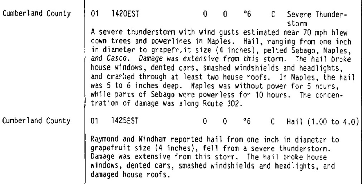
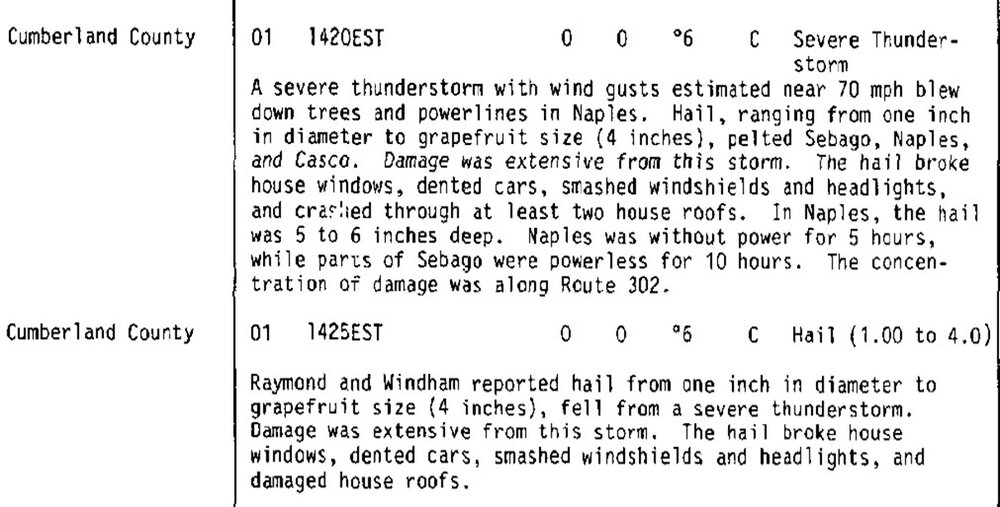
For reference, the biggest hail in New England is 4" in SW ME on 6/1/1986. Here is the Storm Data entry.
-

2026 Spring/Summer Mountain Thread
franklin NCwx replied to Buckethead's topic in Southeastern States
Just won't stop raining now -
WxWiz, I used to have a nickname for CoastalWx - EML MAN! I think I will give the name to you now!
-
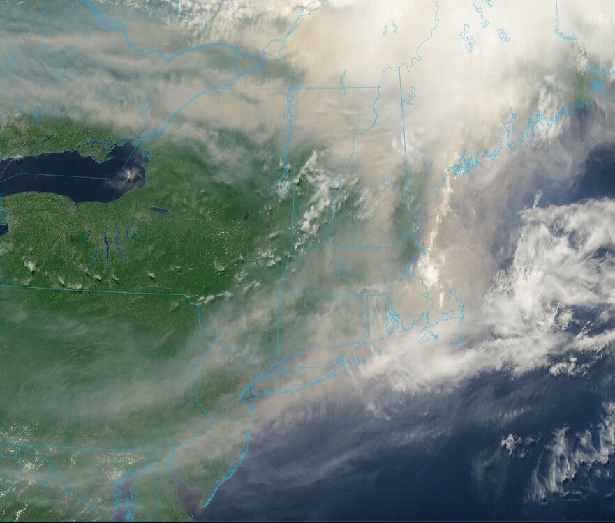
One more band of smoke to sink southeast across the area next few hours. That should be followed by somewhat clearer skies by late afternoon / evening from NW to SE.
-
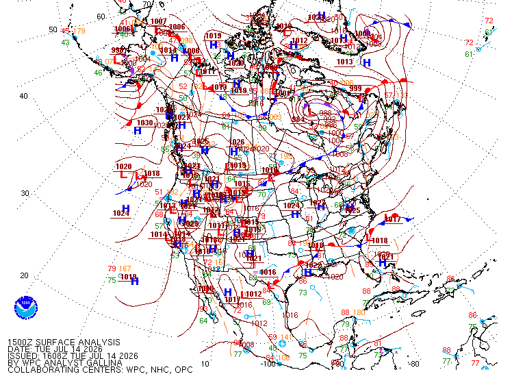
Odd mesoscale feature that cloud line. Something you more typically see in the Plains where anything is possible convective-wise! WPC shows no warm front anywhere but there has to be something there looking at the thickness packing alone across srn Quebec to ern ME.
-
10% snuck into southern Maine on 6/6/10 and western Maine 6/23/24. But this is the first 10% risk in that area and by far the most widespread in the state. Also, there hasn't been a tornado in 6 years there.
-

Central PA Summer 2026 Discussion/Obs Thread
Mount Joy Snowman replied to Voyager's topic in Upstate New York/Pennsylvania
Tomorrow's fairly weak daily high record of 99 may be beatable, although smoke may knock off a couple degrees. -
On the plus side, thar might be enough to hold temps down on Thursday...
-
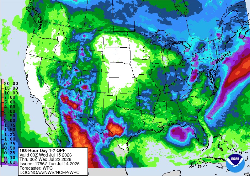
WPC take on rainfall next 7 days. Most of this falls Saturday into early Sunday. Tweaks I'm sure over the next few days but potential for some locally heavier totals over parts of the sub forum.