All Activity
- Past hour
-

July 2025 Obs/Disco ... possible historic month for heat
Torch Tiger replied to Typhoon Tip's topic in New England
Looks like Hubbdave gets the goods. will probably split N/S in this area, not expecting anything. -

July 2025 Discussion-OBS - seasonable summer variability
LongBeachSurfFreak replied to wdrag's topic in New York City Metro
That’s actually super ideal for fireworks. The lower dews mean less smoke clogging up the sky. -
 fixed it for you - The NOAA method is well proven for getting the DESIRED answer
 -

July 2025 Obs/Disco ... possible historic month for heat
NoCORH4L replied to Typhoon Tip's topic in New England
Will be warned soon -
July 2025 Obs/Disco ... possible historic month for heat
Torch Tiger replied to Typhoon Tip's topic in New England
congrats in advance (cia) -

July 2025 Discussion-OBS - seasonable summer variability
donsutherland1 replied to wdrag's topic in New York City Metro
There are cycles and there are also longer-term trends. For example, New York City is seeing increasing precipitation (as expected from climate change). Its cycles continue and a drier cycle will commence at some point, but the overall trend is greater annual precipitation. In contrast, parts of California and the Desert Southwest are in an aridification trend. There will be wetter cycles, but the overall trend is reduced precipitation.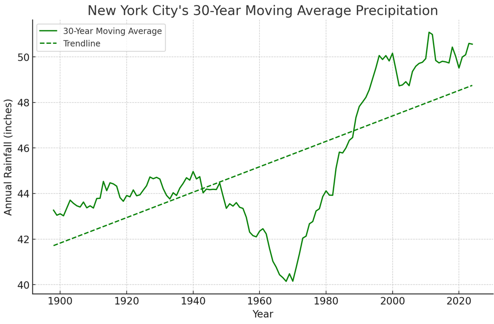
-

July 2025 Obs/Disco ... possible historic month for heat
Chrisrotary12 replied to Typhoon Tip's topic in New England
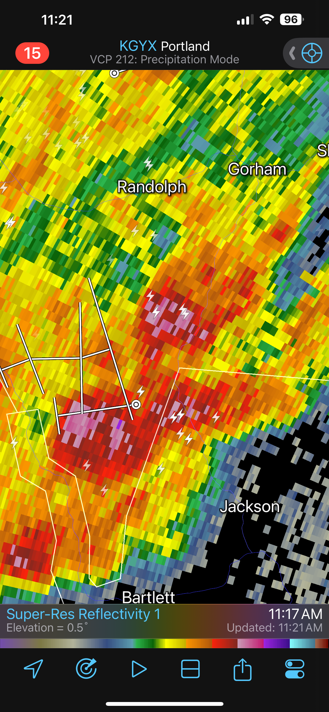
Cell by Jackson is mean. Nice meso. -
July 2025 Obs/Disco ... possible historic month for heat
Chrisrotary12 replied to Typhoon Tip's topic in New England
Make a bet? Nashua always misses -
July 2025 Obs/Disco ... possible historic month for heat
Torch Tiger replied to Typhoon Tip's topic in New England
Nashua can't miss this one. congrats -

July 2025 Obs/Disco ... possible historic month for heat
Typhoon Tip replied to Typhoon Tip's topic in New England
yup there we go nice cell near orange -

July 2025 Obs/Disco ... possible historic month for heat
dryslot replied to Typhoon Tip's topic in New England
No we don't need hail. -
July 2025 Obs/Disco ... possible historic month for heat
Torch Tiger replied to Typhoon Tip's topic in New England
A few light storms, nothing too heavy. -
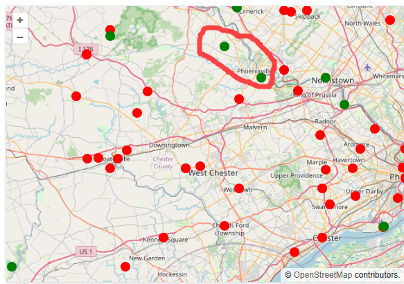
Look at how close these 2 stations are in NE Chesco....certainly not representative of the county climate
-

July 2025 Obs/Disco ... possible historic month for heat
dendrite replied to Typhoon Tip's topic in New England
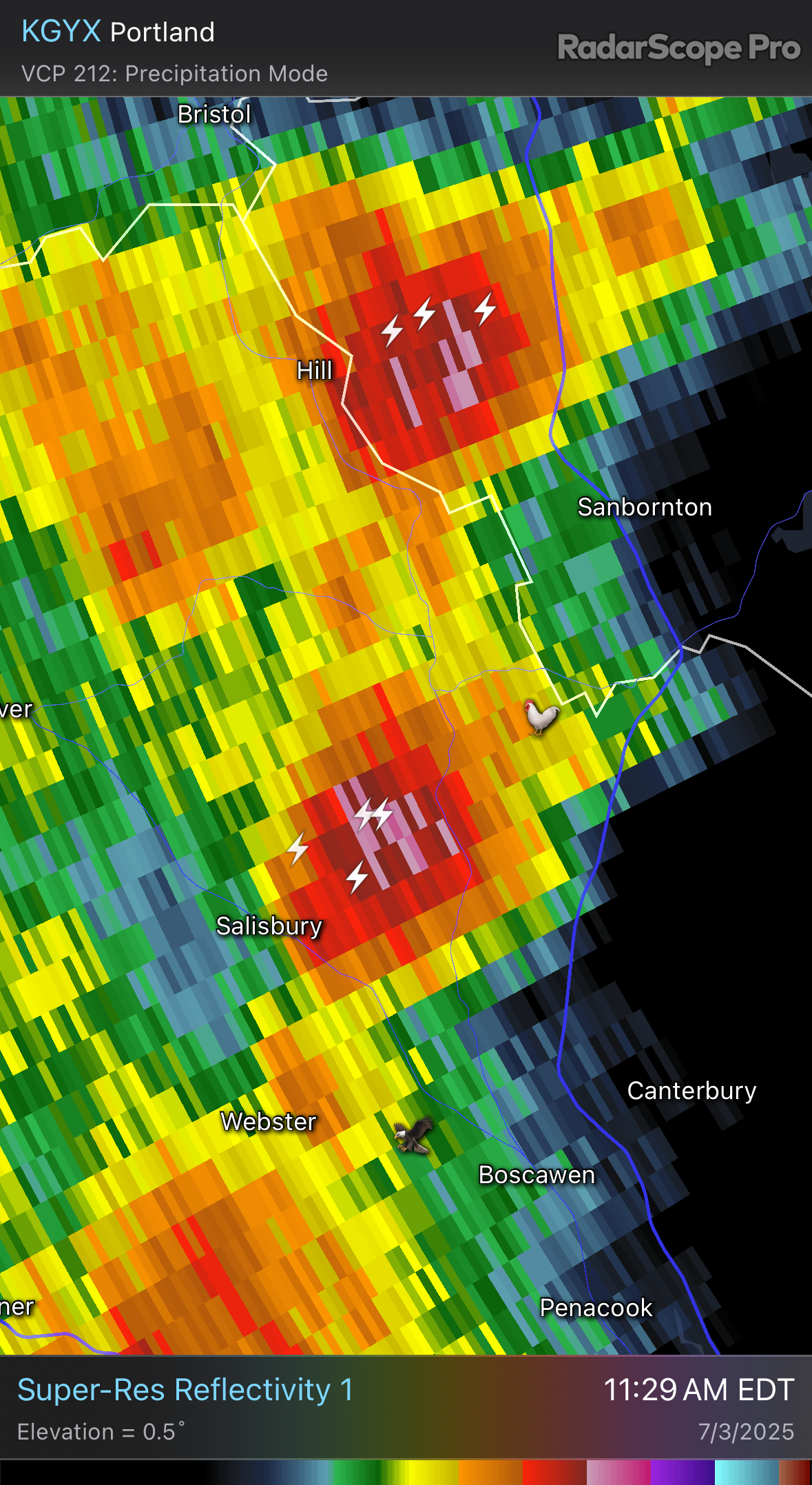
Contoocook reporting 1/2” hail again -

July 2025 Discussion-OBS - seasonable summer variability
Brian5671 replied to wdrag's topic in New York City Metro
Looks pretty isolated on the HRRR -
July 2025 Obs/Disco ... possible historic month for heat
Typhoon Tip replied to Typhoon Tip's topic in New England
Impressive CB structures visible here on the NW-N horizon associated with that... I can also see TCU ( new) just up the way so I suspect Rt 2 may take off down here soon -
July 2025 Obs/Disco ... possible historic month for heat
dendrite replied to Typhoon Tip's topic in New England
Shit I don’t need hail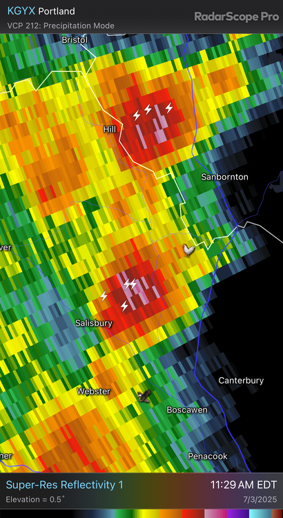
-
July 2025 Obs/Disco ... possible historic month for heat
dendrite replied to Typhoon Tip's topic in New England
Almost 80dBZ up in the county must’ve been fun -

2025 Spring/Summer Mountain Thread
BlueRidgeFolklore replied to Maggie Valley Steve's topic in Southeastern States
Pretty weird seeing the Southern Escarpment so dry. -

July 2025 Discussion-OBS - seasonable summer variability
STORMANLI replied to wdrag's topic in New York City Metro
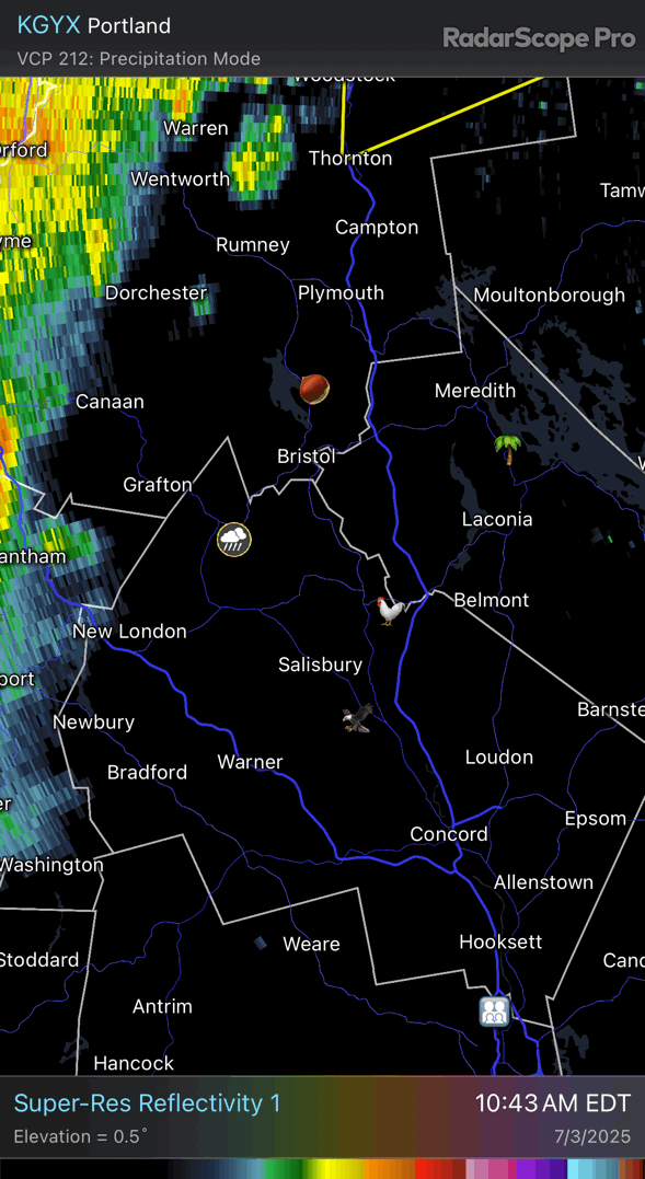
Not sure if any activity makes it here before 630pm and watching Dews drop or at all. -
July 2025 Obs/Disco ... possible historic month for heat
Chrisrotary12 replied to Typhoon Tip's topic in New England
NNE round 1. -
The Phoenixville and Spring City sites that are now the only remaining NWS COOP stations of course run warmer than all other stations in 24 of the last 25 years. On average a 0.8 degree variation. With those sites running as much as 3 degrees too warm in one year and at least a degree warmer in 15 of those years!! Makes very little sense as these 2 stations are much lower in elevation and near each other in the Northeastern section of Chester County....yet these are the 2 stations that NCEI will use to calculate their county averages.....call me stunned!! LOL!

-
July 2025 Obs/Disco ... possible historic month for heat
dryslot replied to Typhoon Tip's topic in New England
Those cell's near Berlin went severe with some hail in them.
-
July 2025 Obs/Disco ... possible historic month for heat
dendrite replied to Typhoon Tip's topic in New England
Let’s wash out Center Harbor and the Weirs again
-
I see the pol thread got nuked lol