All Activity
- Past hour
-

Jan 30th-February 1st 2026 Arctic Blast/ULL Snow OBS Thread.
John1122 replied to John1122's topic in Tennessee Valley
It's been crazy how it's just sat in place. The bands, as you guys are now getting to see, are darn fun. That's the best and worst part about ULLs. At times their banding may give an area 6 inches, and 20 miles away that area may only get an inch. -

Arctic Hounds Unleashed: Long Duration Late January Cold Snap
Snowedin replied to WxWatcher007's topic in New England
I mean relative to the last week or so lol..at least we should be out of the teens for a few days, it’s something man! -
1.8 above. Not gonna get anywhere near -10 at this rate.
-
Hey Mesowest users. New moving to spot https://viewer.synopticdata.com/map/data/now/air-temperature#map=7.92/41.53/-71.74

-

Jan 30th-February 1st 2026 Arctic Blast/ULL Snow OBS Thread.
Jeff Co Vol replied to John1122's topic in Tennessee Valley
Don't be selfish. Slide some of that southeast toward the I-40 bridge across Douglas Lake. -

Jan 30th-February 1st 2026 Arctic Blast/ULL Snow OBS Thread.
Stovepipe replied to John1122's topic in Tennessee Valley
Looking at the mosaic radar it seems like it might be slightly rotating counter-clockwise or wobbling right over east TN, sweeping in the southern areas along the way. Doesn't appear to be going anywhere any time soon, which matches the general look of the HRRR. 19.8 degrees currently here. Hope we can keep the chunky flakes with temps in the teens! -
Jan 30th-February 1st 2026 Arctic Blast/ULL Snow OBS Thread.
John1122 replied to John1122's topic in Tennessee Valley
That's ripping. I can never get good photos of snow falling! -

Jan 30th-February 1st 2026 Arctic Blast/ULL Snow OBS Thread.
housemtnTN replied to John1122's topic in Tennessee Valley
Visibility has gotta be 2-300 yards at best. This is melting my brain right now. -
Jan 30th-February 1st 2026 Arctic Blast/ULL Snow OBS Thread.
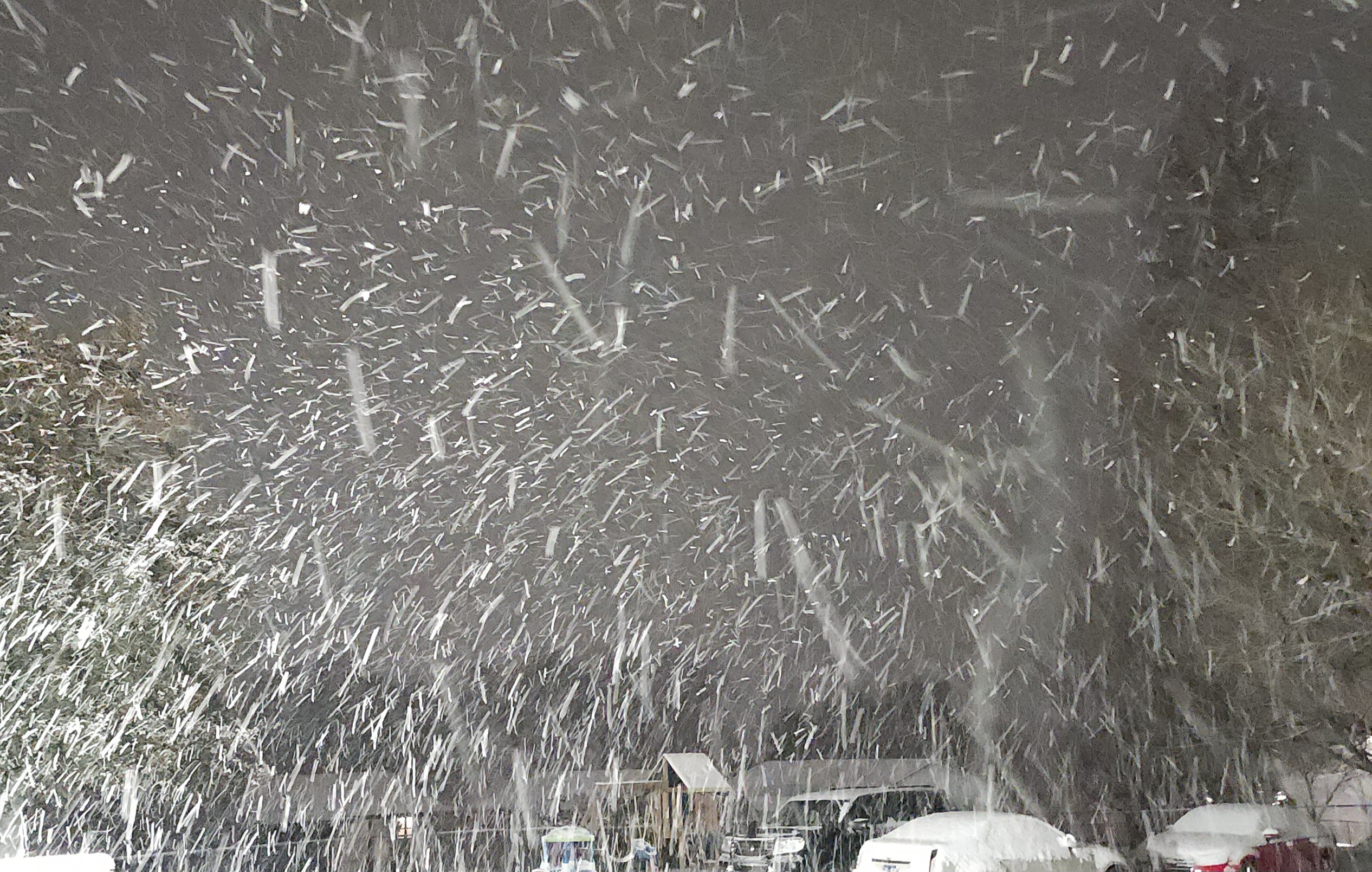
housemtnTN replied to John1122's topic in Tennessee Valley
Best I could do on a picture lol.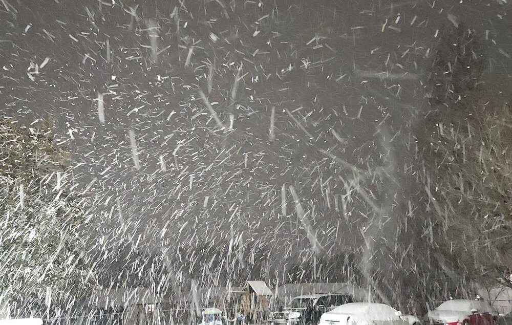
-

Jan 30th-February 1st 2026 Arctic Blast/ULL Snow OBS Thread.
ShawnEastTN replied to John1122's topic in Tennessee Valley
Heaviest I've had yet, mostly big flakes at the moment. I'm really surprised because I thought I might miss the edge of the snow almost completely. If it does this all night I'm going to bust big. I'm already passed forecast amount. Approaching warning criteria. -
Jan 30th-February 1st 2026 Arctic Blast/ULL Snow OBS Thread.
John1122 replied to John1122's topic in Tennessee Valley
I have a spot where I measure and a spot that I clean off every three hours to measure. That will give you a good idea of your rates. And in cases where the snow is wetter than this, it will give you a better measurement of how much snow actually fell since you won't have as much compaction. -
Jan 30th-February 1st 2026 Arctic Blast/ULL Snow OBS Thread.
Stovepipe replied to John1122's topic in Tennessee Valley
East Knox/west Jefferson/north Sevier really intensified, gotta be wild over there! -
Jan 30th-February 1st 2026 Arctic Blast/ULL Snow OBS Thread.
Jeff Co Vol replied to John1122's topic in Tennessee Valley
I'm reading 60+ dbz on my radar for parts of that cell. I'm a weather watching amateur, but that is impressive. -
Jan 30th-February 1st 2026 Arctic Blast/ULL Snow OBS Thread.
John1122 replied to John1122's topic in Tennessee Valley
I'm down to about 1/4th inch per hour now, hopefully it can keep up here until 9am at least. That would get me another inch and a half. -
Jan 30th-February 1st 2026 Arctic Blast/ULL Snow OBS Thread.
housemtnTN replied to John1122's topic in Tennessee Valley
I have no idea how to quantify snowfall rates but from watching for the past 20 minutes, this has gotta be well over an inch per hour. -
Jan 30th-February 1st 2026 Arctic Blast/ULL Snow OBS Thread.
Jeff Co Vol replied to John1122's topic in Tennessee Valley
According to my RadarScope, you've been under a dark blue umbrella for a long time! It has been impressive.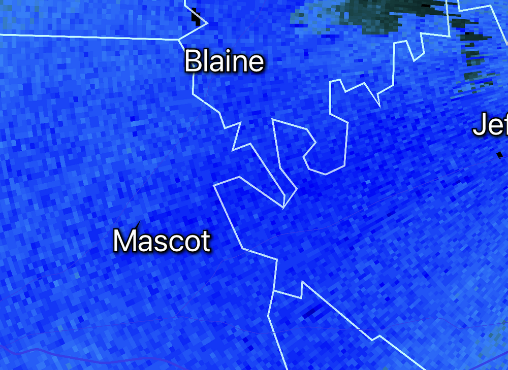
-

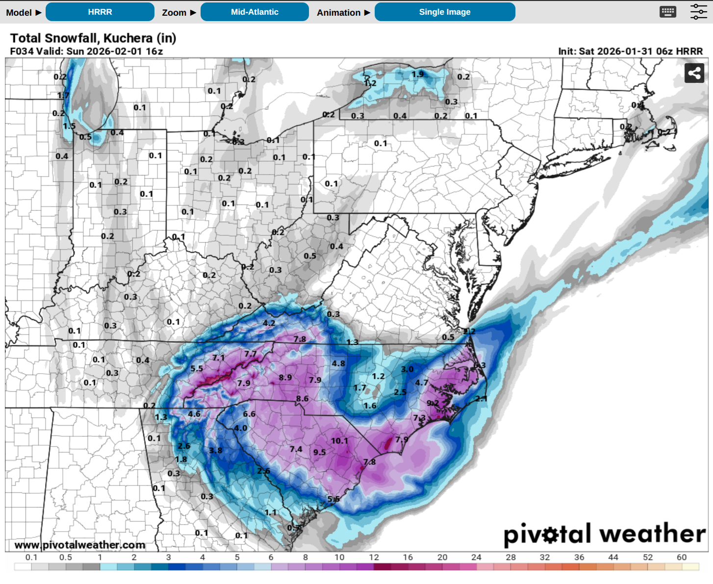
The “I bring the mojo” Jan 30-Feb 1 potential winter storm
JoshM replied to lilj4425's topic in Southeastern States
6z HRRR , FWIW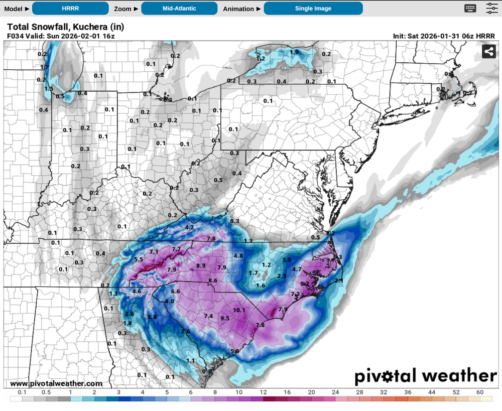
-
Jan 30th-February 1st 2026 Arctic Blast/ULL Snow OBS Thread.
housemtnTN replied to John1122's topic in Tennessee Valley
I think I'm about to have goose feathers. This is wild. Visibility is probably less than 1/10 mile, just absolutely puking it all out! -

The “I bring the mojo” Jan 30-Feb 1 potential winter storm
Silver Meteor replied to lilj4425's topic in Southeastern States
The weak Low moving near the S.C. you refer to has since stretched out and is now in the process of reforming notably farther offshore, probably where it was supposed to form. Notice the tropical feed here at 2:30am. https://www.ventusky.com/wind-speed-map/10m-above-ground#p=31.8;-76.5;5&w=0xIAb9A9A -

Arctic Hounds Unleashed: Long Duration Late January Cold Snap
Ginx snewx replied to WxWatcher007's topic in New England
Thaw?.thumb.png.773bc9082f5ed8d3f6940d0609ff847a.png)
-
Jan 30th-February 1st 2026 Arctic Blast/ULL Snow OBS Thread.
ShawnEastTN replied to John1122's topic in Tennessee Valley
Yeah I've been getting quarters mixed with smaller flakes. Then an occasional wind gust blows clouds of blowing snow off my roof and it swirls around. I'm at about 2 inches now which was the high end of my MRX forecast. -
Jan 30th-February 1st 2026 Arctic Blast/ULL Snow OBS Thread.
John1122 replied to John1122's topic in Tennessee Valley
I think the 10+ projections from models that way will probably verify. The ratios are incredible so it will really stack up. I can't account for micro climates there because I don't know them like the folks who live there. But I did see that this was overperforming around Bristol at least. And Tri had 5 inches 2 hours ago. -

2025-2026 Fall/Winter Mountain Thread
Rainforrest replied to Buckethead's topic in Southeastern States
Little over 2” still moderate snow. -

Jan 30th-February 1st 2026 Arctic Blast/ULL Snow OBS Thread.
Hurricaneguy replied to John1122's topic in Tennessee Valley
John based on what has fallen and what could still yet to fall taking into count hi res models duration left, what do you think areas around Greeneville through Johnson City end up with? -
Jan 30th-February 1st 2026 Arctic Blast/ULL Snow OBS Thread.
John1122 replied to John1122's topic in Tennessee Valley
That's when I started really accumulating fairly quickly. It got up to about 3/4ths inch to 1 inch per hour for a few hours.


.png.73456314a68ad5aeb3f29e02d28dbc33.png)