All Activity
- Past hour
-
As @Scottie16said...last thing our county needs. Lately if a squirrel farts wrong, Flec seems to lose transmission lol.
-

January 2026 regional war/obs/disco thread
SnoSki14 replied to Baroclinic Zone's topic in New England
Massive cold dome with trough out west and SE ridge in place. This will yield a massive overrunning storm. Yes there will be a brick wall somewhere but good chance it ends up affecting areas pretty far north. -
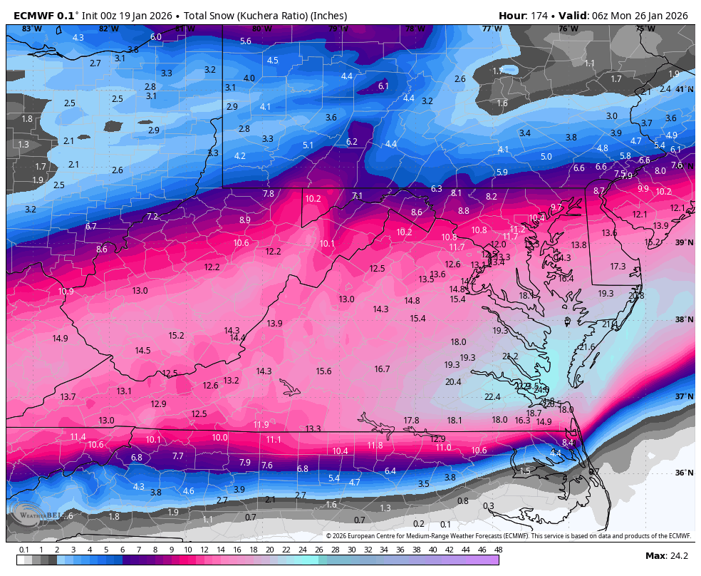
The Euro is less QPF than other models, but would still have around .7 qpf as ice down that way, capped with some snow.
-
.thumb.png.4150b06c63a21f61052e47a612bf1818.png)
January 2026 regional war/obs/disco thread
HIPPYVALLEY replied to Baroclinic Zone's topic in New England
I think -16F is my record low since moving to Greenfield. Challenging that is impressive. -
The last thing our county needs. .
-
-
Just had a random though that this is kinda similar to the January 14th 24’ storm .
-
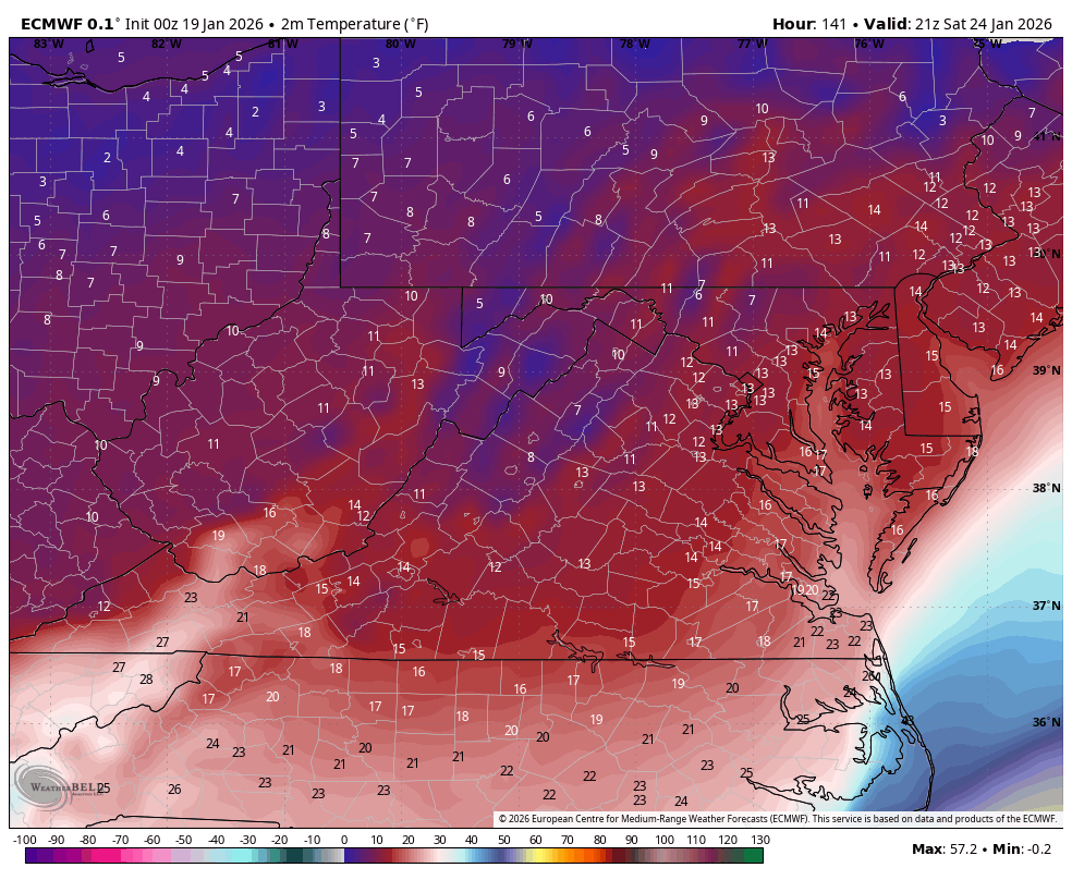
With surface temps area wide in the 20s..that lights out recipe south of 40
-
Sat night
-
Euro OP ever so slightly tried to nose the LP up the spine of the Apps vs 12z, which allowed the 850s to surge up.
-
This looked interesting but it was a nothing burger
-

January 2026 regional war/obs/disco thread
WxWatcher007 replied to Baroclinic Zone's topic in New England
Buns for one. Buns for all. Vodka cold next weekend. -
Damn you’re right my bad!
-
We all know the Richmond jackpot always verifies.
-
what's the time frame here of heaviest snows?
-
18z only runs to 144,s orry.
-
Richmond Metro/Hampton Roads Area Discussion
snowchill replied to RIC Airport's topic in Mid Atlantic


-
Can you post the 18z snowmap for comparison?
-
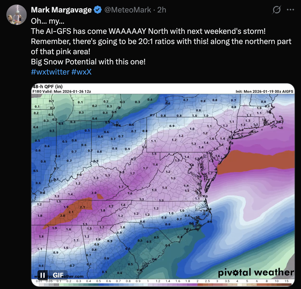
btw the 20:1 ratios are real according to mark mcgarbage


-
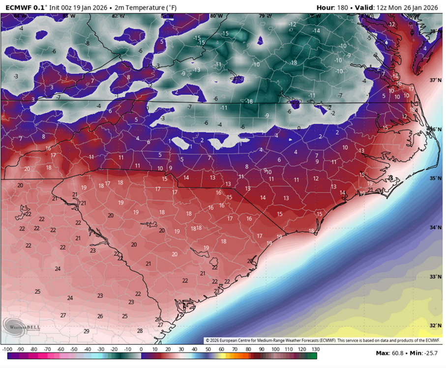
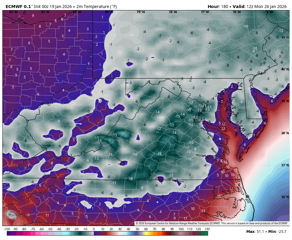
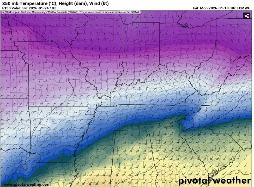
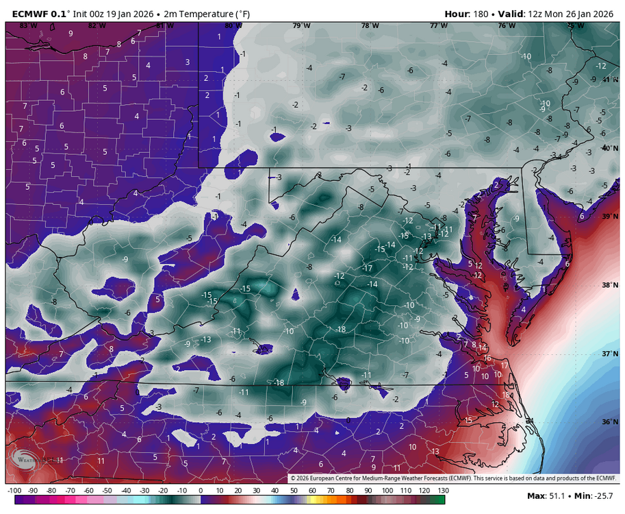
We go deep into the ice box on the Euro with that snow cover. Some -10ish stuff showing up in Western areas.
-
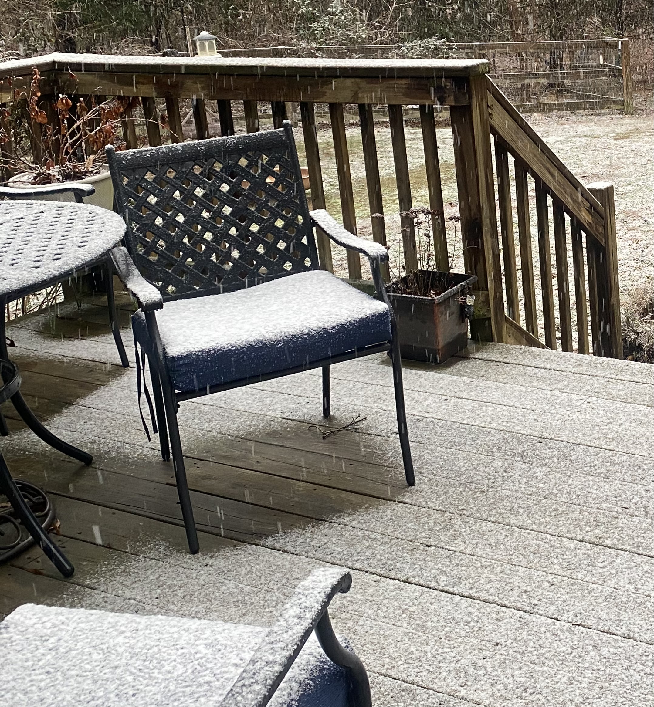
a very light dusting here, but down to 23.4F. 25F at DCA.
-
Fresh arctic air on a fresh, deep snowpack will let those temps bust low.
-
Richmond Metro/Hampton Roads Area Discussion
snowchill replied to RIC Airport's topic in Mid Atlantic
Powhatan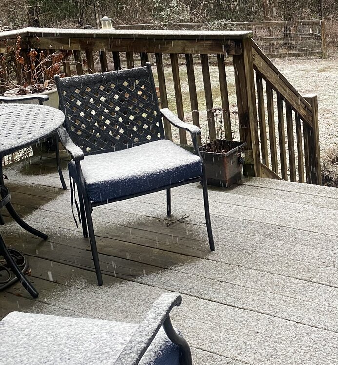
-
Guys, if it snows, it's going to stick around and become glacier for at the very LEAST a week. Models are literally projecting high temps barely getting into the 20s after Jan 25
-
Wow.