All Activity
- Past hour
-

Augdewst 2026: Summer's Last Stand
tamarack replied to Prismshine Productions's topic in New England
Reported measurable precip to Cocorahs each of 8/23,24,25. Unfortunately, those 3 "rainy" days totaled 0.04". drip, drip, drip -
Nice that you got to see it. I forgot about it and woke up at 6. I should have gotten up at 530, doh. 55 degrees this morning.
-
I would do okay, but could def. see it being an ORH season...they have had some uncharacteristically skunkish seasons of late....gonna see that regress.
-
CFS January rendition would make some fun times for WOR folks....Miller B-East, much?
-
Yeah kind of due for those.
-
Has December near normal surprisingly. Is it a bit too cold? Probably....likely underdoing the magnitude and arial extent of that Canadian ridge, but I don't think this will be a bottom-dweller season in terms of snowfall.
-
 pharmacy website india: India MedOk - India MedOk
 -
Here is January:
-
I wouldn't call it a head fake. I envision something more gradual with full tilt a month+ later than usual. But I could be wrong, soooo...
-
Absolute same page....128-495 CFs. Megalopolis Storm CF was right over Wilmington.
-
Records: Highs: EWR: 97 (1993) NYC: 95 (1948) LGA: 96 (1948) JFK: 97 (1969) Lows: EWR: 48 (1940) NYC: 52 (1940) LGA: 53 (1940) JFK: 54 (1987) Historical: 1635: Boston, Massachusetts region hit by the "Great Colonial Hurricane". (Ref. NOAA Boston Weather Events) (Ref. AccWeather Weather History) 1814 - In the early afternoon, a strong tornado struck northwest Washington D.C. and downtown. The severe tornadic storm arrived the day after the British Troops had set fire to the Capitol, the White House, and other public buildings. The storm's rains would douse those flames. The tornado did major structural damage to the residential section of the city. The tornado's flying debris killed more British soldiers than by the guns of the American resistance. The storm blew off roofs and carried them high up into the air, knocked down chimneys and fences and damaged numerous homes. Some homes were destroyed. It lifted two pieces of cannon and deposited them several yards away. At least 30 Americans were killed or injured in the heavily damaged buildings, and an unknown number of British killed and wounded. 1885 - A severe hurricane struck South Carolina causing 1.3 million dollars damage at Charleston. (David Ludlum) 1910: Bowen, MT set the record for lowest temperature ever observed in the lower 48 states in August with a reading of 5 °F. Wisdom, MT was not very far behind with a reading of 11°. Great Falls, MT set an early season and August record snowfall of 8.3 inches on the 22nd and 23rd, while St. Mary, MT reported a foot. Cheyenne, WY reported an all-time August record low of 25°, while Scottsbluff, NE set their lowest August temperature and earliest freeze on record, with a low of 30°. Kimball, NE recorded a low of 26° while the temperature fell to 25° near Lusk, WY. (Ref. AccWeather Weather History) 1914: Boston, Massachusetts had its lowest maximum temperature for August of 57 °F. (Ref. NOAA Boston Weather Events) 1940 - New Jersey experienced its coldest August morning of record, with lows of 32 degrees at Layton and Charlotteburg. (The Weather Channel) 1958: Record chill occurred across parts of the upper Midwest. Cities recording their coldest August temperature included: Austin, MN: 34°, Decorah, IA: 35°, and Genoa, WI: 41°. (Ref. Additional Temperatures Listed On This Link) 1972: Philadelphia, PA measured their 25th consecutive day without measurable rainfall. (Ref. AccWeather Weather History) 1974: Ocala, Fla.--Lightning struck a lakeside dock just west of Ocala killing a 17-year-old boy and injuring five other youths. Tampa, Fla.--A 32-year-old Largo, Fla. woman was killed and two children were injured when lightning struck into a crowd watching an air show at McDill Air Force Base. The two children injured were the woman's 3-year-old son and an 11-year-old Clearwater girl. (Ref. Lightning-The Underrated Killer.pdf) 1987 - Morning thunderstorms produced heavy rain in eastern Nebraska and southwestern Iowa. Stanton IA reported 10.50 inches of rain. Water was reported up to the handle of automobiles west of Greenwood NE. Rainfall totals for a two day period ranged from 7 to 14 inches across southwestern Iowa. Crop damage was in the millions for both states. Subsequent flooding of streams in Iowa the last week of August caused millions of dollars damage to crops, as some streams crested ten feet above flood stage. (Storm Data) 1988 - Seven cities in California reported record high temperatures for the date, including Sacramento with an afternoon reading of 104 degrees. Thunderstorms produced locally heavy rains in Arizona. Chino Valley was drenched with 2.50 inches of rain in just thirty minutes washing out a couple of streets in town. (The National Weather Summary) 1989 - Morning thunderstorms drenched Spencer, IN, with 4.10 inches of rain in three hours causing extensive street flooding. Evening thunderstorms in eastern Kansas produced up to six inches of rain around Emporia, and four inches of rain in just forty-five minutes near Parsons, and also produced wind gusts to 70 mph at Lake Melvern. (The National Weather Summary) (Storm Data) 1992: After unleashing sustained winds of around 165 mph around Homestead/Florida City, FL, Hurricane Andrew headed for the Louisiana coast. Hurricane Warnings were posted from Pascagoula, MS to the Bolivar Peninsula on the northeast Texas coast. Billings, MT fell to 35°, their coldest August temperature on record. This was the 3rd consecutive day with a low temperature in the 30s at that location.(Ref. AccWeather Weather History) (Ref. Wilson Wx. History) 1993: In Augusta County, VA people took refuge from a thunderstorm under a solitary tree. Lightning struck the tree and injured four people.(Ref. Lightning - Virginia Weather History) 1998: Torrential tropical downpours from the remnants of Tropical Storm Charley caused flash flooding along Texas State Highway 349 between Iraan and Sheffield. Just south of Iraan fast moving waters swept pavement away from this highway. Unconfirmed reports of 7 inches of rain were received from citizens of Sheffield.(Ref. Wilson Wx. History) 2003: Record high temperatures occurred across parts of the Midwest. Rockford, IL set a new record high with 97° while O’Hare Airport in Chicago, IL tied their record high with 95°. (Ref. Wilson Wx. History) 2005 - Katrina becomes a hurricane just before landfall in south Florida between Hallandale Beach and North Miami Beach. Maximum sustained winds at the time of landfall were near 80 mph. There were eleven fatalities in South Florida, including four by falling trees. More than 1.3 million customers lost electrical services, and preliminary insured loss estimates ranged from $600 million to $2 billion in the state of Florida (Associated Press). 2011: Earthquake Aftershock West Henrico Co. - Glen Allen VA. area had another 4.5 aftershock this morning at 1:07 AM that woke us up as it rattled the pulls on the chest of drawers. (West Henrico Co. - Glen Allen VA. Weather Station ) 2017: Harvey's intensification phase stalled slightly overnight from August 24–25, however Harvey soon resumed strengthening and became a Category 4 hurricane late on August 25. Hours later, Harvey made landfall near Rockport, Texas, at peak intensity. The strongest winds were focused just northeast of Corpus Christi, around Rockport. The highest reading of 132 mph was registered at Port Aransas. (Satellite-before-Landfall on the 24-25 landfall near Rockport, Texas) (Harvey made landfall near Rockport, Texas)(2017 Hurricane Summary Weatherwise Harvey,Irma,Maria) 2020: Tuesday-August 25 Entering over the waters of the southeastern Gulf of Mexico during the predawn hours of Tuesday, Laura became better organized and began strengthening to become the fourth hurricane of 2020 after sunrise as NOAA hurricane hunter aircraft data determined that maximum sustained surface winds had reached 75 mph. At the time, the center of Hurricane Laura was continuing toward the west-northwest and was located approximately 145 miles to the northwest of the western tip of Cuba. Throughout the remainder of Tuesday Laura continued to strengthen slightly while traveling to the west-northwest across the waters of the central Gulf of Mexico. During the predawn hours, Hurricane Laura strengthened to a category two hurricane as it began to curve to take a track toward the northwest and then to a major category 3 hurricane as winds reached 115 mph as the hurricane's center was slightly less 300 miles to the south of the Louisiana Gulf Coast. Thus, Laura became the first major hurricane of the 2020 Atlantic hurricane season.
-
This has a feeling of a 128-495 gradient deal. Not that the coast gets skunked (might get a good one in Feb) but I could see Dec-Jan be more wet then white on the coast vs what may occur just inland. Kinda like 02-03 only milder.
-
71 / 58 clear a gorgeous day today and much of tomorrow, pending on the arrival of clouds. Next round of unsettled weather Thu-Fri with showers/rain and some heavier 1-2/3 amounts a bit north. Clears out by Saturday for a nice weekend. RIdges push east / west from Atlantic for an overall warm to potentially hot Aug 30 - labor day and beyond.
-

Augdewst 2026: Summer's Last Stand
Typhoon Tip replied to Prismshine Productions's topic in New England
I've noticed it in Augusts ... just sayn' -
 If I had to leave here it would probably be for somewhere in New England. But I don't ever see myself leaving Michigan, I love this state too much.
 -
http://indiamedok.com/# online shopping pharmacy india
-

Augdewst 2026: Summer's Last Stand
TauntonBlizzard2013 replied to Prismshine Productions's topic in New England
I got .17 lol. I said that yesterday. It rained for 5 minutes. Me and Bob are not in the same location -
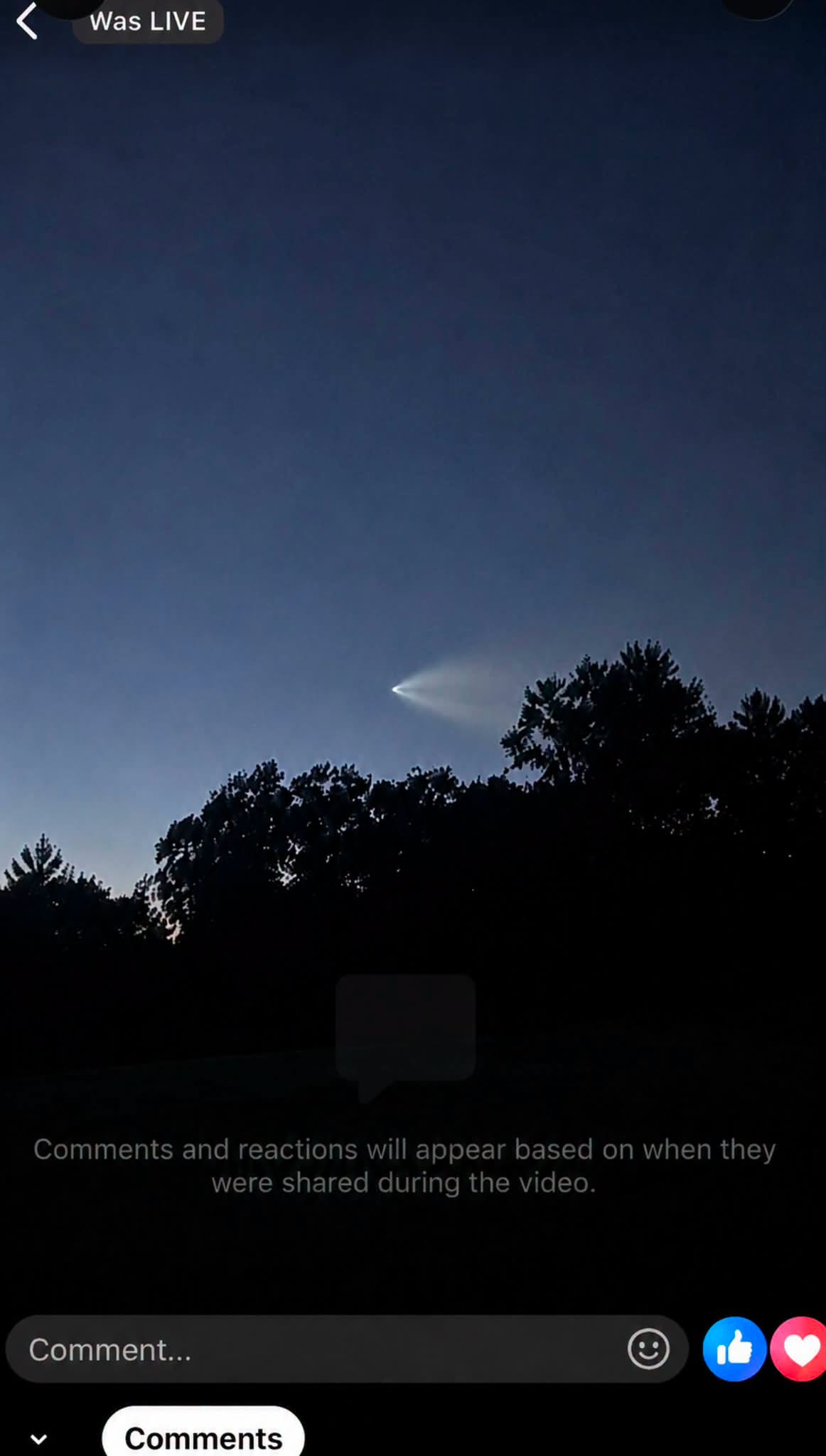
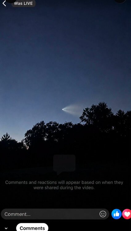
A friend got a nice pic
-

2026-2027 Record-breaking El Nino
40/70 Benchmark replied to Stormchaserchuck1's topic in Weather Forecasting and Discussion
-
This is the European monthly depiction of precip anomalies overlaid with temp anomalies for the month of Feb. Euro is my preferred solution because it doesn't have the zonked Modoki look that the CANSIPS and JMA do....that is overdone and crap. But the Euro simply evolves the El Nino in such a manner whereas the warmth gets pretty evenly distributed..pretty basinwide for winter. You drop those type of precip anomalies, I will gladly take my chances with a +1 temp anomaly at this latitude.
-
Augdewst 2026: Summer's Last Stand
40/70 Benchmark replied to Prismshine Productions's topic in New England
I do, but not during the summer....I consider that before the final write up....I go back and compare summer composites to find fits to the current year. -
Fun fact by the way, there was a TS Bertha back in 2002 that also went into TX. That was also an EN summer, but it didn't have the weird or sheared setup as far as I remember, like this year's 2026 Bertha did.
-
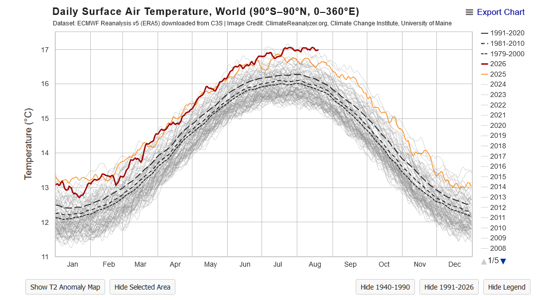
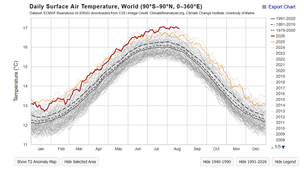
Climate Reanalyzer has us currently warmer than any other august, ever ... Not sure what-how to reconcile these two products - I'll leave that y'all... but it looks like it confirms that idea about Aug. Not sure about 'all months' tho - this below looks like the current month is running along 2nd in that scope. As an aside, also defiant of the fact that all years are typically descending by now. zoink Fwiw, this product includes 1940 - 2026/present
-
2026-2027 Record-breaking El Nino
40/70 Benchmark replied to Stormchaserchuck1's topic in Weather Forecasting and Discussion
Yea, same page...I think this is a good assessment. I initially didn't have time for a deep dive and just looked at the IRI, but I think the dynamical data has over adjusted and is too cooked...I'd go statistical suite. I usually kill it with ENSO forecasting, but being in uncharted territory like this makes it more difficult to pin down a specific range, despite obviously knowing it will be intense. -
2026-2027 Record-breaking El Nino
40/70 Benchmark replied to Stormchaserchuck1's topic in Weather Forecasting and Discussion
@GaWxI edited these down after really looking at it more...I have put most of my energy into the extra tropical Pacific of late. This is consisted with the max rate of growth observed form this point forward, which was in 1982.