All Activity
- Past hour
-
Too early to go big ... responsibly, anyway. It's tricky though because ginormous events have a real statistical proven ability to "show up" early and establish themselves in guidance with relative persistence ... compared to say, a big bomb in the winter that comes and goes in the guidance...only to verify as a pedestrian winter storm. Heat is very fragile in the guidance. That's problematic - early detection of historic heat is not really so statistically clad. As I was pointing out earlier, these so -called "synergistic heat events" - codified that way in attribution science related to CC ...etc. - were not seen in the same way. The reason for that difference is that they are non-linear - they emerge within the on-going signal. The analogy to "rogue wave" in a choppy sea really does work well. We can predict the stormy sea, we cannot tell if that stormy sea with synergize. When I see that pattern like that... I agree, let's get the pattern definite. The other aspect is that I don't think the eastern OV up through NE has ever seen a synergistic heat event. It's not a region conducive to that non-linearity. There are places in the ocean where rogue waves are more apt to occur, for example. I'm under the impression that as the analog goes, we are not as heat prone here. Those that hate heat and see 101 on the thermometer would probably rage that we do heat just fine, but Heathrow AP up at London, put up a 105 in 2022, at a latitude 5 degrees N of Caribou Maine. Relative to their climatology, that is a whopper SD larger than anything Boston has seen. That was a patented SHE ... An equivalent temperature at Boston is ~ 112
-

E PA/NJ/DE Summer 2025 Obs/Discussion
Hurricane Agnes replied to Hurricane Agnes's topic in Philadelphia Region
Better bottle this up because the long range doesn't look "cool". I did manage my first 90+ of the season last Thursday, actually hitting 91. And with all the rain threats that were progged, I actually ended up getting the most yesterday, with 0.60" for the plants. It's currently overcast and 64 with dp 64 and 0.01" in the bucket from some scattered showers. -
If we dont break records its a fail
-

2025 Short Range Severe Weather Discussion
sbnwx85 replied to Chicago Storm's topic in Lakes/Ohio Valley
I've started a thread for the week: -
A nice multi-day setup across the region. Currently, a Tornado Watch is up for much of Minnesota. But most of us are focused on the 18th. There is good potential for a severe complex of storms to plow through the most populated areas of our subforum. ...THERE IS A SLIGHT RISK OF SEVERE THUNDERSTORMS FROM LOWER MICHIGAN SOUTHWESTWARD INTO OKLAHOMA... ...SUMMARY... Scattered thunderstorms with severe wind gusts and hail are expected on Wednesday from the southern Plains to the southern Great Lakes, and over a small part of the Mid Atlantic. ...Synopsis... On Wednesday, an upper trough will move from the central Plains across the mid to upper MS Valley, with a lead wave moving from MO into Lower MI. A surface low is expected from eastern IA into lower MI during the day, with a trough extending southwestward across IL, MO, and OK. A very moist and unstable air mass will exist ahead of this main front with upper 60s to lower 70s F dewpoints. To the east, a weak surface trough is forecast to develop over the Mid Atlantic, where strong heating will lead to an unstable air mass beneath modest southwest flow aloft around western Atlantic high. ...MI southwestward into OK... Scattered storms may be ongoing Wednesday morning from IA into MO and northeast OK, with remnant MCS activity. It appears the greatest ascent will move across northern areas coincident with the shortwave trough, from northern IL into lower MI. Here, shear profiles will likely support supercells, including hail and perhaps tornado threat. Farther south, stronger instability and PWAT will exist along the front but with weaker shear. Substantial convection is expected with areas of damaging winds likely. Some of these storms may move south to southwest due to propagation. Given steep midlevel lapse rates, sporadic hail may occur as well.
-
I think 100 is definitely possible in June. I wouldn't go as far as July 2011 temperatures just yet though (which were 103-108). Let's say 98-102 as a range for now. I definitely want all of us to hit 100 (including the south shore.)
-
CC has made us more damp and with onshore flow which caps max temps, but that doesn't mean the potential isn't there for us to set all time highs when we finally get a super ridge with a downsloping flow. Yes usually we just have higher dews and minimums, but the atmosphere is loaded and ready to go when we finally get the major heat ridge with the right wind direction.
-
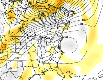
So I guess we've reduced the pixel counts/allowance on the site? graphics are being rejected ...ones not particularly expensive either. This is a truncated CFS solution from 12z centered on 204. I thought it interesting to note that this model's climate fusion with the operational GFS is still bursting through that weight and putting this enormous positive anomaly integral fro Colorado to NS
-
While I think it’ll be hot, I’m still skeptical of a long duration “big heat” wave—big heat defined as 95°+ temperatures or 100°+ heat indices.
-
100 would be downright historic, especially for NYC and JFK.
-
Right now I'd go with 100-104F max but there's higher potential if models give amping this heat dome.
-
Got to go with climate history with whats possible here. If you get more be prepared but no reason to go into uncharted territory yet. CC has not proven itself able to give us that kind of extreme high in the summer yet.
-
CC infused heat dome. Our version of what the Pac NW experienced? The signs are downright scary.
-
Please don’t rile her up. Enjoying the present with hope for the future, as always …..

-
let's see if it happens, but this is like the forecast for January 2015 to me (you know which storm I mean lol, the one the Euro predicted us getting 38 inches of snow lol). January 2016 I found more believable because it was during a super el nino, but January 2015 not so much. It's going to be extremely hot no doubt, but I think a range of 98-101 is more likely than 102-108.
-
Not every place experiences climate change the same way, indeed. But when the stars align (which is always going to be rare but the odds go up) we can break our all time record highs.
-
I don't remember any heat in late June 2021.....
-
Thanks that explains all the extreme heat in 1944, 1948, 1949, 1953, 1955 It matches up with the extreme heat we had in 1991, 1993, 1995, 1999 and 2002.
-
For us the new climate is rainy, humid, elevated mins and highs that have flatlined in the upper 80s and low 90s during the summer anyway.
-
If that ridge and that flow verifies, it's going way above 101. We were overdue our super heat blast that practically every other place on Earth has already experienced in this new abysmal climate.
-
Summer is here huh
- Today
-
Just don't believe this is possible in June, do you know it's never been hotter than 101 in June in NYC (1966)? I go with climate history over fringe models. I think we could hit 100 on one day, but that's it.
-
sounds like July 1993 I highly doubt that kind of heat is possible in June subtract 10 degrees from that
-
I hope JFK gets to 104
-
No, historically on these extreme heat days we peak out between noon and 2 PM, this has been my experience with what happened in 1993, 1999, 2010, 2011. When it gets extremely hot cumulus clouds billow up, even if there is no sea breeze.