All Activity
- Past hour
-
Have fun dying on a hill to defend Howard's bullshit.
-
I would love to but I don’t think we would get along very well. Have a great evening defending a horrible human being.
-
Lol, oh yea it’s definitely not relevant in your eyes.
-
A loser in the woods lol. True to form from you. Come visit.
-
Not relevant. I have seen plenty of your posts over the years.
-
Dude you’re a loser living in the woods, stop trying to bully people. It sure as hell won’t work with me. So simmer down.
-
You don’t even know what the comment was, so STFU and stop your holier than though BS.
-
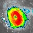
You can see in this IR image that the environment isn't pristine, but there's just enough of a window to allow for the inner core to take shape. Now we're in the intensification phase and if the core can remain shielded from the shear and drier air to the west this has a chance to become a major before shear takes its toll on Friday. As for impacts beyond landfall, meaningful rain continues to look likely up and down the east coast, as the remnants of Isaias seem to get caught up in a subtle trough and get kicked eastward as it gains forward speed post landfall. It doesn't look like flooding rain, but I think we need a little more time to get a sense of the rain potential. What continues to be interesting to me is the potential for at least some favorable conditions for severe storms, especially if the timing ends up a bit slower and the mid level center passes to our west during daytime Sunday. From the SPC: For Sun/D5, the shortwave trough and remnants of the tropical cyclone will generally move northeastward toward the Appalachians and toward the Carolinas and southern Mid Atlantic. It is possible that the upper system outruns the unstable warm sector, but at least a low end chance of severe is not out of the question.
-
I bet there are plenty of people here who think this vile post would be more appropriately directed at you
-
Does anyone know who has more Stanley Cups or playoff victories? Asking for a friend And yes, tell the friend the Capitals won tonight
-
As if you never make 'lowlife' comments. You are the king. gtfoh.
-
I’m happy you do, because you’re a complete douchebag and have always been one. I have a good memory and ill never forget your vile, lowlife comment. Now crawl back into your hole because nobody wants to hear from your pathetic ass.
-
And with that, my peak season forecast grade improves. Might get two H's now that the NHC won't have to worry about postseason futility records with Fay. Peak Season Forecast (Aug 20-Oct 20) Named Storms: 5 (6) Hurricanes: 3 (1) Major Hurricanes: 1 (0) Dolly, Edouard, Fay, Gonzalo, Hanna, Isaias (H)
-
we are working on that, but commercial fusion on a public grid is still at least a decade away if you are referring to fission reactors, lots of those being built around the world; but in the US the folks that have money to invest in energy generation know financial risk vs. reward doesn't pencil compared to other energy investments like renewables
-
Was just coming to post about the dropsondes. Let's see what the next pass looks like but that was a substantial drop in pressure between center fixes.
-
hurricane now.
-
@Skivt2
-
Hurricane Isaias Tropical Cyclone Update NWS National Hurricane Center Miami FL AL092026 1030 PM CDT Wed Oct 07 2026 ...ISAIAS BECOMES A HURRICANE... Dropsonde data from an Air Force Reserve hurricane hunter aircraft indicates that Isaias has become a hurricane, with maximum sustained winds of 75 mph (120 km/h) with higher gusts. The minimum central pressure measured from another dropsonde launched in the eye was 982 mb (29.00 inches). SUMMARY OF 1030 PM CDT...0330 UTC...INFORMATION --------------------------------------------------- LOCATION...22.9N 91.9W ABOUT 180 MI...290 KM NW OF PROGRESO MEXICO ABOUT 460 MI...745 KM SSW OF THE MOUTH OF THE MISSISSIPPI RIVER MAXIMUM SUSTAINED WINDS...75 MPH...120 KM/H PRESENT MOVEMENT...ENE OR 70 DEGREES AT 9 MPH...15 KM/H MINIMUM CENTRAL PRESSURE...982 MB...29.00 INCHES
- Today
-
Yea, I have it falling just short.
-
Oh no not at all. This is probably modest impact at best. Severe risk tbd.
-
Hurricane warnings hoisted for extreme W FL, AL, E MS.
-
Looking pretty Nino at h5 on the latest Euro extended product by mid November. Would be nice to have that Aleutian trough/downstream ridge position for much of the winter.
-
 https://sierramedsrx.shop/# mexican pharmacy for hair loss pills
 -
Yeah, I know. Thanks for calming me down
-
canadian pharmacy king or cipa canada online pharmacy canada pharmacy http://opendata.go.tz/id/api/1/util/snippet/api_info.html?resource_id=19e6c16a-f378-4b74-8dc6-5cb90c254b82&datastore_root_url=https://auroramedsdirect.com online canadian drugstoreor https://www.trendyxxx.com/user/pgylxogshc/videos vipps approved canadian online pharmacy [url=http://pachl.de/url?q=https://auroramedsdirect.com::]canada rx pharmacy[/url] canadian pharmacies onlineor [url=https://exhibitioncourthotel4.co.uk/user-2/umidmzhvqs/?um_action=edit]canadian pharmacy reviews[/url] canada pharmacy store