All Activity
- Today
-
I think 17-18 was a lot more fun than 16-17.
-
using that info, it makes sense why we had we had a pattern of cold/dry wet/mild alternating with each other.
-
I find it ironic he stated that snowfall has dropped since 1989-90 when the late 80s and early 90s were historically horrible for snowfall here!
-

2025-2026 ENSO
Stormchaserchuck1 replied to 40/70 Benchmark's topic in Weather Forecasting and Discussion
I think we'll start warming up around the turn of the month. -
Looks like Memorial Day weekend will be salvaged and beyond that, the heat out west in the Rockies will shift east for early June?
-
like 2011?
-
2025-2026 ENSO
Stormchaserchuck1 replied to 40/70 Benchmark's topic in Weather Forecasting and Discussion
Because of a retrograding -NAO. But again, the NAO is not sustaining for more than a few days, and is rapidly going back and forth between positive and negative phases. bluewave was right in that observation. Longer term it should warm up around the beginning of June. -
2010-11 and 2014-15 were both in the top 3 for here.
-
I wouldn't call this *nice* it's going to be cold and wet here.
-
Nice find, will be adding to the bookmarks
-
2025-2026 ENSO
Stormchaserchuck1 replied to 40/70 Benchmark's topic in Weather Forecasting and Discussion
If the daily PNA gets near -2, that would be the first time since December 2021. CPC +PNA that we saw this Winter has not sustained. -
Chris, can we do something different to compare recent storms with storms from the distant past to make the comparison more meaningful? Instead of taking storms from the distant past and trying to apply modern measurement techniques, let's take modern storms and use the older methods on them. For example, would the January 2016 31 inch measurement at JFK still be 30 inches or more using the old measurements? The liquid equivalent was 3.0 inches so it's still 30 inches using a 10:1 ratio.
-
it's disappointing, it's going to be in the 50s and raining just before Memorial Day weekend (at least there's a chance it might clear before the actual weekend.) I thought CC was supposed to prevent this cold crap from happening when it's nearly summer. This is what everyone will be saying lol.
-
Man, Thursday looks like we'll be taking a page right out of the Shitwaukee playbook. Mid 40s with driving rain on a NE wind in late May.
-
Well I likewise think you argument is kinda ridiculous because it doesn't see the nuances of the situation. Ordinarily you'd be right. An owner who's already been here would have responsibility. But Rubenstein just got here...and last year he and the group were literally just trying to settle in when the seeds of this mess were already being formed. To suggest he, after increasing the payroll; should've stopped Elias from making bad moves? And he doesn't know baseball as much and a departing Burnes being the only big "owner possibly more involved" ticket? That's the part that doesn't make sense. It's just the timing of everything--I just don't see Joe he deserves the blame this time given the timing of all this.
-

Spring 2025 Medium/Long Range Discussion
Chicago Storm replied to Chicago Storm's topic in Lakes/Ohio Valley
spartman broke character? i didn't have that on my bingo card. but, i didn't have a dust storm on it either. -
Friday's dust storm was quite an experience... Never thought I'd ever report a DS at ORD. Peak conditions... ORD: DS 1/2SM G50MPH MDW: +DS 1/4SM G60MPH Info... •The dust storm warning for Cook County was only the second ever issued for the county. •It was the first ever dust storm warning issued for downtown Chicago. •Per Frank Wachowski, the last dust storm of this severity in the metro area was way back on May 10th, 1934.
-
ORD had a high temp of 94° on Thursday, which broke the record high maximum temp for the date of 91° (1962).
-
Chicago Weather Records Tracking
Chicago Storm replied to Chicago Storm's topic in Lakes/Ohio Valley
Chicago/O'Hare had a high temperature of 94° on May 15th, which broke the record high maximum temperature for the date of 91° (1962). -
Could be Monday as well,where ever the boundary sets up.GFS has been showing this for several runs now,but Tuesday looks better as you mentioned ...Portions of the TN Valley... Multiple rounds of thunderstorms are possible along a residual baroclinic boundary across the TN Valley, both during the morning hours, and later in the evening. While not quite as unstable as points farther to the west, modest mid-level lapse rates amid elongated hodographs should support multicells, supercells, and short line segments. The stronger storms may be capable of isolated instances of large hail, gusty winds, and perhaps a brief tornado.
-
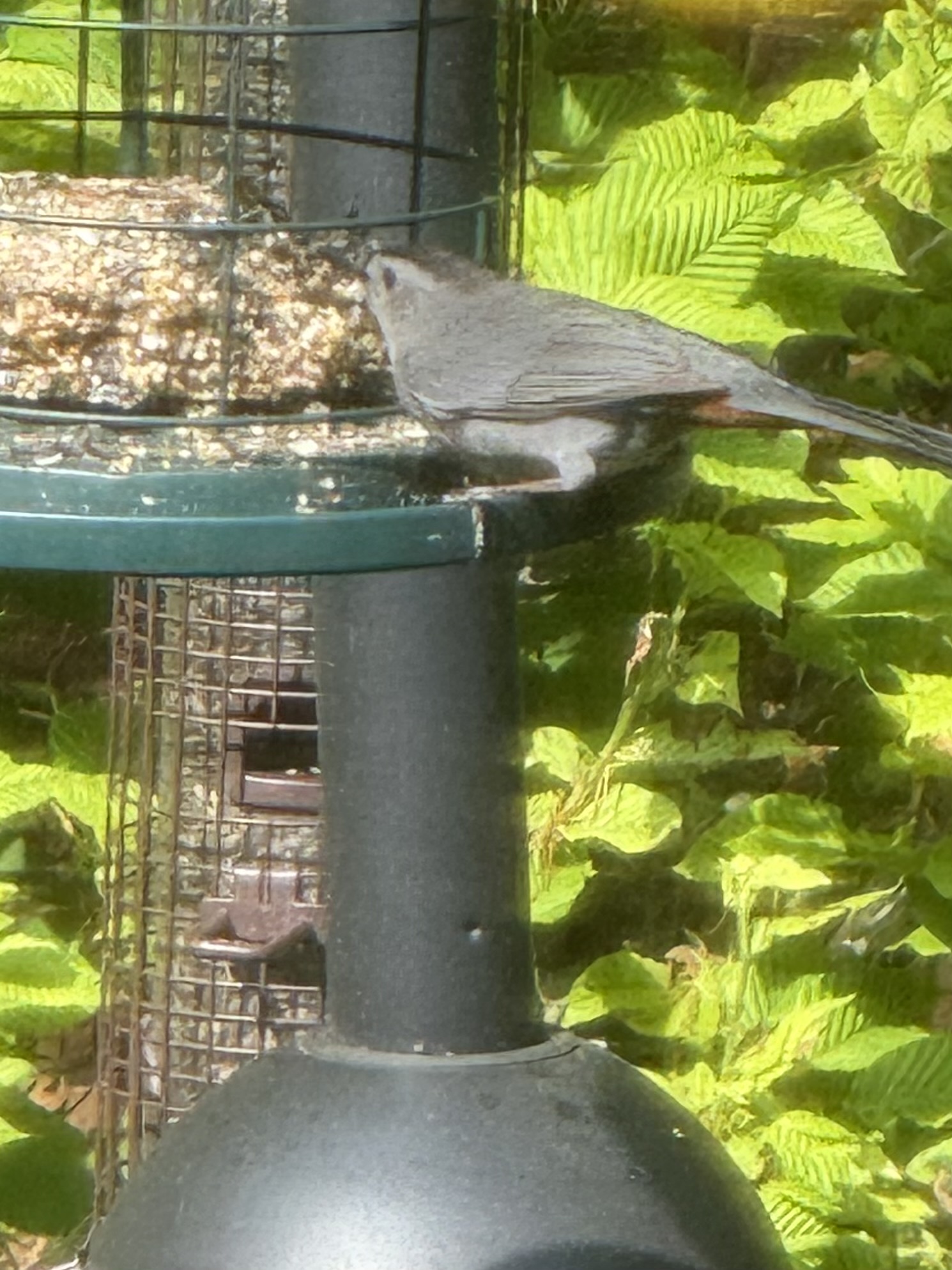
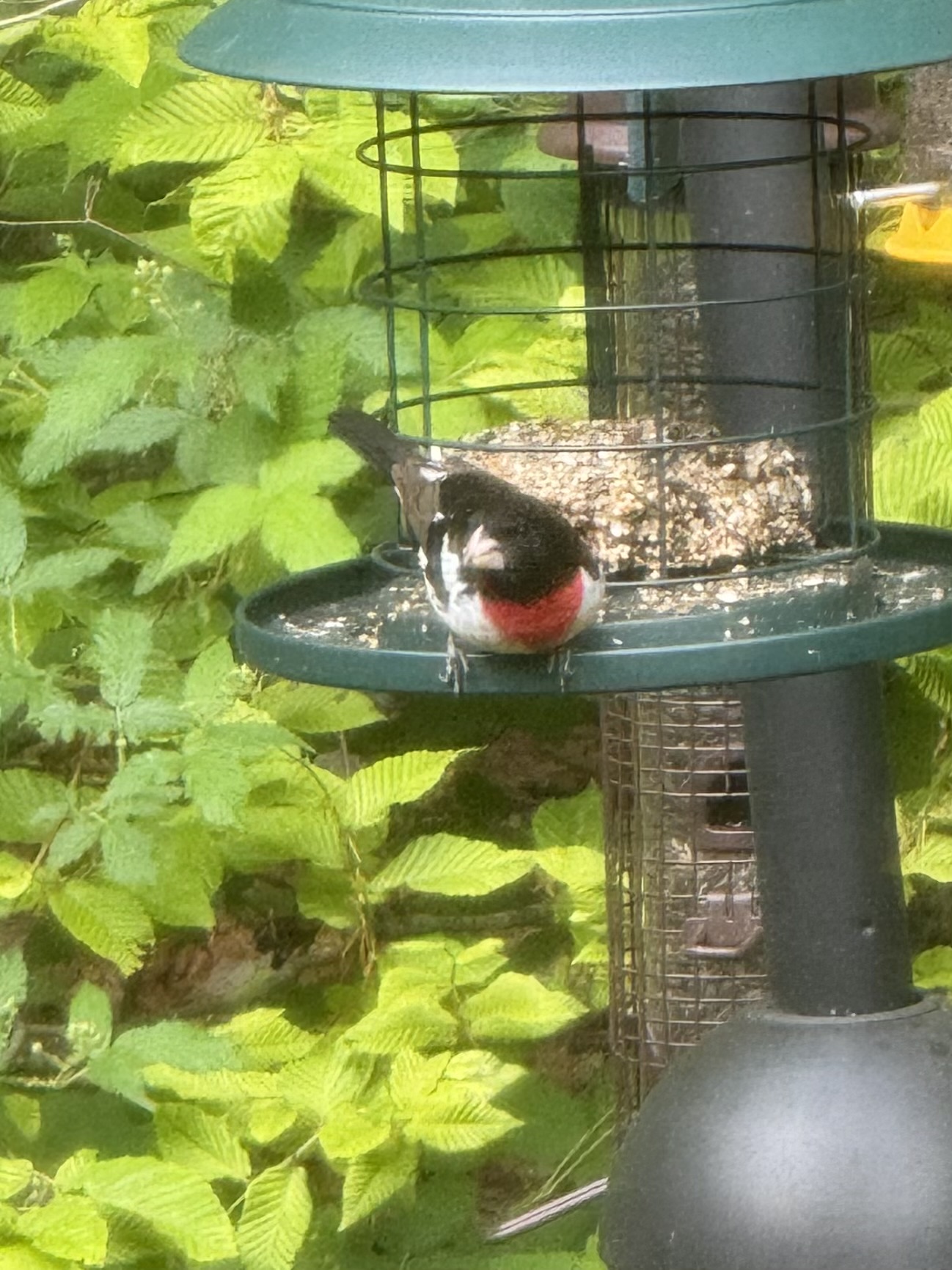
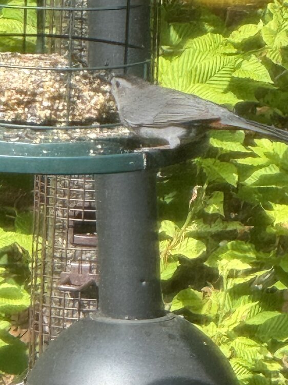
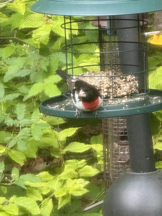
Another beauty out there today for sure. It sounds like the love train might come to a screeching halt for a while but can’t complain after the last few days. Funny how the air has just started taking on that summer-like feel as the warmth has begun to dominate this part of the world. This change is so subtle but after a while you just embrace it. I leave you all with a couple little shots earlier I took of the birds, one of which I believe is a rose grosbeak, something I’ve never seen before and another of a gray catbird, which I don’t believe is a common sight either. Ya really can’t miss the screeching sound of the catbird lol.
-
I know it's been mentioned a few times here, but wanted to make a point to mention https://windy.com for weather maps and models. It's come a long way from wind/waves that it focused on when it first started. They also have apps for iOS/iPad and Android. I'm seriously considering a premium subscription.
-
The FMH-1. Enjoy. https://www.icams-portal.gov/resources/ofcm/fmh/FMH1/fmh1_2019.pdf
-
59/56 feels so much better out
-
Ya it feels terrible with the cool air coming in now.. I hate the heat and haven't needed the ac yet.. I will admit last night was close.. I do think it's funny how much you like you like the heat but need to install right away.. I love the cold and wear shorts in the winter.. so the question is do you really like summer temps and ass sweat?