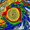
HurricaneJosh Posted October 21, 2013 Share Posted October 21, 2013 Eh so much for the no majors futility streak. Raymond will need to get sheared fast for that to hold. What do you know the storm Josh opts of will turn out to be the hawtest storm in many years. OK, you just hush up! The GFS and ECMWF initialized terribly with the system. The NHC noted significant uncertainty in their forecast and stated it would not take much for this to come ashore. Go on. You guys are terrible, getting me all worked up like this. But, yeah, that MW is crazy-hawt. Link to comment Share on other sites More sharing options...
wxtrackercody Posted October 21, 2013 Share Posted October 21, 2013 Now 110 mph w/ a pressure of 967 millibars. Link to comment Share on other sites More sharing options...
phil882 Posted October 21, 2013 Share Posted October 21, 2013 Its certainly not moving fast tonight, just merely drifting north. The other factor I have been neglecting that is just as important as intensity is the size of the system, which is below average. Because of this, the PV tower is also smaller than a normal TC, which would limit the impact the upper-level steering currents to the north. I don't blame Josh for having cold feet, especially when the guidance continues to shy away from a direct landfall. Link to comment Share on other sites More sharing options...
HurricaneJosh Posted October 21, 2013 Share Posted October 21, 2013 Its certainly not moving fast tonight, just merely drifting north. The other factor I have been neglecting that is just as important as intensity is the size of the system, which is below average. Because of this, the PV tower is also smaller than a normal TC, which would limit the impact the upper-level steering currents to the north. I don't blame Josh for having cold feet, especially when the guidance continues to shy away from a direct landfall. Thanks. Yeah, it's mega-hawt-- my kinda cyclone all the way-- but the setup just ain't clear enough. Even if it comes ashore as an intense landfall-- which it very well could-- I still feel my decision makes sense, given the indicators. Link to comment Share on other sites More sharing options...
phil882 Posted October 21, 2013 Share Posted October 21, 2013 With that said, the ECWMF's track over the next 24-36 hours is absolutely bazare... it still hasn't caught on to the whole RI thing thats been ongoing the last 24 hours, but it intensifies the system as it pushes it to the SE. I don't think I've ever seen a strong intensifying TC moving southeast in the EPAC since TC Norbert in 1984. If you want a good laugh you have to see the loop (below) http://www.atmos.albany.edu/student/ppapin/maps/gridsat/1984/epac/norbert.html Link to comment Share on other sites More sharing options...
jordanwx Posted October 21, 2013 Share Posted October 21, 2013 120 MPH @5AM. WHemi gets a major hurricane after all. Link to comment Share on other sites More sharing options...
olafminesaw Posted October 21, 2013 Share Posted October 21, 2013 It seems to be moving to the north a little faster now. Link to comment Share on other sites More sharing options...
phil882 Posted October 21, 2013 Share Posted October 21, 2013 Link to comment Share on other sites More sharing options...
Yellow Evan Posted October 21, 2013 Share Posted October 21, 2013 See, we've gone a year and 5 days without a major in the EPAC, and now that we have one, I'm like really really excited. Link to comment Share on other sites More sharing options...
Yellow Evan Posted October 21, 2013 Share Posted October 21, 2013 ATCF keeps it at 105 knts for 15z. Link to comment Share on other sites More sharing options...
icebreaker5221 Posted October 21, 2013 Author Share Posted October 21, 2013 Eye is clearing out nicely. BAMD continues to suggest that a deep system (as Raymond is rapidly becoming) would make landfall in about 24 h. That said, last few frames suggest that northward motion has slowed significantly. Could just be wobbles as the core continues to become better defined, or it could suggest that the southerly deep layer steering flow is not as robust as modeled. Need a few more IR images to say for sure. Looks like the early signs were quite telling... Deep layer steering was weak to begin with. A subtle but influential change in the evolution of the synoptic environment now favors a more easterly component to storm motion as evidenced by the abrupt westward shift of the BAMD at 12Z. Coastal MX will be hit by rain and wind, but the core will stay offshore. Good call on the no-go Josh. Link to comment Share on other sites More sharing options...
Superstorm93 Posted October 21, 2013 Share Posted October 21, 2013 Pretty impressive system. Hopefully it moves away from the coastline before those rains become a major issue. Link to comment Share on other sites More sharing options...
Yellow Evan Posted October 21, 2013 Share Posted October 21, 2013 Ill be surprised if this is not 115 knts at 0z. Link to comment Share on other sites More sharing options...
Yellow Evan Posted October 22, 2013 Share Posted October 22, 2013 Down to 105 knts at 3z. Link to comment Share on other sites More sharing options...
HurricaneJosh Posted October 22, 2013 Share Posted October 22, 2013 See, we've gone a year and 5 days without a major in the EPAC, and now that we have one, I'm like really really excited. Looks like the early signs were quite telling... Deep layer steering was weak to begin with. A subtle but influential change in the evolution of the synoptic environment now favors a more easterly component to storm motion as evidenced by the abrupt westward shift of the BAMD at 12Z. Coastal MX will be hit by rain and wind, but the core will stay offshore. Good call on the no-go Josh. Hey, thanks, man. Link to comment Share on other sites More sharing options...
Yellow Evan Posted October 22, 2013 Share Posted October 22, 2013 The longer you go without an intense storm, when an intense storm occurs, you get really excited. Raymond down to 100 knts though. Link to comment Share on other sites More sharing options...
phil882 Posted October 22, 2013 Share Posted October 22, 2013 Its so obvious that southwesterly shear is not the culprit to blame for Raymond's weakening today. Instead, its due to upwelling of cooler waters underneath (+ potentially some dry downslopeing off Mexico). OHC is not all that high underneath the storm currently, and satellite observations of SSTs won't be able to update fully the region until Raymond and its associated convection and cloudiness moves out of the way. Its likely the system has burned through all its fuel as noted by the warmer cloud top temperatures near the center vs. in the outer bands away from the center. Once Raymond starts moving to the west it should be able to recover, but the radial re-distribution of PV based upon the displacement of deeper convection away from the center suggests the radius of maximum winds should grow in size. Link to comment Share on other sites More sharing options...
HurricaneJosh Posted October 22, 2013 Share Posted October 22, 2013 Raymond's on life support-- barely a 'cane now. So glad I listened to the Euro/GFS/NHC triumvirate and avoided the temptation to fly down to ACA. Link to comment Share on other sites More sharing options...
Yellow Evan Posted October 23, 2013 Share Posted October 23, 2013 Raymond still 65 knts. Link to comment Share on other sites More sharing options...
Yellow Evan Posted October 26, 2013 Share Posted October 26, 2013 Raymond 45 knts. Slight chance it could rehook and come crashing inland but more likely will stall offshore. Link to comment Share on other sites More sharing options...
wxtrackercody Posted October 27, 2013 Share Posted October 27, 2013 Round 2. BULLETINHURRICANE RAYMOND ADVISORY NUMBER 31NWS NATIONAL HURRICANE CENTER MIAMI FL EP172013800 AM PDT SUN OCT 27 2013...RAYMOND CONTINUES TO STRENGTHEN...SUMMARY OF 800 AM PDT...1500 UTC...INFORMATION----------------------------------------------LOCATION...14.2N 116.0WABOUT 720 MI...1160 KM SW OF THE SOUTHERN TIP OF BAJA CALIFORNIAMAXIMUM SUSTAINED WINDS...85 MPH...140 KM/HPRESENT MOVEMENT...WNW OR 300 DEGREES AT 10 MPH...17 KM/HMINIMUM CENTRAL PRESSURE...982 MB...29.00 INCHES Link to comment Share on other sites More sharing options...
Yellow Evan Posted October 27, 2013 Share Posted October 27, 2013 Raymond making a comeback like Manuel. Can it go back to MH status? Link to comment Share on other sites More sharing options...
Amped Posted October 27, 2013 Share Posted October 27, 2013 Raymond making a comeback like Manuel. Can it go back to MH status? The small eye may give it a shot. There might be some southerly shear however. Link to comment Share on other sites More sharing options...
Yellow Evan Posted October 27, 2013 Share Posted October 27, 2013 80 knts per ATCF. Looks stronger than that IMO tbh. Link to comment Share on other sites More sharing options...
wxtrackercody Posted October 27, 2013 Share Posted October 27, 2013 BULLETINHURRICANE RAYMOND ADVISORY NUMBER 32NWS NATIONAL HURRICANE CENTER MIAMI FL EP172013200 PM PDT SUN OCT 27 2013...RAYMOND NOW A CATEGORY 2 HURRICANE...SUMMARY OF 200 PM PDT...2100 UTC...INFORMATION----------------------------------------------LOCATION...14.5N 116.6WABOUT 725 MI...1170 KM SW OF THE SOUTHERN TIP OF BAJA CALIFORNIAMAXIMUM SUSTAINED WINDS...100 MPH...160 KM/HPRESENT MOVEMENT...NW OR 305 DEGREES AT 9 MPH...15 KM/HMINIMUM CENTRAL PRESSURE...975 MB...28.79 INCHES Link to comment Share on other sites More sharing options...
Yellow Evan Posted October 28, 2013 Share Posted October 28, 2013 Peaked at 90 knts last night. Now down to 85 knts. Link to comment Share on other sites More sharing options...
Yellow Evan Posted October 28, 2013 Share Posted October 28, 2013 Now 60 knts. Link to comment Share on other sites More sharing options...
Yellow Evan Posted November 1, 2013 Share Posted November 1, 2013 Raymond gone, but 18E is here. Link to comment Share on other sites More sharing options...
icebreaker5221 Posted November 15, 2013 Author Share Posted November 15, 2013 Looks like something brief and weak could come of 98E. Otherwise, looks like the season is coming to a close. It was an odd season, with 20 named storms, 9 hurricanes, but only 1 major - completely at odds with the previous 2 seasons that featured a very high NS:MH ratio. Reminds me of the last 3 seasons in the Atlantic. Link to comment Share on other sites More sharing options...
PSUBlizzicane2007 Posted November 15, 2013 Share Posted November 15, 2013 Looks like something brief and weak could come of 98E. Otherwise, looks like the season is coming to a close. It was an odd season, with 20 named storms, 9 hurricanes, but only 1 major - completely at odds with the previous 2 seasons that featured a very high NS:MH ratio. Reminds me of the last 3 seasons in the Atlantic. It's like the tropical cyclone version of Dutch Disease. Link to comment Share on other sites More sharing options...


Recommended Posts
Archived
This topic is now archived and is closed to further replies.