phlwx Posted June 2, 2013 Share Posted June 2, 2013 the clouds moving in quickly isn't helping if you want severe, Link to comment Share on other sites More sharing options...
NaoPos Posted June 2, 2013 Share Posted June 2, 2013 Doesn't look like that severe type sky... Link to comment Share on other sites More sharing options...
greg ralls Posted June 2, 2013 Share Posted June 2, 2013 Sun is starting to poke through here in Lititz, Pennsylvania. each of the past two years when we were out here for my nephew's birthday we've had severe thunderstorms, if I recall correctly. Link to comment Share on other sites More sharing options...
Voyager Posted June 2, 2013 Share Posted June 2, 2013 15% for Wind and Hail was pulled all the way to the coast, but the 30% Wind was cut off north of NYC with the 1630. Discussion didn't specifically mention why the 30% was pulled back, but it seems that more cloud cover down here limiting instability was what prompted them to do it. Exactly, and if you check the current radar, the storms are pretty much firing north and east of PA in the Hudson River valley and heading toward New England. Link to comment Share on other sites More sharing options...
cast4 Posted June 2, 2013 Share Posted June 2, 2013 Looks like some cells are trying to pop in central MD. Link to comment Share on other sites More sharing options...
tombo82685 Posted June 2, 2013 Share Posted June 2, 2013 the parameters on spc still look decent, but i don't like the clouds being around and the showers scattered about. Just doesn't scream svr t storm type of situation. Link to comment Share on other sites More sharing options...
Snow_Miser Posted June 2, 2013 Share Posted June 2, 2013 PROBABILITY OF WATCH ISSUANCE...40 PERCENT SUMMARY...ISOLATED/MARGINALLY SEVERE TSTMS IN THE LEE OF THE CNTRL APPALACHIANS MAY DEVELOP EWD TOWARDS THE I-95 CORRIDOR THIS EVENING. DISCUSSION...A FEW TSTMS HAVE DEVELOPED ACROSS FAR NRN VA/ERN WV PANHANDLE...WITH ADDITIONAL AGITATED CU NOTED ON VISIBLE SATELLITE IMAGERY NEWD INTO ERN PA. WITH THE SHORTWAVE TROUGH AXIS EVIDENT IN WATER VAPOR IMAGERY RUNNING FROM THE LEE OF LK ONTARIO INTO NERN PA...THERE IS SOME UNCERTAINTY AS TO THE DEGREE OF TSTM COVERAGE IN THE NEXT FEW HOURS GIVEN THE DAMPENING/NEWD MOVEMENT OF THE TROUGH AWAY FROM THE REGION. STILL...A MODESTLY UNSTABLE AIR MASS WITH MLCAPE NEAR 1000 J/KG AMIDST PREVALENT MIDDLE 80S SURFACE TEMPERATURES COULD FOSTER FURTHER DEVELOPMENT. WITH THE REGION LYING ON THE PERIPHERY OF THE STRONGER MID-LEVEL SWLYS...A FEW MARGINALLY ORGANIZED TSTMS SHOULD POSE A RISK OF ISOLATED SEVERE HAIL AND DAMAGING WINDS. Link to comment Share on other sites More sharing options...
phlwx Posted June 2, 2013 Share Posted June 2, 2013 Decent cell down by Gettysburg. Link to comment Share on other sites More sharing options...
Thunder Road Posted June 2, 2013 Share Posted June 2, 2013 KLWX is out? Man they just can't catch a break down there. Link to comment Share on other sites More sharing options...
NaoPos Posted June 2, 2013 Share Posted June 2, 2013 Yawn.... Link to comment Share on other sites More sharing options...
Thunder Road Posted June 2, 2013 Share Posted June 2, 2013 Looks like the Monmouth County jackpot zone will continue this season. That Burlington/Ocean stuff looks nice and crisp from over here in Langhorne. Link to comment Share on other sites More sharing options...
NaoPos Posted June 3, 2013 Share Posted June 3, 2013 Nice lightning show off in the distance with that cluster in jersey Link to comment Share on other sites More sharing options...
SmokeEater Posted June 3, 2013 Share Posted June 3, 2013 Nice lightning show off in the distance with that cluster in jersey About to rock down here, constant lightning, just went severe. Link to comment Share on other sites More sharing options...
SmokeEater Posted June 3, 2013 Share Posted June 3, 2013 Probably getting winds to 50-60, rocking the truck. Ton of wires down calls to my west. Link to comment Share on other sites More sharing options...
Voyager Posted June 3, 2013 Share Posted June 3, 2013 ...and we got not even ONE DROP of rain back here in Tamaqua. Link to comment Share on other sites More sharing options...
famartin Posted June 3, 2013 Share Posted June 3, 2013 ...and we got not even ONE DROP of rain back here in Tamaqua. Your seasonal snowfall listing is also a sad state of affairs... 2012-2013 Snowfall 11/27/12 - 2.50" 01/21/13 - 0.25" 02/13/13 - 0.25 12/24/12 - 1.50" 01/25/13 - 1.25" 12/26/12 - 2.00" 01/28/13 - 0.75" 12/29/12 - 4.75" 02/02/13 - 2.00" 01/16/13 - 3.75" 02/08/13 - 5.75" Seasonal Total - 24.75" Link to comment Share on other sites More sharing options...
Voyager Posted June 3, 2013 Share Posted June 3, 2013 Your seasonal snowfall listing is also a sad state of affairs... 2012-2013 Snowfall 11/27/12 - 2.50" 01/21/13 - 0.25" 02/13/13 - 0.25 12/24/12 - 1.50" 01/25/13 - 1.25" 12/26/12 - 2.00" 01/28/13 - 0.75" 12/29/12 - 4.75" 02/02/13 - 2.00" 01/16/13 - 3.75" 02/08/13 - 5.75" Seasonal Total - 24.75" LOL...I did a two month stint with a long haul trucking company and wasn't home much. I'm sure there are a few events that aren't included. I forgot that was even up. I usually take down the snowfall events once we get into May/June. Link to comment Share on other sites More sharing options...
NaoPos Posted June 8, 2013 Share Posted June 8, 2013 As far as Monday goes, heres what the GFS is printing out. It looks pretty saturated, tropical style airmass. But assuming we can get some sunshine, we could build up some cape and make things interesting. That's all for now. Link to comment Share on other sites More sharing options...
SmokeEater Posted June 10, 2013 Share Posted June 10, 2013 Dr. Forbes is bullish for Wednesday for the southern part of our area for possible "multiple" derechos, and a torcon of 2. Risk area that's painted looks eerily like the derecho event last year. Not saying it's going to happen, just figured I'd get some discussion going about it. Link to comment Share on other sites More sharing options...
SmokeEater Posted June 10, 2013 Share Posted June 10, 2013 From DT *** ALERT ** 1ST POSSIBLE DERECHO EVENT OF THE SEASON FOR OHIO VALLEY and MIDDLE ATLANTIC Wed afternoon ...evening ...into early Thursday morningHere is the 18z WRF /NAM ... at 72 hrs ( top 3 maps) and six hours later at 84 hrs . The LEFT maps are UPPER AIR ( 500mb) .. and shows a Powerful piece of energy in the Jet stream over Chicago ( CIRCLE IN YELLOW) ... 6 hours later that feature is over IND/ OH., The huge cluster of storms over southern WI and raced ESE .. classic DERECHO track-- into southeast MI and Northeast OH.IF .... IF .. this is correct the DERECHO would hit western and / or central PA western / central MD and DEL... It Might skim Northern VA early Thursday morning Link to comment Share on other sites More sharing options...
Thunder Road Posted June 10, 2013 Share Posted June 10, 2013 From DT *** ALERT ** 1ST POSSIBLE DERECHO EVENT OF THE SEASON FOR OHIO VALLEY and MIDDLE ATLANTIC Wed afternoon ...evening ...into early Thursday morning Here is the 18z WRF /NAM ... at 72 hrs ( top 3 maps) and six hours later at 84 hrs . The LEFT maps are UPPER AIR ( 500mb) .. and shows a Powerful piece of energy in the Jet stream over Chicago ( CIRCLE IN YELLOW) ... 6 hours later that feature is over IND/ OH., The huge cluster of storms over southern WI and raced ESE .. classic DERECHO track-- into southeast MI and Northeast OH. IF .... IF .. this is correct the DERECHO would hit western and / or central PA western / central MD and DEL... It Might skim Northern VA early Thursday morning Figured this would happen after last year. Yes, it's a classic ring of fire pattern for Midwest MCSs, but an actual derecho - and one that survives the Appalachians - is too rare to start hyping about. Stormy week ahead? Absolutely. Muchos derechoes? Ya veremos... Link to comment Share on other sites More sharing options...
Thunder Road Posted June 10, 2013 Share Posted June 10, 2013 Anyway... I wouldn't be surprised to see a tornado report or two tomorrow in the Mid-Atlantic. Contingent on pockets of instability, of course, but warm fronts always mean business in terms of enhanced shear, and it's a bit rare to get a set-up where we have that shear in our area instead of up in Canada removed from the warm sector like a typical summer set-up. Link to comment Share on other sites More sharing options...
NaoPos Posted June 10, 2013 Share Posted June 10, 2013 Anyway... I wouldn't be surprised to see a tornado report or two tomorrow in the Mid-Atlantic. Contingent on pockets of instability, of course, but warm fronts always mean business in terms of enhanced shear, and it's a bit rare to get a set-up where we have that shear in our area instead of up in Canada removed from the warm sector like a typical summer set-up.yeah, exactly. Without any clearing. pockets of sunshine, we'll be lmiited on instability. But anyone that can squeak out that sunshine better be aware.as far as "derechos" go, i'd call it an MCS pattern. GFS has been hinting as bal-DC corridor as the taregt area. Nam hinting at small pockets of instability possible, albeit briefly. We wouldnt need much though: Link to comment Share on other sites More sharing options...
phlwx Posted June 10, 2013 Share Posted June 10, 2013 Dr. Forbes is bullish for Wednesday for the southern part of our area for possible "multiple" derechos, and a torcon of 2. Risk area that's painted looks eerily like the derecho event last year. Not saying it's going to happen, just figured I'd get some discussion going about it. I do think there's a good shot of some MCS development but he throws derecho around far, far too often. Link to comment Share on other sites More sharing options...
NaoPos Posted June 10, 2013 Share Posted June 10, 2013 Key word today will be: SUNSHINE and/or CLEARING. Link to comment Share on other sites More sharing options...
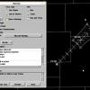
NaoPos Posted June 10, 2013 Share Posted June 10, 2013 And for thursday : Link to comment Share on other sites More sharing options...
HM Posted June 10, 2013 Share Posted June 10, 2013 Well.... Between 20z-00z, the 6z GFS and 00z WRFs were suggestive of a possible supercell along the Delaware River. If we can reasonably develop sufficient CAPE INVOF the warm front, this scenario is possible. Something to look out for later (keep an eye on the warm front / surface obs). Link to comment Share on other sites More sharing options...
greg ralls Posted June 10, 2013 Share Posted June 10, 2013 Wow, starting to look like a wild afternoon or evening is at least possible today, huh? Link to comment Share on other sites More sharing options...
NaoPos Posted June 10, 2013 Share Posted June 10, 2013 Wow, starting to look like a wild afternoon or evening is at least possible today, huh? Ehh, all depending on how far the warm front advances and if we can get some clearing. Best chances are down south towards Balt-Dc, but SE pa-snj isn't completely outta the game. At least the wind shear profiles and hodo's look nice, as well as te lcl levels @<750m agl Link to comment Share on other sites More sharing options...
IsentropicLift Posted June 10, 2013 Share Posted June 10, 2013 2.0"+ per hour rainfall rates showing up now with that stuff crossing the DE Bay. Link to comment Share on other sites More sharing options...

Recommended Posts
Archived
This topic is now archived and is closed to further replies.