

radarman
-
Posts
14,474 -
Joined
-
Last visited
Content Type
Profiles
Blogs
Forums
American Weather
Media Demo
Store
Gallery
Everything posted by radarman
-

Wednesday Feb 18 Mixed event. NOPE …ain’t happenin’
radarman replied to HoarfrostHubb's topic in New England
talk about a burp run Thinking you get more snow than BID and BDR -
Wednesday Feb 18 Mixed event. NOPE …ain’t happenin’
radarman replied to HoarfrostHubb's topic in New England
here in the battleground area, we'll take small victories when we can... the 3km being colder than the 12km for example -
Wednesday Feb 18 Mixed event. NOPE …ain’t happenin’
radarman replied to HoarfrostHubb's topic in New England
Yeah the euro has been probably the worst model for this one. Still playing catchup. -
Pretty big model battle underway for day 2.5. Skynet could be way out to lunch here or would be a helluva coup if this whiffs n of the pike. Gfs is just right.
-
Ice fishing in Ludlow in a low torchy spot... ice is 16". Up in the higher more protected terrain it's gotta be 2 feet I bet
-
Well that clears things up
-
The Beast pass getting better by the year
-
Feb 10-11 Mid Week Minor Event - Ride the hot hand?
radarman replied to HoarfrostHubb's topic in New England
local bust-- half inch last night no biggie but RGEM, GFS, 12km Nam had all advertised a good amount more at various points. Let's keep the Euro streak going for the next one. -
Feb 10-11 Mid Week Minor Event - Ride the hot hand?
radarman replied to HoarfrostHubb's topic in New England
Some kind of sleety snow crap but looks like a bust -
Feb 10-11 Mid Week Minor Event - Ride the hot hand?
radarman replied to HoarfrostHubb's topic in New England
It's actually matching up quite well across Ontario IMO... the sim radar product could be thresholded a bit and may not pick up the weak echoes that extend down across C PA and back into MI, but that stuff won't amount to much anyway. -
Feb 10-11 Mid Week Minor Event - Ride the hot hand?
radarman replied to HoarfrostHubb's topic in New England
I usually like the Nam and think it's underrated as a tool in the box, but it's really struggled lately. That said, I approve of the weenie stripe IMBY. It's dead on this time I'm sure. -
Feb 10-11 Mid Week Minor Event - Ride the hot hand?
radarman replied to HoarfrostHubb's topic in New England
Nam ramped down on the last one as we approached and was wrong. 2-4" sounds good here -
Got it this morning (see below). Bit of a random stat but pick any number and it seems impressive.
-
When you're running the longest stretch of chilly high temps in over a hundred years it's a low bar to say the worst is likely over (after a few more cold days w/snow)
-
Feb 10-11 Mid Week Minor Event - Ride the hot hand?
radarman replied to HoarfrostHubb's topic in New England
Nam hinting at an IVT again this run. Maybe a poor man's version of yesterday, displaced north? -
Friday February 6 FROPA / WINDEX small event
radarman replied to HoarfrostHubb's topic in New England
Agree, meso's ftl in this event. Nam (3 and 12km) especially seemed to be ramping down as we got close to practically nothing. And while the euro and others impressively nailed the Ginxy band, they might have overdone the subsidence to the west of there in the valley. Anyway, we take.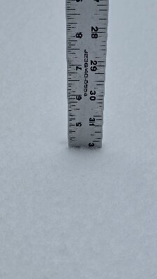
-
Friday February 6 FROPA / WINDEX small event
radarman replied to HoarfrostHubb's topic in New England
Picked up an additional inch in the last 2.5 hours, up to 4", snow continues -
Friday February 6 FROPA / WINDEX small event
radarman replied to HoarfrostHubb's topic in New England
Overperformer throughout the valley Folks east of the front should probably reserve judgment -
Friday February 6 FROPA / WINDEX small event
radarman replied to HoarfrostHubb's topic in New England
3" and light snow continues -
Friday February 6 FROPA / WINDEX small event
radarman replied to HoarfrostHubb's topic in New England
It's a happy ending at least Very heavy snow, low vis. Showing up great on the UMass radar but you'd never know it on ENX. All low stuff. -
End of Dec was cold. Early Jan was cold too until like the 7th. And then you're right it warmed up bigly til the 20th
-
Amazing pics
-
Folks looking for action might like that implied battleground with the cold lurking in Canada. Sure it could go wrong, but volatile at least.
-
Good post and not whatsoever knocking your assimilation. The fact that Monday was missing on the 11" report in Shutesbury makes some sense. Guessing they had minimum 3". We were over 6" on Monday.
-
That site is a mile or two south and lower down than me. Radiates better than here. But yeah, chilly night. Further down in Ludlow at the Springfield Res hit -18 but I am not sure about those Accurite thermometers. The AWOS at CEF was -15 again.


