

USCG RS
-
Posts
3,010 -
Joined
-
Last visited
Content Type
Profiles
Blogs
Forums
American Weather
Media Demo
Store
Gallery
Everything posted by USCG RS
-

The “I bring the mojo” Jan 30-Feb 1 potential winter storm
USCG RS replied to lilj4425's topic in Southeastern States
That shows how hard it is for the CAMs to pinpoint where these heavier bands are going to set up. As many have said... Heavy bands create subsidence which means there may be a rather large disparity in totals over a relatively short distance. That withstanding, as this slows down, I would hedge towards higher amounts due to the fact that it *should* give the LP more time to consolidate and throw back precip. -
The “I bring the mojo” Jan 30-Feb 1 potential winter storm
USCG RS replied to lilj4425's topic in Southeastern States
Two things with this storm 1) Where and exactly how the ULL progresses will result in large changes in sensible weather and thus forecasts 2) Banding will be a large portion of this storm Both of these are changes that can be just a few miles which is nearly impossible to predict. That withstanding, closer to the coast has more wiggle room here as the storm is exploding off the coast. Likewise, forum wide this looks like a good hit as the ULL is favorable for most of the area... It would appear. -
The “I bring the mojo” Jan 30-Feb 1 potential winter storm
USCG RS replied to lilj4425's topic in Southeastern States
I think a general 6-12 for you is not a bad forecast rn. -
The “I bring the mojo” Jan 30-Feb 1 potential winter storm
USCG RS replied to lilj4425's topic in Southeastern States
Snow growth regions, especially in the south, tend to be at or just below the 500mb (h5) level. However, the cold down here is very anomalous, as such, the best snow growth region will be shunted to the 700mb (h7) level for this storm. So for this storm when a forecaster is looking at h5 and sees very low relative humidity (RH), they are seeing low moisture and thus low snow growth potential. However, h7 is full of RH and in this case, this is where we should be looking for snow growth (commonly known as DGZ - Dendrite Growth Zone). As such, while h5 might look like a dry slot or poor snow growth, this forecast should rely on h7 which looks great. -
The “I bring the mojo” Jan 30-Feb 1 potential winter storm
USCG RS replied to lilj4425's topic in Southeastern States
To an extent I see what he means, but unless this storm really gets shunted East, I don't see what he's saying. This storm is exploding and back building and I personally think it will build farther back north and west than what he's concerned about. -
The “I bring the mojo” Jan 30-Feb 1 potential winter storm
USCG RS replied to lilj4425's topic in Southeastern States
CAMS (Short rangers) with the Kuchera method? Neither.... Ive only been here a couple years but I've spoken to a few who have been here a few decades.. Apparently no one remembers this. This is my new work computer wallpaper. I don't envy your job these past few weeks. This feels like it might be your first season on a weather board.....

-
The “I bring the mojo” Jan 30-Feb 1 potential winter storm
USCG RS replied to lilj4425's topic in Southeastern States
Praying for your wife This storm always has had the potential for banding. In this case, short range models will begin to pick up on this. In addition, where banding sets up will also allow for subsidence on each side, or the sinking of air. This causes drying which means that areas next to high totals could have much lower totals themselves. This is a common feature of very strong mid latitude storms and nearly impossible to predict. That withstanding, global models (with less resolution) will normally smooth out the QPF forecast, whereas short range models will attempt to showcase where these bands set up. This is because globals have a lower resolution and therefore the algorithm will not be able to as readily differentiate banding and this will smooth, or average, out the precipitation forecast over its grid (boxes of resolution, ie 12km, 3km resolution, etc etc). Short range models - or CAMS - have a higher resolution and will thus alter precipitation forecasts more, which is where you usually see the qpf (precip forecast) changing. -
The “I bring the mojo” Jan 30-Feb 1 potential winter storm
USCG RS replied to lilj4425's topic in Southeastern States
.jpeg.40d32fd0c67cf11785fde488b3cb79dc.jpeg)
-
The “I bring the mojo” Jan 30-Feb 1 potential winter storm
USCG RS replied to lilj4425's topic in Southeastern States
Trepidation -
The “I bring the mojo” Jan 30-Feb 1 potential winter storm
USCG RS replied to lilj4425's topic in Southeastern States
Thanks for dropping in! -
The “I bring the mojo” Jan 30-Feb 1 potential winter storm
USCG RS replied to lilj4425's topic in Southeastern States
Wow. GFS is rocking with this run. -
The “I bring the mojo” Jan 30-Feb 1 potential winter storm
USCG RS replied to lilj4425's topic in Southeastern States
Looks to me like it's just more robust. -
The “I bring the mojo” Jan 30-Feb 1 potential winter storm
USCG RS replied to lilj4425's topic in Southeastern States
Side note. Your handle (screen name) is awesome. -
The “I bring the mojo” Jan 30-Feb 1 potential winter storm
USCG RS replied to lilj4425's topic in Southeastern States
Good info here: https://registry.opendata.aws/noaa-rrfs/ -
The “I bring the mojo” Jan 30-Feb 1 potential winter storm
USCG RS replied to lilj4425's topic in Southeastern States
I've heard Greenville county has one plow. -
The “I bring the mojo” Jan 30-Feb 1 potential winter storm
USCG RS replied to lilj4425's topic in Southeastern States
I have this fight with Emergency Management all the time. -
The “I bring the mojo” Jan 30-Feb 1 potential winter storm
USCG RS replied to lilj4425's topic in Southeastern States
I think what they mean is that this is another very complicated set up. The ice storm last week had very complicated thermals. This one is a storm transfer over the area with questions of where this closes off. These scenarios tend to create rather hyper local outcomes due to where the moisture sets up and this can lead to significant subsidence in places depending on where banding sets up as well. It takes time for precip to blossom as well when storms are developing. This is where some persons were saying that smoothing of the mean creates qpf forecasts that appear uniform over an area but really aren't. So all of this together, it's another tough forecast leading to last minute trends and observations ruling the day. -
The “I bring the mojo” Jan 30-Feb 1 potential winter storm
USCG RS replied to lilj4425's topic in Southeastern States
Exactly. The earlier this closes off, the more of this sub forum is happy. -
The “I bring the mojo” Jan 30-Feb 1 potential winter storm
USCG RS replied to lilj4425's topic in Southeastern States
Current projections showcase that this is likely to be Central & Coastal Carolinas Bullseye. That withstanding, the storm is evolving and if the storm closes off a touch more quickly, it could nail the entire subforum essentially. The Euro showcases this, though Eastern GA is still on the cusp with that. -
The “I bring the mojo” Jan 30-Feb 1 potential winter storm
USCG RS replied to lilj4425's topic in Southeastern States
Winter Storm Watches issued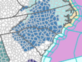
-
The “I bring the mojo” Jan 30-Feb 1 potential winter storm
USCG RS replied to lilj4425's topic in Southeastern States
I spent about two hours using hot water to melt my driveway. I have never seen ice quite this - adhered - to the concrete. -
The “I bring the mojo” Jan 30-Feb 1 potential winter storm
USCG RS replied to lilj4425's topic in Southeastern States
Yes. Already on the ground blowing snow does count. It is hard to obtain this scenario, but it is technically possible. -
The “I bring the mojo” Jan 30-Feb 1 potential winter storm
USCG RS replied to lilj4425's topic in Southeastern States
To my understanding, it is the same across the board for a Blizzard Warning. Winter Storm Watches and Warnings, Advisories, etc are region dependent. -
The “I bring the mojo” Jan 30-Feb 1 potential winter storm
USCG RS replied to lilj4425's topic in Southeastern States
And that is why you are a chain smoker now...? Er... Nvm. -
The “I bring the mojo” Jan 30-Feb 1 potential winter storm
USCG RS replied to lilj4425's topic in Southeastern States
When are we ever not at that part of the storm? Unfortunately when looking at the synoptic pattern, it is a real possibility. This LP could rather easily be punted East, especially with the baroclynic set up near the Bahamas and the confluence at play. I am not saying its correct, just saying, see what the rest of the suite does. Also, I believe it has some of the drop sonde data. Of course, grain of salt and watch the patterns emerge as well as what the rest of the suite does, but I would not simply toss. Yes.


