USCG RS
-
Posts
3,010 -
Joined
-
Last visited
Content Type
Profiles
Blogs
Forums
American Weather
Media Demo
Store
Gallery
Everything posted by USCG RS
-
Oh no you mentioned sun angle. Time for someone to tell you that doesn't exist or something. As an aside - speaking of sun angle - everrywhere the sun has been the past two days has melted all the snow in my area
-
Praying for your family Stealing this. Welcome!
-

January 30th- Feb 1st ULL and coastal storm obs
USCG RS replied to JoshM's topic in Southeastern States
I did. I have been working quite a bit today, so I have been sporadic on my check ins here. That withstanding, I would post the same to those who you are referring to as well. And while I understand the frustration, to purposely egg it on or retaliate is vindictive - even more so with the information provided. All of that withstanding, my two cents was stated and thats that. Side note - to be clear - I am not criticizing the mods on this site either. -
January 30th- Feb 1st ULL and coastal storm obs
USCG RS replied to JoshM's topic in Southeastern States
This is not my forum, so I don't want to overstep here but, if you were on the forum I assist with - you'd be in time out. You are beyond out of line and the number of posts you have shows that you should know better. You are being bitter and bordering on vindictive and inciteful. Anyway, thats my two cents and thats that. Mods - Apologies if this is improper. -
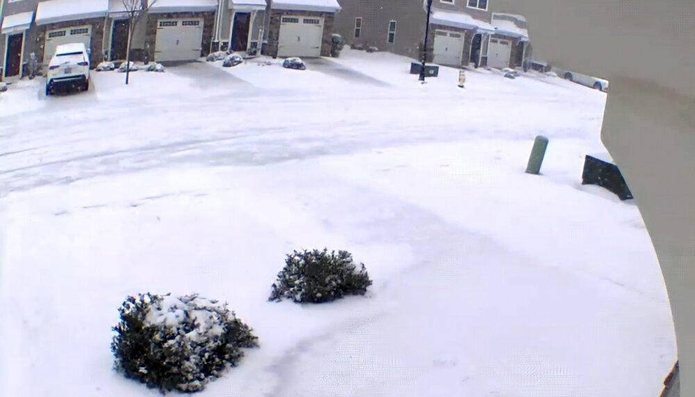
I have a freezer full.....
-
Yeah, I said this in the other thread - what is going on right now on the coast is what I would expect. Because unless this thing is getting punted East, what is taking place is what *should* be taking place. The storm is sitting. Its exploding. And the radar is back filling nicely. I hope this continues for you all.
-
January 30th- Feb 1st ULL and coastal storm obs
USCG RS replied to JoshM's topic in Southeastern States
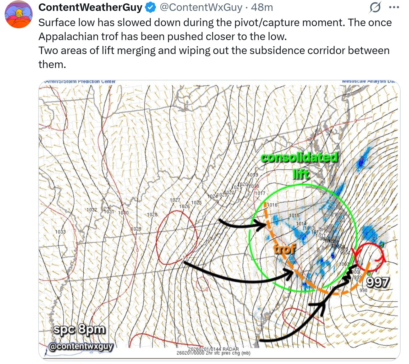
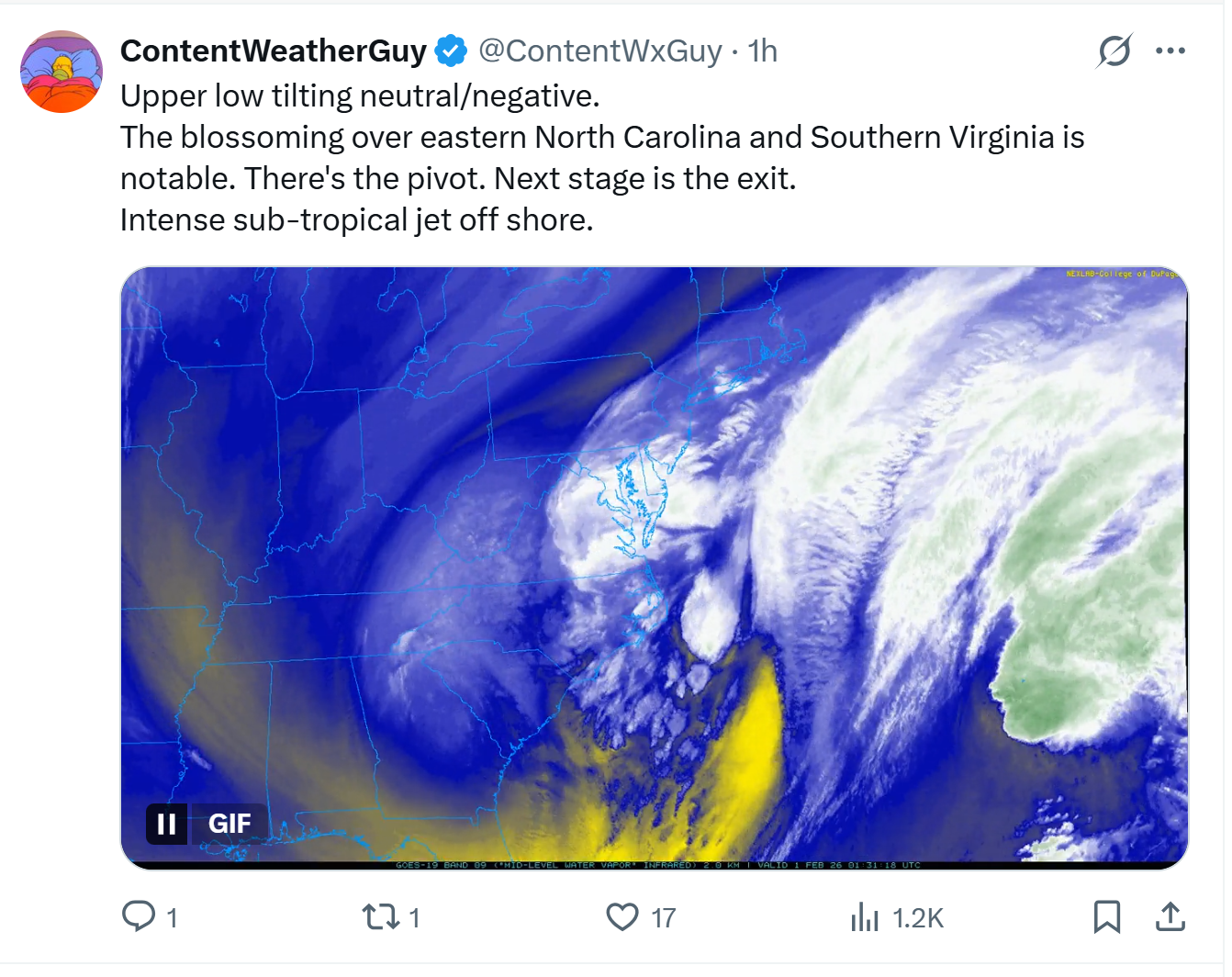
With what is going on the Coast, this is where I was so confused by the dry slotting showing up on the models, because unless this thing is getting punted East, this is exactly what I would expect to be happening (radar filling in and storm just sitting). -
January 30th- Feb 1st ULL and coastal storm obs
USCG RS replied to JoshM's topic in Southeastern States
Yeah. This thing is exploding and sitting. Dropping 2-3mb per hour and its just sitting there right now. This *should* be really good for you guys. -
January 30th- Feb 1st ULL and coastal storm obs
USCG RS replied to JoshM's topic in Southeastern States
-
January 30th- Feb 1st ULL and coastal storm obs
USCG RS replied to JoshM's topic in Southeastern States
You just got nuked. How are you this bitter? -
You're getting hit right now - I think... I hope? Looks like a good few hours coming your way
-
Yeah - I moved here.
-
The “I bring the mojo” Jan 30-Feb 1 potential winter storm
USCG RS replied to lilj4425's topic in Southeastern States
It looks like those who have been missing this afternoon may see a nice hit for the next couple of hours. -
The “I bring the mojo” Jan 30-Feb 1 potential winter storm
USCG RS replied to lilj4425's topic in Southeastern States
https://x.com/ContentWxGuy/status/2017779509555048657?s=20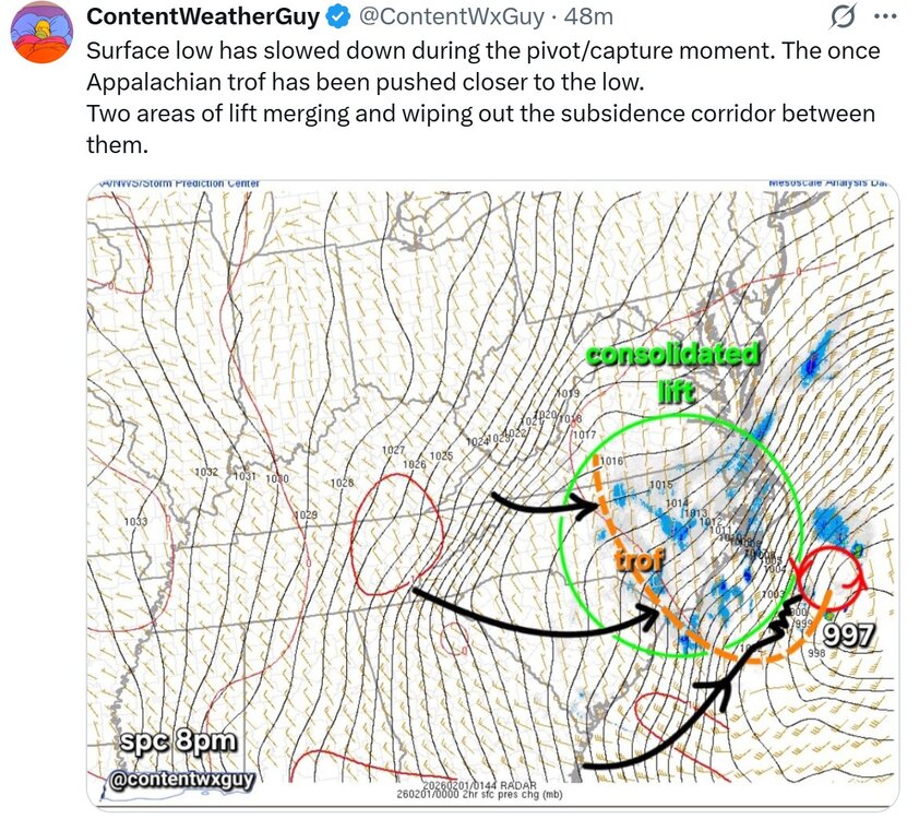
-
The “I bring the mojo” Jan 30-Feb 1 potential winter storm
USCG RS replied to lilj4425's topic in Southeastern States
https://x.com/ContentWxGuy/status/2017776140472013050?s=20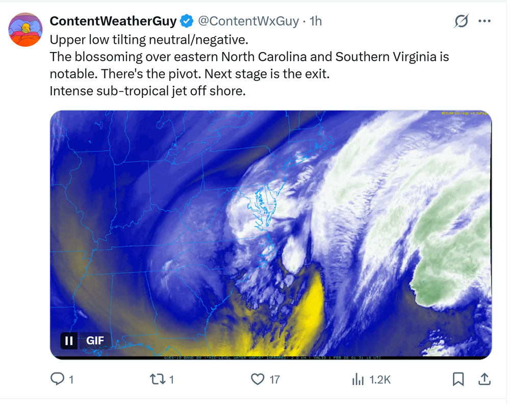
-
The “I bring the mojo” Jan 30-Feb 1 potential winter storm
USCG RS replied to lilj4425's topic in Southeastern States
Yeah, Raleigh looks like they are getting a good hit right now per radar. -
The “I bring the mojo” Jan 30-Feb 1 potential winter storm
USCG RS replied to lilj4425's topic in Southeastern States
Sorry. that was convulooted. What I meant to say was that hopefully they are wrong and you get hit. Sometimes I reply quickly here between work. -
The “I bring the mojo” Jan 30-Feb 1 potential winter storm
USCG RS replied to lilj4425's topic in Southeastern States
Per GSP thats what my area got last weekend. Spoiler: I was wrong with my forceast and we did not get an inch of ZR. However, it is nice to see NWS forecast offices share in my delusion. So perhaps yours will as well..... -
The “I bring the mojo” Jan 30-Feb 1 potential winter storm
USCG RS replied to lilj4425's topic in Southeastern States
I believe that is addittional -
January 30th- Feb 1st ULL and coastal storm obs
USCG RS replied to JoshM's topic in Southeastern States
Jinx! -
January 30th- Feb 1st ULL and coastal storm obs
USCG RS replied to JoshM's topic in Southeastern States
For the record - That is a beautiful residence. -
January 30th- Feb 1st ULL and coastal storm obs
USCG RS replied to JoshM's topic in Southeastern States
-
January 30th- Feb 1st ULL and coastal storm obs
USCG RS replied to JoshM's topic in Southeastern States
-
January 30th- Feb 1st ULL and coastal storm obs
USCG RS replied to JoshM's topic in Southeastern States
-
January 30th- Feb 1st ULL and coastal storm obs
USCG RS replied to JoshM's topic in Southeastern States
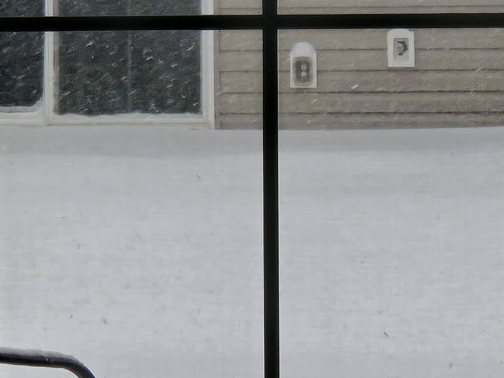
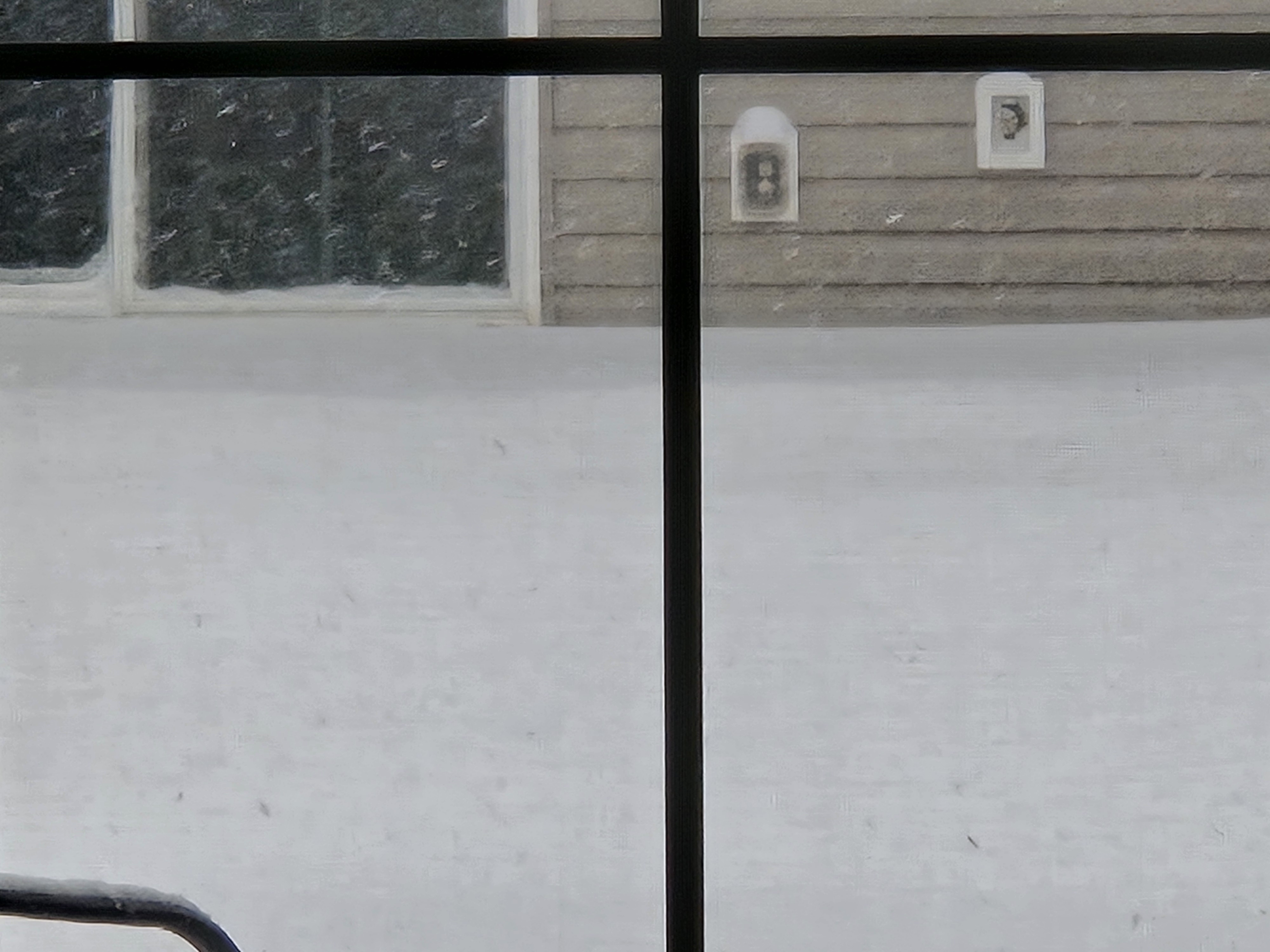
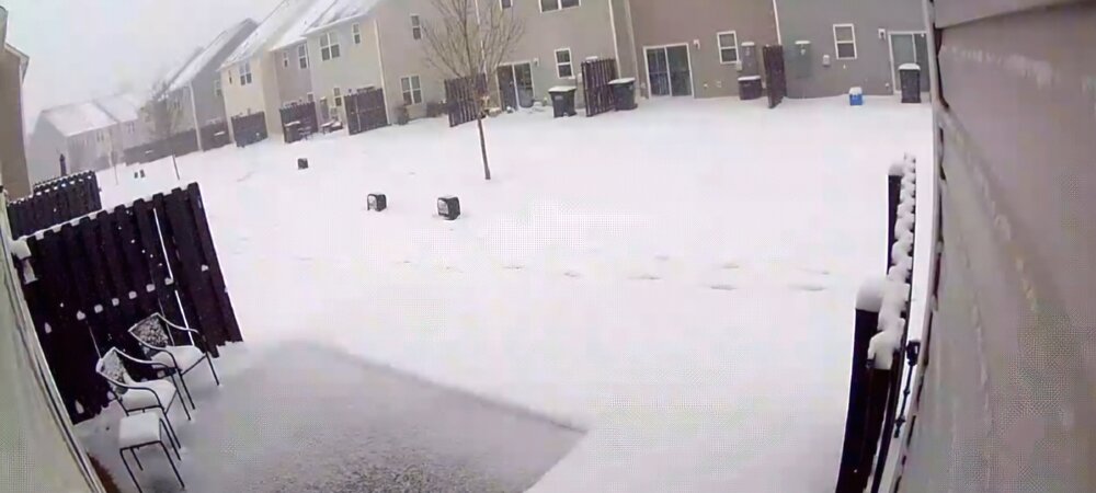
Heavy snow - Simpsonville, SC