Boston Bulldog
-
Posts
837 -
Joined
-
Last visited
Content Type
Profiles
Blogs
Forums
American Weather
Media Demo
Store
Gallery
Everything posted by Boston Bulldog
-
 Blocky look, but with that complexity we are still far away from any confidence in what that will actually look like in the second half of the week. Higher than normal probs of bad weather I guess
 -
He's been living in The Hock this whole time!?
-
Torrential downpours in Boston. Tropical rates
-
Clouds and smoke during peak heating today… take the under on temps?
-
Bavi failed to go annular, but remains a monster of a storm
-
Bavi appears to be wrapping up a successful EWRC and is clearing out a massive eye. Watch for a run at sub 900mb with a near annular appearance if trends hold. Visually this thing looks like it wants to pull an Isabel
-
Wind shift incoming for KBOS. Looks like the new airmass is coming in from the southern boundary rising northward. Because of this I don’t think Logan will see a massive spike like it would if the coastal boundary broke earlier, but 92 could be challenged with the incoming SW winds
-
Yeah the "west fart" has been happening pretty consistently. Easterlies break down around 4-5pm and a quick spike follows. Easterlies broke down around 2:30 yesterday and KBOS spiked 6F in 5 mins. For enterprising folks looking to make a quick buck, this is a very gameable liquidity pattern on the prediction markets. Easterly winds tamp down temps, degenerate gamblers (or bots) who don't know what they're doing pump money into this suddenly interesting looking bracket of lower temps (higher temp positions gain much better pricing at the same time), then the west wind rug pulls 'em at the buzzer. These easterly winds rarely hold through sundown... dollars are being sold for 70-80c
-
2026 Atlantic Hurricane Season
Boston Bulldog replied to Stormchaserchuck1's topic in Tropical Headquarters
Can’t lie, it’s been a long time since I’ve been so down on HU activity in the short and medium time scales. SSTs across the Tropical Atlantic, unfavorable subseasonal variability, ripping ENSO conditions, and general early season hostility are slamming the door shut on deep tropical development for the foreseeable future. The most recent lemon is a good example of what we can get until a lucky MJO-CCKW linkup occurs with more encouraging climatology… mediocre subtropical spin ups. Blah -
2026 Atlantic Hurricane Season
Boston Bulldog replied to Stormchaserchuck1's topic in Tropical Headquarters
This verified decently well with a slew of tornado warnings and observed tornadoes across the south as Arthur swung through. Obviously it did not intensify. The moisture didn't quite hook up with the major tornado outbreaks across the midwest, though honestly so much deep moisture streaming in could have tempered the storm mode and filled regions of observed discrete tornadic supercell development with slop-vection. -
Hey all, despite the cold season being long gone, I can't help but look towards next winter/ski season. I have begun working on a new project for the upcoming season in which I hope to develop and host some unique tools that can be used for forecasting, akin to what is available on the New York State Mesonet: https://nysmesonet.org/ . Geographically this will be smaller though, with a focus on the mountainous zones of NNE. And no, I am not building a mesonet! I have some visualization ideas for overlays that do not yet exist in the open internet, but are essential to orographic forecasting. I am going to keep the core plots and visualizations I have in plans under wraps for now, but I will drop one hint: think of the critical number for a major Spine upslope event... If you have anything that you would like to see, please let me know! I am open to all ideas for products to host on this future website
-
2026 Atlantic Hurricane Season
Boston Bulldog replied to Stormchaserchuck1's topic in Tropical Headquarters
It's not much, but this lemon is enough to get me thinking about the tropics again. Always fun to start a new season, though I'd expect this one to be a bit rough in terms of overall HU activity. Do yourself a favor and take a look at the westerly wind burst on going in the Nino zone. There is a gigantic pool at the subsurface that is primed to get churned up by downwelling oceanic kelvin waves during any westerly burst events. This Nino is going to get strong very quickly barring an unexpected downtrend. Anyways, take a look at recent Euro depictions of this AOI (partially ex-Cristina) once it gets inland over the SE USA. I spy a major brown ocean effect bias within the Euro that is once again showing up, though GFS and other do manage to retain a somewhat competent vorticity packet while over land. This soon to be invest is going to be a real feature, but a storm essentially RI'ing over land is not a realistic outcome. My thoughts: A depression making landfall in Texas will NOT intensify into a 985mb borderline hurricane over Shreveport (0Z 6/14 Euro begs to differ) . I doubt this thing intensifies on an organizational or SLP sense once inland, rather its injection of moisture and vorticity into the trough will help boost an already volatile severe weather look for mid-week across the Midwest and Ohio Valley. -
Friend in Cambridge had a tree fall on their car. Phil in full effect. The winds were pretty violent in the South End, smaller branches down and such
-
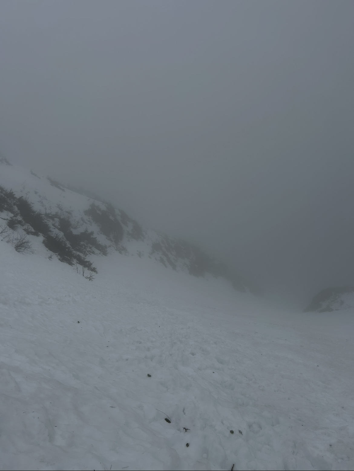
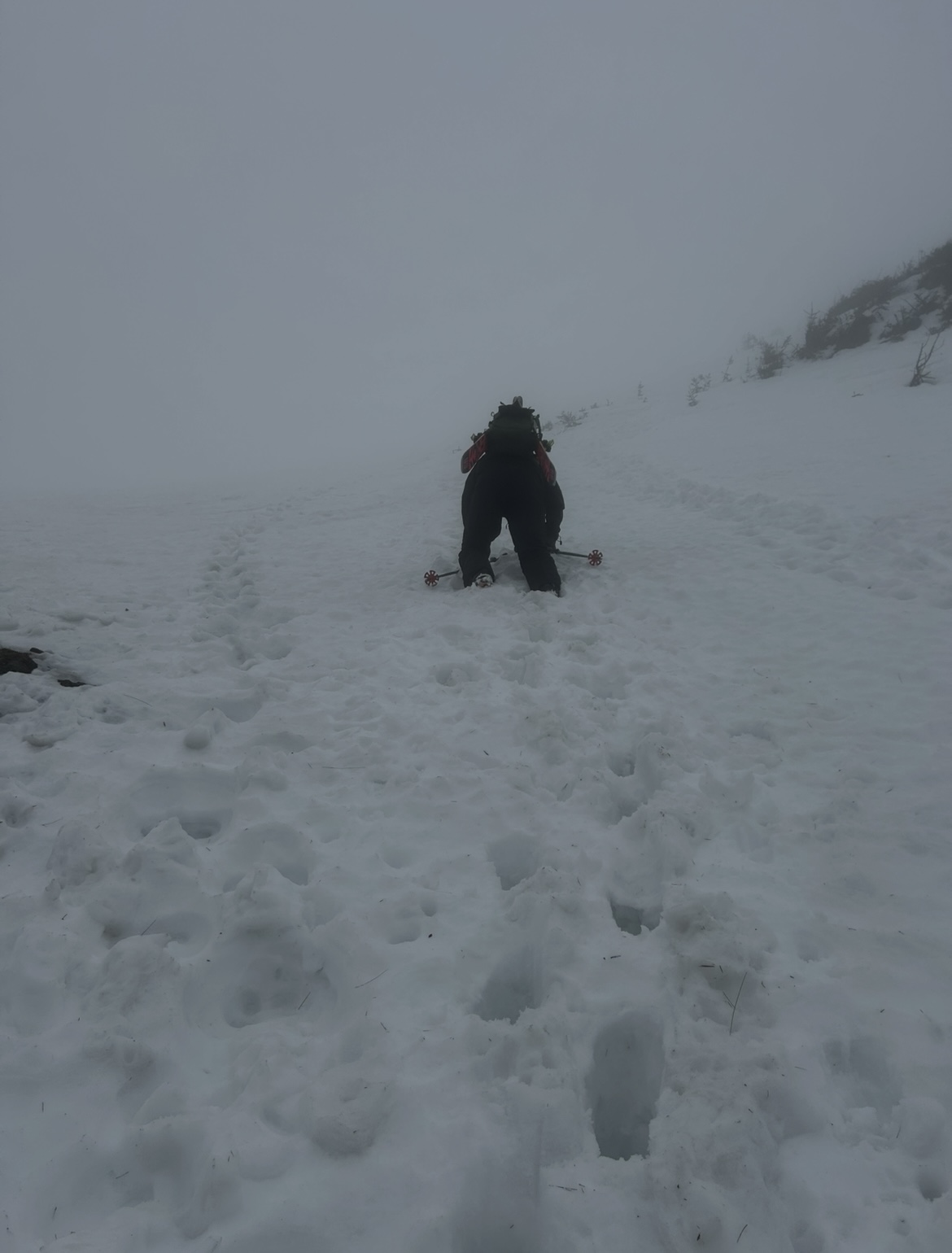
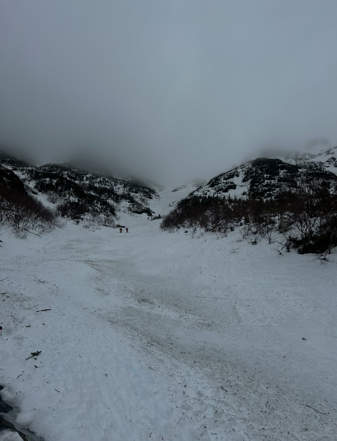
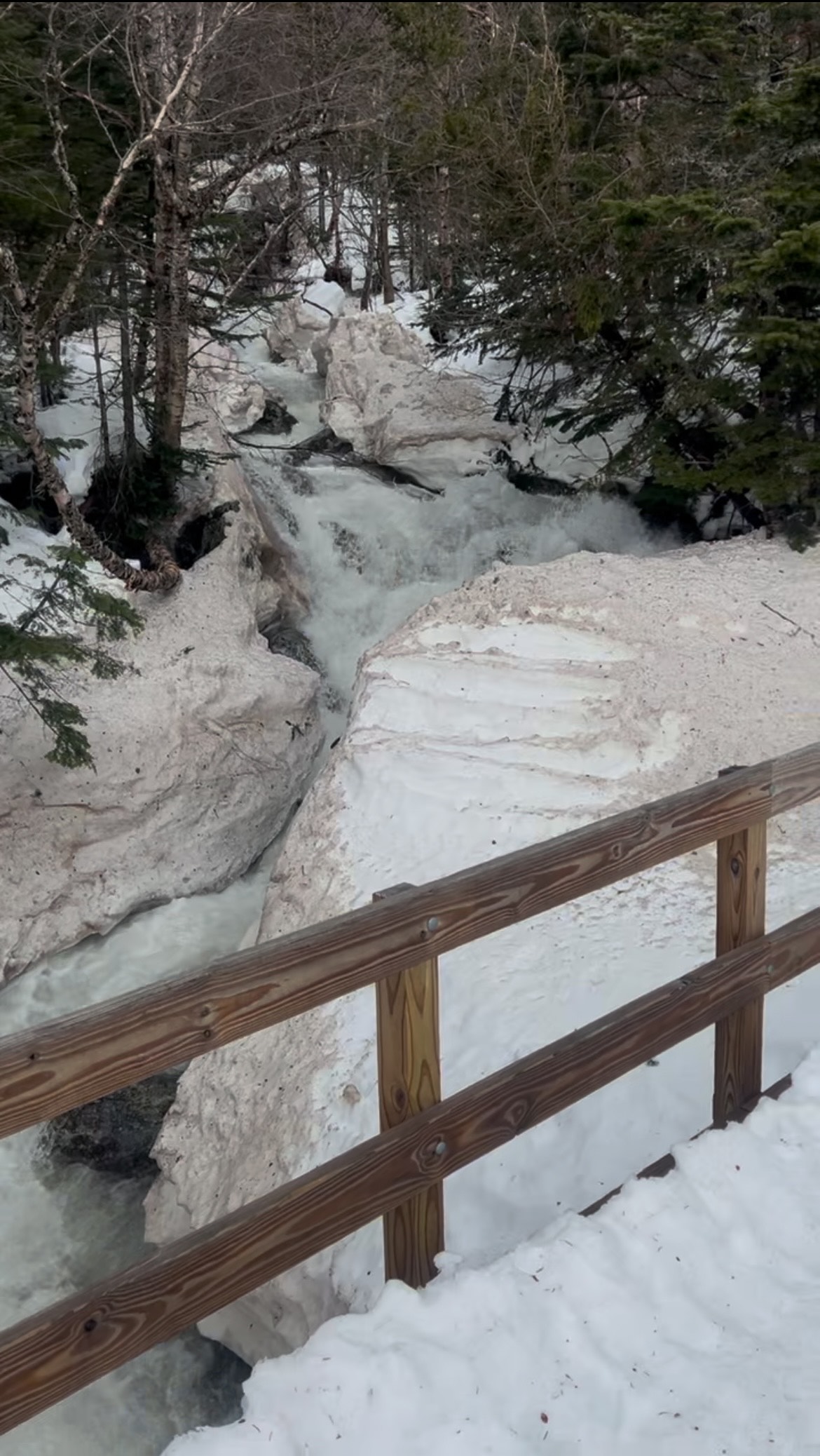
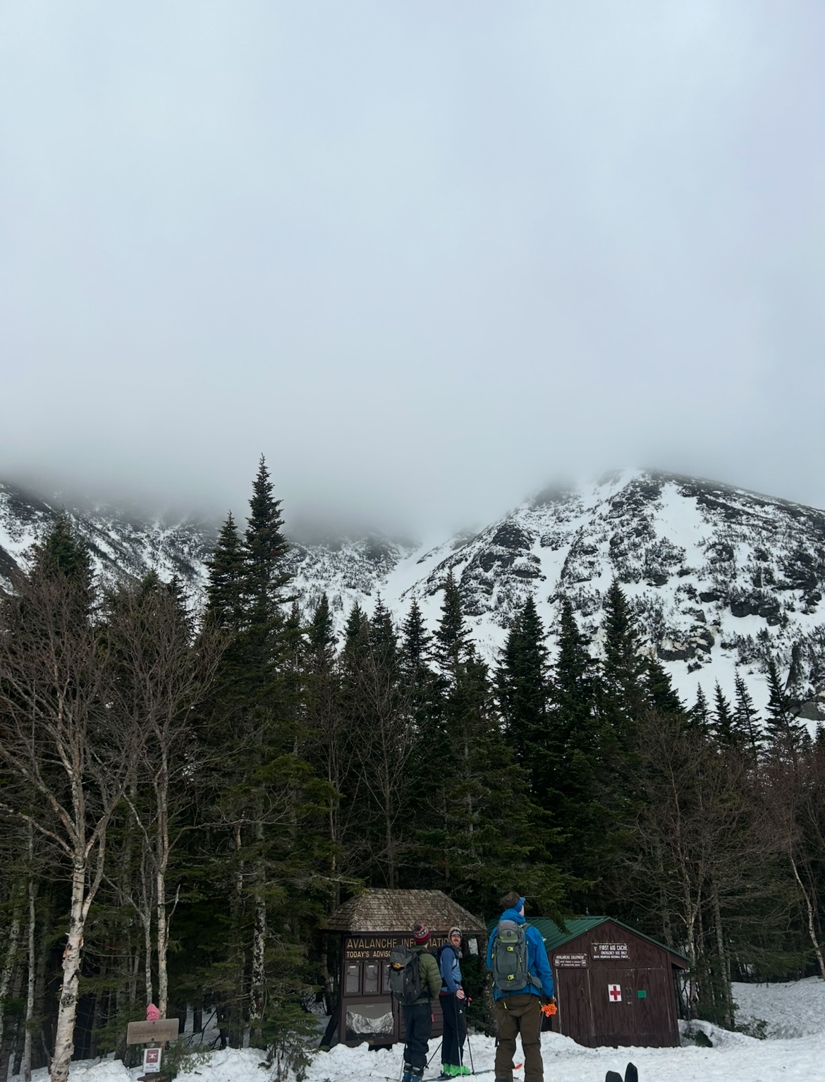
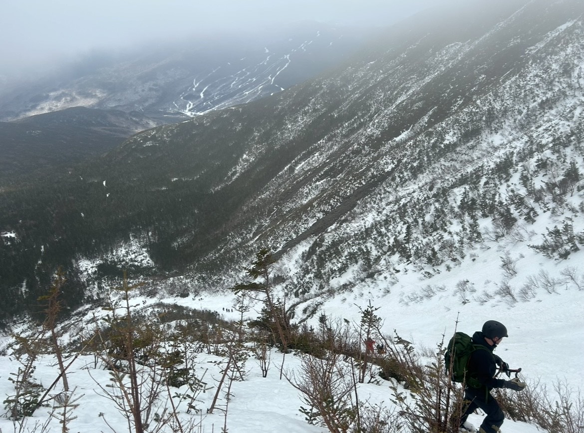
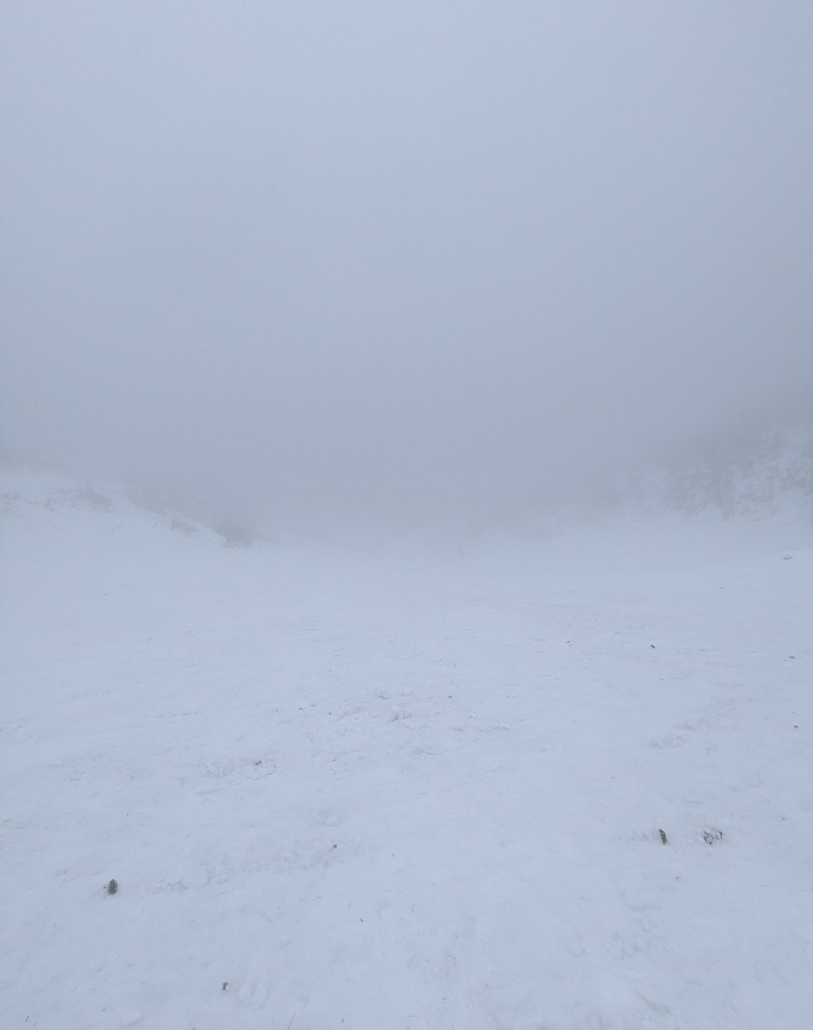
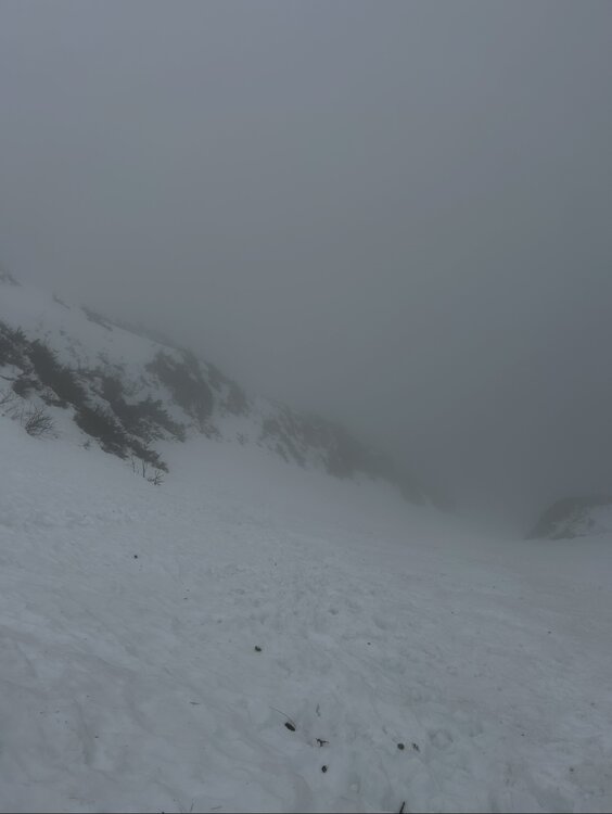
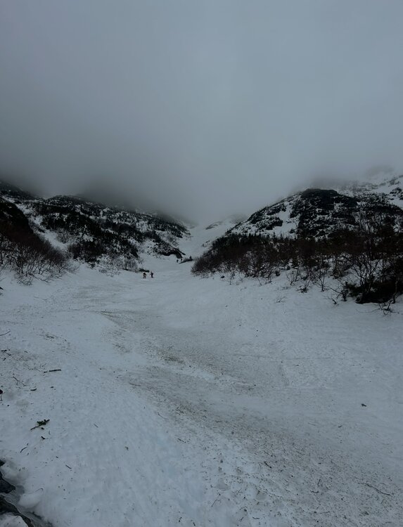
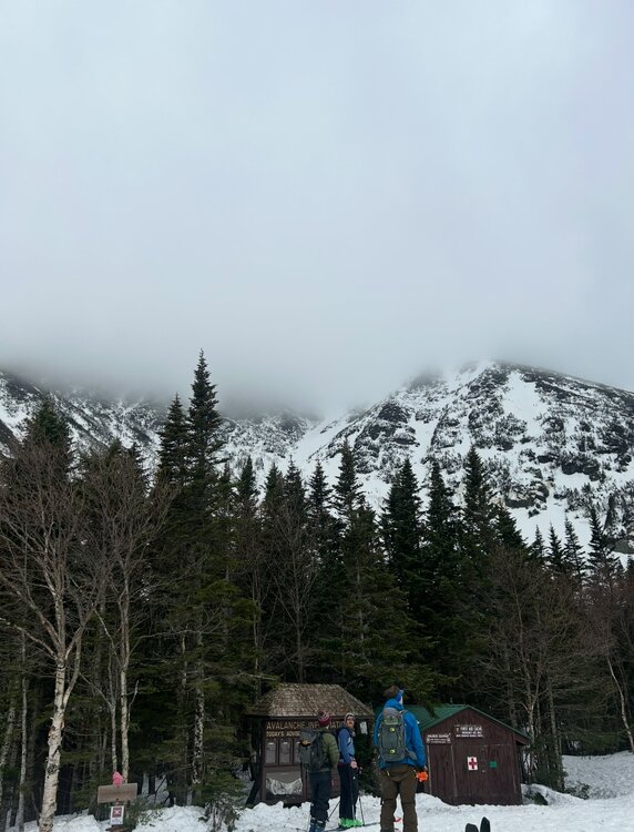
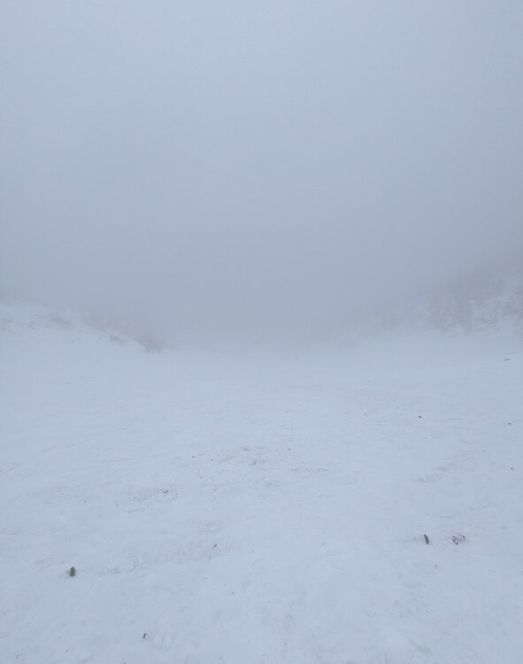
With the Mid-March thaw delivering a hefty blow to the low elevation snowpack across New England, the window for enjoying peak depths in the Presidential alpine was coming to an abrupt end. Ultimately the thaw provided some spectacular spring skiing up high from 3/9 to 3/11, with report after report filtering out of the Presidentials showing cobalt blue skis and just enough overnight firm ups to fold conditions into a superb corn surface across the Gulfs, Ravines and Snowfields. My schedule did not allow me to time up the best conditions, but with a marginal weather window available on Sunday 3/8, I decided to take it despite no guarantee of success. Having already been turned around in the alpine due to avalanche danger in January, I was wary that a second disappointment would be the result. The crux of the day was clear, trying to time the clearing of elevation fog before the snowpack up high froze solid. Saturday night's (3/7) cold front cleared New England of much of the low level moisture that enveloped the region in dense fog for much of Saturday. The lone holdout were the high peaks of the Presidentials, with just enough moisture and orographic forcing to shroud the summits in clouds. Forecasts indicated that gradual clearing of summit fog would occur through midday, perhaps opening up a window for sunshine to peek through. At the same time, colder air was beginning to filter across the higher elevations, threatening to lock the snowpack into ice by the afternoon. Pulling into the Pinkham Notch parking lot at 9:30, I checked the temperature profile across Mount Washington, the summit had quickly plummeted from the upper 30's to 34. Fortunately, temperatures at 4000 feet held firm in the mid 40s. The gradient was tightening but the window to try and steal a descent was still there. Racing up the TRT there was the constant roar of meltwater raging down the Cutler River. The evidence of the thaw was everywhere. Just a few days prior Andrew Drummond had tagged a rare descent of Empress in mid-winter conditions, while Dutchess and Dodge's were wide open for the taking for those looking for exposure. These snow packed lines had thinned out considerably only 24 hours into the thaw. Cruxes of these lines had receeded to cliffs, rocks and brush, their now hanging snowfields filled with rain runnels. By the time I reached Hojos much of the high alpine was still shrouded in fog, much to my dismay. The summit continued to inch closer to freezing, now down to below 33 degrees. It was going to be a one run type of day. Hillman's Highway appeared to be the best option as 2/3 of it's length remained in the clear and only the snowfields above the choke were obscured. Additionally, the Hillman's bootpack is one of the easier pitches in the zone and features plenty of platforms for transitioning. If the freeze came faster than anticipated there would be plenty of options to turn around and descend from. With the clearing trend forecasted, we hoped that perhaps the fog would burn off during the climb. While climbing, it was clear that wishful thinking regarding visibility would not pay off. The cloud deck actually began to lower, now fully obscuring the view once we reached Hillman's right choke. Despite the poor visibility, the snow in the couloir was a pleasant surprise. The lack of a pure refreeze overnight rendered the surface a bit heavy but wind affected enough that it wasn't pure slop. Outside of a few punchy spots the booter was drama free. Approaching the top of the line, some aspects were beginning to harden - we had just beaten the freezing line to the top of Boott Spur. The heavy snow on the descent was a substantial workout, though while shrouded in cloud cover the surface was very workable and pleasant. Once we punched through the overcast about 1/2 down, temperatures spiked quickly and the snow gained a noticible grab to it. Fortunately the sustained pitch of Hillman's helped negate the impact of the sticky snow until we reached the apron. The ski down to the car was slow going, the Sherb was melting fast and rocks were everywhere on "coreshot corner". Despite conditions not truly aligning, it was a fantastic day up high on the eastern slopes of the Presidentials! I still jealously watched footage of bluebird skies, huge linkups, and perfect corn snow all over the mountain emerge over subsequent days, but I was thrilled to not view from afar with sour regret. Sometimes you just have to go and make it happen.


-
2.9 inches for KSLC all winter… they average 47” by now. The low to mid elevations of the Wasatch are probably even more anomalously horrible. Major major water supply and wildfire concerns across most of the American SW this summer/fall
-
Been a long time since there’s been a radar like this!
-
Sunapee can be a bit flat, but the Sunrise Glade/Hawes Hideout area is pretty fun. Well timed trip right before the meltdown!
-
Seems like our guy in Lunenberg has moved...
-
The predictability barrier really is a humbling beast. All of the advancements in modeling technology and yet we still can't get around it! Hard to ignore how hard the models are driving warmth across the 3.4 as we push forward though
-
Nuking huge aggies in BOS

-
NAM backed off at 0z. Significantly
-
NAM was the first to find the 1/17 storm…
-
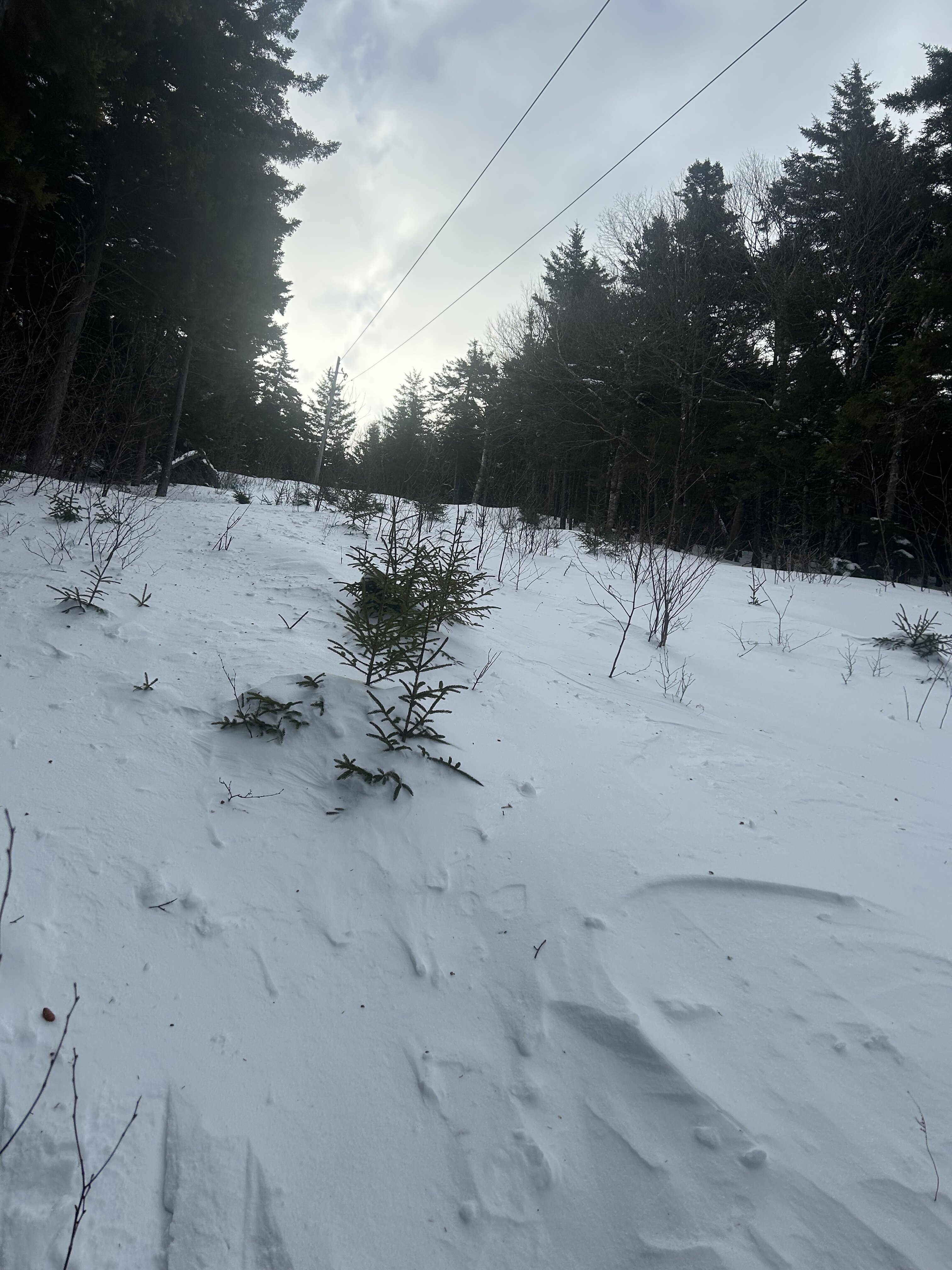
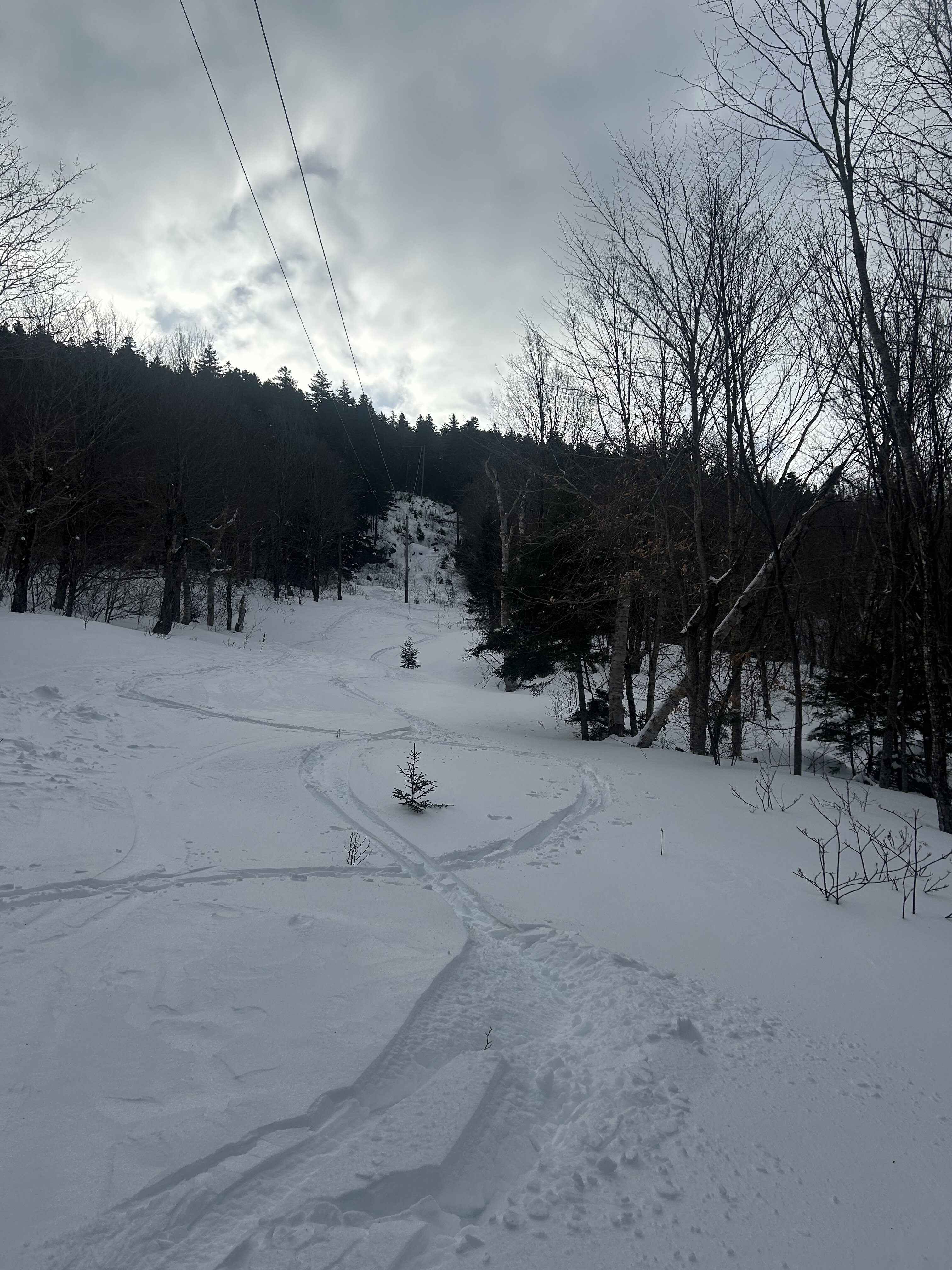
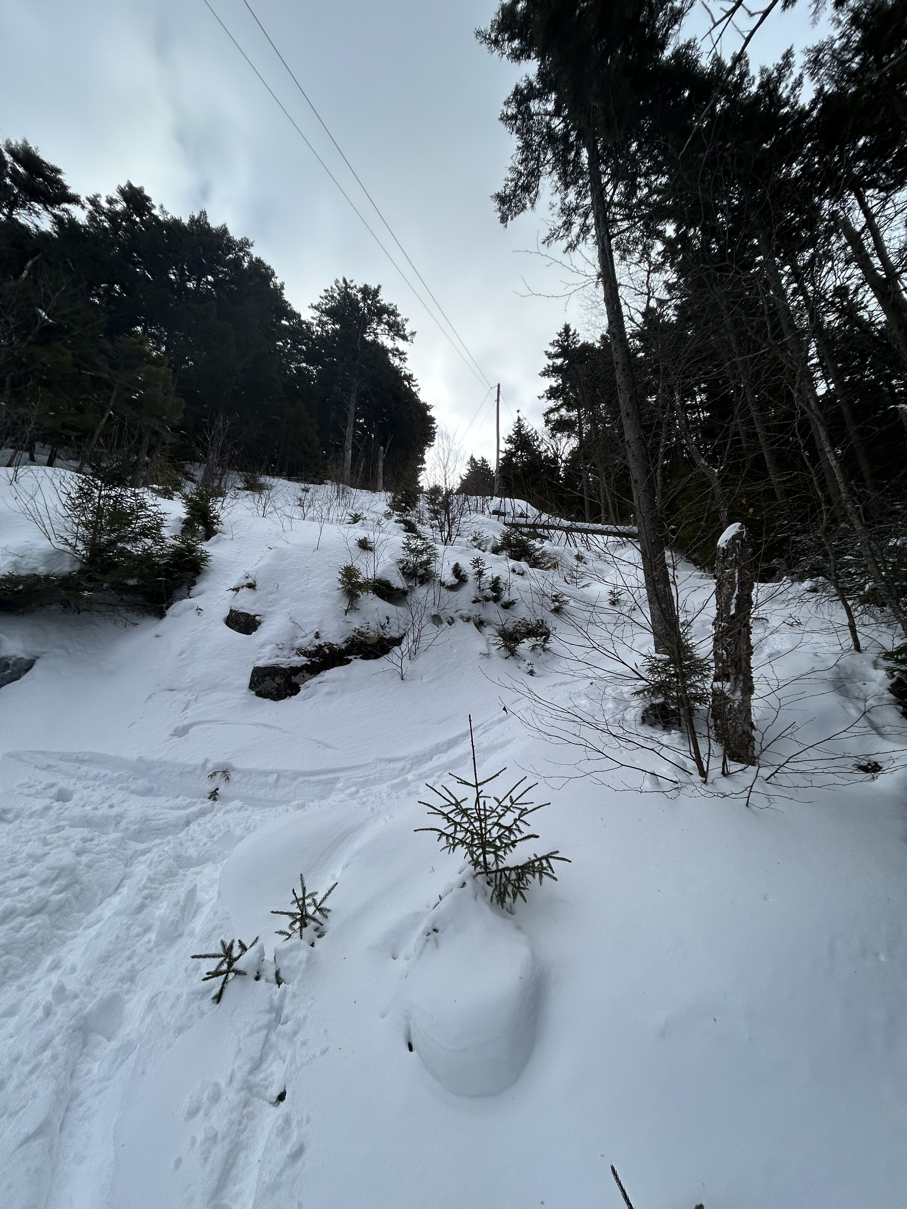
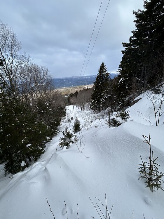
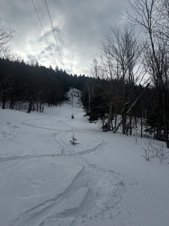
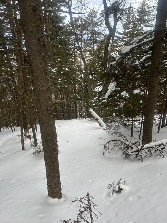
This line is a very prominent scar visible from I-89 for those traveling back to Boston from NNE. Despite its eye catching location it is infrequently skied, partially due to the fact it takes a ton of snow to fill in. There isn’t a ton of compelling backcountry in “Congrats Dendrite” land, but sometimes this punchy fall line shot can do the trick. Decided to give it a go in slightly low-tide conditions this morning before work and was pleasantly surprised! The powerline has some good pitch and some serious teeth across its main cliff band. There’s a couple hundred vertical of good fall line turns. What caught my eye though were the wide open glades adjacent to the main line!


-
Still need to see more cross guidance agreement, but NAM/GFS kind of remind me of the 1/17 advisory event that really popped up out of nowhere within 72 hours or so
-
Are they just not going to do a 7pm Central Park update?