

FXWX
-
Posts
834 -
Joined
-
Last visited
Content Type
Profiles
Blogs
Forums
American Weather
Media Demo
Store
Gallery
Posts posted by FXWX
-
-
3 minutes ago, 40/70 Benchmark said:
Jan 2015 and to a lesser degree, Feb 2013 both captured a bit later and further east than modeled.
Yes they did... But when I look at the evolution at 500, my hedge would be an earlier (slightly) stall / capture. Not that it will make a big difference and not trying to suggest the storm will not be monster over a large area of eastern zones... Just right now I'd hedge a bit earlier. Probably meaningless for many areas whether it does or doesn't.
-
If the volatility / explosive deepening does indeed verify, which seems more likely than not, I would expect the slowing / stalling to actually occur a bit earlier than being model. I would hedge the slowing and explosive deepening occurring a tad further south of where it is modeled.
-
 3
3
-
 1
1
-
-
7 minutes ago, 40/70 Benchmark said:
Well, he would also acknowledge that its a long season.
That's a perfect and optimistic response. Maybe the euro signs a great free agent to save the season.
-
1
-
-
Just now, 40/70 Benchmark said:
I think the EURO is particularly struggling with this pattern....but in the grand scheme of things, its more that the GFS has closed the gap IMHO. But EURO is not as bad as it looks right now.
The again, like Bill Parcells said, "you are what your record says you are!' And right now, Euro is not going to the 2021-22 winter storm forecasting playoffs...
-
3
-
 1
1
-
-
1.5 in Burlington
-
2 hours ago, PhineasC said:
Although the Euro can’t even get it right 48 hours out these days.
It is pretty funny that the Euro has become almost unreliable in the 3 (maybe 2) to 10 day range, but its weeklies are looked at as if they have a long track record of being correct, which they don't. They did ok with seeing some of the January cold but have been brutally wrong many times. They also tend to be very unstable. The one thing going for this latest set is that it fits the scenario of many of the La Nina based winter forecasts, which strongly suggested February would trend very warm into the midmonth period before flipping to cold at the end on into March. Probably the biggest thing they have going for them right now, is that they are predicting warmth, which rarely doesn't verify these days.
-
3
-
2
-
-
Yep... I've called it a mini flash freeze; not a dramatic one for sure, but just enough to cause issues, especially with ground temps right under road surfaces running very cold.
-
1
-
-
Compared to the last system, I'd rather be right here with the mid-level features modeled southeast of SNE; at no time last week did the modeling show the 700-center passing south or even right over us... Given the setup, we could put up with a fair amount of phasing and still be ok... Off topic, but if the Euro has a clue, east-central North Carolina would see a power-wrecking ice storm...
-
1
-
-
17 minutes ago, Typhoon Tip said:
So NAM is Buffalo and he Euro is the Patriots ... in head to head Divisional round playoff game this weekend.
Heh
Finding it interesting that the NAM's the consensus Vegas pick over any model that exists, for predicting synoptic scaled events - oh how times have changed...
I'm never comfortable betting against Belichick! I find the setup and modeling suite fascinating? It's as if the Euro is somehow trying like hell to correct closer to what the large pattern and analogs suggested days ago, but nobody believes it!
-
1
-
-
40 minutes ago, forkyfork said:
climate change
Why not; it's blamed for everything else...
-
1
-
-
9 minutes ago, ORH_wxman said:
Yeah well said....It's amazing that not a SINGLE analog is as far west as the current storm on guidance....but guidance is in such good agreement, you can't go against it at this lead time.
Agree...
-
1
-
-
16 minutes ago, ORH_wxman said:
Yeah there may be a frozen glacier at the end....but meh. If it's not at least 5-6", it kind of sucks at this point. If we get a 6+ thump, I'm all for it....but my worry is we get about 2" before the flip which is useless. I don't see this trending back east aloft enough to matter....but stranger things have happened.
This winter finds new ways to disappoint...
Probably one of the most incredible storm evolutions I've ever seen. Every single CIPS analog for that ULL position down south has us either getting big snow or some of them actually fringe us....not s single one rips the storm to our west (at least aloft), yet this time, it is going to achieve that.
If you showed me this below map at 24 hours before the storm begins and told me we'd get drenched with rain from an inland runner, I'd think you were on drugs....lol
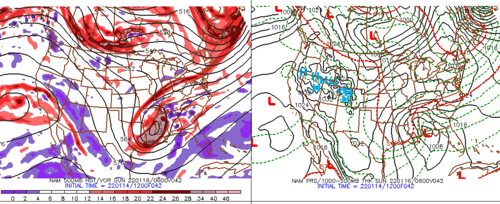
Good post about the CIPS grouping for this storm... I tend to not get overly frustrated or pissed off when a storm does not play-out the way I envisioned or forecast... I've been doing this for too many years to get emotionally involved or bitch when a storm forecast trends away from my original thoughts. But this storm, or should I say the modeling trends, have managed to pissed me off a bit. I do a lot of analog assessment (CIPS & Kocin storms) when a major storm seems to have a chance of developing for the Northeast; in particular SNE. This one is frustrating for the reasons you outlined above. The modeled forecasts for this storm just do not follow the history of upper air / surface setups like this? If you go look at the Feb. 14-17, 1958 event, it is almost a perfect overlay at 500 mb & sfc to what is now underway. The CIPS analogs are remarkably consistent in their assessment of what the vast number of similar setups produced. I have rarely seen (probably never) an analog storm pattern show such different outcomes compared to the current suite of modeling, and I find it a bit unsettling. In the back of my mind, I almost expect there to be a flip back closer to the analog outcome. But then I come back to reality and don't see any positive trends on the major modeling trends. This system appears to be one that will almost completely break away from where my analog method steered me...
-
5
-
2
-
-
40 minutes ago, Typhoon Tip said:
When was it touted a monster?
I dunno - the thread was headlined with these sentiments,
"Confidence grows for a moderate to major, low latitude transferring Miller B/ Miller A hybrid then gets foisted up the coast as a "hook low"
...
*However* with such a high upside I feel monitoring is necessary.. ... confidence remains less than medium. It's an important storm - how much impact and where, TBD. "
Not sure that confers 'monster' but whatever.
Frankly nothing's really changed LOL... Think about it, I mean... doesn't that rather aptly describe where we are at right now, still at 96 to 108 hours lead?
It's like NBA basketball games... What the first 5 minutes and the last 5 minutes - that's all one needs. 'Course, that takes the d-drip journey away, just sayn'.
Too many folks are so busy comparing the minor nuisances of every 6-hour model run that they don't take the time to read and comprehend a very clear-cut statement! Nothing in your original headline & post suggested you were screaming "here comes the monster"...
-
2
-
1
-
-
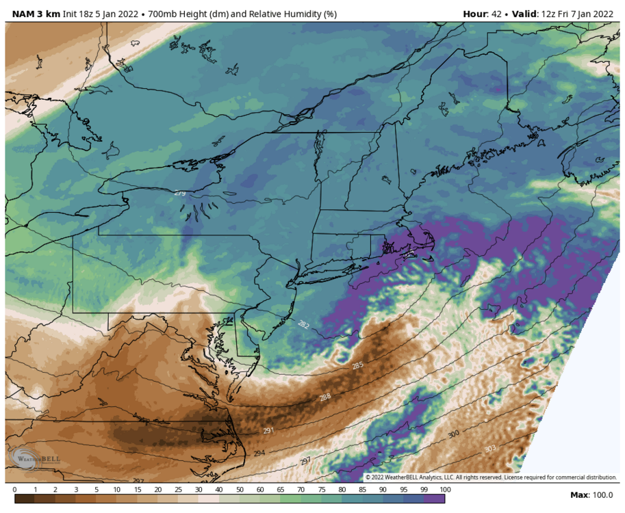
For those of you with the Kocin / Uccellini Northeast Snowstorms Volume II - The Card book available, check out the Feb. 15-17, 1958 storm. Very close surface and 500 mb match for the pre-storm 48 hours period onward to the day of the event. The result was widespread 9 to 16" amounts across SNE with a heavy deformation band of 20 to 36 inches running northeast across eastern PA, eastern NY on into srn VT / central NH... It was a slower mover than the upcoming event is likely to be, but good features analog match?
-
8
-
-
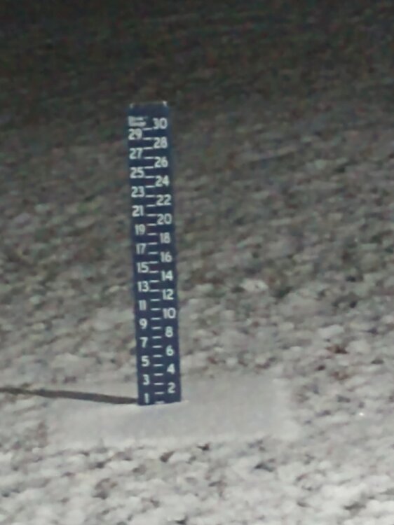
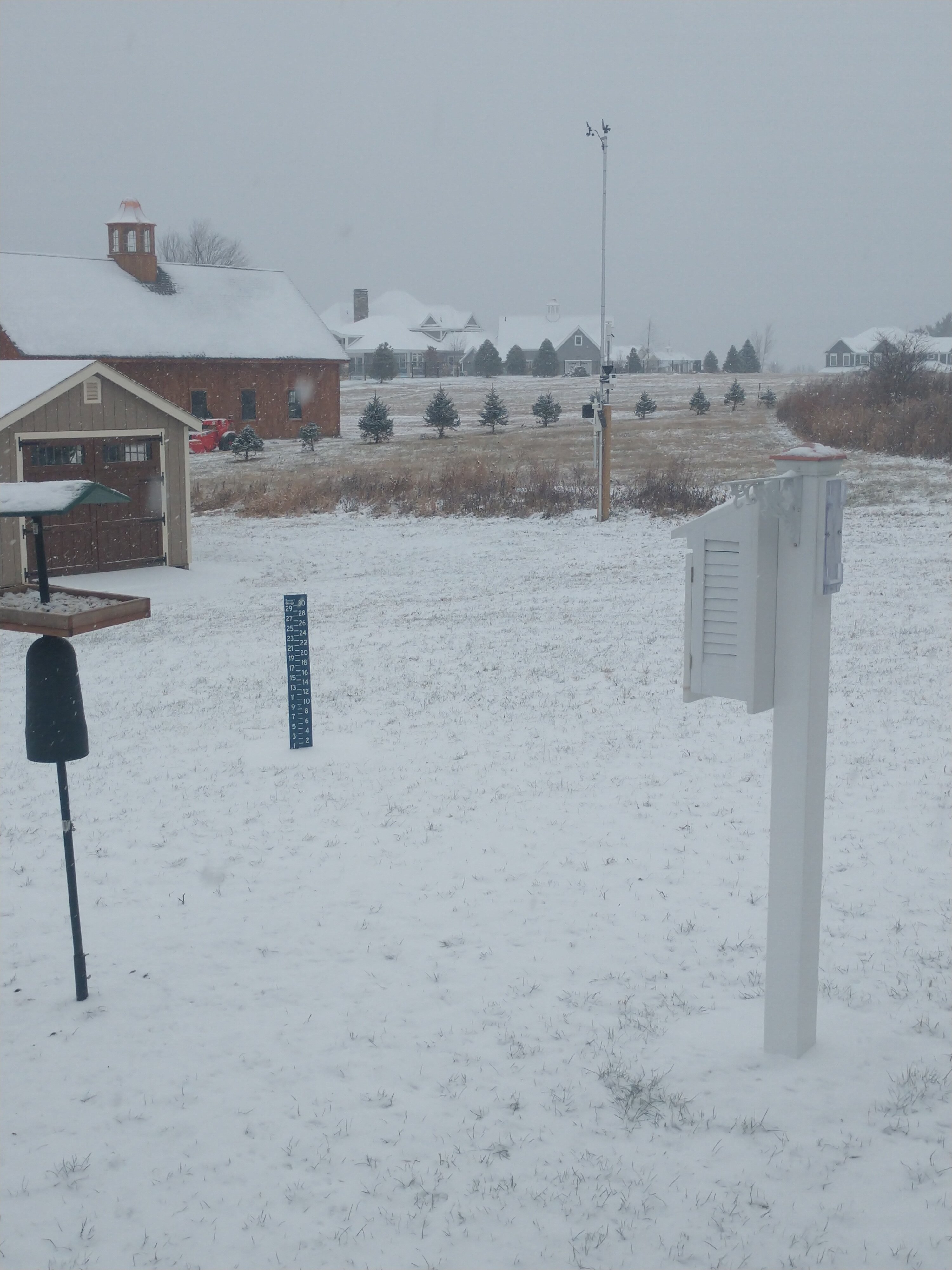
7.0 here in Burlington, CT (1,140')...
-
49 minutes ago, CT Rain said:
Seems like the convection is going to be an issue. A bit disappointing to see the RAP/HRRR and the NAM trends but still looks good for 3-6 in many spots in CT.
That's all I want...
-
28 minutes ago, CT Rain said:
I don't hate that 700mb low track on the NAM. Explains the QPF max/mid level goodies from HFD to BOS.
Those are the types of features that you (we collectively) always need to use when looking at a raw qpf output, and then make appropriate adjustments...
-
33 minutes ago, ineedsnow said:
Lol seriously?
 Connecticut Department of Transportation·38mFreezing rain is not like snow and ice
 this event was a Perfect Storm: too cold yesterday to lay down liquid pre-treatment & too
 windy ahead of the weather to pre-treat with hard salt. We're out there across #CT. When you see us, give us room to work.
  https://pic.twitter.com/ymYoiWXfH3
Replying to @CTDOTOfficial
https://pic.twitter.com/ymYoiWXfH3
Replying to @CTDOTOfficialThat's a joke... and a lot of BS!!!
-
1
-
-
23 minutes ago, HoarfrostHubb said:
A lot of it is Covid related stuff. We had a delayed opening to test all of our staff. A number in my building tested positive this morning and were sent home.
The state botched this one in Mass. We were supposed to get kits over the weekend but they were late.
Some on the Cape prob due to the 1" blizzard
In CT, Mass, including Cape it is all Covid related... None due to weather issues...
-
Anyone having slow connection issues with WXBell model section?
-
1
-
-
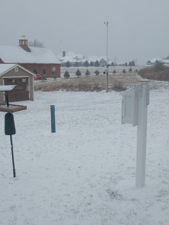
Back edge getting ready to come through here... calling it 1.1"...
-
2
-
-
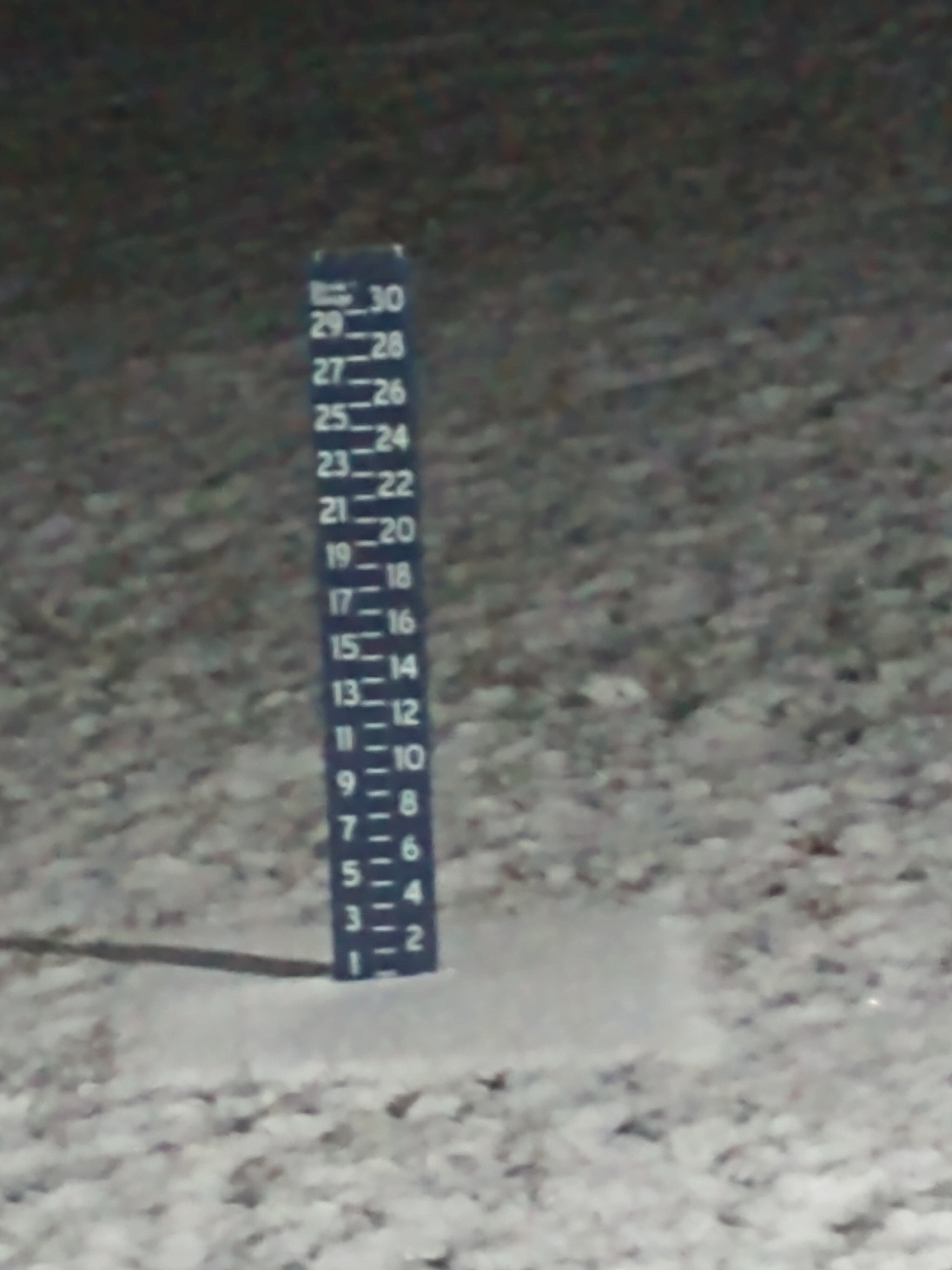
Approaching the 1-inch line here in Burlington, CT
-
3
-
-
38 minutes ago, CT Rain said:
Even Hartford/Tolland may get a nice thump before pl/zr/ra. Maybe a 1-3 kinda deal for N CT and more north of the Pike?
Agree... Still close call for northern CT with respect to seeing measurable s/ip, but more wiggle room with 12z euro trends. Overall a pretty messy mix but front-end dump has improved.
-
1 hour ago, Sey-Mour Snow said:
Fair enough, I think there’s still some room, just unlikely IMO, crazier things have happened.
I hear ya, and it may well trend into a goner. I certainly would not lay any money down on it; likely gets answered with the 0z run...


Powerful Multi-regional/ multi-faceted east coastal storm now above medium confidence: Jan 29 -30th, MA to NE, with snow and mix combining high wind, and tides. Unusual early confidence ...
in New England
Posted
Couple of things... The other day I suggested there would be a stalling / capture earlier than modeled. I now think the Euro is too fast with it and would expect it to be northeast of what it is now showing. Secondly, I agree that comparisons to 78 need to be tempered; not flushed but tempered a bit, especially as it relates to the point of capture / stall. Third, trying to get very specific about locations of CF, deformation band(s) and related screw zones (relatively speaking) needs to be put on the back burner for a bit until 700 circulation center becomes locked in for a couple of cycles. Lastly, modeled inflow is so intense, I will almost always kick deformation / fronto zones a bit west of modeling.