olafminesaw
-
Posts
4,602 -
Joined
-
Last visited
Content Type
Profiles
Blogs
Forums
American Weather
Media Demo
Store
Gallery
Everything posted by olafminesaw
-
Worst humidity of the year in Greensboro this morning. 86/75
-
-
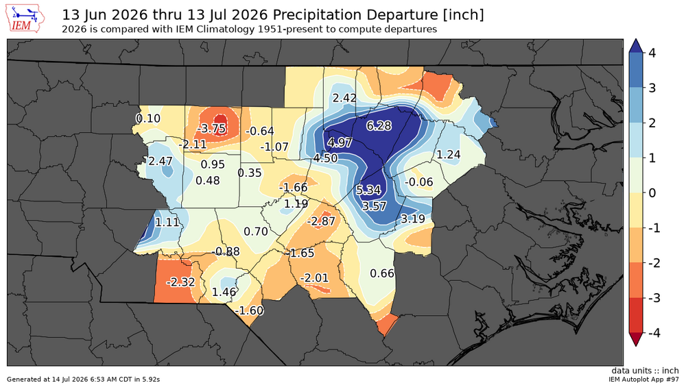
Certainly, although Guilford county only saw .5-1.5" for the most part over the last week we'll see on all of D4 being removed
-
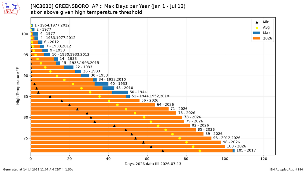
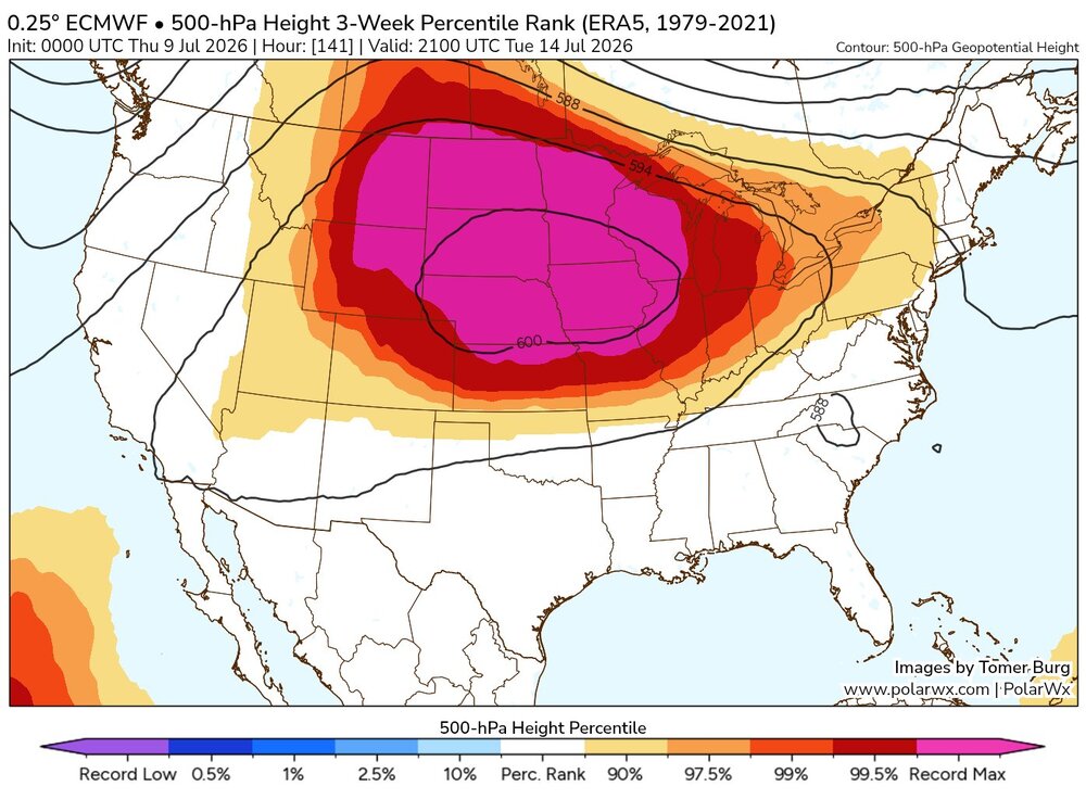
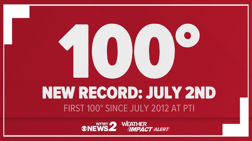
On pace to rival records for most # of days at or above x temperature as well
-
Most everyone cashed in, but still some losers and winners.
-
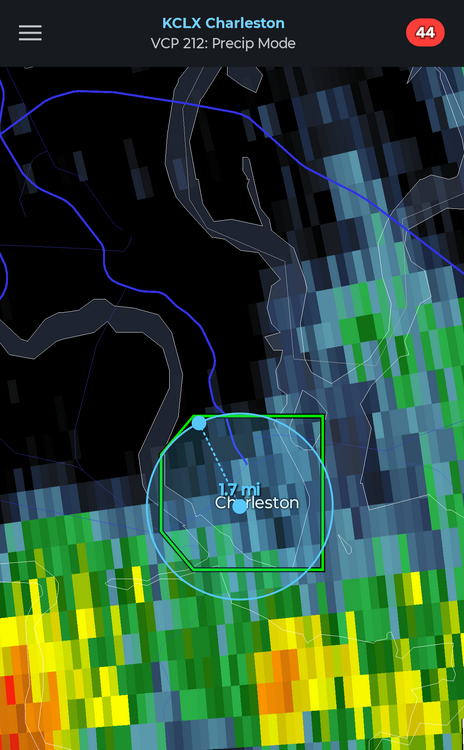
It's the world's smallest flash flood warning
-
About three more weeks until we start the slow descent towards fall
-
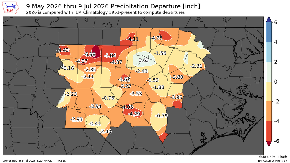
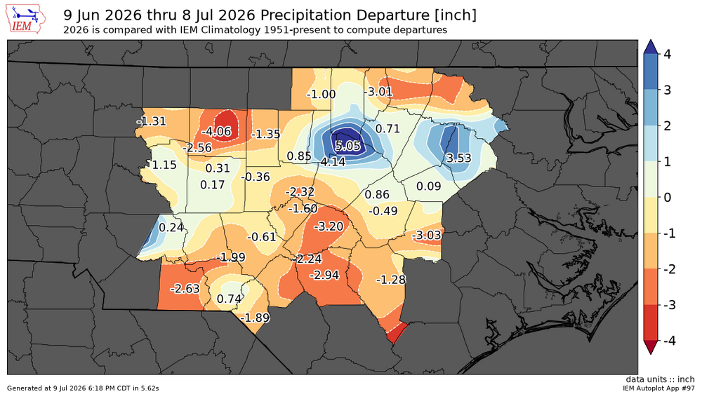
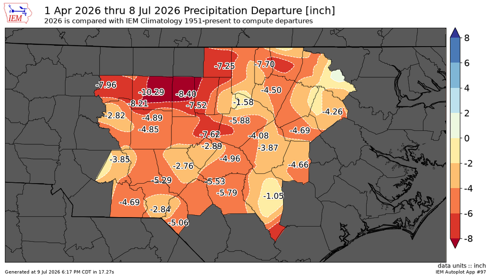
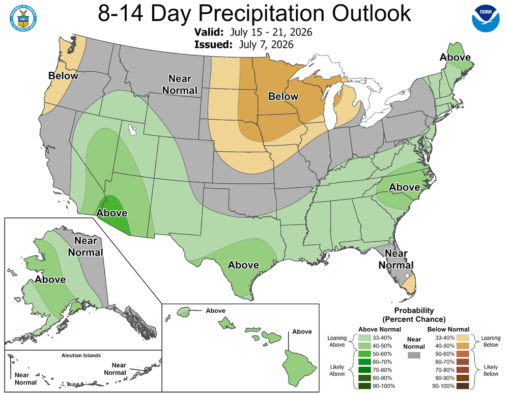
30 60 days and since April 1st departures
-
While we enjoy temps in the low to mid 80s this weekend (albeit still a bit sticky), the West bakes with temps as high as 110 at lower elevations and all time records possibly broken
-
A New Orleans special
-
-
Feels like El nino has finally forced the pattern change, storms developing nicely again today. Going to have to mow the lawn for the third time this summer
-
Today is again looking promising for downpours across the area
-
Also should start to see some cumulus start to form in the next couple hours. Already popcorn storms over the higher elevations
-
Round 2 in 10 days?

-
-
The DC swamp ends it's influence at the Triangle I guess.
-
Yeah, it's really strange, because you would expect downsloping to produce lower DPs in the western Piedmont not higher
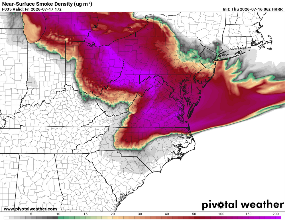
.thumb.png.b822878da2da249afac8b29cfd045e25.png)
-
This may well be the hottest day of the heat wave by heat index, Dewpoints holding in the low 70s and heat index climbing into the mid 90s
-
Philly seems to be ground zero. Tommorow 104 with Dewpoints in the high 60s/low 70s, heat index near 115
-
In some ways the NE does heat better than us. Greensboro has reached 100 only in 5 of the last 50 summers (12 days total). Boston has hit 100 in 9 of those years (9 days total)
-
Yes, definitely accurate for that particular strip of concrete
-
I've noticed RAH does a poor job of picking up on the warm bias the GFS and Euro have. Always seem to be a few degrees warm
-
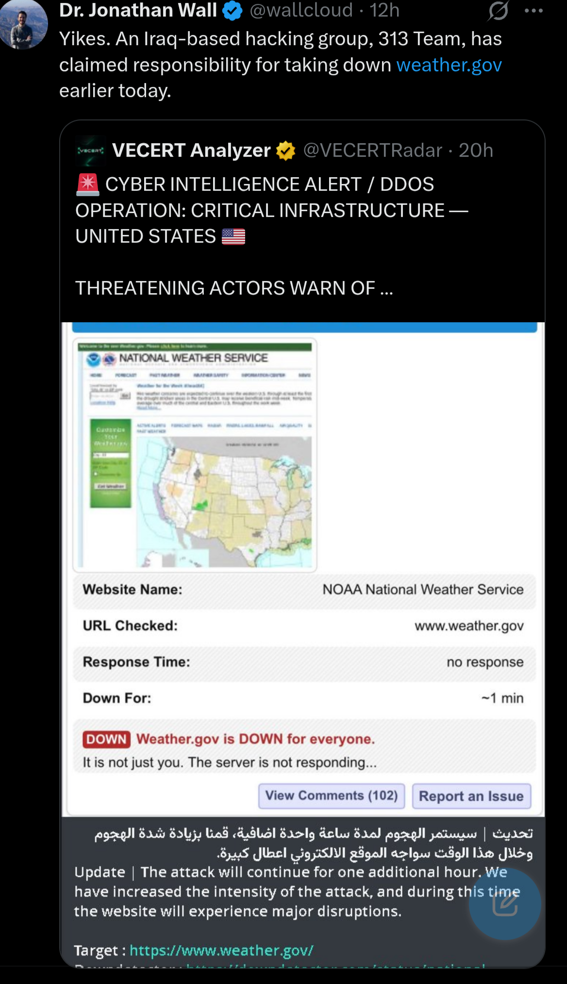
Maybe they went after Americanwx too


.png.96974298f8ec1a279f53f6b2cdbe468e.png)