
.png.5608f5bab30d37cac5ee5443be92fc2f.png)
HIPPYVALLEY
-
Posts
29,424 -
Joined
-
Last visited
Content Type
Profiles
Blogs
Forums
American Weather
Media Demo
Store
Gallery
Posts posted by HIPPYVALLEY
-
-
2 minutes ago, STILL N OF PIKE said:
Same as other Nashua guy
5 and change
prolly 5.5 now
It's pretty amazing the consistency of snow totals along and N of RT 2 with SWFE no matter how weak or strong they are. Right @40/70 Benchmark?
-
Just now, STILL N OF PIKE said:
Watch next weekend
You back on board? I think most of the interior is in play for that one. What is your total tonight, wherever you are?
-
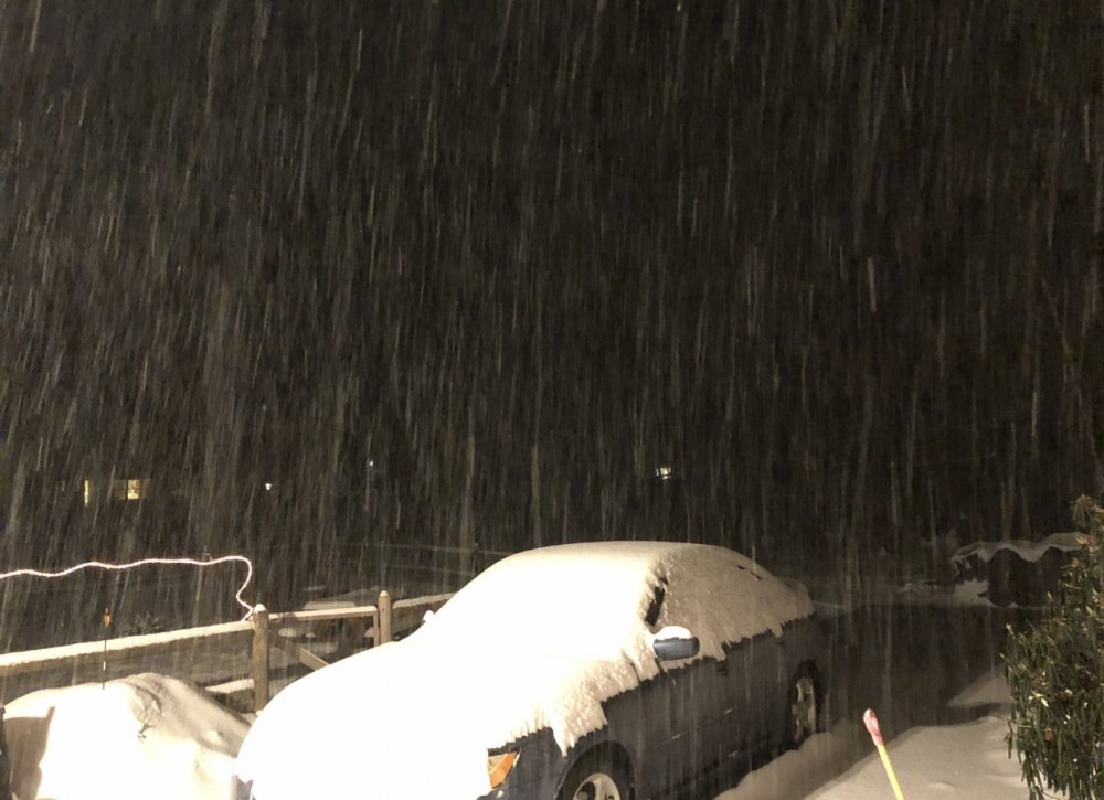
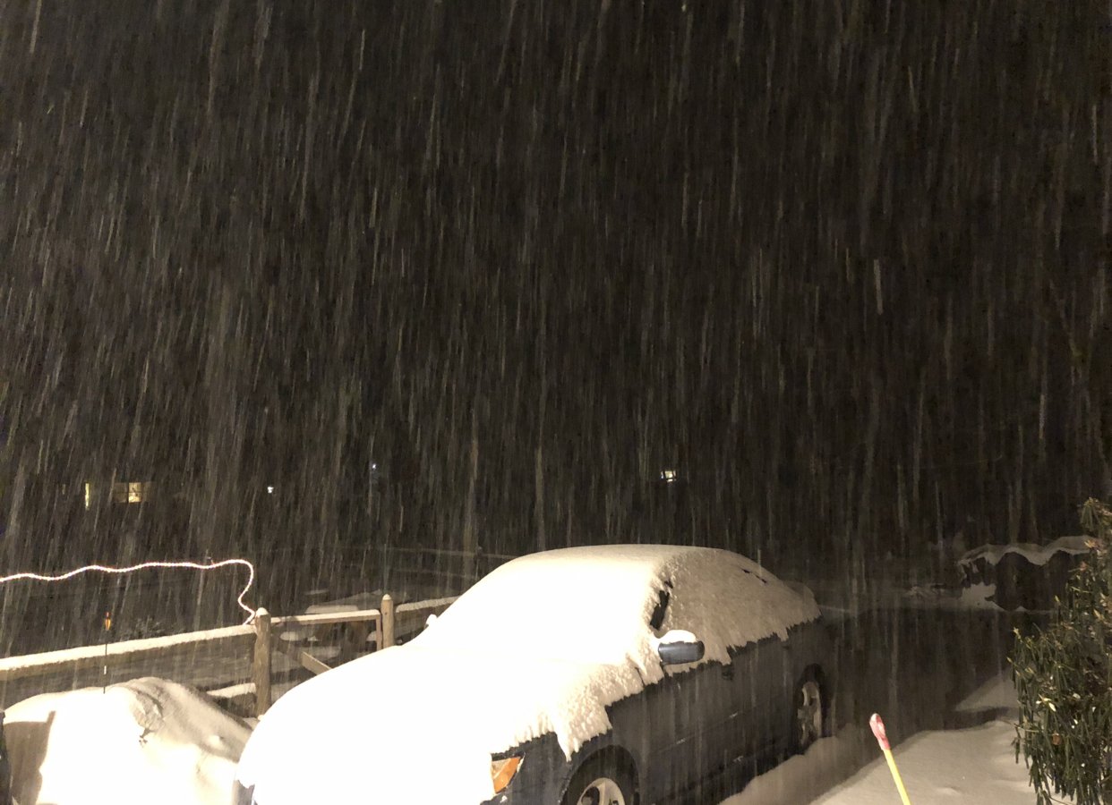
Down to -SN now with big flakes. Submitted 5" to NWS although might end up slightly more. Fun storm, nice to walk around in +SN with doggo.
-
Damn, it is snowing hard, heading out for that snowy dog walk.
-
-
Just hammering snow right now, hope these bands hold together all the way to Ray.
Closing on 5”
-
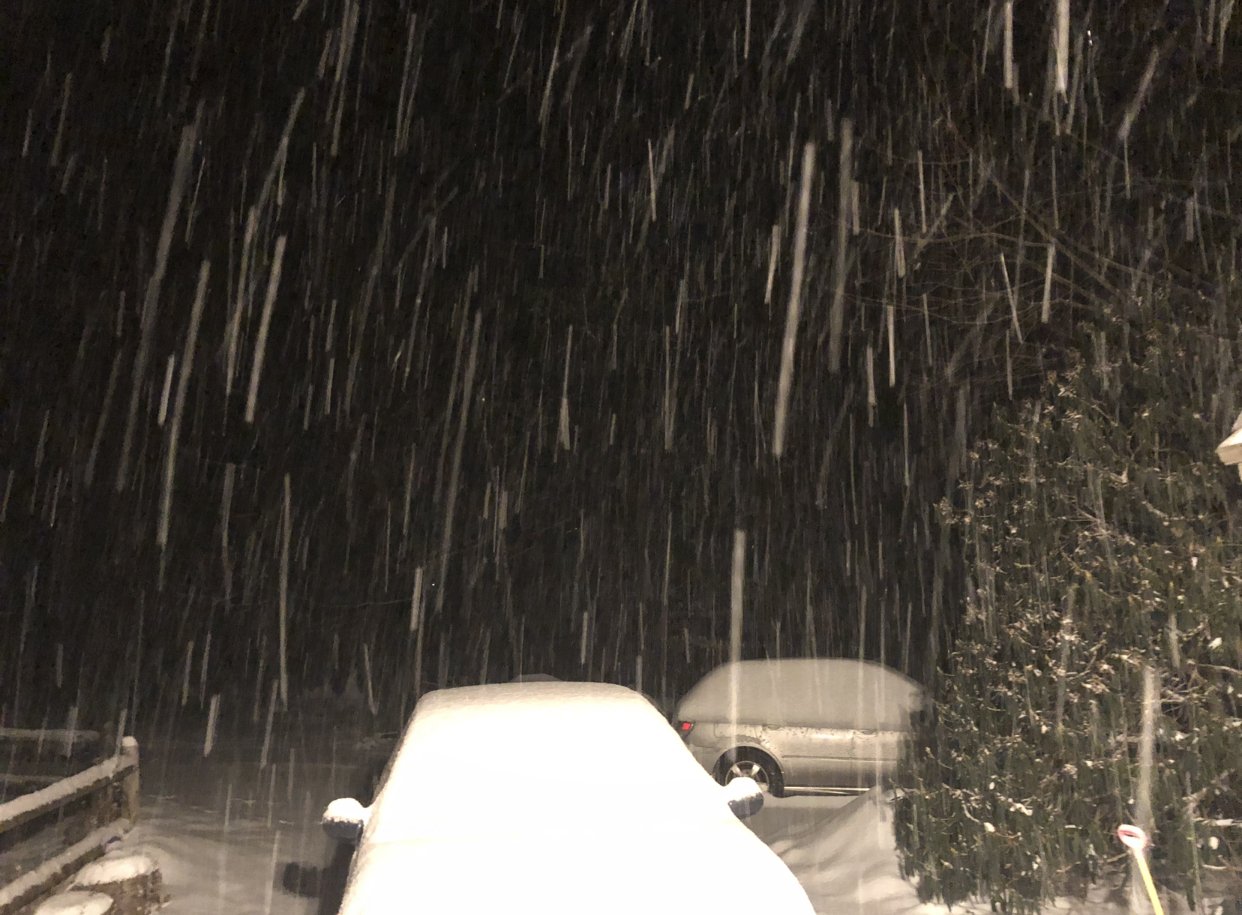
Wow, dumping again.
-
 2
2
-
-
Decent storm, another heavy band reforming just to my west. Maybe get close to 5”?
Models nailed the late bands along MA/VT border. I was skeptical but solid finish.
-
1
-
-
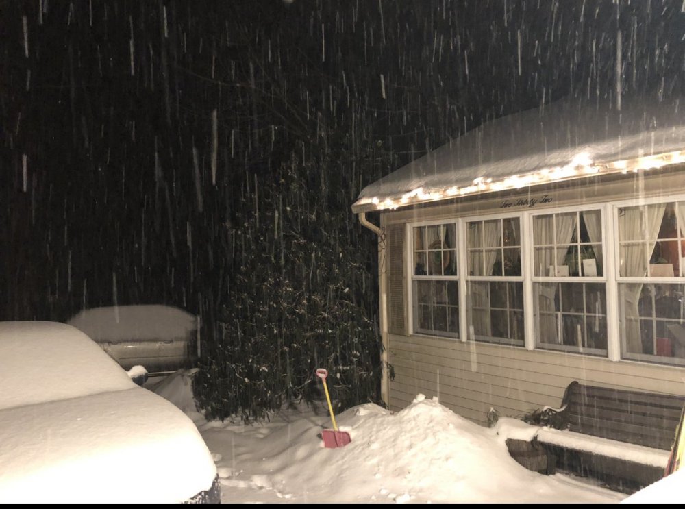
4.25” Steady light snow.
-
Still moderate snow in these bands skirting the MA/VT border. Good call by the models I guess on that feature.
-
1
-
-
Decent finale, definitely over 4” here, I’ll measure when I take the dog out.
-
Albany radar says we done. 3.8” can I break 4”?
-
3 minutes ago, CoastalWx said:
Yep. Why we questioned 6” and WSW in SNE. Remember the SWFE commandments. This wasn’t hard.
This is fast even for a SWFE.
BOX went wild yesterday with totals, didn’t have the sustained lift most places to cash in.
QPF will probably still be close to .5”. here, first few hours were dense needles.
-
Looks like back edge will have the heaviest snow of the night. Probably done here in an hour? Albany radar looks dry over the Berkshires.
-
Heavy snow now. 3.5”
-
2
-
-
Baking powder festival here so probably not expecting more than 3-4”. Should have good staying power though it’s pretty dense when I shoveled a bit.
-
17 minutes ago, moneypitmike said:
You can see on the regional radar how the returns are building nicely toward the MA/VT-NH line. There through CNE look like they will wind up the winners in this relatively equitable event.
Albany radar beefed up nicely past hour so should be several more hours of decent snow swinging through RT 2 corridor.
-
I’m thinking 4-5” here to Ray seems reasonable.
-
Moderate snow now, .75” much of that in the past 30 minutes.
-
1
-
-
Much better snow growth now, close to moderate. 19F
-
Steadier band on my doorstep, hopefully better dendrites, still small flakes. .25"
-
1 hour ago, ORH_wxman said:
18z rap loves the pike regionup into S NH/S VT for 6"+...not sure I'm buying that but the early start of the snow is a good sign. Not a ton of virga it seems like...surprisingly.
Steady snow at 16/8 is pretty impressive.
-
 1
1
-
-
2 minutes ago, Damage In Tolland said:
Yes and no
I dunno', it's movin' pretty quickly but hoping to snow through midnight, we'll see.
-
1
-
-
16/8 Steady light snow, small to medium flakes
Picking up in intensity, radar to the W looks solid. Very happy we caught a nice lull after the initial burst because the ride back from Charlemont was easy.
-
1
-

January 18-19 SWFE Obs
in New England
Posted
That's on the positive side of what you expected. Congrats.