
.png.5608f5bab30d37cac5ee5443be92fc2f.png)
HIPPYVALLEY
-
Posts
29,475 -
Joined
-
Last visited
Content Type
Profiles
Blogs
Forums
American Weather
Media Demo
Store
Gallery
Posts posted by HIPPYVALLEY
-
-
1 minute ago, RDRY said:
GEM is a worse model than the GFS -- it's much more erratic.
Yeah, but it has given a glacier’s worth of snow to NE over the years so we can’t help but indulge that models fantasy’s.
-
 1
1
-
-
11 minutes ago, wxmanmitch said:
This weather sucks! I simply don't get how or why people are so happy about this weather in the middle of January. It's not normal. It should be snowy and cold with subzero temperatures and a snow pack measured in feet, not inches.

-
1
-
-
1 hour ago, CoastalWx said:
Shut em down
Skiing was fine, they will survive.
-
Meh’ high of 54F today, yard still 3” of glacier, tomorrow should do some damage though.
-
10 minutes ago, Sugarloaf1989 said:
57F here and overcast.
Whoa, 46 here. No precipitation yet this weekend.
-
-
10 minutes ago, Ginx snewx said:
Pretty sweet
There are so many ski areas in New England that are bigger and more up-to-date but there’s something about that place that makes me smile.
-
1
-
-
27 minutes ago, GCWarrior said:
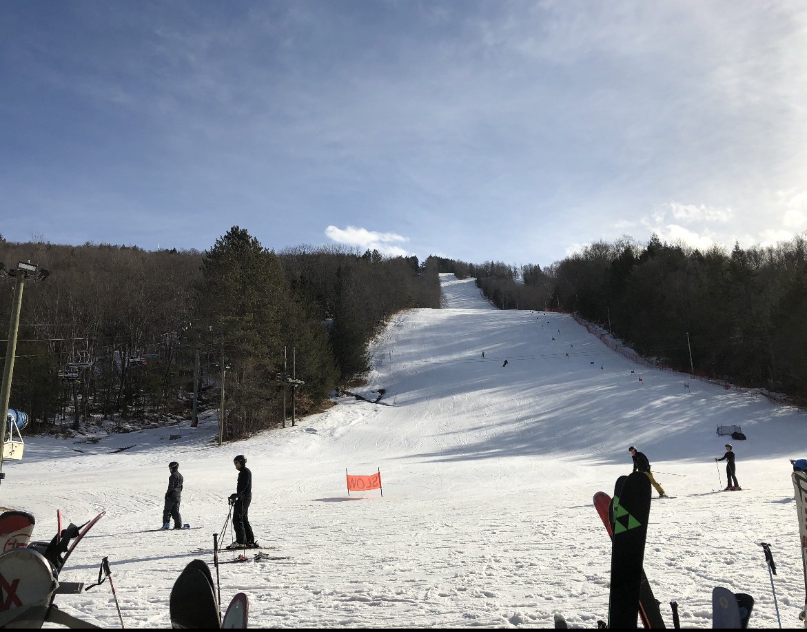
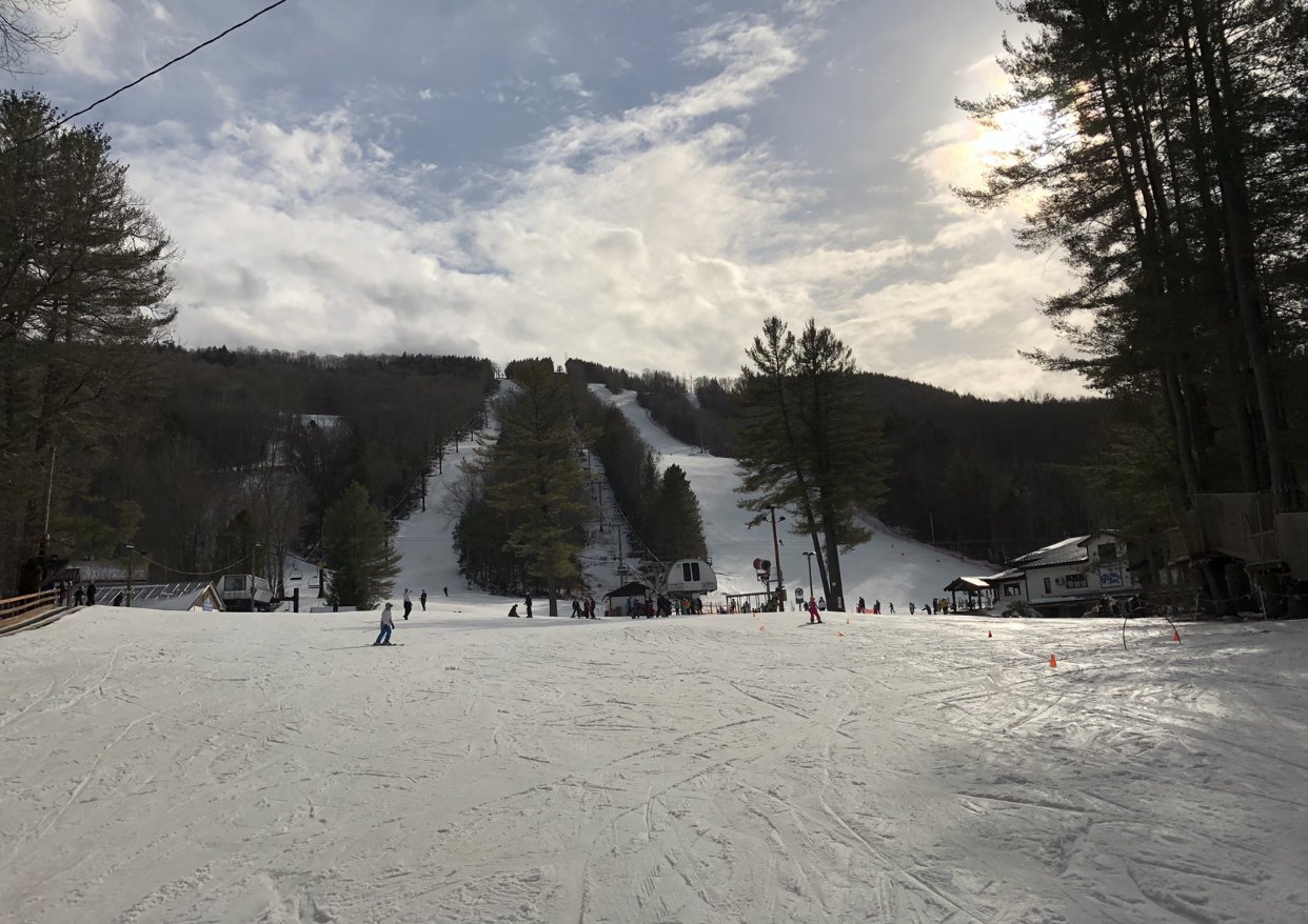
Looks great up there at Berkshire East! I'll be heading up for a bit after I get out of work. Kids are already up skiing with friends. Going to be slush on top of ice tonight!
Wasn’t as mushy as you would think. Pretty damn good snow considering it was close to 60° when the sun was out.
-
Pretty fantastic spring conditions at Berkshire East right now. Probably no more than 100 people or so here and it is an absolutely gorgeous sunny day. I think the rain forecast scared a lot of people away.

-
4
-
-
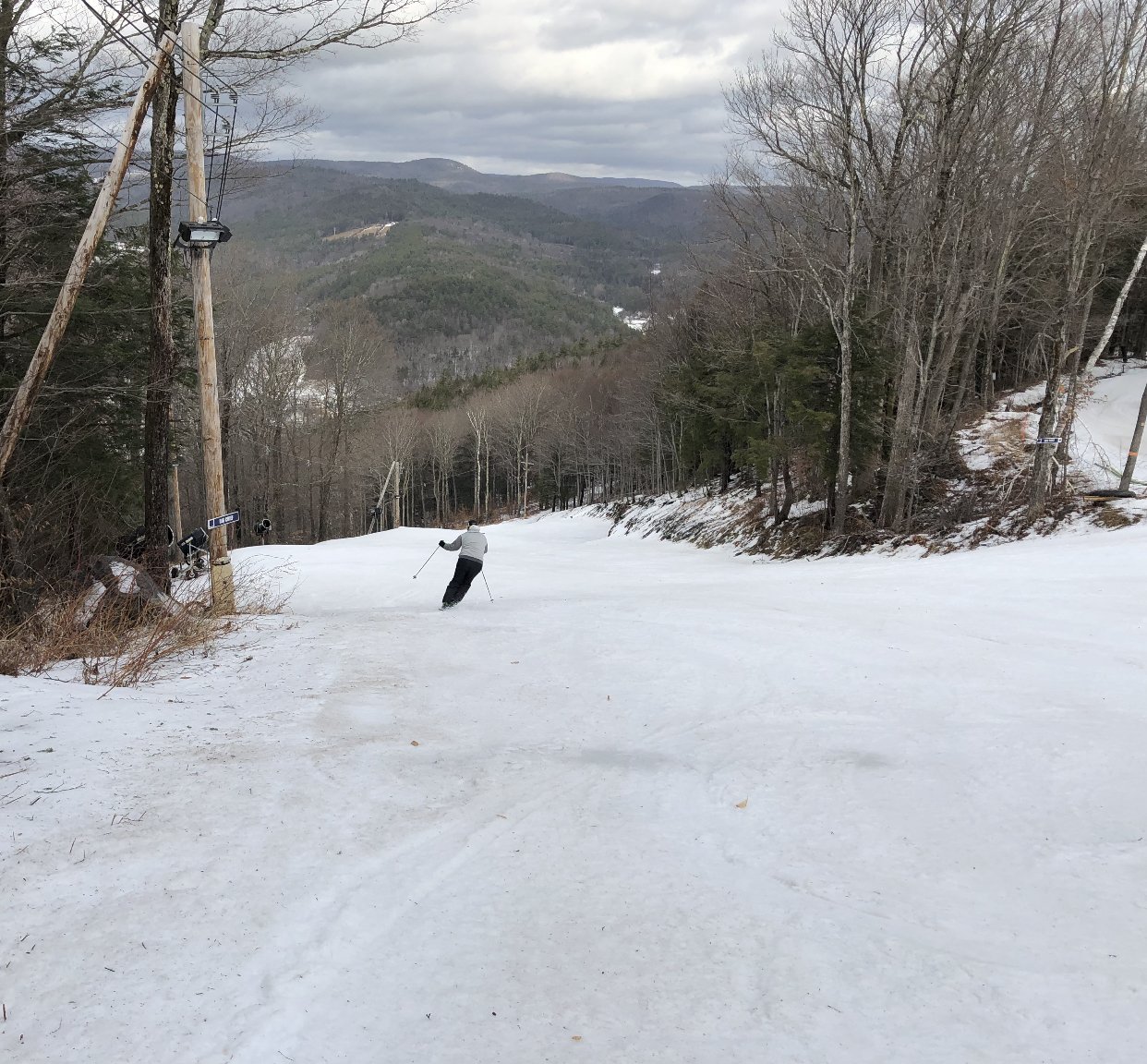
Off to Berkshire East for some spring skiing.
-
Still 39F here.
-
5 minutes ago, RUNNAWAYICEBERG said:
Nice gfs run and cmc with a teaser.
It's comin', now through PD should be fun.
-
1
-
-
57 minutes ago, CoastalWx said:
We tan.
You expecting sun?
-
30 minutes ago, Dr. Dews said:
That's a long convective line...like Gary IN to Corpus Christi
I wouldn't discount a few rumbles for WNE tomorrow night.
-
1
-
-
35/34 here. Probably CAD for a bit before the inevitable torch. Should be a good morning of spring skiing at B'East tomorrow. Apres on the deck should be nice.
-
1 hour ago, snowgeek said:
Mt. Bachelors forecast! My son is going this weekend. I'll be out there in February. Stoked!
This Afternoon
Snow. Temperature falling to around 21 by 5pm. Breezy, with a southwest wind 23 to 28 mph, with gusts as high as 41 mph.Chance of precipitation is 100%. Total daytime snow accumulation of 4 to 8 inches possible.TonightSnow. Steady temperature around 19. Wind chill values as low as -1. Windy, with a west wind 30 to 32 mph, with gusts as high as 47 mph.Chance of precipitation is 100%. New snow accumulation of 11 to 17 inches possible.SaturdaySnow. Areas of blowing snow after 10am. Temperature rising to near 23 by 10am, then falling to around 15 duringthe remainder of the day. Wind chill values as low as -5. Breezy, with a west wind 26 to 28 mph, with gusts as high as 38 mph.Chance of precipitation is 100%. New snow accumulation of 8 to 12 inches possible.Saturday NightSnow. Low around 17. Wind chill values as low as -4. Windy, with a west wind around 31 mph, with gusts as high as 44 mph.Chance of precipitation is 90%. New snow accumulation of 7 to 11 inches possible.SundaySnow. High near 22. Windy, with a west wind 26 to 31 mph, with gusts as high as 44 mph. Chance of precipitation is 100%.New snow accumulation of 9 to 13 inches possible.Sunday NightSnow. Low around 12. Windy. Chance of precipitation is 100%. New snow accumulation of 10 to 14 inches possible.MondaySnow. High near 17. Breezy. Chance of precipitation is 100%. New snow accumulation of 9 to 13 inches possible.Lol, that's like 60" in 5 days.
-
4 minutes ago, RUNNAWAYICEBERG said:
Pretty big/good signal for a d8 eps.
Yeah but Day 8 and all. I’m optimistic just cautious. Nice to see some run to run consistency on a storm threat. New regime incoming for a few weeks hopefully.
-
2
-
-
I’m not afraid to take my chances with this pattern at my location. Should be a fun couple of weeks tracking despite any let downs.
-
32 minutes ago, Kitzbuhel Craver said:
12z ICON is a soaker for almost all of NNE, except far N. Maine. Let’s hope that’s a trash solution.
That model has been leading that charge all week.
-
Already 42° in downtown Greenfield. Three day torch?
-
15 minutes ago, Kitzbuhel Craver said:
No way SLP’s can just plow through that kind of cold.
Cutters will always find a way to cut so don’t whistle past the graveyard but yeah, nice look for overrunning events.
-
1
-
 1
1
-
-
On 1/6/2020 at 5:16 PM, MarkO said:
Living in different parts of New England, I've noticed some areas develop and retain a snowpack. If I were to define that area it would look something like this. Thoughts?
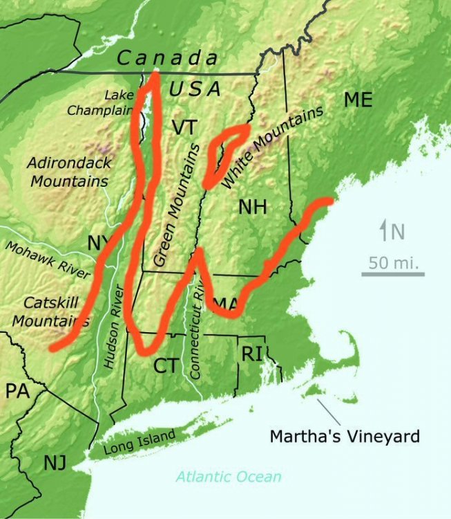
Drop your Ct River Valley ridge about 20mi S.
Brattleboro to Greenfield (especially Greenfield) has some great snow retention due to CAD and elevated valley topography. Just ask all the posters who get sick of pictures of my yard.
-
Looks like upper valley from Greenfield to Brattleboro will struggle a bit to warm so might only get a half day in the 50’s.
-
35 minutes ago, dendrite said:
This is the closest to LES or upslope I’ll ever get. Fun night. I almost hate to torch it all away now.
A taste of honey is worse than none at all? Congrats!

-
1
-

January 2020 Discussion
in New England
Posted
I almost think yesterday was warmer here in terms of sustained warmth. Didn’t really get out of the low 50s here today, what’s up with that?