
.png.5608f5bab30d37cac5ee5443be92fc2f.png)
HIPPYVALLEY
-
Posts
29,485 -
Joined
-
Last visited
Content Type
Profiles
Blogs
Forums
American Weather
Media Demo
Store
Gallery
Posts posted by HIPPYVALLEY
-
-
1 minute ago, STILL N OF PIKE said:
I will say this , this current pack in Nashua is bullet proof
2” of water locked into 3-4” of snow/ice
-
31 minutes ago, Damage In Tolland said:
Snowy morning CT
Coming down pretty good here now, maybe grab a quick half inch.
-
Heavy coating here, flurries now..
-
27 minutes ago, Ginx snewx said:
I thought it said NNE
Berkshire was pretty much closed yesterday so kids lesson was canceled and my buddy was up at Stratton today with morning wind holds and lots of ice.
Hopefully things turn around after next weekend. High dews will not be welcomed though.
-
5 hours ago, Ginx snewx said:
Um Sugarbush MRG Stowe all had over 6 inches of powder
4 hours ago, ORH_wxman said:Not sure those qualify as CNE/SNE which is what hippy was talking about.
He'll catch on.
-
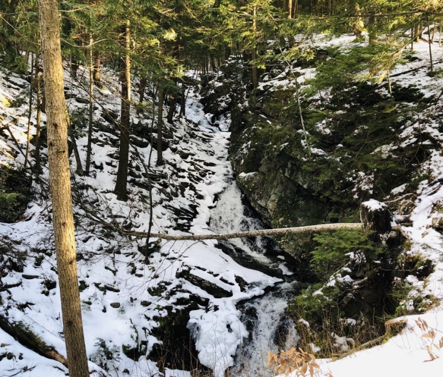
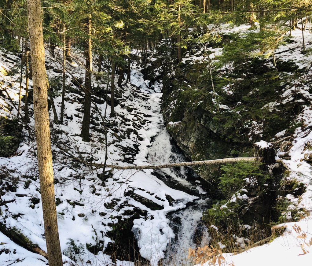
Put the spikes on and hiked the family into Chesterfield Gorge (NH). The picture does not do it justice, it was stunning.
-
 2
2
-
-
1 minute ago, Snow88 said:
I wouldn't even trust the models a day out
In a fast flow models blow?
-
1
-
-
Brutal weekend for skiers in CNE/SNE, rain yesterday howling wind gusts today.
-
Coating of sleet or graupel overnight.
-
Just now, CoastalWx said:
I hope this goes back west and gives everyone rain.
I love flirting with rain.
-
Quitters gonna’ quit.
-
2 minutes ago, weathafella said:
Euro coming in nice for midweek.
You are in a nice battleground zone for the rest of the winter.
-
6 minutes ago, USCAPEWEATHERAF said:
00z model cycle continues to improve from the far east runs yesterday of the 12z cycle, with the latest 00z UKMET run now over the BM. I could see further trends towards a more intense low, faster development and higher rates of precipitation.
Correction NW from today’s runs expected. This will be a nice 2-4” event for some SNE peeps. Anything more is welcome gravy.
-
14 minutes ago, weathafella said:
How about the cmc crushing next weekend?
I’m all for it! The CMC snows over the years have interior NE as a permanent glacier.
Hopefully CMC becomes king someday.
-
6 minutes ago, USCAPEWEATHERAF said:
If you are reasonable, then this system will provide, but you think it will be 12"+ then sure it is disappointing. You should never give up on an event 66 hours out with the mess the models have been recently.
Never is a bit strong but yes, very variable pattern that is never a lock beyond 48hrs. The fast jet flow has been pretty impressive with mitigating the logical atmospheric model leaning towards Low pressure cutting to the lakes but eventually flattening. The sneaky E Canada Highs are always the wildcard in this type of transitional pattern.
-
I’m thinking nice over running event mid-month to kick the interior back into winter mode.
-
31 minutes ago, ORH_wxman said:
GFS and RGEM have nice ML magic look for eastern areas.
Weenies have been way to impatient with this threat. It has had the possibility for a nice advisory event for someone in SNE for a few days and still does.
-
34F. Cloudy w/ fog.
-
11 minutes ago, dendrite said:
36° and rain. Another fail.
No coop crusher? Shocking
-
53 minutes ago, Whineminster said:
When do i snow
Midweek if things break right?
-
 1
1
-
-
3 minutes ago, Damage In Tolland said:
I hope it comes back , but when I saw how fast the flow was aloft early this Am on the charts, I worried a miss was possible. So far modeling confirms
I’ll defer to Tip on this but it seems like fast flow has been the story more often than not the past few years.
-
3 minutes ago, 40/70 Benchmark said:
When Ginxy posts day 8 ice soundings for moosegrundle, ME, its time to focus on football.
That probably won’t be a focus for most here either after tonight.
-
1
-
-
Yay, 35° sheet drizzle.
-
34 minutes ago, Baroclinic Zone said:
It’s sad. Ecological catastrophe of epic proportion.
I feel like, as with almost everything else in the news, many people in the US have sort of forgotten about it or don't care.
January 2020 Discussion
in New England
Posted
Me thinks I am going to end up with more snow today then with the mid week critter. Already .5” this morning. Roads are slick.