HIPPYVALLEY
-
Posts
32,859 -
Joined
-
Last visited
Content Type
Profiles
Blogs
Forums
American Weather
Media Demo
Store
Gallery
Everything posted by HIPPYVALLEY
-

1/9-1/10 Now Morphing to Less-Than-Exciting Power Cutter
HIPPYVALLEY replied to Torch Tiger's topic in New England
This one may be moving too quickly to drop the high end rain amounts. -
1/9-1/10 Now Morphing to Less-Than-Exciting Power Cutter
HIPPYVALLEY replied to Torch Tiger's topic in New England
Fortunately I’m in the valley and tucked behind a hill. I think the high elevations around here are going to get rocked for a few hours. -
1/9-1/10 Now Morphing to Less-Than-Exciting Power Cutter
HIPPYVALLEY replied to Torch Tiger's topic in New England
I already got the Eversource text on my phone to prepare for power outages. -
That’s a great beer but tough to find in SNE.
-
1/9-1/10 Now Morphing to Less-Than-Exciting Power Cutter
HIPPYVALLEY replied to Torch Tiger's topic in New England
Worst case is 4” that gets loaded with water but doesn’t quite wash away. -
January 6-7, 2024 Winter Storm Obs Thread
HIPPYVALLEY replied to WxWatcher007's topic in New England
FYI, the New England snow table is active. Post your totals. (Double posting this in both threads) -
FYI, the New England snow table is active. Post your totals.
-
January 6-7, 2024 Winter Storm Obs Thread
HIPPYVALLEY replied to WxWatcher007's topic in New England
Actually picked up another .25” of under the radar fluff since 4:30 PM. -
January 6-7, 2024 Winter Storm Obs Thread
HIPPYVALLEY replied to WxWatcher007's topic in New England
That’s all people do around here because there’s so many old logging roads and trails. -
January 6-7, 2024 Winter Storm Obs Thread
HIPPYVALLEY replied to WxWatcher007's topic in New England
Nice burst of light snow to wrap up the night here. -
January 6-7, 2024 Winter Storm Obs Thread
HIPPYVALLEY replied to WxWatcher007's topic in New England
Yeah, Springfield gets snow it’s just been a tough few years there. Congrats -
January 6-7, 2024 Winter Storm Obs Thread
HIPPYVALLEY replied to WxWatcher007's topic in New England
What did you get in the March paste job last year? -
January 6-7, 2024 Winter Storm Obs Thread
HIPPYVALLEY replied to WxWatcher007's topic in New England
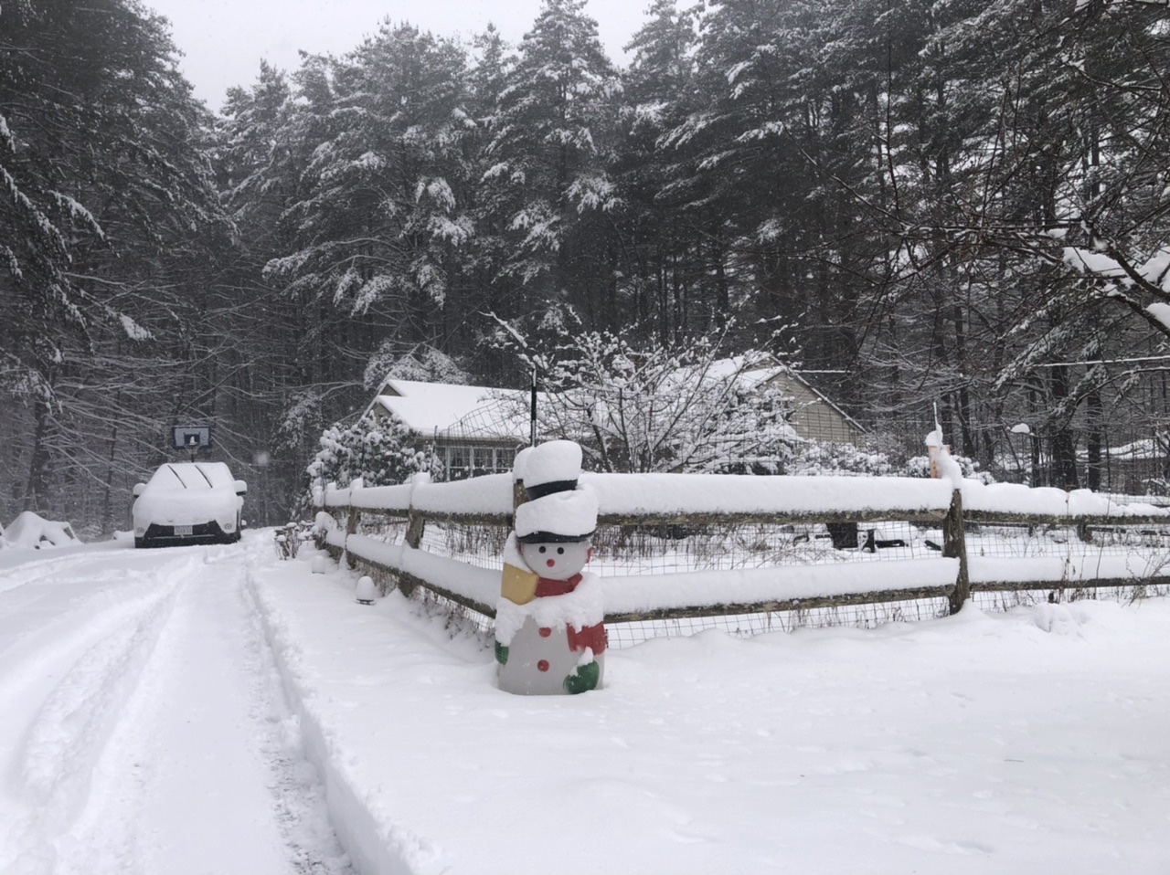
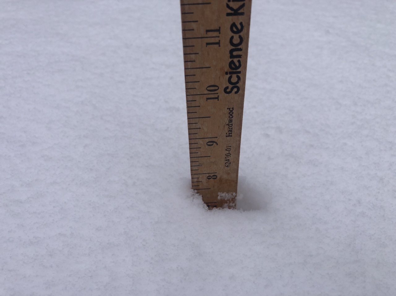
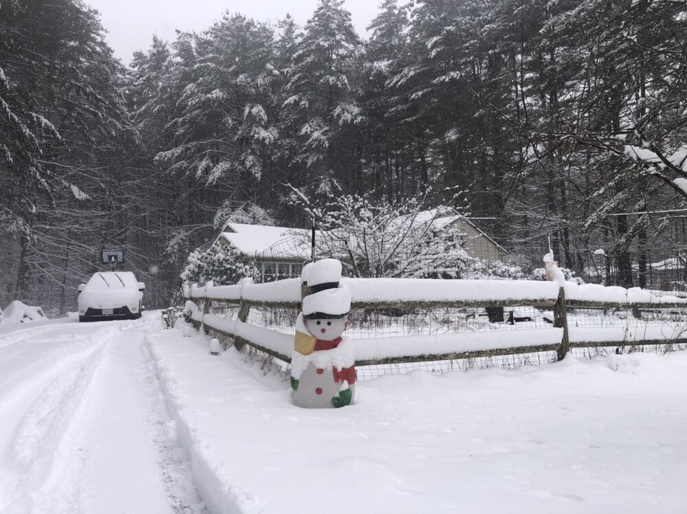
OTG settled. We might’ve had closer to 8 inches total but the 7” is what I’ll report. -
January 6-7, 2024 Winter Storm Obs Thread
HIPPYVALLEY replied to WxWatcher007's topic in New England
-
January 6-7, 2024 Winter Storm Obs Thread
HIPPYVALLEY replied to WxWatcher007's topic in New England
Winding down here. 7.25” respectable -
January 6-7, 2024 Winter Storm Obs Thread
HIPPYVALLEY replied to WxWatcher007's topic in New England
More than I thought out there.
-
January 6-7, 2024 Winter Storm Obs Thread
HIPPYVALLEY replied to WxWatcher007's topic in New England
Radar looks like it’s pounding along a line from Fitchburg to Manchester. -
January 6-7, 2024 Winter Storm Obs Thread
HIPPYVALLEY replied to WxWatcher007's topic in New England
In the 6.5” vicinity but still moderate snow here. -
January 6-7, 2024 Winter Storm Obs Thread
HIPPYVALLEY replied to WxWatcher007's topic in New England
What's your total there? -
January 6-7, 2024 Winter Storm Obs Thread
HIPPYVALLEY replied to WxWatcher007's topic in New England
Yeah, I have to stay away from those late in the day. Different coffee beers vary of course but I believe a pint of Berkshire coffee porter is equivalent to about 40mg caffeine. So a little less than half of the average cup of coffee, which is a lot at night for me. -
January 6-7, 2024 Winter Storm Obs Thread
HIPPYVALLEY replied to WxWatcher007's topic in New England
It looks like Bennington and Brattleboro average the same amount but take different routes to get there. -
January 6-7, 2024 Winter Storm Obs Thread
HIPPYVALLEY replied to WxWatcher007's topic in New England
We are all absolutely shocked! -
January 6-7, 2024 Winter Storm Obs Thread
HIPPYVALLEY replied to WxWatcher007's topic in New England
Only 3" here overnight but approaching 6" now from the 2nd round. That was my fail threshold so I'm happy we'll break that! -
January 6-7, 2024 Winter Storm Obs Thread
HIPPYVALLEY replied to WxWatcher007's topic in New England
Yeah, they actually average 56" per year, a little less than I thought. Surprising since Greenfield averages around 60" -
January 6-7, 2024 Winter Storm Obs Thread
HIPPYVALLEY replied to WxWatcher007's topic in New England
Brattleboro couldn't get hosed that badly since they average 60"+ Bennington, Keene and N Adams are worse snow holes.