

Typhoon Tip
-
Posts
43,577 -
Joined
-
Last visited
Content Type
Profiles
Blogs
Forums
American Weather
Media Demo
Store
Gallery
Everything posted by Typhoon Tip
-
Come to think about ... in a May 2005, 20th -30th redux taking place in early April... we're probably adding to seasonal snow totals pretty significantly - this f'n thing may not be over
-
Almost smacks a bit of May 2005 ... I'm gonna take a look -
-
I get it that not many give a shit about this sort of thing... but...I see the height gradient everyone abruptly relaxing across a lot of guidance out there just beyond D6 and by 10, some 3 or 4 in the count from the subtropical latitudes to 70 N are reduced,...slackening the integrated gradient across the whole domain when that happens... I don't think that it is a geophysical coincidence that just about in tandem the height nodes pop off with those ridges at higher latitudes. It makes sense at a baser conceptual level - fast flows are progressive; retrograde flows - to which -NAOs are a part - tend to be slower. In this case the relay from the fast to slow is seemingly as though cause to effect responsive - like the fast flow that presaged, caused the blocking -
-
It has only been on-line for 3 ..4 days though ? ...give or take. which is good for at or < 4 days - I think perhaps expectations on modeling could at times use a reality tap on the shoulder. But, most of the problems with it is/were in the middle+ ranged handling. We'll have to see how the mid range, D4 to 7 starts to fall out in the verifications. During the last few weeks just prior to the the roll-out, I did notice the same shenanigans of lowering ( tending to..) heights too much on the polar side of the ambient westerlies, ...which tends to augment the already velocity saturated hemisphere that much more. The speeding aspect/progressive shit's related to a separate causal circuitry ..but the GFS physics seems to then add to that - effectively, cloaking that has that bias. The N/stream dominance is another way to conceptualize ...it just has too much 'main band' power ..but it is an aspect the emerges out in time/gathering momentum .. such that mid range more so than the first four days is when it is noticeable. But it's funny - because who has the right to complain about a D6 model solution anyway -
-
The 00z entire modeling technology ambit was interminably worse, too - what a godless pattern that is ... Regardless of race, creed, color or country of origin, pick a model ... the are unredeemable. Euro displays D10, 850 mb warm plumes over the D. Straight/lower Greenland regions to +2 C in pockets, while Maine is -12 C at 850 ..failing that 2nd bold notion as though by agenda to do so. Just perfectly wrong setting up NOT getting us to your "back door" idea of suppression - I mean it may ultimately get there.. who knows, but zippo redemption model run for anything beyond D7. I'm leaving New England March 15 to May 3rd every year ... just need a windfall. Not sure how you people can live like this As an aside, something like that happened in the 2010 winter, when a -6 SD west based NAO brought what pretty much amounted to a planetary storm to the M/A ... that theory of L/W being the real event, and each S/W is like a single squall within. For a couple of weeks, Maine was getting mild and sunny from the Atlantic.. while DC was handing out 18" events from Pez clicks. I wonder if that larger circulation circumstance can actually pay 'bootleg dividends' in spring though... The difference between the winter variant of that synoptic scenario occurring now...is the sun. During the solar nadior, roughly November 8 to February 8, the difference in insolation and diabatic differentiation across the hemisphere is actually a smaller gradient than now...when it Atlanta GA and Boston MA and NF are on a thermal slope. That changes "what" is backing SW a bit ... Lol, I don't think anyone's ever done a qualitative scientific, formally framed up work/paper that discusses being butt-boned in New England -
-
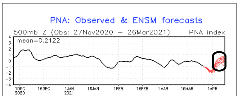
I'm hoping the roughly 2/3rds of the GEFs members that are nudging the block ballast more E in stature are onto something and the whole aspect ends up an east based NAO. I think an east based NAO and a PNA that stops rising at neutral might be workable and not as bad as some of those/these early cold washes wanna sell - but we'll see.
-
It's all predicate on the assumption that the -NAO will pan out.. . Complicating/adding to that, some of the individual GEF members east-base the NAO block - we all know that matters. Plus, the wave lengths are trying to shorter pretty much right on top of the late mid and extended range - like it's the time chosen this particular go of it to do that particular large scale flow modulation. That also complicates - We'll see how it all aligns. The GEFs from last night say we April blue bomb ( above seasonal probability to do so...), but the EPS and operational Euro ... and the operational GFS are trying to be flatter over the western domain of the NAO region - the shallowing/normalizing of the lower Maritime vortex as noted by Brian is an example of that hem-hawing... Lord knows I don't want it - just being objective.
-
Winter starts in April if GEFs gets its way... Five nights of banging negative NAO with a huge rise in the PNA… It’s going to prove to y’all not to discount Tele connectors so early in the season for one but secondly ...indicates a seriously f*ed up spring until mid May “IF” that happens... Originally I had surmise the possibility that as the flow relaxed, the Lanina would maybe take over and we ‘d end up with a warmer spring consistent with that longer-term ENSO footprint ... that doesn’t seem to be emerging - Instead we are manufacturing the same shit that happened for the last five years… Which is to say the flow relaxes—> blocky notes pop —> seasonal rollback screwed
-
Terrible extrapolation from D5 to 6 on this Euro ... that screams as over modification of the flow do to correction scheming they wash their solutions with at that seam. Just look at the southern aspect of the trough at D 5, and not that it is sloping positive and weakening, as it should against high heights over the SE ... Yet, D 6...it just suddenly materializes all that mechanical power?
-
I gotta do that too ...shit. kicking myself for not doing it last Sunday in that 67 high sun dry air. Woulda been fast -
-
Lol, it matters none in "Napril" ...because that means it was a warm so it didn't - but in general? It matter in April's wholeheartedly. I have notice folks peddling out the index correlation seasonality stuff lately...and as usual, they don't get it or it comes off as though it's absolute - like a light switch. "Up, -NAO and + PNA doens't mean anything now, phew -" WRONG Look, there's a 'gestation' ... it takes time for that to become the case, every year. It's not an April 1 or May 1 or June 1 requirement. hahha. It starts slowly...and over weeks and weeks and weeks, you end up at a state where the PNA and NAOs and the whereever she blows mean less. In April? Holy hell - particularly the front side of that month, we are in the still heavy end of still gonna matter! In fact, I'd strongly suggest not ignoring this, .... at least for the time being. And if it ends up mattering less, it won't be because the PNA didn't correlate - it would be because the pattern didn't verify. Two different things.
-
Yeah... I mean really - it's less ( at this stage of the game of "climate monitoring" if people feel less confident or comfortable labeling it as 'change' ) about losing March as a winter-defined month, and more about just instability in wild swings
-
I suspect a 00z Euro-like layout is the likeliest general impact re that latter Sunday. I might even edge the verified faster to leave if anything; it would fit seasonal trend ( which is really more like a dedadal trend ...) to do so - systems lose curvature of structure, modulating .. pulled/stretched in the models, due to speeding up in time. I think that last predicate phrase is the main cause for why so many 'bigger events' in the extended times seldom get into shorter range without significantly minoring out, fwiw - But I am noticing the westerlies are getting faster for next week .. right on schedule again. This has probably been a 'canvas correction' that's been going on in all guidance all along...where the ambient velocities ( we call that geostrophic wind ..) are consummately correcting faster from D10s to D4s ...and that, right there, could simplify the search for why these bombs end up smeared whimpers so often. Yep... round and 'round we go ...end up right back into HC expansion causing hemispheric compression against boreal winter heights... I'm digressing but it is indirectly related, and why I am not ready to sans the notion of a big -NAO at some point in April. It's 'thermal rebound' - basically... the flow finally does relax as these heights N of 50th finally fill...and when that happens, there's a window were latent heat dumps into those regions and we get that blocks in springs. Trouble is, .. that is at statistical odds with the La Nina footprint ( that supposedly...) in the general planetary system right now. This latter signal is a flatter 'ridgier' warmer April ... diametrical to a -NAO. Lol. blah blah but HC shit is fighting the La Nina spring in that sense ... hm
-
We got stuck with the paint-spill-on-the-freeway look... It's my euphemism for when the ongoing traffic of synoptic cloud patternization glides over top a permanent white substrate on hi res visible satellite looping ... said substrate is strata and murk too dense to allow the sun through. It reminds me of white latex paint outta the back of a stoned house painter's van on a road surface with cars flyin over it It can 'burn' off but there's just enough of said real cloud over top to slow that process... It's like yesterday...probably we wait until 18z to clear out and there goes our thunderstorm threat - .. Lol, f'n March in region proven to be a convection sink anyway - what were we thinkin'
-
I get the chastising and finger pointing of the playground antics thing but ... C'mon Will - remove 2015's deep anomaly and that Trend "surges" all the way to a fiery +0.001 LOL In his "sort of like" defense ( I guess...), I will say ..I've personally noted some distinctly warm anomaly 'periods' that are sub monthly in scale, spanning the last 7 or 8 years. Thus anecdotal, these did actually take place in either February, March or Aprils. They were particularly obscene, and nothing like I had ever experienced or ever thought possible at this latitude at during late winter into early spring. Those longer term statistical graphs ... hide those, thus negate their significance. However indicative they are or not, at least for this 8 or so years... hell call it 12 and include those crazy warm weeks in April of 2009, too ... A conclusion could be fairly made that isolated warm intraseasonal events are increasing in frequency ? I mean, that is empirically shown - ..so those stats should count for something too.. Open-minded: Maybe this is how it begins ? We start increasing frequency of 2 ... 3, 5 -day long +20 events enough, and we're 'playing with fire' - haha. But we may start smearing some together and ... smear enough, there goes March.. -who knows when that would ultimately be, just sayn' In fact, not only do those warm events host record breaking temperatures, I feel confident that if ever a metric could be derived, call it the "integrated kinetic index" ( kind of like ISE for TC... only "IKE" for warm events etc..), those events that each lasted multiple days? They probably best most warm anomalies that have happened in history, too - even if by decimals... I'm sure there are/would be those that are comparable... ( say in the 90th %tile ...), sprinkled over the hundreds of years of climo, of course, but increasing frequency - that's the argumentative tell. But 2009, 2013, 2017, 2018 ... last year... now... I remember one year on Easter Sunday, at my sister's place up there in Winchendon, it was 87 F ...Anyway, I think the point is valid - Having said that, it doesn't mean the March is no longer a winter month - not yet anyway. No more than it would mean February is non-winter months in that list. Funny thing is, those years that did that... had cold shots and CAA with virga exploded CU and packing pellet showers ...if not a synoptic threat or two, just the same. interesting... more of an "unstable" climate than one that qualifies no longer cold and snowy March's - that much seems clad
-
Unfortunately ... now those dolphins are sterile for having venture into those waters -
-
Funny y'all noticing that about pack loss rates ... I was thinking on my b-ride that today feels like the real first mild day of the year - ...those other ones were like shot across the bow and had that kind of "fake warmth" feel to them.. .even into the low 70s it didn't feel quite the same because the evap rate was so high you still sort of got annoyed by the breeze ? somethin like that -
-
Everything discussed about that Euro run beyond D ~ 4.5 is not considering it's patently obvious amplification bias it regularly/routinely applies as a systemic wash to everything and all features it already has in process/ physically handling in those extended time ranges ... I bet anyone 10 bucks that four cycle from now that won't be there - if not the next ... talking about the D7/8 thing - The only real reason to tweet that and then make fun of it, is because that personal really really hopes it happens. Lol ...otherwise, that realization of its bias makes it not really commendable enough to comment on
-
I'll tell you though... it feels nice to not have the heat on at all in 18 straight hours... I think at this point no heat through Saturday night - by the way, Saturday is starting to look like a sneak gem -
-
There it is... phew - just when I thought we'd dodge the bullet
-
We labored 'till 18z ... but it was 49 and light lab-fridge urine here at 13Z with slate ... handling memories of 76 F and sun forecast aft by only 12 hours. Jeez. But, here we are ..open sky hot sun and 71 big ones. DP is 61, too - heh... forgot to consider that. It's a whole 'nother world compared to those 70/20 days... Putting up 71/61 is a strange feel with no foliage and the ground still beige. And with Sept 15 equivalent late summer sun ...we probably won't max until 4:30 either.
-
Hopefully readers realize that snark humor - But, topography does play an important role in timing warm fronts. They are particularly needful of overcoming low level drag ...and having the land mass fall away/lower elevations peering roughly east of an HFD-EEN line the way it does, tends adds more drag by virtue of more mass ... thus inhibits "light wind field" type warm front erosion scenarios ... front stops at the Worcester Hills. See it all the time. It's something also exaggerated in the spring - when of course by nature when no one 'sane' wants it to persist chilly... We typically are going from very dry DP like yesterday, and then saturation of that air mass, in between, makes the air thermodynamically dense, and offers that much more drag... It's just harder. If the TD out ahead of the warm front was warmer than .. 20 F, we probably would have the boundary up there at PWM already
-
oh yeah...it's an eastern zones issue ... warm fronts creep to the rim of the worcester elevation line and then stops there... You need a p-wave of a f'n comet impact to scour this shit
-
it's a teach-able moment about always adding 6 hours to warm fronts in this f'n bottom less cold well
-
stubborn low cloud... the orb of the sun is plainly getting through... enough that it's 66 and way above normal but somehow still an injustice - hahahaha. I guess not advertising 77 with mid summer appeal would help that set up, huh - But in any case, it is clear like 3 miles west of here out to NYS ... open sky, and the clouds are move WSW to ENE so this is entirely lower level terrain fall away caused at this point... They'll probably make 74 to 76 west of the ORH hills, and then that air mass floods east as late high with a later mix out I'm guessin... The old 6 pm Logan t-spike ?


