

Typhoon Tip
-
Posts
43,363 -
Joined
-
Last visited
Content Type
Profiles
Blogs
Forums
American Weather
Media Demo
Store
Gallery
Everything posted by Typhoon Tip
-
yup, an early autumnal vibe. particularly when the sun slips behind one of those 20 minute pancakes - circa september 24thish
-
okay... i guess i'm describing more so a pathway to winter sucking giant donkey balls, and why ? i'm not in any kind of argument over whether the hemsiphere resembles whatever wrt to enso.
-
i suspect the enso will be too weak to matter against the din of these overwhelming other aspects. not much else. the ao being preponderantly positive is a bigger issue for me, as well. if so ( and it is robustly correlated to be ... ) it would be in a constructive interference with other mitigating stuff, muting enso forcing even more. i said the -enso may turn out weaker - i meant so on its own. but that's also hurting it's case as an exerting influence, granted - i'm not obfuscating anything - i'm just not considering any of that noise as factoring enough over the louder indicators. the hemisphere's destined to be velocity soaked and stressing telecon correlations - this is also being papered. I don't have a problem with those publications because matter of fact ...i've been railing about this since 2010
-
MJO desk: • During the past 2 weeks, the RMM-based MJO signal has increased in amplitude and is now located over the Indian Ocean (Phase 2). • Dynamical models are in good agreement regarding enhanced MJO activity across the Indian Ocean and Maritime Continent during the next 2 weeks. • The MJO propagation across the Indian Ocean and Maritime Continent supports an enhanced easterly wave train coming off of Africa in late August into early September. • Combined with anomalously warm SSTs, and the approaching climatological peak of hurricane season, this favors high chances for tropical cyclone (TC) development over the Atlantic Main Development Region despite the suppressed convective pattern aloft.
-
yeah, like that
-
yo Brian ... you might find this interesting. or not. but we were wondering if smoke particulates entrained into rain mechanics may also goose rain. " Pollution acts as cloud nuclei. " https://phys.org/news/2024-08-year-air-pollution-thunderstorm-danger.html very closely related -
-
i've noticed the gfs has actually not completely sucked pieces of cat shit when it comes to targeting genesis. i haven't looked very closely at it - could be it just happened to score when i checked so ...this opinion doesn't mean anything ... but, have noticed it enough that it seemed okay relative to having no clue at all
-
but i'd be willing to suggest an early winter event from late oct - mid dec, prior to the gradient lock down prison. then again perhaps late when relaxation teams up with cold meanders in the spring.
-
y'all can simplify a lot of stuff going into this seasonal outlook hobby - at least on my desk. summer and autumn solar demos a robust lag correlation to ao during ensuing winter. +solar = +ao -solar = -ao ...to me, we are looking at a +ao winter when factoring in that no formal prediction source saw the highest solar active max in over 20 years, and in fact, thought the opposite prior to this rage. heh. that, together with preexisting ( decadal recency ) to observe + as the dominant mode, anyway, +ao seems academic in this case. +ao winters are not summarily ruled out in 1990 securing d-drip doses in 2024? gets a bit 'shakier' we're gonna have to lop this attribution shit ( which is unfortunately real shit) on top of the former statistic. as to the lower and mid latitudes, it seems to me this la nina is either weaker in general , or made less effectual anyway, because like all ensos of the last 20 years ... they've been manifesting lesser responses ( i didn't say zero ). again, i believe they are getting buried/overwhelmed. it's been my own take on that for years. since, this roni business has emerged and well there you go. it's getting arithmetic for me. la nada-relative hemisphere pretty much leaves the dominating mode to the attribution stuff, which is a gradient rich, higher speed sheary shit show, taking place under a +ao. should all = a low scoring winter from winter enthusiast side of grading, to put it nicely
-
KWO ? ...is that a radio station
-
welp ...that 'bout wraps it up for 2024
-
sun is april 20-like .. still warm enough to heat things up. 850's appear to +6 to 8c-ish, which if we mixed that high and actually get more sun we could still 72 or so down here along the cp. probably won't mix that high but it doesn't matter because the atm is adiabatically stable, so 900 or 850 probably ends up with similar sfc ranges. a NW d-slope trajectory not hurting.
-
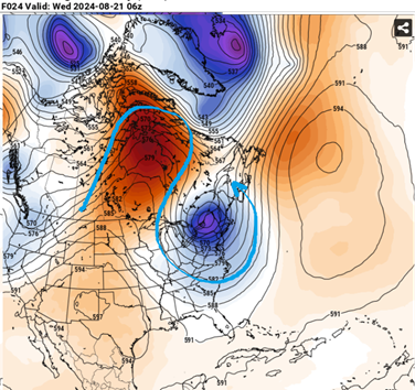
it's the continental folding over pattern causing premature cold meanders ... i used to conceptual post about it but stopped last year when i realized the room is empty. but it's a thing we've been observing more and more so over the last 10 to 15 years. this ... is really a manifestation of the same thing as far as I can tell - it's just doing so 45 days early. But that deep anomaly is an 'atmospheric meander' - it's been papered as an increasing phenomenon associated with CC connection to pattern morphology... blah blah. but this little cool thing as you can see above, is almost disconnected from the prevailing hemispheric footprint there. It's actually put there by the folding over +anomaly over central Canada. clearly what this is... attribution --> cold piece of shit imagine this were October 15 ? this is how we've been getting these October/Halloween snow airs if not actually snowing.
-
That looks like the new climate footprint: speed ..which is a crapse shoot that actually tends to roll pieces of shit more than not
-
We should also see an eastern continent/mid latitude ridging and warm intrusion, too. Could be the last heat wave chance of this season ...circa early next week. models are tepid on the idea ( operational ) but some of that ( the GFS in particular ) is native bias related.
-
Eventually it'll happen. March 2012(?) was something like a raging +10 to +15 above average. Doing that at a whole month's chunk of time is nothing shy of extraordinary - an achievement that I've always felt was way ...waaay under recognized, let alone even much talked about why? because +12 F in March does not appeal to any pain sensory in the common everyday experience enough to warrant a head's up. That's the biggest problem with CC and GW and AGW and whatever abbreviation of the moment suffices, is that it doesn't actually appeal to anyone's common experience - or never used to... Yeah, people are dying in swelter more frequently now, and along with other specters and popularizing dystopian headline attention grabbing is beginning ( finally! ) to appeal somewhat. People need punches in the noses leaving their house, with a burning bush and voice from the heavens claiming responsibility for the pain before they'll admit their about to die - Making America great again is impossible when there is no world within which to actually have an America - this will forever escape anyone's connective intelligence until they start to feel pain. Anyway, if March 2012 can do it... it's not a huge leap to back date that achievement to include Feb ... hell, it was 80 in Feb twice during the last 7 years, and 70+ in half of 'em as it is. Trade those weird week events for an aggregate there you go. ( the preceding is frustrated dark humor along with some seriousness )
-
No...it's not just you. heh. and yes to bold. I suspect ( not that you asked ... ) this is a "region of the continent" emerging problem? CT may be preferentially situated within that general dimension, but with the sample size not being very weighty yet, it may just be a CT fractal. ... VT also scoring. They're clearly headlining lately up that way, too with an increased frequency, so the distribution may have more than one nodal focus. I also suspect we have our own "attribution" aspect going on at a general scope. Time will tell if start seeing these hydro bombs going off outside CT and VT, but the Leominster 9" evening event along interior/Rt 2 thing just last year adds to the argument that there's broader perspective risk concern. All regions are susceptible imo. The ever usable 'just a matter of time' cliche is apropos. But, one can intuitively see why the CT-VT axis may also be more prone within the larger generality.. Wiz' and I were ruminating yesterday that this sort of thing is beyond the scope and capacity of modeling state of the art. I don't know how you can "see" a 10 to 15" hydro bomb before hand, when all of the mechanical players are under the floor of the model grids ?? It's a f-up circumstance to be in if we are going to be tip toeing blind through a Meteorological minefield.
-
The problem with Gloria is that the regional excitement leading ended up getting "screwed." It was akin to a giant blizzard forecast, where its in the headlines early ... say period 4 blizzard watches issued ( rare ), and then only getting 6-8" out of it with less wind. Good storm ...sure, but heh. Winter or Summer, that feeling of being gypped is the same. ..it weakened at a very rapid rate shortly after turning the corner ENE of the Bahamas. I think I read somewhere that it took 13 hours to move from roughly that latitude to it's landfall point - very fast forward motion if that's true. But I know that it dropped from a cat 3/4 all the way down to really barely a cat 1 as it was cutting up across western LI. It really was not 'as bad' as it theoretically could have been. A disappointment ( in the screwed sense ...) because Gloria spent time as a high end cat 4 as it was passing 70 W down there, and that really sent the headlining and the, at the time, primitive meme society into fever pitch. There were people taping windows around mid Middlesex Co, some 80 or 90 MI from the S coast. In retrospect, that was a combination of ignorance and celebrating the dystopia thrill. What we experienced in Acton, MA, surrounding communities, and most E of the track ( just W of HFD CT to RUT VT) were occasional gusts to 65 mph (ave), 35-ish sustained. These were not sparsely occurring 65ers, either. If you experienced Gloria over interior eastern SNE your neighborhoods likely heard Lockheed C-5 Galaxy class aeronautical engine tests, with embedded sounds of failing large timber, more than once or twice. Power outages were widespread. Most of the region described was in darkness that night and this lasted for up to a week in some areas. But, this was a high end Wind Warning scenario as it turned out, and does not really describe ( again ) what is theoretically possible - nor did it match very well what the expectations were made to be. For that, there are mixed opinions. This is all just the way I remember it for having experienced the full spectrum of a New England Express hurricane, from inception to event-post-mortem. Others may have more or less impacting memories - I don't mean to gaslight those experiences.
-
Mm. I think there’s some hoping for additional carnage and getting annoyed and googly eying people that see this as becoming less.
-
It’s S guys. lighter rains may be more slow moving rain raters tomorrow tho
-
Not that the LI Sound was any kind of paragon of angel tear water purity to begin with, but I wonder if there’ll be a measurable pollution spike from the effluvium this thing’s about to deliver it. Think of all that “fresh” humanity rushing into the sea there. From microplastics to blown out sewage cisterns … spiced with homeless corpses, may as well be a Fukushima discharge
-
Mm ..I understand the frustration. But, the vagaries of wind, and the weather that transpires because of it, that is not like controlling electrons along imprinted wafer chips and so forth - which is the technology you refer to when acknowledging 'life's advantages' for having access to it. Try to make this brief but, Quantum Computing technology has been recently proven possible, to the extent that it is actually almost ready to leave the lab and head to beta environments. People don't really grasp what Quantum Computing really is - it's difficult for the every day intellect to wrap their mind around that. Not saying that is you ...or any of the other of the best and brightest current readers ( ), but tech as we know it ( computation in computing) is still and always has been about faster and faster computing binary, 1 vs 0 ... On or off. Instructions carried about in dizzying speeds, granted - so fast that no one reading can really conceptualize how fast a terabyte of date done in a second really is.. QC doesn't run instructions to solve problems. QC knows all the possible answers. instantly. I just gave this rhetorical run-down to say ...maybe QC has an fantastic horizon in the field of spontaneity - to wit, the vagaries of the wind are so highly subjected to chaos. The spontaneous emergence, which has its horizon in the quantum field.
-
I don't yeah I'm not sure that's possible without some sort of innovative thinking ... maybe even savantistic special order insight. The present era of technology appears to be incapable. To many times these things are occurring where antecedent indicators were blind to them going off - all over the world with alarming increasing frequencies, involving not just rain. I mean weird wind. Strange atmospheric boogie man bullshit. These are blind shot events. Heh, sounds like a good intro to a sci fi. Only problem is, the proportions of that are essentially true. hahaha
-
-
sorry... I'm just a cave man and these common vernacularisms of typing escape me ... but 'ehhh' comes off as flippantly dismissive of people being shocked by this. Everyone very much should be shocked and appalled at a foot+ of zero notification explosions of water. I'm bustin ur balliez a little here .. but seriously, there's nothing about Friday that suggested anything like this. We seem to be in an era now where a whole dimension of atmospheric phenomenon can not be foreseen by this state of technology that's in place. fascinating


