Typhoon Tip
-
Posts
43,359 -
Joined
-
Last visited
Content Type
Profiles
Blogs
Forums
American Weather
Media Demo
Store
Gallery
Everything posted by Typhoon Tip
-
plenty of time.. i'd really like it better if there was more than a tepid response from the eps/gefs. and what's with virtually no acknowledgement from the geps ... in all is a bit unsettling for confidence in this thing. there are still possibilities that are about 1/3 each: completely missing phase; partial phase; proficient phase. these latter two need to get above 40% and start divorcing from the complete missed phase, because it occurs to me ( anyway ...) that whenever there is no phase, the n/stream is not ever getting it done. just in a crude sense, the sensitivity as to whether there's anything worth really threading for (deterministically) comes down to establishing confidence in the phase proficiency obviously, the agreement by the 12z op euro, yesterday, was hinted and as everyone's seen ... the 0z basically married the 18z and 6z op gfs solutions. cmc largely follows it's ensemble mean - it's an impressive storm potential, no argument. anytime a storm evolves in guidance ...it's like they can't constrain and go right to or nearing apex solutions. but again, this appears so far to be very determined by phasing. if the ens means start coalescing better ( and it wouldn't hurt to get he cmc cluster to wake up even a little )
-
this is still going to result in a coastal storm this is going back to that middling idea I was talking about earlier without the southern Stream. It’s could still be impressive though.
-
what’s interesting is altho it’s trying to bipass the N component is stronger/deeper over the plains
-
this gfs cycle may not be as dramatic
-
was just reminiscing. on jan 4, 2015 we were facing jack shit in guidance. not sure if the tele's were quite even lit up yet. abysmality ruled the days and bruised up red-headed step children...
-
i actually wanted to start a long lead 'experiment outlook' thread, that same material i began discussing back on page 30 something of this thread. sometime between xmass and ny... i've been hightlighting 8/9/10/11 several times ever since since, this thread's actually been pretty good at coverage so ... typically, unless it's a thread where that intent and purpose is explicitly that above, I don't typically start a threat-specific date until D7 at that earliest. we're sort of on that boundary - yeah... but i'd like a better bite by the eps mean frankly. and have a chance to analyze it. i suspect we're on the verge of getting that. we'll see. it's a damn big beacon of a signal though
-
just posted the member position at 168 hours
-
huge step from the gefs ... not ideal yet, but considering the last three cycles in consecutive order, this gets interesting
-
how about this beaut is just unique and has never happened before - so there's no way to know what horrors it may have in store .. muah hahahahahaha
-
negligible comparison... analog loading is roughly 4%
-
i get it ... i didn't mean to be declarative even tough i typed it like an dink. early jan 1978; now that was a miller A. capturing from an n-stream just seems to pollute the miller A model to me. interesting. i like miller D frankly for phasing
-
i think there was a storm in the early 1960s that wound up a 960 low and there was thundersnow with 70 mph wind gust - Jerry or Will might know
-
yeah...perhaps the scalar of the model is doing that at 925 but a-priori interpretation of that sucker in totality ...that would never do that at 925 - sorry. if that approaches get captured and has 516 dam height well closing off a drill bit over ri, the entire region is chalk dust pulverized crystals in 0 visibility, period
-
this is where the receding NAO becomes an index modal/archembaultian restoring storm.
-
ah ..gotcha... well, yeah... still, relative to parametric layout/synoptics, that's probably circumstantially the best location for "the punisher blizzard of 2025" - ironically
-
seriously ...this is tucked [ enter head scratch emoji ] either way ..that's situated position-wise and relative to all available parametrics for maximizing impact that is the b -word incarnate
-
not sure phasing/capture is a Miller A it's like a Miller D ...seriously... or C or something but it's not a gulf wave running up along the ec. yeah, there's an instantiation of surface wave associated with tennessee valley convection/vestigial b-c axis, but the capture and bombing is really the take-off plateform and it's more of a "cloaked Miller B" so to speak -
-
jesus, we're almost back to that crazy run from 4 days ago holy smokes!
-
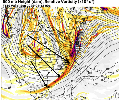
it really wasn't west - y'all got fooled. it was 3-6 hrs faster along the track and rate of development, both maybe a tiny bit but it's really rather more so remarkable good continuity for this range. wow to that point alone -
-
it actually kinda should be west with that ridge like that tho
-
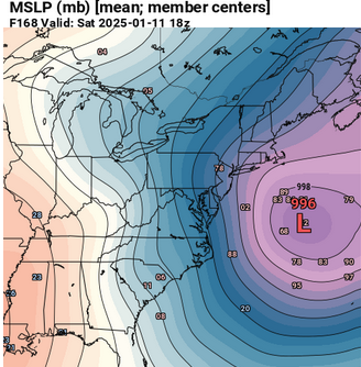
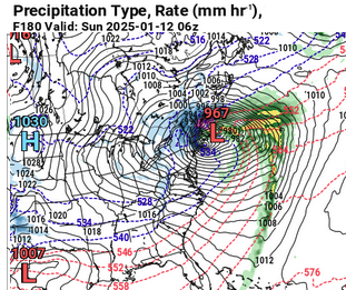
that 970 mb low a flipped over cargo ship's distance off montauk point doesn't need any more improvement. lol -
-
so there's a lot of differences in how the euro and gfs ( operationals ) get it done. that's not necessarily a detraction from 180 hours out in this case, because the principle players and interactions are essentially the same. that's important. that suspends the mere coincidence. i feel like these runs are a snap shot along a trend. like trying to judge a portrait while the artist is only part of the way into the illustration.
-
that's a specific aspect i've noted about the gfs' handling of cyclogen in the past. if/when it finally gets around to admitting there's a low developing, it tends to generate it too quickly. it's like even middling low pressures go through an ri phase
-
yet ..the euro's even leaving a lot on the table ... look at this slope back from negative interference - it's clearly having trouble with this 9/10/11 period of time. they all have been -
-
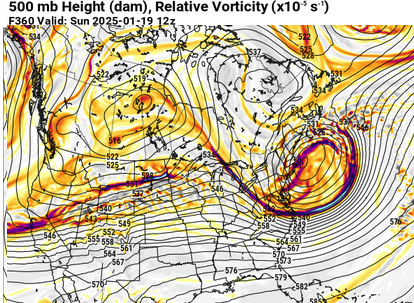
LOL, ya think yeah that 19th thing's been showing up for awhile - and the telecon showing a new +d(pna) chance. i want to point out that there is a powerful mjo sequencing into the phase 1/2, and it's not going to take a long time getting there. by the 7th we're living the wave coherence strongly out of the n/s region of the rmm, and this is true with every guidance system. meanwhile, after an interlude of +wpo, the index in the d10-20 range appears slated to a hefty sag... those two factors are a compelling telecon convergence that the pacific will reload... i find it interesting that the operation gfs, unrelated to those aspect, is indirectly doing this kind of suggetion on or about the 20th .. it's not a deterministic forecast - yet - but in principle