GaWx
-
Posts
17,538 -
Joined
Content Type
Profiles
Blogs
Forums
American Weather
Media Demo
Store
Gallery
Everything posted by GaWx
-
- So, verbatim, the July Euro is forecasting ONI of ~-0.1C in OND and NDJ. That compares to -0.3 in June and -0.5 in May. - The June runs over the last 15++ years have averaged a whopping 0.5 too warm for OND ONI. I haven’t analyzed July yet. But logically it should have a slightly smaller bias. Something like +0.3 to +0.4. - Thus implied bias corrected (bc) July Euro ONI prog is for -0.4 to -0.5 in OND/NDJ. - The latest ONI-RONI is +0.61 and has only slowly been falling from earlier record peak of +0.66. So, it’s realistic to assume an OND/NDJ ONI-RONI still up at ~+0.50. - Thus, the implied bc July Euro RONI prog is for -0.9 to -1.0 in OND/NDJ. The Euro and other progs look closer to a “basin-wide” than either E based or Modoki imo. - That -0.9 to -1.0 would be a much weaker La Niña than what many of us were earlier expecting as drop in Nino anoms was stalled for >month. However per @snowman19, Chris, Ray, and others, that might not make much of difference as far as winter is concerned due to the overwhelming W PAC warmth. - Regarding implications for H season, I posted in late May that on avg the worst seasons for US H landfalls, especially NE Gulf to Carolinas, have been when ASO RONI was weak La Niña as opposed to either mod/strong Niña or cold neutral. This is also the case for the area from the Bahamas to Lesser Antilles. This was backed by detailed maps I saw elsewhere. - The bc July Euro suggests an ASO RONI of ~-0.8, which would be ~the worst ASO RONI if one doesn’t want a bad season. That doesn’t mean it will be bad though as not all with a weak Niña have been. These are just averages. - Perhaps the long awaited resumed cooling is commencing. CDAS and CRW anomalies have dropped 0.1 to 0.2 in recent days. Also, the SOI has finally increased substantially the last 11 days (as expected per models). New easterly wind bursts have been mentioned by @snowman19and others. So, we’ll see.
-
1PM CDT: Beryl as expected downgraded to a TS/986 mb: NHC 1:00 PM CDT Fri Jul 5Location: 20.8°N 88.8°WMoving: WNW at 15 mphMin pressure: 986 mbMax sustained: 70 mph
-
The 12Z Euro is significantly NE of the 6Z’s CC landfall with it going ashore about dead-on mid TX coast. Also, it is much stronger at 971 mb vs 989 mb at 6Z! Those old ICON and JMA runs into Galveston are looking more realistic. There were a good number of runs of these two models in that vicinity. Example: ICON 12Z 6/30 run: (the 12Z 6/30 JMA was actually similar!) 12Z 6/30 JMA:
-
I can see it easily being significantly colder than last winter’s very mild winter in the NE, especially NNE. That shouldn’t be difficult to do. But these maps, everything else I’ve seen, and most indicators suggest the SE US will be much warmer than last winter’s only slightly AN as well as much drier.
-
Chris, after looking at this Euro map more closely, I see that >95% of the N Hem has H5 forecasted for NDJ to be >1 DM above the 1993-2016 based normal with 0% >1 DM BN. I usually think of 1 DM as the equivalent of ~1 F. So, this is suggesting 95% of the NH is forecasted to be 1+ F AN in NDJ. I guess that’s realistic considering how rapidly the globe has been warming since 1993 thus suggesting true up to date normals are probably a whopping ~2F warmer than 1993-2016. Does that seem right? Do you think it has warmed that rapidly?
-
12Z GEFS: increase in strong members to the NE (I see at least 5 members there between strong cat 1 and cat 2):
-
12Z UKMET landfall is all of the way up to Corpus Christi. The 0Z run was in NE MX. But this isn’t at all surprising considering clearcut N trends. 12Z CMC at MX/TX border, which is ~100 miles N of 0Z run. It is still the furthest S landfall by far compared to the ICON (Galveston), GFS (CC), and UKMET (CC).
-
Those are ugly maps if you don’t want a mild E US winter. I’d already seen the ugly CANSIPS maps. Would you please post the new Euro 2m temp anomaly maps? TIA
-
Hurricane Beryl Discussion Number 28 NWS National Hurricane Center Miami FL AL022024 1000 AM CDT Fri Jul 05 2024 The center of Beryl made landfall on the Yucatan Peninsula of Mexico just northeast of Tulum at about 11Z. The landfall intensity is somewhat uncertain, but surface observations suggest the central pressure rose into the 977-980 mb range before landfall. The cyclone is now weakening as it moves farther inland, and the initial intensity is reduced to 75 kt. The initial motion is now 290/14 kt. For the next 24 h or so, Beryl should be steered generally west-northwestward by the western portion of the subtropical ridge over the southeastern United States. After that, a turn toward the northwest is likely as the storm moves towards a break in the ridge caused by a combination of a trough in the mid-latitude westerlies over the central United States and an upper-level trough moving westward over the southwestern Gulf of Mexico. This motion should bring the center near the western Gulf coast in about 72 h. Subsequently, a northward motion through the break appears likely. While the track guidance has come into better agreement, there is still uncertainty based on the possible strength and vertical depth of Beryl. A stronger and vertically deeper cyclone would feel more steering from upper-level southwesterly flow caused by the Gulf trough, and thus would have a more northward motion, while a weaker system would probably continue more northwestward. Overall the guidance favors the more northward motion and has shifted a little to the right, and the new official forecast also is nudged a little to the right of the previous forecast. Additional adjustments of the forecast track could be necessary later today. Beryl should continue to weaken while over land, and it is expected to emerge over the Gulf of Mexico as a tropical storm. After that, it could take 12-24 h for the cyclone's structure to recover over the Gulf of Mexico before re-intensification can begin in earnest. Based on this and the overall trends of the intensity guidance, the new forecast calls for gradual strengthening to start after 24 h and continue until landfall. One important note is that the GFS and ECMWF suggest that ongoing westerly shear could decrease after 48-60 h, accompanied by an increase in upper-level divergence. Should this occur, Beryl could strengthen more than currently forecast, especially if the center stays over water longer than forecast. FORECAST POSITIONS AND MAX WINDS INIT 05/1500Z 20.7N 88.3W 75 KT 85 MPH...INLAND 12H 06/0000Z 21.4N 90.1W 55 KT 65 MPH...OVER WATER 24H 06/1200Z 22.5N 92.2W 55 KT 65 MPH 36H 07/0000Z 23.6N 94.1W 60 KT 70 MPH 48H 07/1200Z 24.6N 95.6W 65 KT 75 MPH 60H 08/0000Z 25.6N 96.6W 70 KT 80 MPH 72H 08/1200Z 26.8N 97.5W 75 KT 85 MPH...NEAR COAST 96H 09/1200Z 29.0N 98.0W 35 KT 40 MPH...INLAND 120H 10/1200Z 31.0N 97.0W 25 KT 30 MPH...INLAND $$ Forecaster Beven
-
Hurricane Beryl Advisory Number 28 NWS National Hurricane Center Miami FL AL022024 1000 AM CDT Fri Jul 05 2024 ...BERYL WEAKENING AS IT MOVES FARTHER INLAND OVER THE NORTHEASTERN YUCATAN PENINSULA... ...DANGEROUS HURRICANE-FORCE WINDS, STORM SURGE, AND DAMAGING WAVES EXPECTED OVER PORTIONS OF THIS AREA FOR A FEW MORE HOURS... SUMMARY OF 1000 AM CDT...1500 UTC...INFORMATION ----------------------------------------------- LOCATION...20.7N 88.3W ABOUT 100 MI...160 KM ESE OF PROGRESO MEXICO ABOUT 680 MI...1095 KM ESE OF BROWNSVILLE TEXAS MAXIMUM SUSTAINED WINDS...85 MPH...140 KM/H PRESENT MOVEMENT...WNW OR 290 DEGREES AT 16 MPH...26 KM/H MINIMUM CENTRAL PRESSURE...980 MB...28.94 INCHES
-
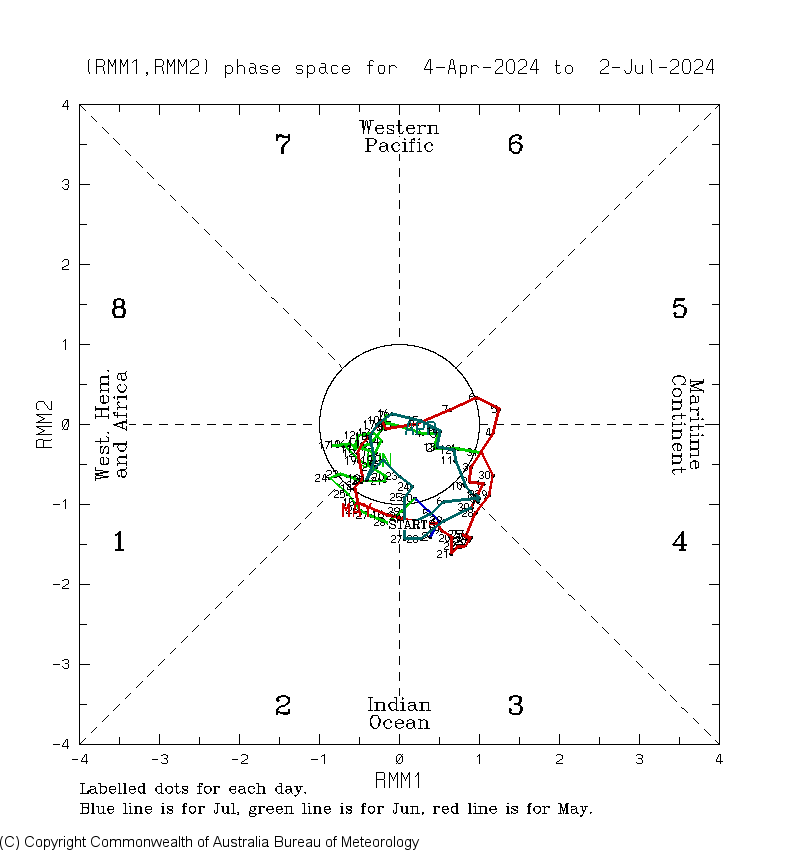
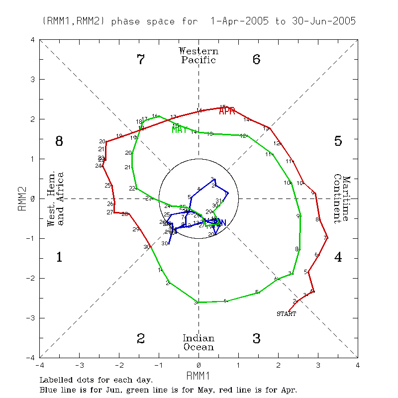
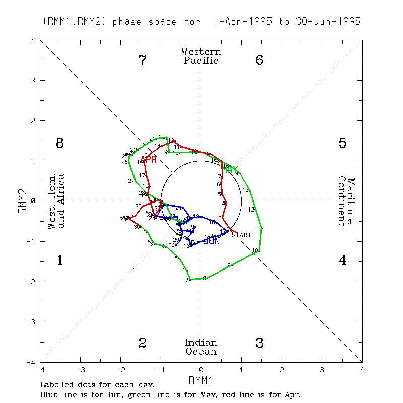
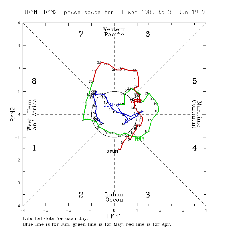
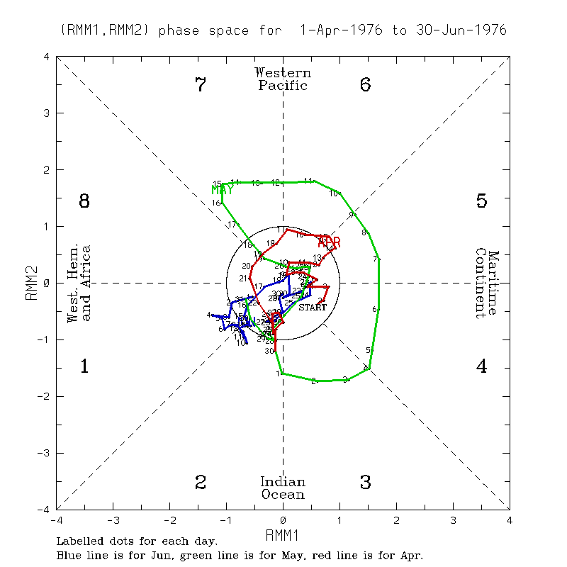
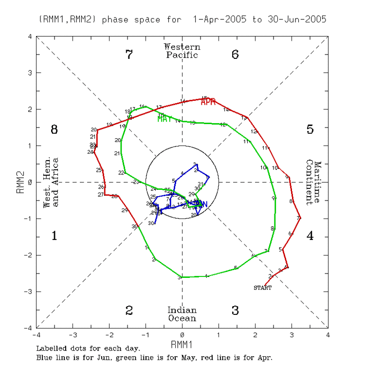
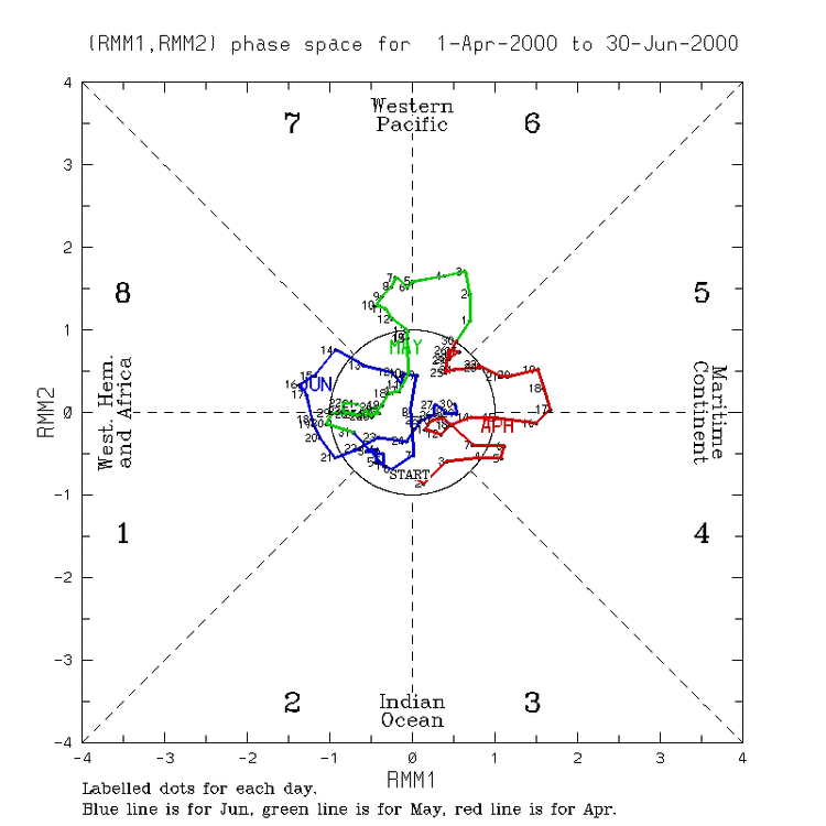
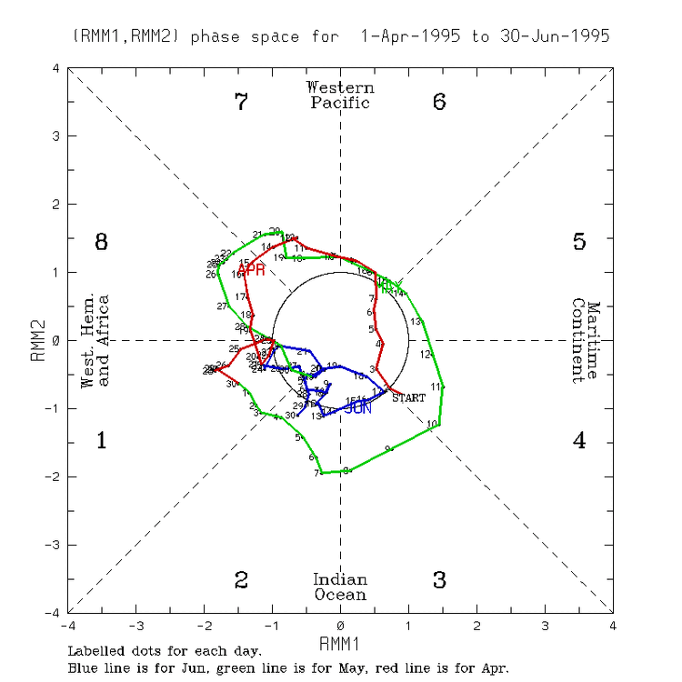
Indeed it does. So, I’ll now look at which of those 8 low amp June MJO years remained weak through July: -2011: no but was already a poor analog -2005: remained fairly weak in Jul (and even into Aug) keeping this a top June/July low amp MJO analog -2000: not at all and thus knocking it out as a good analog -1995: not at all and thus knocking it out as a top analog or even a good analog -1990: no but was already a poor analog -1989: no but was already a poor analog -1980: yes, very weak in July; was already a good low amp June MJO analog but this raises it further to a top weak MJO June/July analog -1976: yes, very weak in July but Niña to Nino already made this a poor analog So, by incorporating a weak July MJO, I’m left with only 2005 and 1980 as noteworthy analogs. They both followed El Niño, headed to either Niña or cold neutral, and had high ACE. But as Chris said, these are only based on RMM plots and are downplaying the VP anomalies, which show the main forcing to be the equivalent of robust forcing in 3-6 due to the very warm WPAC water. Related to this, the PDO in both 2005 and 1980 was so much higher than 2024, which is probably enough to disqualify 2005 and 1980 as useful analogs with the current strong -PDO not expected to go away anytime soon. Any other opinions?
-
It’s unanimous for the main 0Z globals. The 0Z Euro is also further N than the 12Z (by 125+ miles) and is even ~100 miles N of the 18Z! Though pretty strong, it isn’t as strong as the 18Z. Landfall is halfway between Brownsville and Corpus Christi! So, 3 of these 5 0Z globals are in TX. Anyone following the 0Z hurricane models?
-
0Z globals’ W Gulf landfalls starting with northernmost: further N than 12Z runs: -ICON: mid-TX coast ~25 miles N of 12Z run -GFS: Corpus Christi, which is ~150 miles N of 12Z’s NE MX landfall -UKMET: ~40 miles N of 12Z run, which places it ~40-50 miles S of the TX border -CMC: ~25 miles N of 12Z run or ~100 miles S of the TX border -Euro not out yet
-
Hurricane Beryl Advisory Number 26 NWS National Hurricane Center Miami FL AL022024 1000 PM CDT Thu Jul 04 2024 ...MAJOR HURRICANE BERYL IS APPROACHING THE YUCATAN PENINSULA... ...HURRICANE-FORCE WINDS, DANGEROUS STORM SURGE, AND DAMAGING WAVES EXPECTED TO BEGIN OVERNIGHT... SUMMARY OF 1000 PM CDT...0300 UTC...INFORMATION ----------------------------------------------- LOCATION...19.6N 85.5W ABOUT 135 MI...220 KM ESE OF TULUM MEXICO MAXIMUM SUSTAINED WINDS...115 MPH...185 KM/H PRESENT MOVEMENT...W OR 275 DEGREES AT 16 MPH...26 KM/H MINIMUM CENTRAL PRESSURE...964 MB...28.47 INCHES ———————— Hurricane Beryl Discussion Number 26 NWS National Hurricane Center Miami FL AL022024 1000 PM CDT Thu Jul 04 2024 The weakening trend of Beryl has reversed this evening. Satellite images show that the eye has occasionally been evident and the eyewall is about two-thirds closed based on Cancun radar images and reports from the Air Force Hurricane Hunters. Data from the reconnaissance mission indicated that Beryl has strengthened back to a dangerous category 3 hurricane with maximum winds of about 100 kt. The minimum pressure has fallen about 10 mb from this afternoon to 964 mb. The aircraft also indicated that Beryl remains compact, and it is actually a little smaller than previously estimated. The hurricane has turned westward and slowed down slightly on the south side of a ridge centered over the southeastern U.S., with the latest initial motion estimated to be 275/14 kt. Beryl is expected to maintain that general motion during the next 12 hours, which should cause it to make landfall in the Yucatan Peninsula very near Tulum early Friday morning. Most of the models show the center remaining over land for about 18 hours, and then emerging over the southwestern Gulf of Mexico Friday night. Around that time, Beryl is expected to turn to the northwest and slow down some more as it moves along the western periphery of the weakening ridge and toward a trough over the south-central U.S. Although the models are in fair agreement, there is still some spread in exactly how sharp the system turns northwestward, and to a large degree the structure and intensity of Beryl will be a notable factor on its track over the Gulf. The new NHC track forecast is a little slower than the previous one, following the trend in the latest models. It now seems likely that Beryl will maintain its strength until it reaches the coast. Once the core moves inland, rapid weakening is expected, and Beryl is forecast to fall below hurricane strength by the time it exits the Yucatan. Assuming the system is able to maintain some elements of an inner core, gradual re-intensification seems likely before it makes its final landfall in northeastern Mexico or southern Texas. The NHC intensity forecast again lies near the high end of the models and continues to show Beryl becoming a hurricane again over the western Gulf. FORECAST POSITIONS AND MAX WINDS INIT 05/0300Z 19.6N 85.5W 100 KT 115 MPH 12H 05/1200Z 20.0N 87.5W 95 KT 110 MPH...INLAND 24H 06/0000Z 20.9N 89.9W 55 KT 65 MPH...INLAND 36H 06/1200Z 21.9N 92.1W 55 KT 65 MPH...OVER WATER 48H 07/0000Z 22.9N 94.0W 60 KT 70 MPH 60H 07/1200Z 23.8N 95.5W 65 KT 75 MPH 72H 08/0000Z 24.7N 96.6W 70 KT 80 MPH 96H 09/0000Z 26.8N 98.6W 45 KT 50 MPH...INLAND 120H 10/0000Z 28.9N 99.1W 25 KT 30 MPH...INLAND $$ Forecaster Cangialosi
-
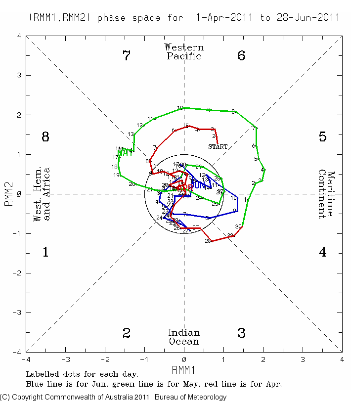
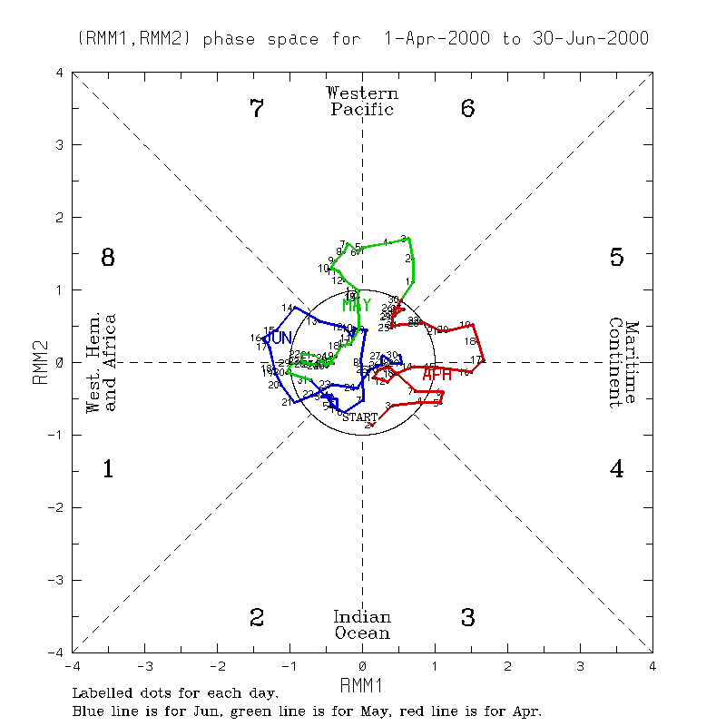
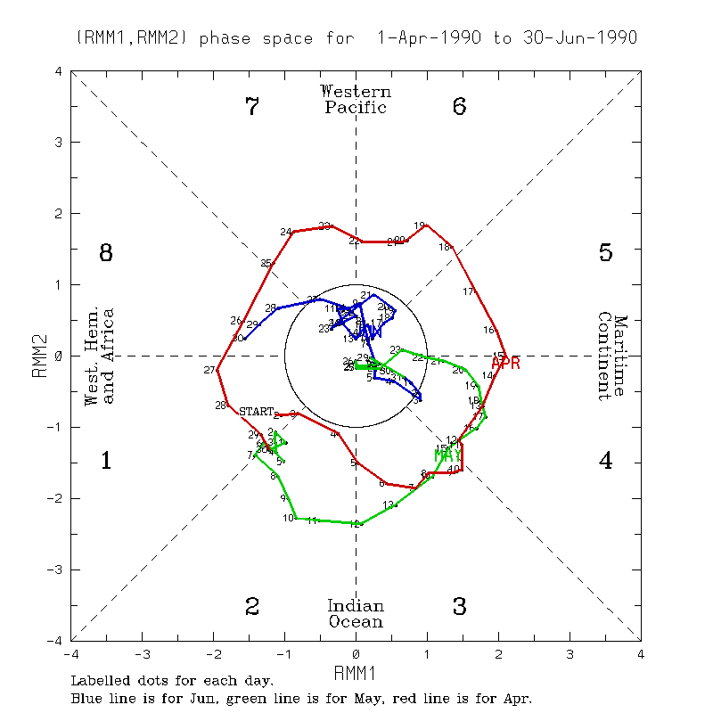
June of 2024 having this low of an amp isn’t all that rare. However, the last one was 13 years ago. The Junes since 1975 with MJO about this low of an amplitude or lower were these 8: 2011, 2005, 2000, 1995, 1990, 1989, 1980, and 1976. So, about 1/6 of the time (uncommon but not that rare). But the only other year I could find back to 1975 with this low an amp for Apr-June was 2000! So, that puts Apr-June of 2024 in quite rarified territory. I’m going to analyze these 8 years to see whether or not I think there may be significant implications. I’ll start off by throwing out 1976 as a potential good analog since that was La Niña to El Niño. Assuming we’re really going to have La Niña, the best analogs of these would be 2011, 2005 (huge ACE, too), 2000, and 1995 (huge ACE, too). That leaves the ENSO neutral years of 1990, 1989, and 1980. I don’t like 1990 since it just missed El Niño later in the year. Also, I don’t think 1989 is all that good because it followed La Niña. But 1980 looks good since it not only followed El Niño but its June AND May MJOs were both of low amp, it went to cold neutral, and ACE was pretty high. Of the 4 La Niña analogs, I’d say 2005 and 1995 are the best because they both followed El Nino and had high ACE. I’d put 2000 as pretty good despite being Nina to Nina only because its Apr-June was the only other with as low amp MJO as 2024. 2011 doesn’t look that good because it was also Niña to Niña and didn’t have the low amp Apr-June. So, I’m left with: -best June MJO analogs 2005/1995 (marked below w/**) -good June MJO analogs 2000/1980 (marked below w/*) More later on whether or not I think these June MJO analogs are of much forecasting significance….maybe I’ll decide no but I need more time to analyze other factors. —————————— Data: 2024: low amp Apr-Jun/Nino to Niña?/high ACE? 2011: low amp Jun/Nina to Nina **2005: low amp Jun/Nino to Niña/huge ACE** *2000: low amp Apr-Jun/Nina to Nina* **1995: low amp Jun/Nino to Niña/huge ACE** 1990: low amp Jun/neutral to +neutral 1989: low amp Jun/Niña to neutral *1980: low amp MJ/Nino to -neut/high ACE* 1976: low amp Apr & Jun/Niña to Nino


-
18Z ICON: very slightly SW of 12Z run on S-central TX coast
-
Hurricane Beryl Discussion Number 25 NWS National Hurricane Center Miami FL AL022024 500 PM EDT Thu Jul 04 2024 The Air Force Reserve Hurricane Hunter aircraft that left the storm around 17Z reported that the central pressure had risen to near 974 mb, and also reported flight-level and SFMR winds supporting an intensity of 95 kt. Since that time, as happened yesterday afternoon, despite the ongoing shear the eye has become better defined in both satellite imagery and in radar data from Grand Cayman and Cuba. Given this increase in central core organization, the initial intensity will be held at 95 kt pending the arrival of the next aircraft near 00Z. Satellite imagery also shows that the outflow has become better defined in the northeastern semicircle. The initial motion is 285/17, although the last several satellite images suggest a westward wobble is in progress. There is again little change in either the track forecast philosophy or the track forecast from the previous advisory. A large ridge centered over the southeastern U.S. should cause Beryl to move westward or west-northwestward during the next day or so, with the model guidance tightly clustered about a landfall on the Yucatan Peninsula in 12-18 h and emerging into the southwestern Gulf of Mexico at around 30 h. After that, Beryl should turn northwest toward a developing break in the subtropical ridge caused by a mid-latitude trough over the central United States. This general motion should continue until the cyclone makes landfall on the western Gulf coast between 72-96 h. There is still some spread in the track guidance regarding a landfall location, with the range of possibilities from northeastern Mexico to the middle Texas coast. Users are reminded that the average track forecast error at day 3 is about 100 miles and at day 4 is about 150 miles, and so it is still too early to pinpoint a specific region for the worst hazards. The new official forecast is a little north of the previous forecast through 24 h and similar to the previous forecast after that. It is unclear whether the current developments with the hurricane core and outflow are temporary or a sign that the westerly shear has somewhat abated. The intensity forecast follows the premise that the shear has not fully abated and that Beryl will weaken before landfall. However, even the intensity guidance that forecasts weakening keeps Beryl at hurricane strength at landfall on the Yucatan Peninsula. Additional weakening should occur while the center is over land. Over the Gulf of Mexico, the guidance does not forecast a lot of strengthening, but conditions appear generally favorable and the intensity forecast continues to show Beryl at hurricane strength before landfall on the western Gulf coast. It should be noted that the dynamical models suggest that the best chance for re-intensification could be during the last 12-18 hr before the western Gulf landfall, with the storm slow to intensify before that time. FORECAST POSITIONS AND MAX WINDS INIT 04/2100Z 19.5N 84.3W 95 KT 110 MPH 12H 05/0600Z 20.0N 86.6W 85 KT 100 MPH 24H 05/1800Z 20.7N 89.2W 60 KT 70 MPH...INLAND 36H 06/0600Z 21.6N 91.5W 50 KT 60 MPH...OVER WATER 48H 06/1800Z 22.6N 93.5W 55 KT 65 MPH 60H 07/0600Z 23.6N 95.2W 60 KT 70 MPH 72H 07/1800Z 24.5N 96.5W 65 KT 75 MPH 96H 08/1800Z 26.5N 98.5W 45 KT 50 MPH...INLAND 120H 09/1800Z 29.0N 99.5W 25 KT 30 MPH...INLAND $$ Forecaster Beven
-
Hurricane Beryl Advisory Number 25 NWS National Hurricane Center Miami FL AL022024 500 PM EDT Thu Jul 04 2024 ...CENTER OF BERYL HEADING FOR THE YUCATAN PENINSULA OF MEXICO... ...STRONG WINDS, DANGEROUS STORM SURGE, AND DAMAGING WAVES EXPECTED ON THE COAST OF THE YUCATAN PENINSULA BY EARLY FRIDAY... SUMMARY OF 500 PM EDT...2100 UTC...INFORMATION ---------------------------------------------- LOCATION...19.5N 84.3W ABOUT 215 MI...345 KM ESE OF TULUM MEXICO ABOUT 200 MI...325 KM W OF GRAND CAYMAN MAXIMUM SUSTAINED WINDS...110 MPH...175 KM/H PRESENT MOVEMENT...WNW OR 285 DEGREES AT 20 MPH...31 KM/H MINIMUM CENTRAL PRESSURE...974 MB...28.77 INCHES DISCUSSION AND OUTLOOK ---------------------- At 500 PM EDT (2100 UTC), the center of Hurricane Beryl was located near latitude 19.5 North, longitude 84.3 West. Beryl is moving toward the west-northwest near 20 mph (31 km/h). A westward to west- northwestward motion is expected during the next day or so, with the center expected to make landfall on the Yucatan Peninsula of Mexico early Friday. Beryl is expected to emerge over the southwestern Gulf of Mexico Friday night and move northwestward across the southwestern Gulf of Mexico on Saturday and Saturday night. Maximum sustained winds are near 110 mph (175 km/h) with higher gusts. Slow weakening is forecast before the center makes landfall, with additional weakening expected while Beryl crosses the Yucatan Peninsula. Slow re-intensification is expected when Beryl moves over the Gulf of Mexico.
-
I disagree. Wxman57, a pro met, is about as knowledgeable as the pro mets and more knowledgeable amateurs here. Plus he has 4 decades of experience largely with tropical meteorology. Thus, it isn’t at all BS. @Ed, snow and hurricane fanand anyone else should be welcomed to post 57’s thoughts as well as the thoughts of other pro mets that don’t post here.
-
Tropical Weather Outlook NWS National Hurricane Center Miami FL 200 PM EDT Thu Jul 4 2024 For the North Atlantic...Caribbean Sea and the Gulf of Mexico: Central Caribbean Sea (AL96): A fast-moving tropical wave located over the central Caribbean Sea is producing some disorganized shower and thunderstorm activity. Development, if any, of this system should be slow to occur while it moves quickly westward to west-northwestward at 20 to 25 mph during the next several days. The system is forecast to cross the Yucatan Peninsula late this weekend and enter the southwestern Gulf of Mexico by early next week. Regardless of development, gusty winds and locally heavy rainfall are possible across portions of the Greater Antilles over the next few days. * Formation chance through 48 hours...low...near 0 percent. * Formation chance through 7 days...low...10 percent. Forecaster Reinhart
-
BULLETIN Hurricane Beryl Intermediate Advisory Number 24A NWS National Hurricane Center Miami FL AL022024 200 PM EDT Thu Jul 04 2024 ...CENTER OF BERYL MOVING ACROSS THE NORTHWESTERN CARIBBEAN SEA... ...STRONG WINDS, DANGEROUS STORM SURGE, AND DAMAGING WAVES EXPECTED ON THE COAST OF THE YUCATAN PENINSULA OF MEXICO BY EARLY FRIDAY... SUMMARY OF 200 PM EDT...1800 UTC...INFORMATION ---------------------------------------------- LOCATION...19.2N 83.4W ABOUT 135 MI...215 KM W OF GRAND CAYMAN ABOUT 275 MI...445 KM ESE OF TULUM MEXICO MAXIMUM SUSTAINED WINDS...110 MPH...175 KM/H PRESENT MOVEMENT...WNW OR 285 DEGREES AT 18 MPH...30 KM/H MINIMUM CENTRAL PRESSURE...974 MB...28.76 INCHES
-
12Z Euro: slightly N of its 0Z run and near yesterday’s 12Z run; it is ~90 miles S of TX border, which is where 12Z UKMET is and is between 12Z GFS and 12Z CMC So, from N to S for 12Z global runs: ICON (Matagorda) GFS (60 miles S of TX border) Euro/UKMET (90 miles S of TX border) CMC (125 miles S of TX border)
-
The 12Z UKMET has Beryl already at 85.4W when at 19.0N at 8PM EDT/7PM CDT today. But regarding the 11AM EDT/10AM CDT actual position, the NHC was already up to 19.0N with her only to 82.6W. That means she was a whopping ~185 miles E of the 12Z UKMET 7PM CDT position. That implies to me that the UKMET is likely going to verify too far S when it reaches the W GOM.
-
12Z global model runs vs earlier runs: -ICON: Matagorda, TX (furthest SW yet) after many runs at Galveston -GFS: ~60 miles S of TX border (slightly S of last 3 runs) -CMC: ~125 miles S of TX border (slightly further S of last 2 runs) -UKMET: ~90 miles S of TX border, which may be slightly further N than last run and is ~55 miles N of yesterday’s 12Z run -Euro: out next hour
-
NHC 11AM forecast yesterday: 36H 05/0000Z 19.0N 85.5W 90 KT 105 MPH NHC 5AM forecast today: 12H 04/1800Z 19.0N 83.6W 95 KT 110 MPH NHC 11AM actual location: INIT 04/1500Z 19.0N 82.6W 100 KT 115 MPH By comparing these 3, one can see the trend that she gets as far N as 19.0N at a further E longitude: note that current location of 19.0N is with longitude of 82.6W vs 85.5W on yesterday’s 11AM forecast and 83.6W on today’s 5AM forecast. The implications are that this may mean a further N landfall in the W Gulf than earlier forecasted.