GaWx
Members-
Posts
17,089 -
Joined
Content Type
Profiles
Blogs
Forums
American Weather
Media Demo
Store
Gallery
Everything posted by GaWx
-
1988-9: 0.9” (Feb) 1989-90: 8.0” (Dec) (record) Same consecutive years for SAV
-
BULLETIN Tropical Storm Melissa Advisory Number 2 NWS National Hurricane Center Miami FL AL132025 500 PM EDT Tue Oct 21 2025 ...HEAVY RAINS EXPECTED TO SPREAD OVER HISPANIOLA DURING THE NEXT COUPLE OF DAYS... SUMMARY OF 500 PM EDT...2100 UTC...INFORMATION ---------------------------------------------- LOCATION...14.2N 73.0W ABOUT 305 MI...495 KM S OF PORT AU PRINCE HAITI MAXIMUM SUSTAINED WINDS...50 MPH...85 KM/H PRESENT MOVEMENT...W OR 275 DEGREES AT 15 MPH...24 KM/H MINIMUM CENTRAL PRESSURE...1003 MB...29.62 INCHES Tropical Storm Melissa Discussion Number 2 NWS National Hurricane Center Miami FL AL132025 500 PM EDT Tue Oct 21 2025 Satellite data indicate that Melissa is struggling in strong shear, which has been the theme for many systems over the deep tropics this year. The low-level center of the storm is exposed to the west of the main area of thunderstorms. Air Force Hurricane Hunters have been investigating the system this afternoon and found that the minimum pressure is around 1003 mb. Based on their observations, ASCAT passes, and Dvorak estimates, the initial intensity is held at 45 kt. Melissa's wind field is also quite asymmetric, with most of the tropical-storm-force winds occurring on the system's east side. Some of the outermost northern bands are approaching Hispaniola, and these heavy rains are expected to spread across that island during the next couple of days. Melissa is a little south of the previous track and it continues to move westward at about 13 kt. There has been no change to the track forecast scenario, which remains complicated. Over the next couple of days, there is fair confidence that Melissa should slow down and gradually turn to the northwest or north and approach Haiti and Jamaica late this week. The motion after that appears to be linked to how strong and vertically aligned the system gets, and that is when the models diverge. If Melissa organizes like the GFS predicts, it could turn northeastward into the weakness in the ridge and move over Hispaniola. Conversely, if Melissa remains sheared and lopsided, it will likely stall and eventually drift westward as a ridge builds north of it. Given the expected continued shear, the NHC track forecast leans toward the latter scenario. This prediction is a little left of the previous forecast and remains a blend of the latest Google DeepMind ensemble mean, the corrected consensus aid HCCA, and simple consensus TVCA. Although the ocean is very warm, the models suggest that the vertical wind shear could persist over Melissa during the next few days. In addition, there is also some dry air in the storm's vicinity. Based on these mixed signals, the strengthening trend is expected to be slow. In fact, the new guidance supports nudging the short term intensity down a bit. If Melissa remains over the Caribbean late this week and over the weekend, the upper-level winds could become more conducive for more significant strengthening. The NHC intensity forecast is in best agreement with the HCCA model. FORECAST POSITIONS AND MAX WINDS INIT 21/2100Z 14.2N 73.0W 45 KT 50 MPH 12H 22/0600Z 14.5N 73.7W 45 KT 50 MPH 24H 22/1800Z 15.0N 74.4W 50 KT 60 MPH 36H 23/0600Z 15.5N 75.0W 55 KT 65 MPH 48H 23/1800Z 16.1N 75.1W 60 KT 70 MPH 60H 24/0600Z 16.5N 75.0W 60 KT 70 MPH 72H 24/1800Z 16.9N 75.0W 60 KT 70 MPH 96H 25/1800Z 17.3N 75.0W 65 KT 75 MPH 120H 26/1800Z 17.5N 75.2W 75 KT 85 MPH $$ Forecaster Cangialosi
-
NG was up another 2.4% today on even colder modeled HDDs vs yesterday: 0Z EPS (purple) had 7 more HDDs vs prior EPS: Then later the 12Z GEFS (purple) had several more HDDs than the prior GEFS runs: @mitchnick@LakePaste25 @Stormchaserchuck1
-
12Z -GFS (Hisp.), CMC (C Cuba), Icon (weaker than recent runs but still E of Jamaica to Jamaica) and UKMET (Nic/Honduras border) are pretty similar to recent runs. UK: TROPICAL STORM MELISSA ANALYSED POSITION : 14.7N 70.8W ATCF IDENTIFIER : AL132025 LEAD CENTRAL MAXIMUM WIND VERIFYING TIME TIME POSITION PRESSURE (MB) SPEED (KNOTS) -------------- ---- -------- ------------- ------------- 1200UTC 21.10.2025 0 14.7N 70.8W 1007 36 0000UTC 22.10.2025 12 14.7N 73.1W 1005 33 1200UTC 22.10.2025 24 15.0N 74.3W 1005 36 0000UTC 23.10.2025 36 15.5N 75.0W 1004 35 1200UTC 23.10.2025 48 16.1N 76.4W 1005 35 0000UTC 24.10.2025 60 16.4N 76.4W 1005 27 1200UTC 24.10.2025 72 16.6N 76.7W 1005 30 0000UTC 25.10.2025 84 16.4N 78.0W 1005 27 1200UTC 25.10.2025 96 15.7N 79.7W 1006 25 0000UTC 26.10.2025 108 15.1N 81.5W 1005 23 1200UTC 26.10.2025 120 15.0N 82.8W 1005 24 0000UTC 27.10.2025 132 15.5N 84.0W 1006 22 1200UTC 27.10.2025 144 CEASED TRACKING
-
Tropical Storm Melissa Discussion Number 1NWS National Hurricane Center Miami FL AL1320251100 AM EDT Tue Oct 21 2025Satellite images, regional Caribbean radar data, and surface observations indicate that invest 98L has developed a well-defined center and organized deep convection to be designated a tropical cyclone. A ship report that recently passed near the center of the system reported a minimum pressure of about 1003 mb. Satellite imagery shows the system is asymmetric, with the low-level center near the western edge of the central dense overcast. The initial intensity is set at 45 kt, based on a blend of the latest satellite intensity estimates, marking the formation of Tropical Storm Melissa. An Air Force Hurricane Hunter aircraft is scheduled to investigate the system this afternoon, and their data should provide a better assessment of Melissa's strength and structure. The system was moving very quickly westward over the past several days, but it has slowed down significantly this morning, which has likely helped Melissa form. The initial motion is estimated to be 280/12 kt. Melissa should continue to slow down and gradually turn to the northwest and then north during the next couple of days toward a weakness in the subtropical ridge. This motion will likely take the storm very near the southwestern tip of Haiti and Jamaica by Thursday. After that time, the guidance diverges significantly with some models like the GFS and HWRF showing a motion to the northeast into the weakness, while the other solutions show a stall or a westward drift on the south side of a building ridge. An examination of the GFS, ECMWF, and Google DeepMind ensemble suites suggest that the majority of the members show Melissa not moving into the weakness and remaining in the Caribbean Sea throughout the week and into the weekend. The NHC official track forecast lies between the Google DeepMind ensemble mean track and the correct consensus aid, HCCA.Melissa is expected to be over the very warm waters of the Caribbean, but the models suggest that vertical wind shear will be moderate with some dry air in the vicinity of the storm during the next few days. Based on these mixed signals, the strengthening trend is expected to be slow and steady, not rapid. However, the future intensity of Melissa is linked to the track and since that is quite uncertain beyond a couple of days, the strength of the storm is also quite uncertain. The NHC intensity forecast is in best agreement with the HCCA model.Key Messages:1. Melissa is expected to bring heavy rainfall and the risk of significant flash flooding and the danger of landslides to portions of Haiti and the Dominican Republic through the weekend.2. A Hurricane Watch has been issued for the southern coast and Tiburon peninsula of Haiti. A Tropical Storm Watch has been issued for Jamaica. Preparations to protect life and property should be completed by Thursday.3. There is significant uncertainty in the track and intensity forecast of Melissa. Interests elsewhere in Hispaniola and Cuba should continue to monitor the latest forecasts.FORECAST POSITIONS AND MAX WINDSINIT 21/1500Z 14.3N 71.7W 45 KT 50 MPH12H 22/0000Z 14.4N 72.8W 50 KT 60 MPH24H 22/1200Z 14.8N 73.5W 55 KT 65 MPH36H 23/0000Z 15.3N 74.2W 60 KT 70 MPH48H 23/1200Z 15.7N 74.5W 60 KT 70 MPH60H 24/0000Z 16.1N 74.6W 60 KT 70 MPH72H 24/1200Z 16.5N 74.5W 60 KT 70 MPH96H 25/1200Z 16.9N 74.5W 65 KT 75 MPH120H 26/1200Z 17.2N 74.9W 70 KT 80 MPH$$Forecaster Cangialosi/Bucci
-
The 12Z position is estimated to be near 14.3N, 71.3W, per this:AL, 98, 2025102112, , BEST, 0, 143N, 713W, 45, 1003, LOThus we now know with more confidence that the 6Z GFS’ 6 hour position near 14.3N, 70.4W is ~60 miles too far east. It’s likely going to be designated as TS Melissa at 11AM per this: ```AL, 13, 2025102112, , BEST, 0, 143N, 713W, 45, 1003, TS, 34, NEQ, 100, 70, 0, 40, 1009, 150, 35, 55, 0, L, 0, , 0, 0, MELISSA, M, 0, , 0, 0, 0, 0, genesis-num, 035, TRANSITIONED, alB82025 to al132025,``` Melissa’s center is on the W edge of the convection meaning nearly half naked as has been expected initially while the shear is strong.
-
Whereas the 6Z Euro shifted 200-250 miles NE of the 0Z/12Z runs for that forecast time, keep in mind that the 6Z Euro op is near the NE most 6Z EPS members: 6Z Euro op 144: 40 miles E of easternmost point of Jamaica 6Z EPS 144: large majority are 300-500 miles WSW to SW of the Euro op!
-
1. 6Z Euro 144: significant shift NE vs 0Z 150 and 12Z 162 (which were both 150-200 miles SSW to SW of Jamaica) with the 6Z 40 miles E of Jamaica. That’s a 200-250 mile NE shift from the 0Z/12Z! 2. Tropical Weather Outlook NWS National Hurricane Center Miami FL 800 AM EDT Tue Oct 21 2025 For the North Atlantic...Caribbean Sea and the Gulf of America: 1. Caribbean Sea (AL98): Satellite, radar, and surface observations indicate that the area of low pressure over the central Caribbean Sea appears to be developing a well-defined center, and is already producing winds up to 45 mph. A tropical storm is expected to form later today while it slows down over the central Caribbean Sea. Heavy rainfall and gusty winds are possible over portions of the ABC Islands during the next day or two. Interests in Puerto Rico, Hispaniola, Jamaica, and Cuba should monitor the progress of this system as there is a risk of heavy rain and flooding, strong winds, and rough surf later this week. The Air Force Hurricane Hunters are scheduled to investigate the system later today. For additional information on this system, including Gale Warnings, please see High Seas Forecasts issued by the National Weather Service. * Formation chance through 48 hours...high...near 100 percent. * Formation chance through 7 days...high...near 100 percent. High Seas Forecasts issued by the National Weather Service can be found under AWIPS header NFDHSFAT1, WMO header FZNT01 KWBC, and online at ocean.weather.gov/shtml/NFDHSFAT1.php Forecaster Cangialosi
-
0Z runs: all are now out -Icon cat 2 H W. Haiti -CMC first moves W and then WNW/NW to Jamaica as a TS followed by SW and then abrupt turn to N and then NNE/NE over C Cuba/NC Bahamas as a cat 3 H followed by a turn back to the N with it ending on a heading toward Cape Cod as it gets caught on the E side of a strong trough/upper low -GFS very consistently hits Hispaniola again (cat 2 H) -Euro just W of Jamaica, EC Cuba to C Bahamas (MH) -UKMET remains quite consistent with the track and this time the text has it as a TC through hour 156, after which it weakens on approach to the NE Nicaraguan coast. The direction of movement starts off mainly WNW (with the furthest N being at 15.3N, which is actually furthest N of recent runs) followed by W and then WSW; strongest it gets is a minimal TS and lowest SLP 1004. At hour 156, the 0Z UKMET is a whopping 1,500 miles WSW of the 0Z GFS! TROPICAL STORM 98L ANALYSED POSITION : 11.1N 69.0W ATCF IDENTIFIER : AL982025 LEAD CENTRAL MAXIMUM WIND VERIFYING TIME TIME POSITION PRESSURE (MB) SPEED (KNOTS) -------------- ---- -------- ------------- ------------- 0000UTC 21.10.2025 0 11.1N 69.0W 1009 30 1200UTC 21.10.2025 12 14.0N 71.5W 1008 35 0000UTC 22.10.2025 24 14.0N 73.6W 1006 31 1200UTC 22.10.2025 36 14.2N 74.3W 1005 34 0000UTC 23.10.2025 48 15.3N 75.2W 1004 31 1200UTC 23.10.2025 60 15.3N 75.8W 1005 33 0000UTC 24.10.2025 72 15.3N 76.8W 1005 28 1200UTC 24.10.2025 84 15.3N 77.3W 1005 27 0000UTC 25.10.2025 96 14.7N 78.0W 1005 25 1200UTC 25.10.2025 108 14.6N 79.1W 1006 26 0000UTC 26.10.2025 120 14.2N 80.6W 1004 23 1200UTC 26.10.2025 132 14.4N 81.8W 1005 25 0000UTC 27.10.2025 144 13.9N 82.5W 1004 20 1200UTC 27.10.2025 156 14.1N 82.8W 1005 18 0000UTC 28.10.2025 168 CEASED TRACKING
-
NG was way up at 3.55 on Oct 7th. It then plunged to the Oct 17th low of 2.89, a drop of 19%, on continued mild temperatures in the E US throughout the 2 week forecast period. This drop was caused by speculators selling to go flat or, in some cases, short. Then suddenly over this past weekend, when markets were closed, the models started cooling their late week 2 forecasts to near normal. Even though that’s not due to Canadian air, it’s still notably colder than the 2 weeks of mild that had been dialed in by the market on Friday. Thus as of Fri, the majority of spec traders had been short. Then this change to a less mild period late in week 2 meant a forecast of higher HDDs, which means newly progged higher NG usage than earlier progged. When the market opened last evening, there was a sharp gap up due to so many shorts running for the exits by buying to go flat. In addition, some of these specs decided to buy additional contracts to go long. In summary, the sharp price rise was due to a sharp increase in forecasted HDDs during the 2 week period rather than a forecast of very cold. Large changes in 2 week forecasts cause the largest price changes. Had the forecasts last week already had near normal in late week 2, prices on Friday would have been higher than they actually were and thus there wouldn’t have been today’s big rise.
-
Natural Gas Futures Surging as Weather Models Shift Dramatically Colder Daily Gas Price Index Markets Report Natural Gas Prices Having trended substantially colder over the weekend, weather forecasts were in the driver’s seat Monday morning as natural gas futures mounted substantial early gains. ———— This is referring to colder 2 week forecasts, which is typically what NG reacts mainly to. They don’t normally react in a substantial way to updated winter forecasts.
-
1. 12Z UKMET (goes to 168) maps once again have the low stay in the S Car and go west into Nicaragua; low is a bit stronger with it down to 1003 at strongest, which should easily be strong enough to be a TD although the textual output doesn’t show that. Will UK for 98L be a miserable fail, the big winner, or in between? Stay tuned! 2. 12Z JMA (goes to 192): has a cat 1 hurricane headed due west to just offshore the Nicaragua/Honduras border
-
Today here I’m experiencing the first widespread dewpoints below 50 of the season. They’re actually way down near 40. It’s a beautiful sunny day. I’m looking forward to my evening walk.
-
There remains the 3rd main model option, that of many UKMET runs in a row (including today’s 0Z) that never get it much more organized than it is now due to a splitting off of the main H5 vorticity, which turns sharply north in the E Car leaving behind just a weak surface low. That weak low then continues westward in the S Caribbean with the run then ending (168) with just a 1007 low that’s likely about to dissipate near the Nicaragua coast underneath a pretty solid ridge. The JMA had been similar though the latest run (yesterday’s 12Z) developed it into a 1004-5 TD to possibly low end TS that skims the N coast of Honduras to S Belize at 192 (end). Interestingly, the 0Z CMC was kind of similar to the 12Z JMA though it survives Honduras and then turns NE as a TS over WC Cuba and then the NW Bahamas. We’ll see whether or not this is one of those cases of the UKMET being genesis shy/too weak due to the splitting of energy. It (along with the JMA for the most part) has a good chance to either bust badly or score a coup.
-
Not for me. We usually have to wait many years and sometimes several decades between big winter storms. We loved our 3” of sleet, easily the heaviest sleet on record! Just like you guys love your snow, we loved our sleet and look forward to the next big winter storm in whatever decade that will be if we’re fortunate enough to still be around to enjoy it. And even if we had gotten nothing, just seeing a historic wx extreme like they had in FL of nearly a 10” max last winter would still have been fascinating on its own to follow. I don’t get upset when places south of us get a winter storm and I don’t.
-
Followup: -12Z UKMET is still another headed into Nicaragua with a weak low -12Z JMA: after four 12z runs in a row of weak low into Nicaragua, today’s is a bit stronger (1004-5 mb) and slightly further N with a Mitch-like track that skims N coast of Honduras
-
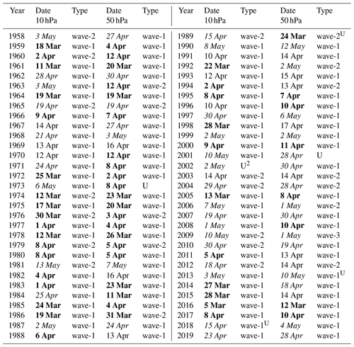
Only 13% of winters since 1980 have had a sub -0.25 DJF averaged NAO and they were all within 2 years of a sunspot minimum. All 4 sunspot minimums since the mid 80s have had either 1 or 2 sub -0.25 NAO winters. They were way more common from the late 1950s through late 1970s. This is despite Octobers pretty heavily favoring -NAO the last 15 or so years!
-
Raindance, I assume you realize those two analogs had opposite QBO (west) to our current/upcoming east. Any thoughts about that and why they’re still good analogs?
-
Joe D’Aleo posted this yesterday: The northwest and northeast Pacific had warm water mid September, a cold signal for the US in the colder months if it persisted. *The latest warmth relating to the latest deep sea volcanism is moving east through the north Pacific. The QBO mode (east or west) modulates the favored trough ridge. This is an east QBO, favoring more cold further east in the USA. The La Nina is weak but supported by cold PDO. You can see that the east QBO La Ninas are colder than the west. Compositing the average year matching the east QBO, weak La Nina cold PDO and warm AMO with declining to weak solar matches JB's/WB's winter outlook. West QBO, strong La Ninas a very different tendency. —————— *Aside regarding what I bolded/asterisked, D’Aleo is attributing the W Pac warming to an increase in deep sea volcano activity there, which is a theory originating from Dr. Arthur Viterito, someone who doesn’t believe in AGW as the main reason for GW. I’m not agreeing with it, largely based on many@donsutherland1posts in our CC forum, but am posting it only because it is part of D’Aleo’s quote. ————— Any comments regarding D’Aleo’s support of JB’s winter outlook being like the colder top map and much colder than the mild bottom map? I see some problems with the QBOs for the winters he included for the 2nd map per this 30 mb table that I always use: https://psl.noaa.gov/data/correlation/qbo.data -1973-4 DJFM QBO was a slowly dropping neutral rather than W -1949-50 DJFM was E rather than W -1988-9 DJFM was neutral rather than W -2007-8 DJFM was a rapidly diminishing E rather than W
-
Don and others, This was posted by JB 2 hours ago at WxBell: “Continued Climate Community Denial Dr Viterito writes: This is the latest ‘buzz’ in the climate community. The BBC just ran an article on it, and the conclusion of the Berkeley Research Group is that the warming can be partially explained by a reduction in cloud cover due to reductions in sulfur dioxide, a reflective aerosol. Improved Chinese air quality is also listed as a possible cause. Of course, the fallback position is ALWAYS what's happening above our heads and NEVER what is beneath our feet. So, it's business as usual as there is no mention of geothermal inputs into the system. First and foremost, the East China Sea is the locus of the warming. As Google Gemini posits: Hydrothermal activity is widespread in the East China Sea, particularly in the Okinawa Trough, a back-arc spreading basin. Here, seawater circulates through the oceanic crust, becoming superheated and carrying unique chemical and biological properties to the seafloor. This activity is concentrated in the central and southern parts of the trough and is often associated with volcanic and tectonic activity. Notable sites include the Yokosuka vent field, which is the deepest and hottest known in the area. And a huge rise in seismic activity has been recorded this past year. According to All Quakes (East China Sea Earthquakes Archive: Past Quakes in 2025 | AllQuakes.com), there has been a large amount of volcanic/seismic activity in 2025. Here are the summary statistics for the East China Sea: In 2025, East China Sea has had 14,770 quakes of magnitudes up to 5.9: 50 quakes above magnitude 5 271 quakes between magnitude 4 and 5 1,375 quakes between magnitude 3 and 4 3,197 quakes between magnitude 2 and 3 9,877 quakes below magnitude 2 that people normally don't feel. Keep in mind, we still have 10 weeks left in 2025. If we compare this with the FULL YEAR statistics for 2024, we see the following: In 2024, East China Sea has had 12,143 quakes of magnitudes up to 6.4: 1 quake above magnitude 6 23 quakes between magnitude 5 and 6 382 quakes between magnitude 4 and 5 655 quakes between magnitude 3 and 4 2,365 quakes between magnitude 2 and 3 8,717 quakes below magnitude 2 that people normally don't feel. That is, we have a 21% increase year over year, and if we adjust for the remaining time left this year (i.e., extrapolate out to the end of 2025), we would see a 53% increase, or an extrapolated total of roughly 18,500 seismic events for the year. More importantly, according to AllQuakes.com, the average yearlystatistics for the East China Sea are as follows: East China Sea has a high level of seismic activity. On average, there are about 6,600 quakes every year. That is, the extrapolated value for 2025 will be nearly three times higher than an average year for the East China Sea! And we aren't even factoring in the extraordinarily high vales for the fore-arc basins east of Kamchatka I discussed in the PSI article a few weeks ago. That activity will impact the temperatures of the Kuroshio Current as it makes its way into the north central Pacific. We have to keep plugging away at this!! Art You cant make this stuff up”
-
That’s why I feel it’s better to continue to repost JB’s posts regarding Dr. Viterito’s undersea volcanoes warming from underneath hypothesis (like Don just did and I’ve been doing) so that it can be repeatedly be refuted here with facts.
-
The 0Z UKMET once again has just a rather weak low (not even a TC on the textual output; it has yet to show TCG in the Caribbean on this output though it awhile back had several runs with TCG east of the Lesser Antilles) and again into Nicaragua. The last 5 runs have shown a weak low either hitting Nicaragua (0Z 10/19, 12Z 10/18), barely E of Nic. but heading into it (0Z 10/18, 12Z 10/17), or still 200 miles E of Nic. but likely headed into it (0Z 10/17). Looking at the H5 vorticity, it appears that as the AOI on the TWO comes into the E Car that a portion of it turns sharply right like the GFS but unlike that model it never develops. Then what looks like a split from this, possibly incorporating additional vorticity coming off northern S America, causes the weak low to move into the SW Caribbean, which then goes into Nicaragua. So, the UKMET remains a SW outlier. I should add that yesterday’s 12Z JMA is similar and it has been similar all of the way back to the 12Z 10/15 run. So, the JMA has had 4 12Z runs in a row with just a weak low into Nicaragua or just offshore headed there. Thus the UKMET and JMA have a good chance to both either fail badly or end up doing the best of the major operationals with this. ——— 0Z 10/19 UKMET 156 12Z 10/18 JMA 168
-
Don, I want to make sure I’m following you correctly. You’re saying the errors increase at depth but that the at depth data is still reliable?
-
Thanks, Don. What you’re saying seems intuitive. Do you think these at depth SSTA maps can be trusted for accuracy?
-
12Z UKMET: still no actual TCG shown in textual output but 1007 mb low is E of Nicaragua headed slowly in the direction of Nicaragua. Don’t know yet if it will landfall there though. Run not finished. Edit: looks like it on 10/24.