Buddy1987
-
Posts
4,511 -
Joined
-
Last visited
Content Type
Profiles
Blogs
Forums
American Weather
Media Demo
Store
Gallery
Everything posted by Buddy1987
-
@BristowWx


-
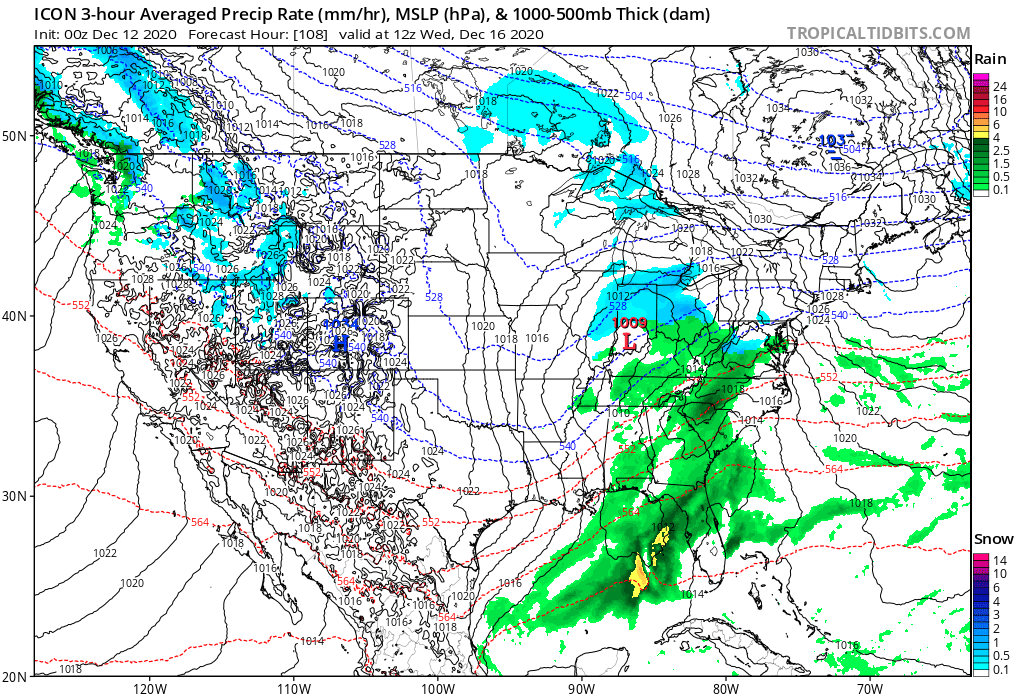
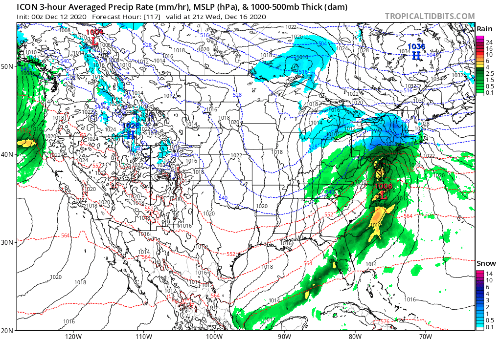
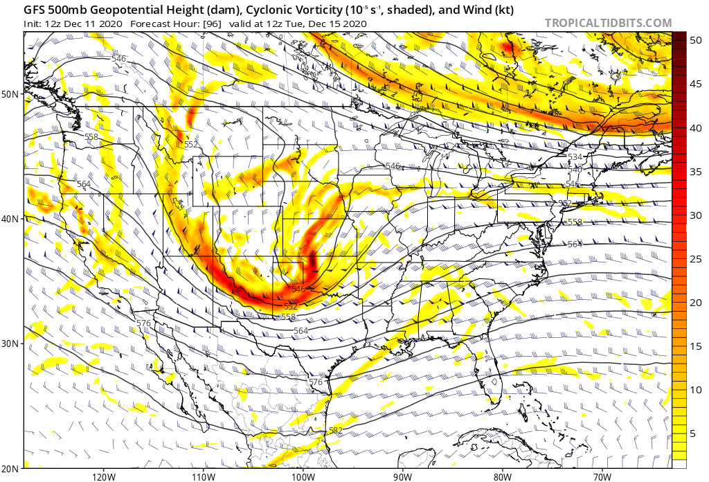
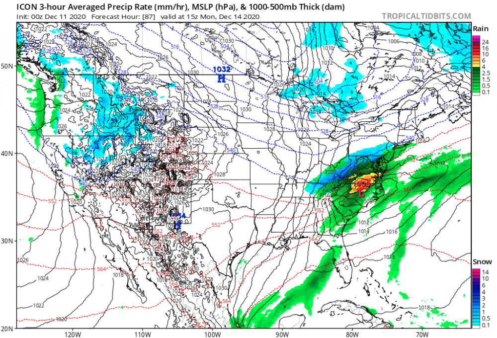
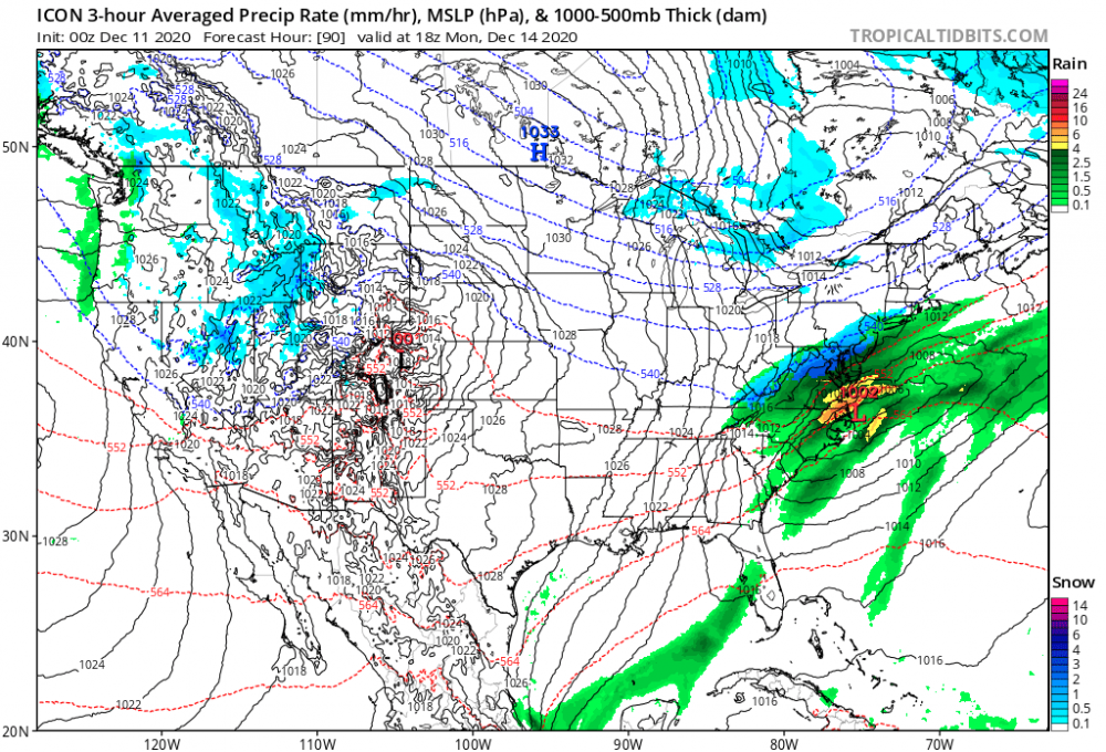
Icon just looks wonky and wrong with a 1037 HP being bullied. Highly doubt that occurs. Also primary pushes into SE Indiana. Unlikely imo edit: referencing 2nd wave
-
I’m confusing the hell out of myself now it’s like I’m overthinking the posts. So less amplified wave round 1 makes a better chance for a big dog with wave 2? Holy dyslexia. Meanwhile 0z Icon looks to be coming in slightly more amped for wave 1


-
You’re gonna get smoked up there brother! This is your type of storm. Low traversing too close to me down here usually bodes well for you. I’ll gladly raise the white flag if it makes us both happy come Wednesday.
-
Yea I think that’s what PSU was alluding to when I asked him for gut opinion. It will allow the 2nd wave to amplify more with a stronger 50/50 in place.
-
Hahahaha appreciate the honesty. Just for the fact first storm creates a 50/50 and we have a good cold source of high pressure (1034-1036) for the Wednesday system, screams to me at the minimum a mixed bag. I naturally tend to view my area more so than DC because I don’t have marine influence or I’m not associated as closely to the low track as you all could possibly be. I could definitely see it going either way with good potential frontogenesis and lift up that way to where if it’s borderline it could be a wet heavy snow or to where unfortunately above 850 gets cooked by southerly flow and flips to a mess. Jury is still out so I guess you are right although when I see thermals on Canadian it gives me cause to be reasonably positive for a majority of us.
-
What does your gut tell you from experience that the expectation should be for the board come Wednesday if it was do or die?
-
Don’t cliff dive yet. GFS isn’t superior in CAD situations, although some of the pros have alluded to the fact that there could be strong southerly flow up above the cold dome.
-
Yea it just completely dislodges the high and has it haul a** east allowing the storm to be amped. First I’ve seen of that but hopefully it wouldn’t be a trend.
-
For me the biggest takeaway is we have a strengthening high pressure in a prime position to supply CAD. HP goes from 1031 to 1034. Even if it is ice ice baby anything frozen is a huge win. I will take moisture with the Canadian thermals and I obviously trust the Canadians thermals in these situations.
-
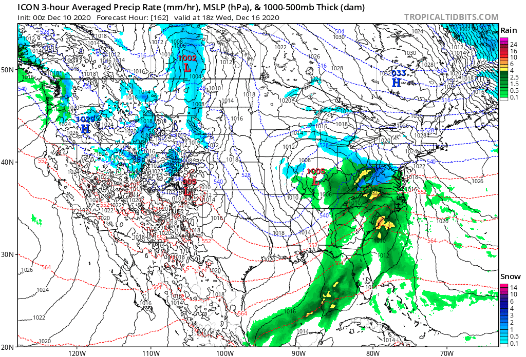
Gulf moisture looks primed this go around.
-
Very subtle changes thus far with 18z GFS at 5h. Have that feeling big run incoming.

-
Calling @Jebman Alert! Incoming nuclear assault!
-
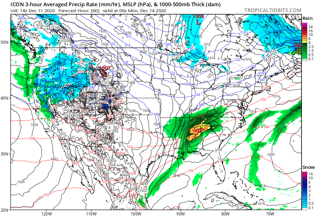
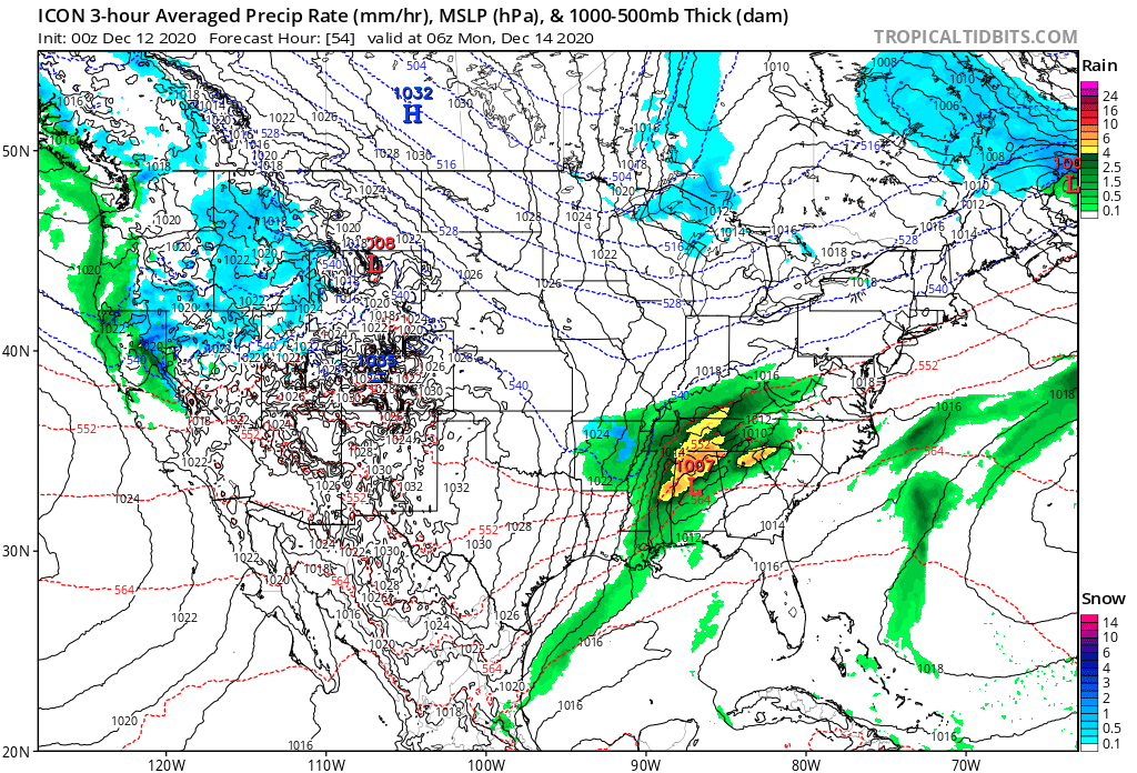
Man got off from work early today after meeting and holy crap I missed like 9 pages lmfao! You need that primary as do I to an extent to die off just a tad quicker but regardless I’m so desperate I don’t care if I get 5” of sleet. The way the last couple of winters have been beggars cannot be choosers. Just happy to be tracking something significant and worthwhile.
-
Damn it’s really trying hard to snow SW VA and mountains of WV Monday. Can only hope we get something. My fear is Wednesday system blossoms too late and we primarily miss out this way right now.
-
What’s everyone’s take on gfs vs euro and cmc? Which usually wins out in these types of scenarios. Gfs is more or less nuisance event with low taking off too late and/or has a big dry slot come through southern portions of forum.
-
I agree but it’s all we got right now lollll. I do think H5 wise though it’s similar to GFS and to Euro but I know your feelings about GFS end of the day haha.
-
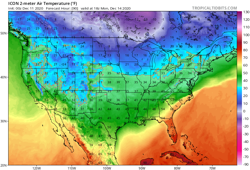
It is so freaking close here to it being a bigger deal. 2M in the mid 30s along the 81 corridor. I’m hoping rates can possibly turn it over to a wet a** snow. Looks great for the DC crew and that’s with it having a known warm bias.

-
I know the general rule of thumb with cold dense air HP helping out naturally in a lot of situations, especially one anchored around St Lawrence Valley. Will 1036 be strong enough to combat the primary low pressure?
-
I actually feel relatively positive about Monday around ROA. I don’t really consider myself the mountains however like some do. Going to be close.
-
Yea I would agree I think the primary will end up more west northwest of this particular setup but I also don’t think it drives as far north into the HP. We’ve all been around the block wrt that.
-
Which one would you personally put your money on for down this way based on model guidance. I was more or less transferring all my eggs to Wednesday but Euro and GFS keeps me interested for Monday.
-
For me I’d be more inclined to put my eggs in one basket for the Wed system, at least for my direct area. Any time HP sitting up top the LP does not make it as far north and east and ends up transferring. Even if WAA overcomes shallow cold, still problematic for sleet/ZR. Any type of wintry precipitation this year would be a huge boost, as last year was just a complete debacle in every facet.
-
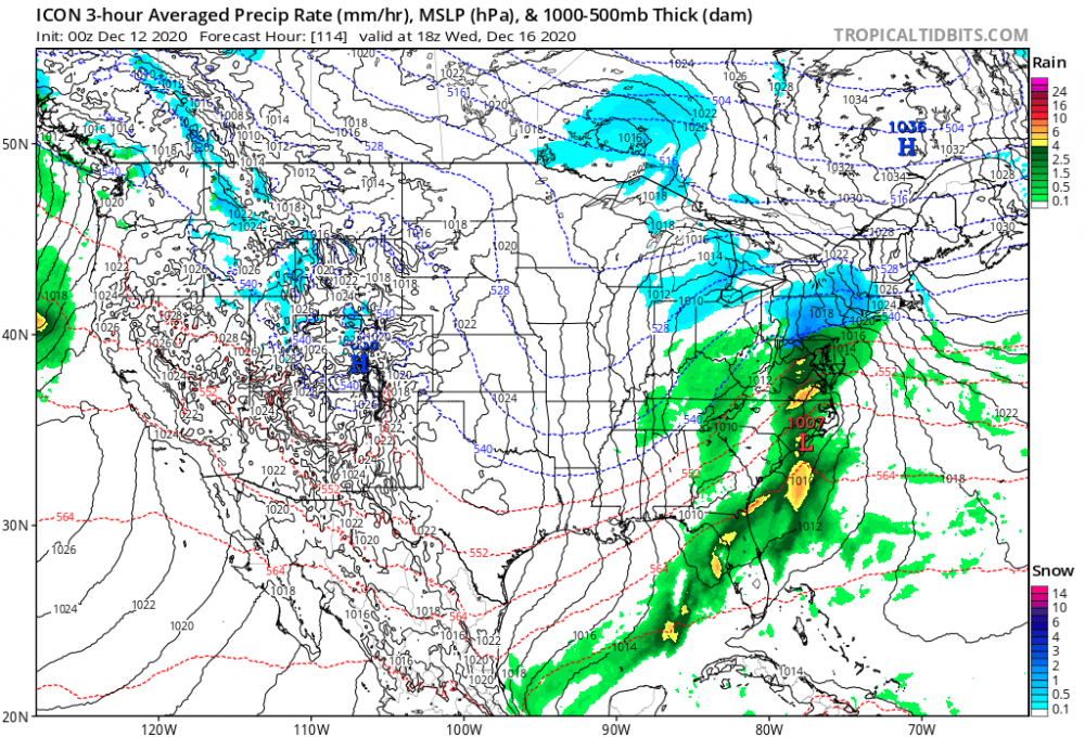
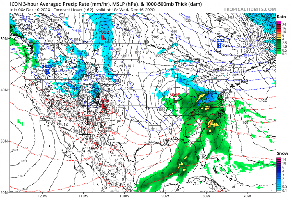
Icon in CMC camp and honking for next Wed.
-
What happened to Bob anyway?