Buddy1987
-
Posts
4,511 -
Joined
-
Last visited
Content Type
Profiles
Blogs
Forums
American Weather
Media Demo
Store
Gallery
Everything posted by Buddy1987
-
Def wouldn’t take much but I think even where it is at now we can still bank on all frozen for cad areas because that high is in a really good spot. Just depends what type of frozen is your cup of tea. I really want snow but after last year I will take anything I can get at least for myself.
-
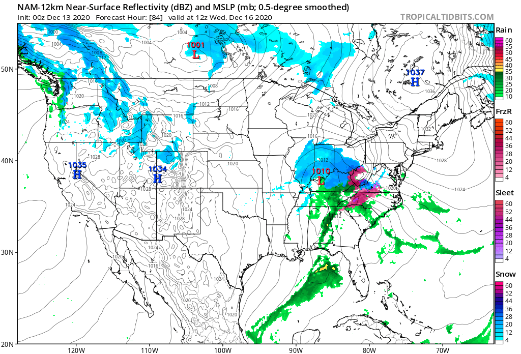
Here’s 84hr panel.. big time cad all the way down into NW SC

-
Out to 63 stout wedge building in. High looks to be a little stronger as well. All the panels haven’t updated yet so only have surface and not upper levels as they’re stuck at 45.
-
0z nam looks to be trying to set the stage for a better 50/50 with wave 1 exiting toward Nova Scotia at 51. Yes I’m ready for the 0z suite and no I’m not ashamed to extrapolate the nam.
-
Isn’t this the time frame where Euro or some of the models have their blips and then come back to reality? Usually between 72-96 hours or so from start time? Do some wonky things and then recorrect?
-
This is something that I enjoy because as long as it trends in the right direction we have plenty of time to fix evolution and precipitation type. This goes wrong way we’re all in trouble. Good to see 850s trying to wedge down into SW NC mountains. Good sign normally for I-77/81 and northbound from there.
-
I’m not sure it’s too late to share the same sentiment with you
-
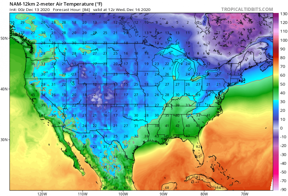
I’m still sticking to my 3” bar so I don’t get disappointed out this way with expectation we switch to sleet or freezing rain as waa comes up over top
-
Nam has the primary pretty far north and east but then again it’s the 84 hour nam and that’s the equivalency of trusting a wet fart when you have the stomach bug so there’s that..
-
Tends to over amp. I wouldn’t be overly concerned and is not known to sniff out cad. For the GFS and GEFS to be honking is a big tell tale sign.
-
I agree I don’t have that warm fuzzy feeling anymore. I think 3” is a win down here then sleet and freezing rain to crust it on top.
-
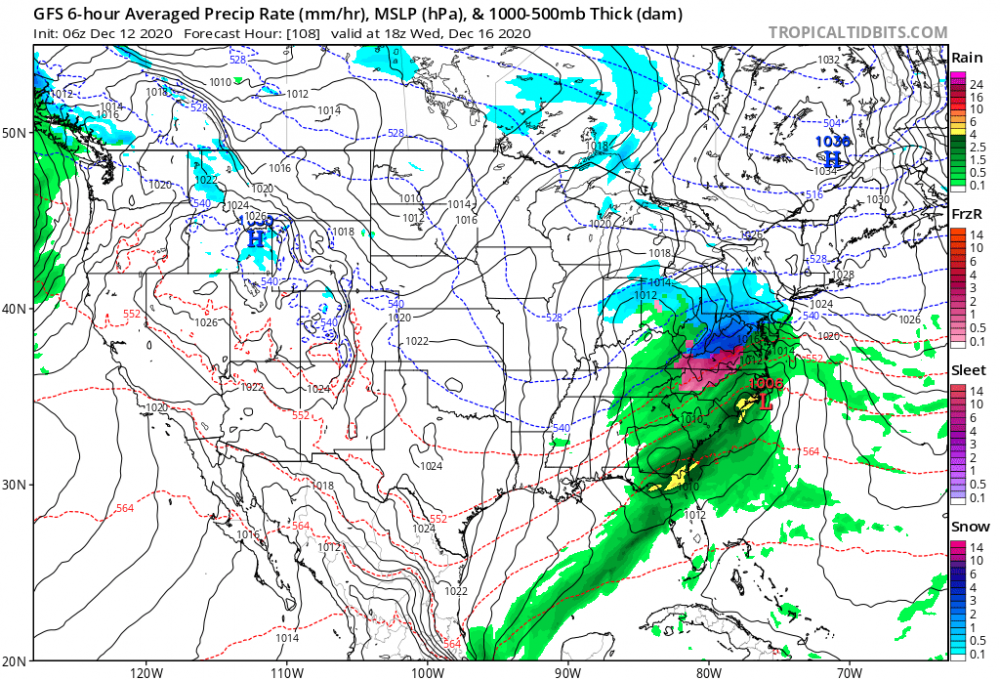
That would be a change of events considering most of the 12z guidance locks it in a good way for most here. Will be enhanced IMO as we move closer to game time.
-
Surprised with the evolution and lock step from previous runs my totals got cut in half down here. I don’t get it..
-
From your experience do you think nw banding will increase as we get closer farther to the south/southwest for NC foothills/VA and up into you all?
-
@Disc how do soundings look down here?
-
Confluence at 72 looks even a little bit better than GFS had and we all see how that played out.
-
CMC looks like it too will be pretty amped for wave 1 so we can get the 50/50 in place
-
Canadian running here we go out to 12
-
It’s like a damn hurricane south of Montauk. What a storm!
-
Low tucked in a little more so than 6z however low traversing over Hatteras but it’s an absolute shellacking majority of the board. Great thump
-
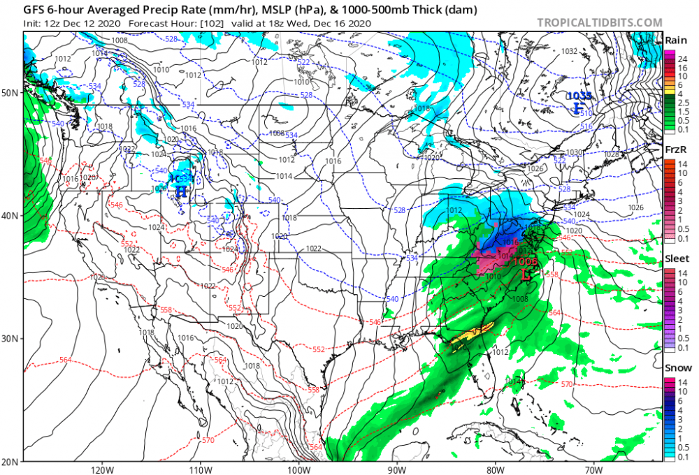
96 HP only a couple hundred miles to the west of 6z position and a mb deeper no big deal lollll. Low south of Tallahassee
-
Juice bomb incoming. Low over mobile AL
-
Agreed. At 84 you can see it’s positioned at that juncture more like Canadian.
-
Trough out west looks a little sharper and more “diggy” at 60 if there’s any slight difference. We’ll see how it translates downstream.
-
We need @yoda brought good juju yesterday.