

Windspeed
-
Posts
4,835 -
Joined
-
Last visited
Content Type
Profiles
Blogs
Forums
American Weather
Media Demo
Store
Gallery
Everything posted by Windspeed
-
Wow.. Lee has had a massive expansion of hurricane force winds.
-
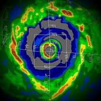
After 84 years, Major Hurricane Lee has a dominant eyewall that is producing enough subsidence to clear out a rather large eye. As has been reiterated, Lee's gradient is loose for a sub 950s mb hurricane; as pressures fall, hurricane force winds are spreading out away from the center rather than increasing near the center. However, convection does have some >70°C tops for now. There should still be Category 3 winds in the eastern eyewall as Lee slugs NNW, and it could tighten a bit of gradient enough to increase the eyewall winds slightly. But not enough to increase a category.
-
I think Maine has a good shot if the block and trough time correctly, but, of course, Canada remains the biggest landfall threat. We may start getting swings back and forth with the OPs, though, as they iron out the position of turn and trough versus ridge. These could show a western run into southern New England at times as this interaction gets ironed out. It may open the door for hype, but it is what it is...
-
Should be a Cat 2. Still think we'll see some impressive reintensification this evening through Sunday. I still think Lee will make Category 4 again with a big eye once it gets structural issues resolved and the shear is negated. An eyewall will have some work to do to tighten the gradient, but Lee will have a big outflow channel to help as well.
-
Give it time though. Old inner core is still pulsing. Shear is not fully gone yet. Should look drastically different tomorrow.
-
400 hPa upper mid-level flow that had been undercutting the canopy and disrupting Lee's core is starting to ease up. It is still there; however, updrafts are strong as Lee remains an intense vortex with strong surface convergence. It doesn't take much backing down of this shear or having the flow come into more alignment with the vector of steering motion for Lee's eyewall to recover. You can make this out very clearly with lightning data as CBs regain a foothold on the core. The core will still battle some tonight. But shear will continue to lessen through Saturday, I would expect another round of RI by Sunday. I'm not saying Lee will reach its previous peak, but it will eventually be in a favorable environment for several days as it pushes WNW. It should look pretty impressive by Sunday afternoon and will likely bottom back out in the 930s. The gradient may not be as tight, so I don't know if it will achieve Category 5 windspeeds again. It may end up with a large eye, though.
-
^ Interesting to note that Lee outperformed all intensity guidance model runs, including the new HAFS suite. Keep in mind guidance didn't actually bomb the pressure until the weekend or just NE of the Leewards. It's quite possible that Lee's period of explosive RI in IRL occurred prior to the simulation of a time frame of southwesterly mid-level shear. This shear looks to back off tonight. In other words, Lee may get back that more classic satellite appearance overnight or on Saturday and bomb out again. It should have several days of good mid-to-upper level environment north of the Antilles.
-
-
Keep in mind that inevitably, we will get an EWRC. But environmental conditions are going to remain sufficiently supportive of high MPI. So after the first completion, we could see another peak in intensity with the new eyewall. Perhaps even an impressive peak with the third eyewall. Should be an impressive hurricane through the weekend.
-
I want to say this is a classic CV hurricane, but Lee is in a league of a rare few in this location of the Atlantic. Hugo, Irma and now Lee in the satellite era.
-
Oh...
-
Official forecast is a Category 5. Such Atlantic forecasts are extremely rare. Normally, a Cat 5 just happens out of outperforming intensification, outside of forecasting discussion.
-
Lee is ahead of my forecast; and I thought I might've been too hasty. Think it will be a major by 5PM AST now. The eye is warming fast. Two CBs rotating around should drop pressures like a rock. Recon will find a hurricane undergoing rapid intensification when it reaches the core this evening.
-
Nah. The MPI ingredients needed to hit Patricia level MPI just aren't there. But it's most certainly a beast.
-
It should weaken quite a bit prior to any potential interaction with Bermuda; however, both the ECMWF and GFS consistently want to model Lee into very large hurricane by then. It might not be a major due to the surface "cold pool," but large swells and a big expansion of the windfield could bring significant impacts there if indeed it heads that way.
-
Or 96L/future Margot get sheared and displaced NE, ending up literally over or east of the Azores, becoming an ET system. That might help with an Omega.
-
Don't you think that would be a better possibility though if Margot actually drove westward and pumped heights to its NW, versus merely moving NW into the region west of the Azores? Seems like its position there erodes heights that would aid in keeping Lee from turning NE.
-
Of course, in IRL, there's also the potential that a future Margot remains weak due to shear. In part by Lee's upper level backside exhaust and a possible ULL that might form, imparting westerly shear. That could keep future potential Margot in check. But oh well, plenty of days left to watch this all unfold.
-
The problem with getting a US strike now in the GFS is its forecast position of 96L, which is currently positioned near the Cabo Verdes. The GFS wants to make this a major hurricane (probably Margot) and drive it into 500mb ridging west of the Azores. This breaks down any block faster and keeps Lee away from any interior CONUS cutoff.
-

2023 Atlantic Hurricane season
Windspeed replied to Stormchaserchuck1's topic in Tropical Headquarters
Based on modeling, it doesn't look like the Atlantic MDR is done, staying busy for at least a few more weeks. That being said, a +ENSO is still strengthening. Sub-tropical jet placement and shear across the Caribbean and MDR that was experienced in August has since subsided, which, to no coincidence, we have a developing major hurricane coming. But El Niño is still there, and perhaps it will have more effects to close out September into October. At any rate, despite a strong El Niño, I was wrong on ASO below normal activity. Very wrong. -
Lee is coming along with haste and will likely be a hurricane sometime overnight into Thursday. Waiting for those CBs to start swinging around the core. Should even see a period of RI on Thursday.
-
Interesting discussion going on about that "death band". May aid in rapidly developing the core tonight.
-
I don't disagree, I just figured that was his angle. I'm not going to let Ryan Maue ruin my day. lol...
-
He probably just means significantly above the 135 kt threshhold. I mean, if Lee were to reach MPI after the first EWRC, it could get down in the 910s. A 150 kt storm is not impossible with this setup. I'm not calling for that as there can always be unexpected variables, but he probably thinks it will.
-
18z EPS members are S and SW of 12z at 144hr. Still clears the Leewards and PR, but the ridge is a tick west and stronger. May not result in ECONUS interactions yet, but we'll need to see if a trend is beginning.


