

Windspeed
-
Posts
4,734 -
Joined
-
Last visited
Content Type
Profiles
Blogs
Forums
American Weather
Media Demo
Store
Gallery
Posts posted by Windspeed
-
-
We've seen these crazy cyclonic loops in the past in interaction with the mountainous island of Taiwan. It's still quite eye-opening, no pun intended.
-
 4
4
-
-
Gaemi has thrown on the brakes and made a hard left turn down the eastern coastline. It's absolutely incredible to see such a scenario unfold in real-time.
-
2
-
-
Well, that escalated quickly. Gaemi is now a powerful Super Typhoon with a very intense eyewall and evolving concentric structure. Most likely, this concentric banding structure will result in an ERC prior to landfall and hopefully bring down intensity prior to crossing the shoreline. Hopefully, any such cycle will not be completed with haste to allow reintensification, but Gaemi is no doubt going to be a powerful strike on Taiwan regardless.


-
3
-
-
Typhoon Gaemi is visibly intensifying and may peak prior to land interaction. Moderate northerly shear has decreased somewhat to allow Gaemi to intensify. The eyewall has become thick and intense on the radar, but the eye is still cloud-filled.


-
Wrong thread..There is stuff in the Pacific. -90*C cloud tops for 05W.
https://www.americanwx.com/bb/topic/48875-wpac-indian-ocean-and-southern-hemisphere-tropical-cyclones/&share_tid=48875&share_fid=13197&share_type=t&link_source=app -
Nobody is ragging on you. You have valid points that the numbers of NS in some of the higher-respected forecasts might be too high. 2024 could be a lot like 2017: Quality over quantity (i.e. hyperactive ACE values but a lower number of named TCs), which, perhaps, is an even worse outcome. As that means several long-duration / long-tracking TCs with multiple landfall threats. Big ACE producers verses frequent occurance of short duration events that stack up to lower ACE values. It's all guesswork at this point however.Just want to respond to all the above posts saying "you people" canceling the season. All I'm saying is I don't see the high number of named storms verifying based on the activity so far. The seasons with a lot of named storms have a lot of slop in June and July taking up names which we don't have this season. I'm not at all saying things won't ramp up quickly and we could get a big ACE season.
The only person canceling this season is ldub which if you've been around here long enough you know that happens every single year from that person and you should just disregard every post that comes from him/her.
I do think some of these numbers are too high as well. Not because 25+ NS isn't possible this year. It certainly is possible. It's just so rare that it's harder to forecast that versus just forecasting hyperactivity in general, even though that is also rare. 2020, a good example, got a lot of junk TCs that encountered unfavorable environments that merely didn't stack a lot of ACE, regardless if that years also had a few big producers. Then you have years like 2004 and 2017 that had lower numbers of NS, but numerous violent long-tracking hurricanes. Of course, we also have '33 and '05 that had both high numbers of NS (for their record-breaking seasons) and big ACE generators ('33 still holds the record there).-
3
-
-
Good lord. Unfortunately, they're dead wrong and doing what they always do. Their annual moaning and complaining posts because it's been more than 12 days without a major hurricane. It's nothing to do with climatology or interseasonal states. It's not even a lack of understanding about patterns. They're just trolling.
Back to reality. Scroll up and read. This slow period and the preceding period of activity has been forecasted well. The reasons Beryl occurred when it did have been thoroughly discussed. Even still, Beryl struggled through portions of the central and NW Caribbean due to, yep, climatological factors. Unfortunately, those factors weren't in place in the western MDR and eastern Caribbean, hince we've a devastated Grenadines, and it's not even August yet. Not to mention, we have a $6+ billion CONUS landfall already.
Enjoy the quiet interseasonal period, folks. Mid-August through October is going to be crazy. People will be complaining about not being able to keep up with all the chaos.-
5
-
 3
3
-
-
It's slow in the tropics right now. But there's still great discussions going on about potential upcoming patterns and any that may lead to CONUS landfalls during ASO. As such, a really good one is ongoing right this minute between Hazelton and Webb...
-
2
-
1
-
-
Where did Irma bomb out?
Irma was indeed a classic long-tracking CV hurricane, but even by comparison to the historical record, it took precedence. After TCG occurred 120 n mi WSW of São Vicente in the Cabo Verde Islands, it only took 48 hrs to become a major hurricane. But even with respect to its initial RI, perhaps what stands out most is its track. Irma gained a decent amount of lattitude due to a modest weakness in the eastward extension of the Bermuda-Azores SPH. The hurricane also weakened due to some interaction with SAL and cooler SSTs, undergoing some internal restructuring. However, Irma turned back WSW during its four-day trek across the MDR. Irma's position timed perfectly and, unfortunately, with respect to the Leewards, with restrengthening of the ridge and east-north-easterly flow of the 700-500 hPa steering layer. Above normal SSTs across the central and western MDR combined with exceedingly stacked/aligned atmospheric flow from the surface to 300 hPa level and favorable ULAC aloft enabled Irma to become, at that time, the most intense CV hurricane on record (surpassing Isabel) at 914 mb prior to slamming Barbuda and St. Martin. Beyond the more technical meteorological discussion, in general, when you have a CV hurricane losing latitude on its westward track through the MDR, it is bad news.Near the Azores if I remember correctly. It seems like every year lately we set a new milestone
Note: Irma first reached 20N at 40W. After its turn WSW, it didn't reach that lattitude again until 66W, north of Puerto Rico.
-
3
-
2
-
-
The Caribbean Low-level Jet (CLLJ) is usually why the Caribbean, from east to west, is a graveyard in June and July. Especially if there is a TUTT in place over top. The CLLJ tends to relax by mid-to-late August, if not earlier, as the SPH cells gain a bit of latitude. Generally, the westward extension of the Azores-Bermuda high propagate east and west across the basin in a tug of war with exiting CONUS trough and jetstream interaction. But this year, with a +AMO in place and cool neutral ENSO, we may see the Bermuda cell linger into the ECONUS coastal region, even if the eastward Azores extension waxes and wanes with digging central Atlantic troughs.
-
2
-
1
-
-
Ongoing electrical infrastructure woes...
-
Latest ECMWF rainfall anomaly for ASO from Ben Noll's site. Interior CONUS is dry except for portions of the Midwest and Ohio Valley and very suggestive of cool neutral ENSO / La Niña pattern. Note the very active Atlantic and long-track setup for TCs. Potential drought conditons during the period for the Tennessee Valley without much progressive frontal precipitation. Hopefully, some weaker systems will bend around the ridge a curb drought conditions. Unfortunately, some of those systems will likely be hurricane strikes for the SE CONUS.

-
2
-
2
-
-
The latest rainfall anomaly by the ECMWF for ASO from Ben Noll's site. You'd not expect to see a more ominous pattern / setup for TCs being driven west. Ridging is in place, so frontal / trough induced precipitation in the CONUS interior is below normal. This not only smells of a cool neutral ENSO / La Niña, but also suggests long-tracking TCs with late recurves.

-
4
-
-
Their forecast of 140 ACE west of 60° longitude is pretty much a dead giveaway that you'd expect an ugly season for the Caribbean and SE CONUS. The pattern screams either central American landfalls or late recurves during ASO. We have potential drought conditions developing in the inter-SE region for August and September. Bermuda ridging and westward extension of the Azores SPH is already having its way. The relief may only come from landfalling TCs. You'd hope that all of them would just be weaker systems for beneficial rain. But you'd expect some of those would unfortunately be hurricane strikes. I agree that Beryl is likely a harbinger of things to come.
-
1
-
-
RE: Rain from Beryl...
A line of storms tries to advance eastward into Wednesday, but unfortunately, moisture feed and the advancing southerly flow just dwindles and dies. It's not looking all that promising, but perhaps the NE TN Valley can get some isolated development.
-
-
Azores ridge block-induced SPH cells should be cranking easterly low-mid level trades. ITCZ should be under a suppressive regime until late July/ early August. Not complaining; in need of a reset. SSTs will still be predominantly at mean or above normal in time for ASO. Even within a hyperactive season, there is a relatively confined period of lull. 2005 was pretty much dead between Emily and Katrina aside from some weaker central Atlantic TCs that got named and a weak BoC system into Mexico.SSTs also aren't super above average in the tropics like they were a few months ago.. as the averages climbed, the deviation evened out a bit.
All the heat is migrating to the N. Atlantic, where a strong High pressure is suppose to set up for the next few weeks continuing the warmth there..
Edit: In hindsight, the 2005 lull was not exactly dead, and Franklin reached 60 kts in its brief cycle, but we didn't see much in the way of any substantial ACE producers. This isn't to say we won't have another significant TC between now and mid-August. But it's important to note that the last few hyperactive seasons didn't get started until their climatological norm.
Edit 2: I feel like I am correcting myself too much, but 2020 did feature a landfalling hurricane into, big surprise here, Texas! That was Hanna on July 26th. This was a GOM system that had an easterly wave as its source. However, it was more in line with climatological norms. So, to be specific, I want to state the MDR may remain in a lull until mid-August as that was the overall point of my mind when I typed above. It's been a long day.-
4
-
1
-
-
In short, yes. An intraseasonal period is modeled out beyond a few weeks with some westerly wave breaking and SAL plumes. Perhaps in a few weeks, there is something homegrown/SW Caribbean.After Beryl, a lull?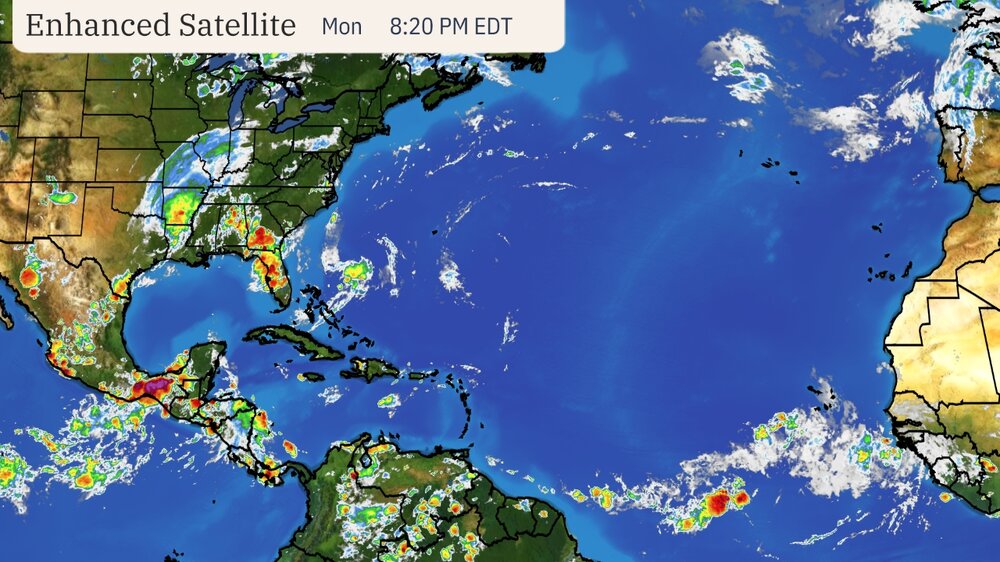
-
2
-
-
Multi-model ensemble tracks for the 95L/Beryl from onset to final landfall.
https://x.com/burgwx/status/1810425710223483086?t=ZBTiQmbgg0oO73E-KiNHvw&s=19-
1
-
-
Beryl may end up being the most expensive Cat 1 landfall just from wind damage. Katrina was pretty high due to Miami. It's never good when you have an eyewall cross over a densely populated metropolitan and residential area, not even a Cat 1.
-
2
-
-
As has been repeated, an intensifying eyewall and associated bands with strong convection mix down more efficiently versus an eyewall that is falling apart with gusts that are merely gradient driven. I am not surprised by all the 80+ mph gust reports. There are plenty of examples of rapidly weakening category 3 hurricanes that had very spotty or limited 90-115 mph gusts. Though we have limited data currently, this same hurricane may have been exactly such an example on its landfall in the Yucatán. Most reports were unimpressive versus the reports out of Jamaica. There is no need to bring up Carriacou, Union, and the Grenadines, which were devastated.A strengthening 1 is often worse than a weakening 2.
100% certain Beryl will be retired.-
7
-
-
Beryl appears to gradually be increasing forward motion. Must be feeling the trough. Flooding is occurring, but hopefully, Beryl can lift out by this afternoon, and the metro can avoid any trailing feeders off the GOM.
-
Landfall.
000
WTNT32 KNHC 080853
TCPAT2
BULLETIN
Hurricane Beryl Advisory Number 39
NWS National Hurricane Center Miami FL AL022024
400 AM CDT Mon Jul 08 2024
...CENTER OF BERYL MAKES LANDFALL NEAR MATAGORDA TEXAS...
...DANGEROUS STORM SURGE AND STRONG WINDS OCCURRING WITH FLASH
FLOODING EXPECTED...
SUMMARY OF 400 AM CDT...0900 UTC...INFORMATION
----------------------------------------------
LOCATION...28.6N 96.0W
ABOUT 0 MI...0 KM N OF MATAGORDA TEXAS
ABOUT 85 MI...135 KM SSW OF HOUSTON TEXAS
MAXIMUM SUSTAINED WINDS...80 MPH...130 KM/H
PRESENT MOVEMENT...N OR 355 DEGREES AT 12 MPH...19 KM/H
MINIMUM CENTRAL PRESSURE...979 MB...28.91 INCHES
Discussion....
000
WTNT42 KNHC 080907
TCDAT2
Hurricane Beryl Discussion Number 39
NWS National Hurricane Center Miami FL AL022024
400 AM CDT Mon Jul 08 2024
The strengthening forecast by the regional hurricane models began
in earnest just after the last advisory was issued. Doppler radar
and Air Force Reserve Hurricane Hunter aircraft data indicate that
Beryl regained hurricane strength near 04Z, and intensification
continued until the just-occurred landfall of the 28 n mi wide eye
on the Texas coast. The landfall central pressure was near 979 mb,
and the maximum winds were near 70 kt.
The initial motion is 355/10. Beryl should move northward for the
next 12 h through a break in the subtropical ridge, with the
center moving through eastern Texas. After that, the cyclone
should turn northeastward with an increase in forward speed, with
the cyclone accelerating across the lower Mississippi Valley and
into the Ohio Valley until dissipation occurs between 72-96 h.
The new forecast track is similar to the previous forecast.
Now that Beryl is moving inland, it should quickly weaken, with the
system becoming a tropical storm in the next few hours and a
tropical depression in a little over 24 hours. After that, the
cyclone should merge with a frontal system over Mississippi Valley
and become an extratropical low before it dissipates.
Key Messages:
1. There is a continuing danger of life-threatening storm surge
inundation along the coast of Texas from Mesquite Bay to Sabine
Pass, including Matagorda Bay and Galveston Bay. Residents in those
areas should follow any advice given by local officials.
2. Beryl is bringing damaging hurricane-force winds to portions of
the Texas coast this morning. A Hurricane Warning is in effect from
Mesquite Bay to Port Bolivar.
3. Considerable flash and urban flooding is expected today into
tonight across portions of the middle and upper Texas Gulf Coast and
eastern Texas. Minor to isolated major river flooding is also
expected.
4. Rip currents will cause life-threatening beach conditions through
Tuesday across much of the Gulf Coast. Beachgoers should heed
warning flags and the advice of lifeguards and local officials
before venturing into the water.
FORECAST POSITIONS AND MAX WINDS
INIT 08/0900Z 28.6N 96.0W 70 KT 80 MPH...ON COAST
12H 08/1800Z 30.4N 95.8W 55 KT 65 MPH...INLAND
24H 09/0600Z 32.7N 94.4W 35 KT 40 MPH...INLAND
36H 09/1800Z 35.0N 92.1W 25 KT 30 MPH...INLAND
48H 10/0600Z 37.5N 89.0W 20 KT 25 MPH...POST-TROP/INLAND
60H 10/1800Z 40.0N 85.8W 20 KT 25 MPH...POST-TROP/INLAND
72H 11/0600Z 42.0N 83.0W 20 KT 25 MPH...POST-TROP/INLAND
96H 12/0600Z...DISSIPATED
$$
Forecaster Beven
-
Josh has 982 mb and dead calm, near the center of the eye. Official landfall is imminent.
Edit: 981 now.


2024 Atlantic Hurricane Season
in Tropical Headquarters
Posted
This is a reminder that we had this microwave presentation in the Caribbean Sea, in the Atlantic, on.... July 2nd....

Better thank the current interseasonal behometh Azores-Bermuda ridge suppressive regime right now. That's the only thing holding in the cork. Every other climatological factor is a bloody damn powder keg.
This season is going to suck. And yes, that is intense hyperbolic acid coming from me to pour in your stiff drink. It's going to be very bad.....