

IWXwx
-
Posts
6,438 -
Joined
-
Last visited
Content Type
Profiles
Blogs
Forums
American Weather
Media Demo
Store
Gallery
Posts posted by IWXwx
-
-
2 hours ago, Hoosier said:
I think we will definitely see snow in the sub early next week, and outside of the UP/northern tier.
Which reminds me, where is Bo? I'm sure that he has seen flakes already.
-
Picked up 0.09" last night/early this morning. First measurable rain in 18 days and a total of only 0.51" in the past 30 days. At least it's good for the farmers.
-
...and so it begins
Monday NightA slight chance of rain and snow showers. Partly cloudy, with a low around 30. Chance of precipitation is 20%.-
 1
1
-
-
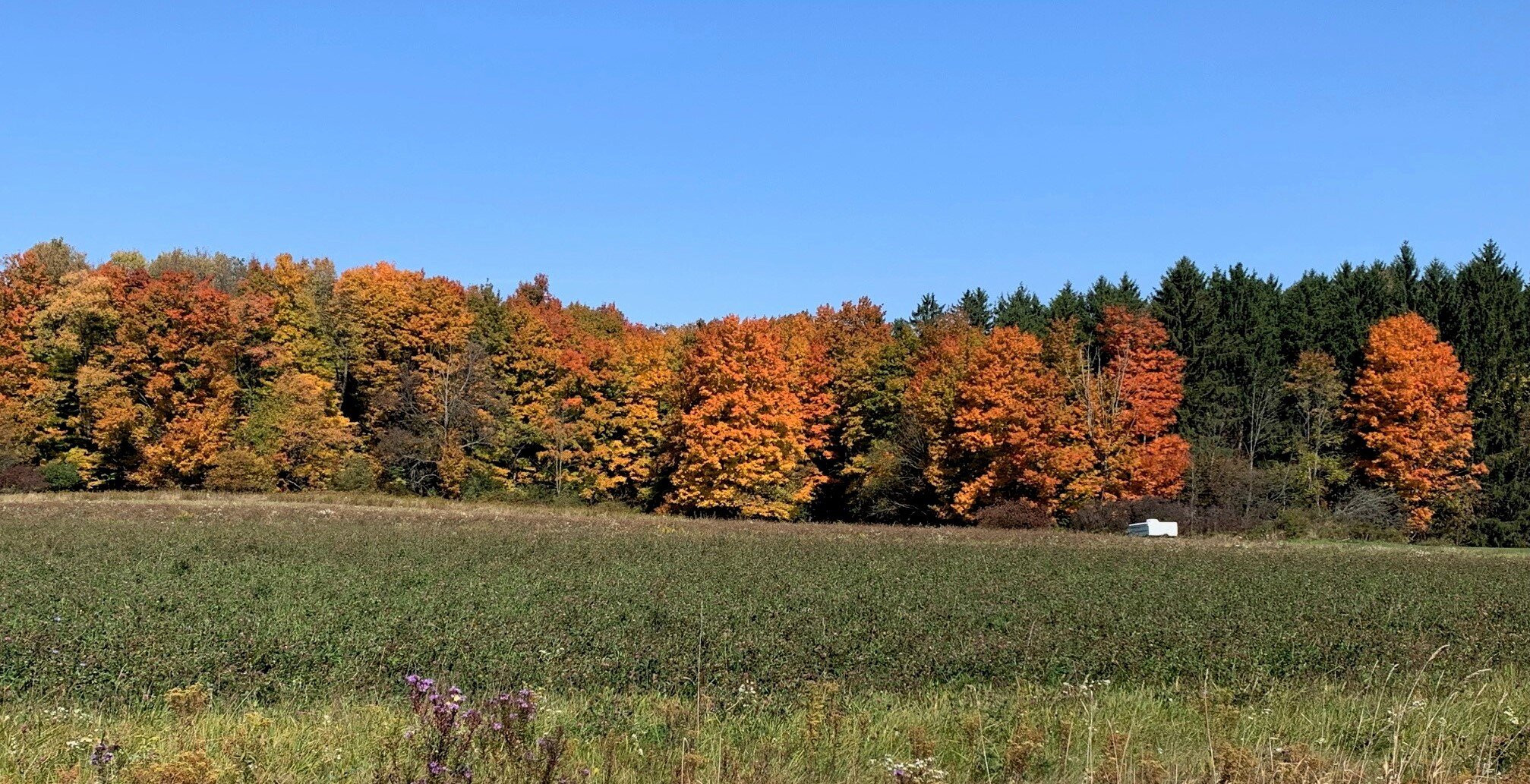
2 hours ago, NEOH said:
Trees are getting close to peak... colors seem more vibrant compared to the past couple of years.
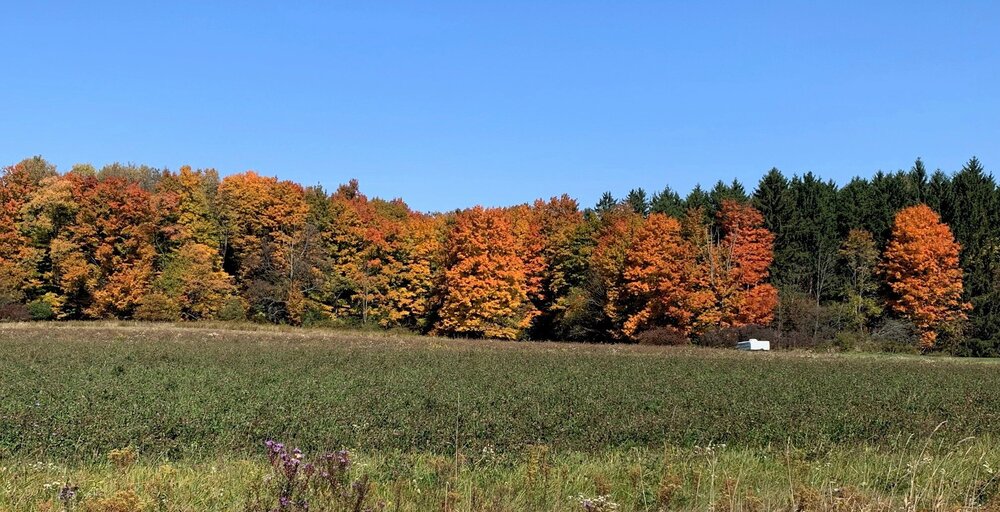
Even though haven't quite hit peak here in the Fort Wayne area, I also noticed that the colors are brighter this year than the past couple of years.
-
1
-
-
The first mention of the S word of the season in an Indiana forecast discussion.
AND WITH FRIDAY, 500 MB HEIGHTS APPROACHING 540 DM, STILL UNSETTLED
WEATHER WITH THE TROUGH SITTING OVER THE REGION,
A FEW SNOW SHOWERS ARE NOT COMPLETELY OUT OF THE QUESTION.
AT THIS TIME, I HAVE OPTED TO LEAVE MENTION OUT OF THE GRIDS, BUT
AS WE GET CLOSER I WILL NOT BE SURPRISED IF THIS WILL BECOME
NECESSARY. FRIDAY TEMPERATURES WILL STRUGGLE TO JUST GET INTO THE
LOWER 50S. THAT TIME OF YEAR AGAIN.
-
48 minutes ago, Hoosier said:
BAMWX has spoken
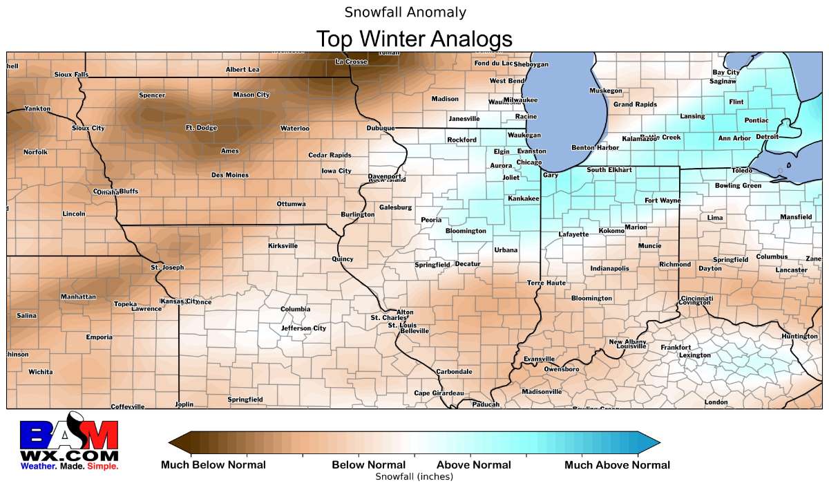
"I'm michsnowfreak, and I approve this map."
-
2
-
 3
3
-
-
6 hours ago, Hoosier said:
This would be an interesting lake setup if it were colder. 850 mb temps are well below 0C but 925 mb to the surface is above freezing... not cold enough for snow. Coincidentally this is progged on the anniversary of the 10/7-10/8/2000 lake effect event, when I did witness heavy, wet snow accompanied by plentiful thunder/lightning.

I remember that event. I was fishing in a bass tournament in Marshall County IN (Lake Maxinckukee) and watched the lake effect clouds off on the horizon rolling across the sky. A blustery day on the water for sure.
-
A snowstorm in winter or something out of season? If it's the latter, early or late?
In winter
Wet snow, dry/fluffy snow, or something in between?
Something in between
Light/calm winds, or windy conditions while it's snowing?
Calm winds
Continuous snow, or do lulls not matter as long as amounts end up as expected?
Either
12" in 12 hours, or 18" occurring over 36 hours?
18" over 36 Hrs.
Bitter temperatures, or just cold enough to stick well during the storm?
Cold, but not bitter
Storms on holidays/your birthday/some other meaningful day, or are dates irrelevant?
Irrelevant
If living in a lake effect area, would you rather have a synoptic or lake effect storm of the same amount?
n/a, although we usually get a couple Lake MI les events down this way most winters which are always fun even if they are only light amounts
-
1
-
-
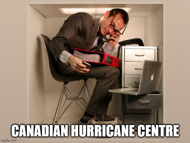
With a hurricane watch being issued for Nova Scotia, Prince Edward Island, and Newfoundland by the Canadian Hurricane Centre, I had to look this Agency up. Here's what I found...
-
3
-
-
From 90° late Wednesday afternoon to 39° at 6 AM this morning. Autumn says, "Hi"
-
2 hours ago, Hoosier said:
Can't believe nobody posted about the Sunday slight risk.
..Broyles.. 09/16/2022
-
5
-
 1
1
-
-
14 hours ago, michsnowfreak said:
Will be interested to see if we can shake things up a bit. We have really been stuck in a very persistent odd pattern. Really want a good December. After quite a few great decembers in the 2000s, since 2011, only 2016 and 17 were great. The way the past decade has gone locally, a betting man would go:
Oct- mild but flakes before Halloween
Nov- chilly and snowy
Dec- warm, few fluke snows
Jan- pretty avg
Feb- snow, snow, snow & more snow
Mar- zzzzz and mild
Apr- cold, late month snowstorms
May- frosty mothers day, hot memorial day
You nailed it
-
2
-
-
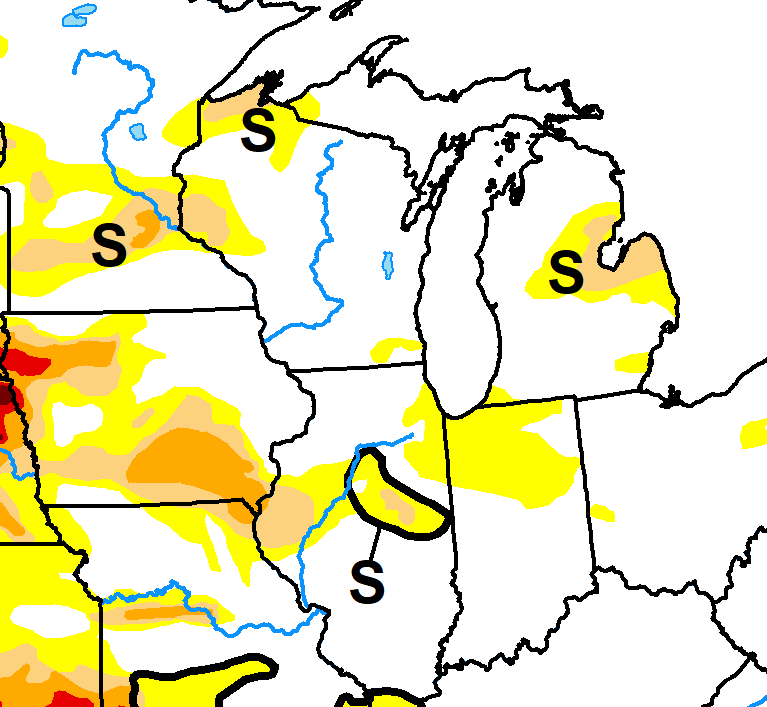
Although drought is incipient over several areas in the sub, the predicted cutoff ULL this weekend/next week should do some damage to that map for some areas.
-
2 hours ago, Chambana said:
December has been crap? Who says


Imagine what the anomalies would be if you break out 2011-'21 and compare them to only the 1991-2010 average.
-
I shouldn't have any travel issues since the northern edge of the path of totality is 3 miles southeast of my house.
-
1
-
 1
1
-
-
Quite the flip in temps being progged mid-month.


-
1
-
-
4 hours ago, bowtie` said:
This past weekend was supposed to be a wet one in the area. Pops in the 60% or higher and precipitable water in the one inch range. While a few areas got that, in my backyard only recorded 0.01" of rain holding true to the summer trend. I really need some water here.
5 hours ago, Hoosier said:We could use some rain.
Same. Three days in a row with a T on my precipitation report.
-
If you're planning on traveling for the eclipse in 2024, you better book now as campgrounds and hotels in Ohio are already taking reservations.
-
1
-
-
It may be a crappy weekend, but it has been great for the past month with mild temps and low humidity dominating and only sporadic bouts of precip.
-
50 minutes ago, cyclone77 said:
Silver maple?
More than likely. Our county had widespread tree damage with some nice 55-60 mph winds. Although I see it often, I'm always surprised at how most trees can bend and not break in 60 mph winds.
-
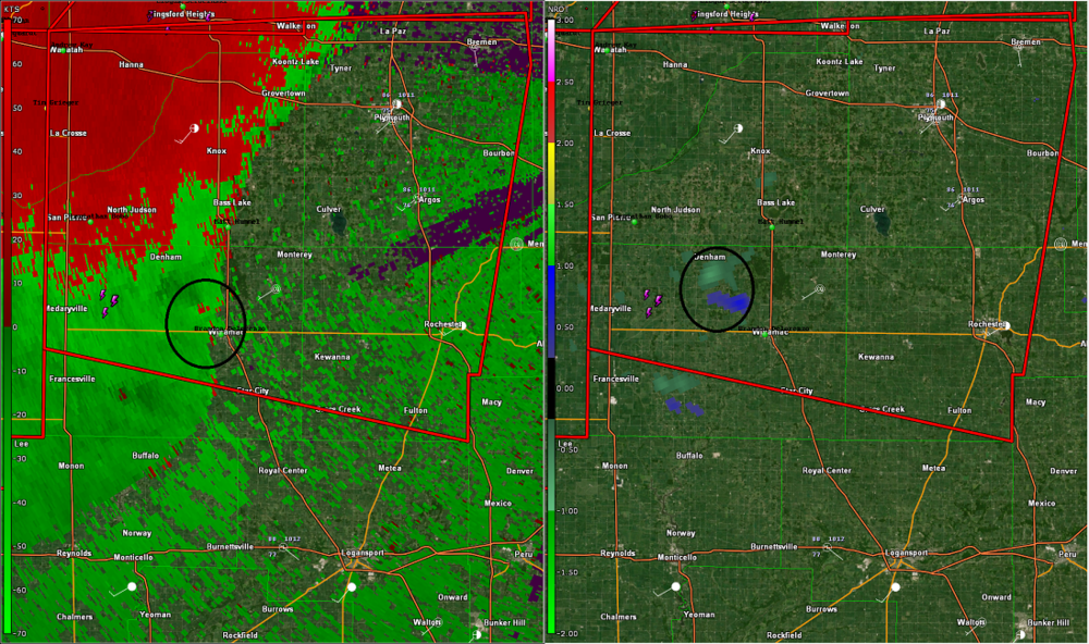
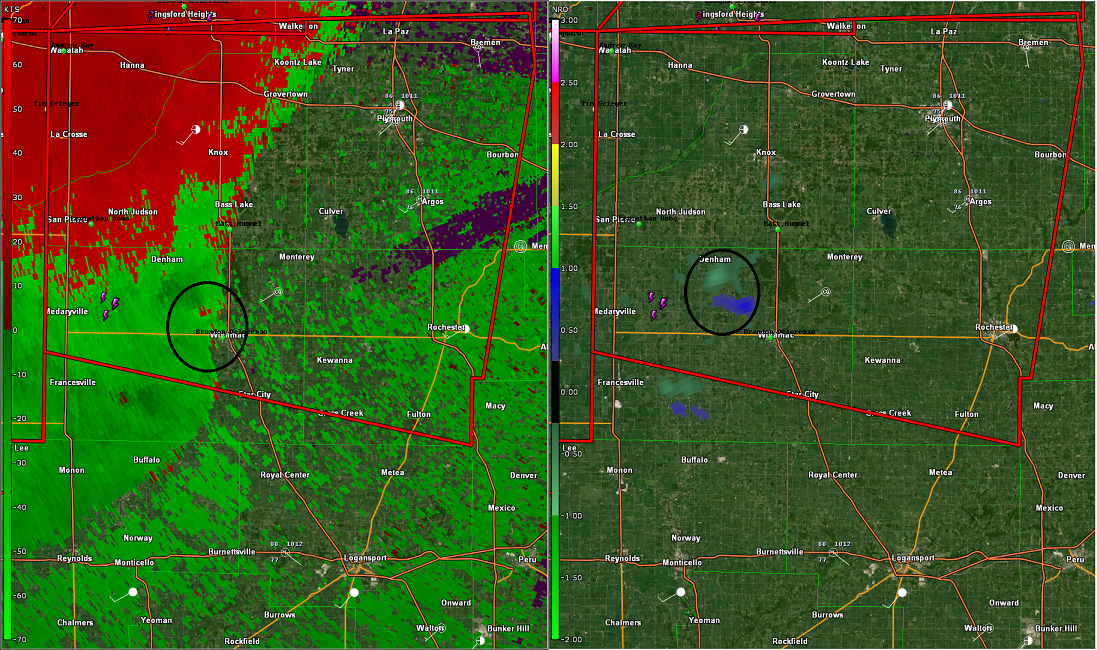
Embedded spinup?
-
2
-
-
4 hours ago, luckyweather said:
Currently snowing with light accumulations in the Rockies west of Denver.

https://www.cotrip.org/camera/597/@-105.80914,39.76082,13?show=normalCameras,roadWork,winterDriving,roadReports,weatherWarningsI have Facebook friend who lives in the area and has been posting pics of the snow. I'm just not quite ready for that yet.
-
Had a landspout touchdown in East Central IN yesterday afternoon.
021
NOUS43 KIND 210010
PNSIND
INZ021-028>031-035>049-051>057-060>065-067>072-210815-

PUBLIC INFORMATION STATEMENT
NATIONAL WEATHER SERVICE INDIANAPOLIS IN
810 PM EDT SAT AUG 20 2022


...NWS DAMAGE SURVEY FOR 08/20/22 TORNADO EVENT #1...

...TORNADO #1...

RATING:                 EF0
ESTIMATED PEAK WIND:    70 MPH
PATH LENGTH /STATUTE/:  0.0559 MILES
PATH WIDTH /MAXIMUM/:   20.0 YARDS
FATALITIES:             0
INJURIES:               0

START DATE:             08/20/2022
START TIME:             03:29 PM EDT
START LOCATION:         3 NNW WINCHESTER / RANDOLPH COUNTY / IN
START LAT/LON:          40.2224 / -84.9967

END DATE:               08/20/2022
END TIME:               03:31 PM EDT
END LOCATION:           3 NNW WINCHESTER / RANDOLPH COUNTY / IN
END LAT/LON:            40.2231 / -84.9961

SURVEY SUMMARY:
A LANDSPOUT TORNADO BRIEFLY TOUCHED DOWN NORTH OF WINCHESTER.
WHILE ON THE GROUND, THE TORNADO CAME IN CONTACT WITH AN OLD
OUTBUILDING, DAMAGING THE MEDAL ENCASING AND THE ROOF STRUCTURE.
PARTS OF THE ROOF WERE THROWN DOWNWIND, WITH A FEW 2'X 4' BOARDS
SCATTERED BETWEEN THE ROOF AND THE BUILDING. THE TORNADO LIFTED
SHORTLY AFTERWARDS WITH NO FURTHER DAMAGE.
-
Yep, after this weekend's rains, we return to mild and dry weather. I feel like I've moved to San Diego.
October 2022 General Discussion
in Lakes/Ohio Valley
Posted
Of course '89 is the gold standard for October snow in IN. An Indy TV station just highlighted it a couple of days ago. Interestingly, they have as their 2nd largest Oct. snow as 1993. I do not remember that event, and the others are from the dark ages.