

IWXwx
-
Posts
6,436 -
Joined
-
Last visited
Content Type
Profiles
Blogs
Forums
American Weather
Media Demo
Store
Gallery
Posts posted by IWXwx
-
-
Almost as much as my composite total for the past three years (87.1").
-
It has been snowing/mood flakes almost constantly for two straight days now here. Just enough for everything to stay white and feels like mid-winter. Looking forward to rain and 55 on Christmas.
-
 3
3
-
-
24 minutes ago, A-L-E-K said:
sitting in buf watching a miss just south would be brutal
BuffaloWeather in Hamburg is getting destroyed
-
The NFL is ruining the excitement by moving the Bills game to Detroit. They may not have had a lot fans in the stands, but the ratings would have been crazy. Of course, all of that was based on the Browns making it there.
-
1 hour ago, Baum said:
i missed this.
I was anxious to see his final call, but he already made it...rainer.
-
1 hour ago, cyclone77 said:
Bills have home game Sun. Could be a fun one.
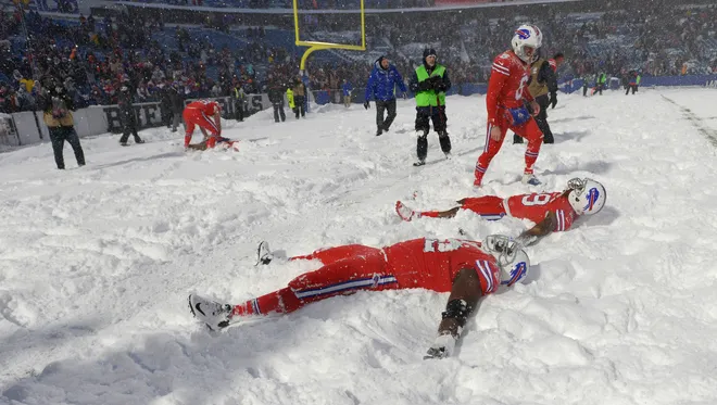
Shades of the 2017 Bills-Colts Snow Bowl game.
-
 2
2
-
-
9 minutes ago, sbnwx85 said:
I haven’t been out much today but haven’t seen anything fall from the sky or any accumulation. Might be a virga storm here. Awaiting the lake effect tomorrow.
Same here. Have had radar returns all day, but haven't seen a flake/drop. Dry air munch.
-
34 minutes ago, BeauDodson said:
Is this the correct thread for the Buffalo area?
Thanks
Welcome back Beau. Kinda looks apocalyptic out there. Measurin' in feet. Poster BuffaloWeather is in Hamburg, which looks to be ground zero for 4-5 feet.
-
3 hours ago, sbnwx85 said:
Will post this information here since it’s really outside the dates of the event thread ongoing. IWX is all in on a relatively widespread lake effect event in Michiana. Potential for a foot or more in some places.
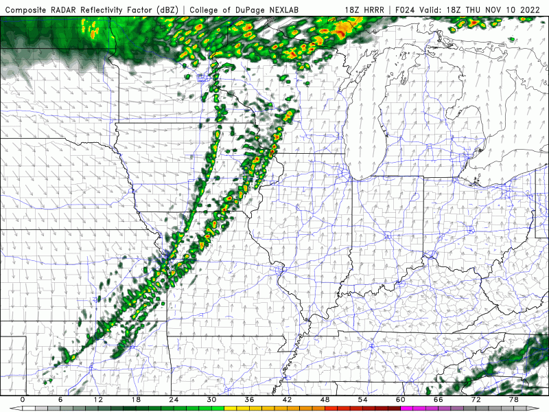
LONG TERM...(Wednesday through Sunday)
Issued at 212 PM EST Mon Nov 14 2022

Elongating/sharpening upper trough through the wrn lakes of sig
concern this period. 12Z guidance a bit stronger/deeper aloft and
dig primary nrn stream wave through srn IL/IN late Wed. While lake
based thermal trough not as strong as was seen Sat, favorable long
axis fetch combined with good synoptic moisture plume will enhance
otherwise strongly forced focused single band during the day/evening
Wed over nw IN initially before backing into sw MI Wed night. Strong
multi-model consensus here lends confidence of sig, heavy snow
accums and no doubt impactful. However subtle differences on exact
placement/duration differ substantially enough to hold for another
model cycle before notching certain headlines. Nevertheless would
expect a fairly sizable swath of >6 inches northwest of a Knox-
Plymouth-Goshen-Sturgis line and potential for a foot or more in the
typical snowbelt from nrn Laporte/St Joe north through Cass/Berrien
by Thu aftn.

Elsewhere numerous snow showers expected far west early Wed,
spreading east and south through Wed night before activity shifts
north into lower MI as upper trough swings through. Accums outside
lakeband influence though will remain limited, generally 1-2 inches.
Todd Holston's discussions are usually...let's just say they're succinct. For him to write more than a couple of sentences says that he's pretty bullish.
-
1
-
-
I don't know what would be worse for him, CAD and or a warmer by the lake 33 and rain.
-
My 2.2" yesterday was on .22" of precip, so exactly 10:1
-
1
-
-
5 hours ago, OHweather said:
Nov 10, 2002...Veteran's Day tornado outbreak. One of my first actual solid wx memories where I remember what I was doing that day, remember coverage of the event and some meteorological details, etc...an F2 tornado went through my town and missed my house by 100 yards. Probably the closest I'll ever be to a tornado (knock on wood)
I caught the very first tornado that day, an F-1 in Hartford City, IN. The same supercell that later dropped the Van Wert F-4.
I was too up close and personal with it as it passed a couple hundred yards in front of me before smacking the Marsh grocery store. That kept me from chasing it, because I had to stop to check on injuries at the store. Otherwise, I probably would have chased it into Ohio. It also put down 2 more short-lived tornadoes (Wells and Adams Co.) before dropping big one.

-
2
-
-
Blizzard of '78...hands down
-
2
-
-
Still snowing, but not accumulating. Finished with 2.2"
-
1
-
-
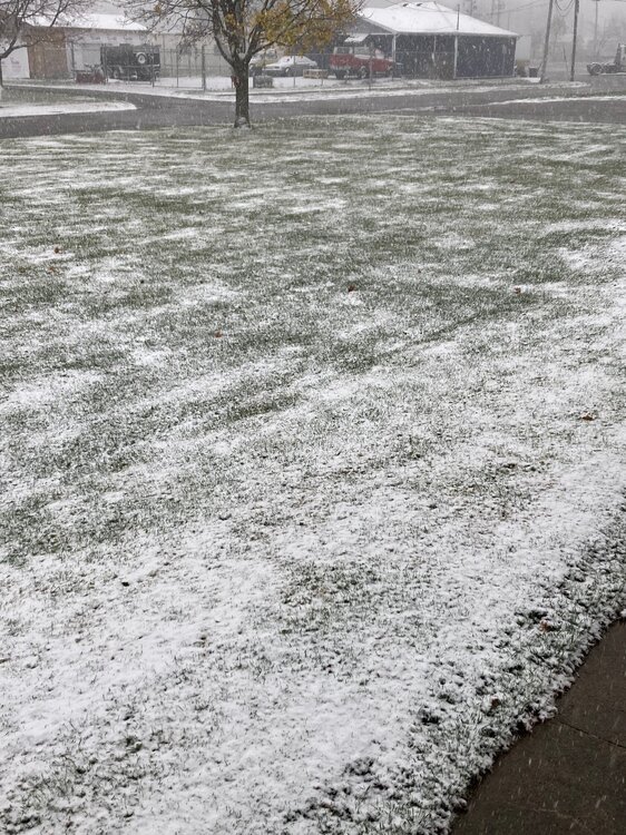
2" and still falling.
-
6
-
-
A nice way to begin winter, waking up and looking at the HHHR. Made me check current obs and saw that stuff to the southwest heading this way. Sitting under that f-gen band and accumulating here now. Surprise!!
-
8
-
-
5 hours ago, Hoosier said:
Rain along/behind the cold front just goes poof
The tropical system remnants have really trended west. I even get a graze job.
-
2
-
-
Bold
-
1
-
3
-
-
47 minutes ago, cyclone77 said:
Picked up 0.05 from yesterday's light showers, so we'll finish Oct with 1.67" and T of snow.
You beat me. We had a T of snow and 1.63".
-
1
-
-
4 hours ago, Hoosier said:
Some 80 degree readings into western IL, which is even a little warmer than the warm guidance like the HRRR.
These early/late season airmasses seem to have a way of overperforming, especially when it's dry.
As dry as it is, forecasters would be wise to lean toward the higher end of guidance for highs.
-
23 hours ago, Hoosier said:
Maybe we can get some good fires this weekend.

Well, that escalated quickly.
-
9 minutes ago, sbnwx85 said:
Lock it in.
 mode.
mode.
We even get in on some that action down here. Time to start a new sig
-
2 hours ago, Hoosier said:
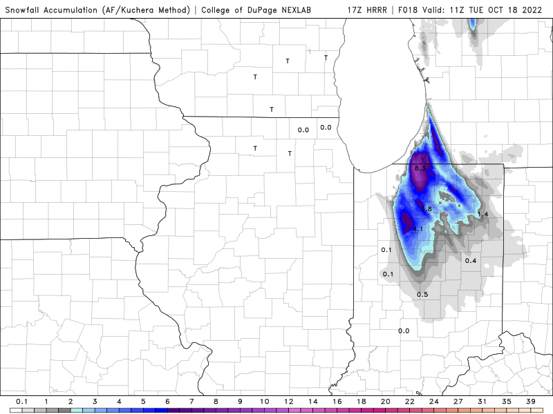
As far as snow chances, not saying there will be no negative marine influence for South Bend, but I would think they are far enough inland to not get completely skunked like the areas near the IN/southwest MI shore probably will. So I dug into October snowfall climo for SBN.
There have been exactly 2 years that produced an inch or more of snow on October 18 or earlier -- 1.5" on 10/18/1972 and an incredible 13.0" on 10/10-11/1906, which appears to have been a lake effect event (in case anyone is wondering, the storm in 1989 happened just after the 18th).
I found an alleged 1.0" snowfall in September 1994, but this appears to me to be erroneous as the lowest temp that day was 41. Maybe it was hail or something? Anyway, this was disregarded.
So, if they can somehow manage to get an inch, it would be pretty significant. Really anything measurable at all would be noteworthy for this part of October.
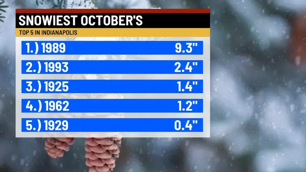
Of course '89 is the gold standard for October snow in IN. An Indy TV station just highlighted it a couple of days ago. Interestingly, they have as their 2nd largest Oct. snow as 1993. I do not remember that event, and the others are from the dark ages.
-
2 hours ago, Hoosier said:
I think we will definitely see snow in the sub early next week, and outside of the UP/northern tier.
Which reminds me, where is Bo? I'm sure that he has seen flakes already.


Winter 2022/23 Lake Effect Snow Thread
in Lakes/Ohio Valley
Posted
Watch it. That might get the old "fake snow" debate started again. RIP
RIP
Congrats on getting a rare Lake enhanced/LES that packed a punch.