

IWXwx
-
Posts
6,441 -
Joined
-
Last visited
Content Type
Profiles
Blogs
Forums
American Weather
Media Demo
Store
Gallery
Posts posted by IWXwx
-
-
Had a landspout touchdown in East Central IN yesterday afternoon.
021
NOUS43 KIND 210010
PNSIND
INZ021-028>031-035>049-051>057-060>065-067>072-210815-

PUBLIC INFORMATION STATEMENT
NATIONAL WEATHER SERVICE INDIANAPOLIS IN
810 PM EDT SAT AUG 20 2022


...NWS DAMAGE SURVEY FOR 08/20/22 TORNADO EVENT #1...

...TORNADO #1...

RATING:                 EF0
ESTIMATED PEAK WIND:    70 MPH
PATH LENGTH /STATUTE/:  0.0559 MILES
PATH WIDTH /MAXIMUM/:   20.0 YARDS
FATALITIES:             0
INJURIES:               0

START DATE:             08/20/2022
START TIME:             03:29 PM EDT
START LOCATION:         3 NNW WINCHESTER / RANDOLPH COUNTY / IN
START LAT/LON:          40.2224 / -84.9967

END DATE:               08/20/2022
END TIME:               03:31 PM EDT
END LOCATION:           3 NNW WINCHESTER / RANDOLPH COUNTY / IN
END LAT/LON:            40.2231 / -84.9961

SURVEY SUMMARY:
A LANDSPOUT TORNADO BRIEFLY TOUCHED DOWN NORTH OF WINCHESTER.
WHILE ON THE GROUND, THE TORNADO CAME IN CONTACT WITH AN OLD
OUTBUILDING, DAMAGING THE MEDAL ENCASING AND THE ROOF STRUCTURE.
PARTS OF THE ROOF WERE THROWN DOWNWIND, WITH A FEW 2'X 4' BOARDS
SCATTERED BETWEEN THE ROOF AND THE BUILDING. THE TORNADO LIFTED
SHORTLY AFTERWARDS WITH NO FURTHER DAMAGE.
-
Yep, after this weekend's rains, we return to mild and dry weather. I feel like I've moved to San Diego.
-
This model is depicting a face-melting torch for much of the subforum.....or at least one day that hits 125°.
-
IWX's entire short term discussion this afternoon lol
.SHORT TERM...(Tonight and Friday)
Issued at 308 PM EDT Thu Aug 11 2022

Quiet/benign wx this period as high pressure builds across the Great
Lakes.
-
1 hour ago, WaryWarren said:

No kiddin'
-
-
Well, nothing like a tornado warning at 5:48 AM with rotation bearing down on LOT's office.
-
 3
3
-
-
-
I picked up 0.71" of light to moderate rain that began yesterday afternoon and continued off and on through this morning, just what the agriculturist ordered, but now time to break out the mower.
The HRRR paints a dollop of 2" amounts over a few counties in North Central IN in the next 24 hours, which combined with last night's rain would fend off an increase in drought conditions, at least locally.
-
2
-
-
I haven't had it as far as I know. Been vaxxed and both boosters. And yes, it's still out there and being passed around at a pretty good rate.
-
....but the really bad news

-
...It still looks plenty warm, even if we are not sitting directly under the ridge axis

-
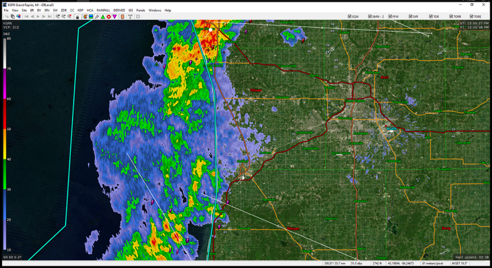
Looks like the better returns are going to do the splitsville on GRR. Frostfern Special.
-
 1
1
-
-
FWAland doing some drought busting
...ALLEN COUNTY...
FORT WAYNE 8.0 N             9.18 IN   0800 AM 07/06   41.19N/85.11W
3 E WALLEN                   8.85 IN   0850 AM 07/06   41.17N/85.11W
FORT WAYNE 6.0 N             8.58 IN   0645 AM 07/06   41.16N/85.13W
2 SSE ARI                    8.50 IN   0535 AM 07/06   41.24N/85.24W
FORT WAYNE 9.0 NNE           7.91 IN   0937 AM 07/06   41.19N/85.07W
WALLEN                       6.95 IN   0637 AM 07/06   41.16N/85.17W
ARCOLA                       6.40 IN   0648 AM 07/06   41.10N/85.29W
FORT WAYNE 4.1 NE            6.09 IN   0700 AM 07/06   41.12N/85.09W
FORT WAYNE 9.1 SE            5.82 IN   0700 AM 07/06   40.99N/85.00W
FORT WAYNE 1.6 S             5.62 IN   0800 AM 07/06   41.05N/85.14W
1 N LEO-CEDARVILLE           5.50 IN   0600 AM 07/06   41.23N/85.02W
FORT WAYNE 2.6 NE            5.40 IN   0700 AM 07/06   41.10N/85.11W
WOODBURN 2.6 NNW             5.31 IN   0900 AM 07/06   41.16N/84.88W
ELLISVILLE                   4.91 IN   0730 AM 07/06   41.02N/85.29W
FORT WAYNE 7.1 WSW           4.46 IN   0930 AM 07/06   41.05N/85.27W
FORT WAYNE 9.3 W             4.08 IN   0700 AM 07/06   41.05N/85.31W
WOODBURN                     4.05 IN   0430 AM 07/06   41.14N/84.86W
HOAGLAND 1.5 SSW             3.92 IN   0711 AM 07/06   40.93N/85.00W
MONROEVILLE                  3.68 IN   0700 AM 07/06   40.97N/84.86W
HARLAN 2.2 ENE               3.30 IN   0753 AM 07/06   41.20N/84.88W
HARLAN 3.4 NE                3.26 IN   0930 AM 07/06   41.23N/84.87W
FORT WAYNE 9.0 NNE           3.18 IN   0937 AM 07/06   41.19N/85.07W
FORT WAYNE 7.6 SE            3.00 IN   0700 AM 07/06   41.01N/85.02W
FORT WAYNE INTERNATIONAL AP  2.93 IN   0354 AM 07/06   40.98N/85.18W
FORT WAYNE 7.5 NNW           2.77 IN   0800 AM 07/06   41.17N/85.21W
-
 1
1
-
-
1 minute ago, Hoosier said:
I went back and looked at this morning's forecast, and it was only low 90s. Potential was there to overachieve though (based on HRRR, etc).
Yeah, there were lots of questions concerning this morning's storm track and accompanying clouds clearing out. Even though the FWA area had 5-6" rains this morning, they have quickly shot up to 88°
-
14 minutes ago, zinski1990 said:
Its 99 at my place now. Also it hasn't rained in my location at all since June 13th
That's probably soon to change. Let's play find the boundary.
-
1
-
-
41 minutes ago, Hoosier said:
Up to 97 at IND, which is the warmest temp there since 2012.
99° now
-
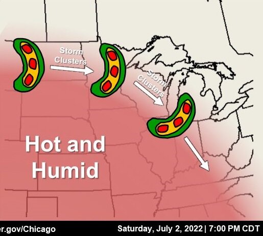
Speaking of LOT, I have to share the graphic they posted on their Facebook page tonight. Of course, the replies are peppered with comments about being attacked by boomerang pizzas and jalapeno poppers.
-
1
-
1
-
-
The radar looks like heavy rain may be more widespread than the cams were predicting.
-
Had a noisy storm roll through around 3-4 AM. Although it woke me, it was music too my ears. I actually got up and watched it for a few minutes. Unfortunately, it only dropped four tenths, which is not enough to be a drought buster, but at least I won't have to water my garden for a couple of days.
-
2
-
-
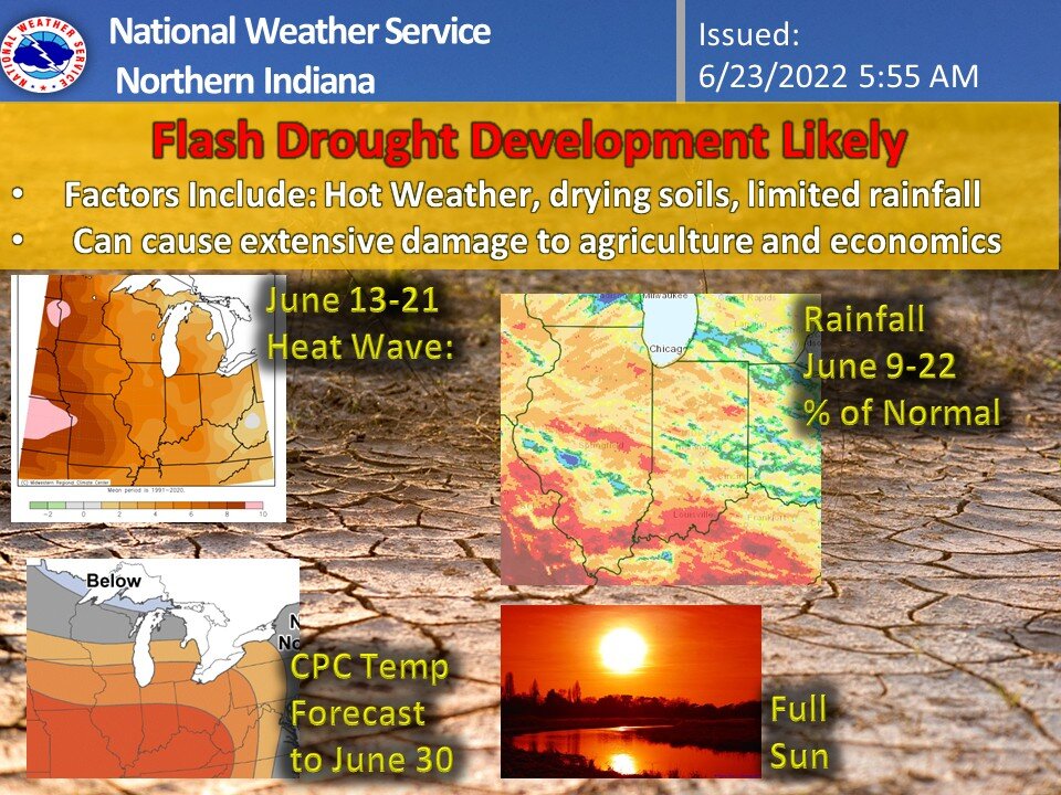
IWX is jumping on the bandwagon. I honestly haven't heard of a "flash drought" until this year.
-
Widespread damage throughout the county north of me (Whitley) and the southern part of Ft. Wayne/Allen Co.
FWA rainfall - 2.03" My place 20 miles SW of FWA 0.01"
Also, this is just west of Fort Wayne:
PRELIMINARY LOCAL STORM REPORT NATIONAL WEATHER SERVICE NORTHERN INDIANA 1101 AM EDT TUE JUN 14 2022 ..TIME... ...EVENT... ...CITY LOCATION... ...LAT.LON... ..DATE... ....MAG.... ..COUNTY LOCATION..ST.. ...SOURCE.... ..REMARKS.. 1018 PM TSTM WND DMG 3 ESE ARCOLA 41.09N 85.24W 06/13/2022 ALLEN IN NWS EMPLOYEE TRAIN BLOWN OFF THE TRACKS NEAR BASS ROAD. TIME ESTIMATED FROM RADAR. -
SPC has officially declared the storm a derecho.
-
3 hours ago, A-L-E-K said:
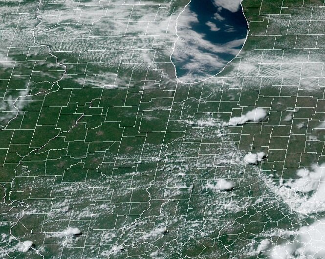
Cool and cloudy doa here
-
1
-
4
-

Spring/Summer 2022 Complaint/Banter Hangout
in Lakes/Ohio Valley
Posted
I have Facebook friend who lives in the area and has been posting pics of the snow. I'm just not quite ready for that yet.