mitchnick
-
Posts
28,569 -
Joined
Content Type
Profiles
Blogs
Forums
American Weather
Media Demo
Store
Gallery
Everything posted by mitchnick
-
Feb 22nd/23rd "There's no way..." Obs Thread
mitchnick replied to Maestrobjwa's topic in Mid Atlantic
12z Euro reflects your/our concerns. -
Feb 22nd/23rd "There's no way..." Obs Thread
mitchnick replied to Maestrobjwa's topic in Mid Atlantic
Just going to post that it's starting to pivot. https://weather.cod.edu/satrad/nexrad/?parms=LWX-N0B-1-24-100-usa-rad -
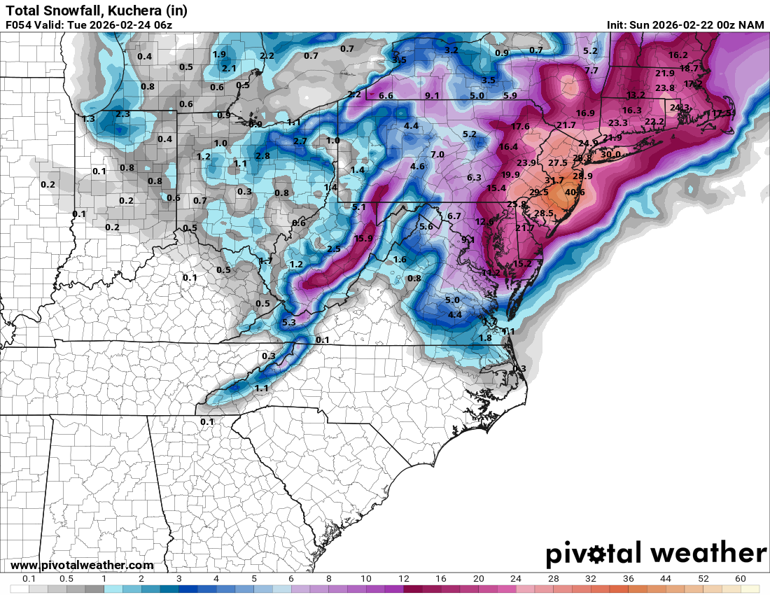
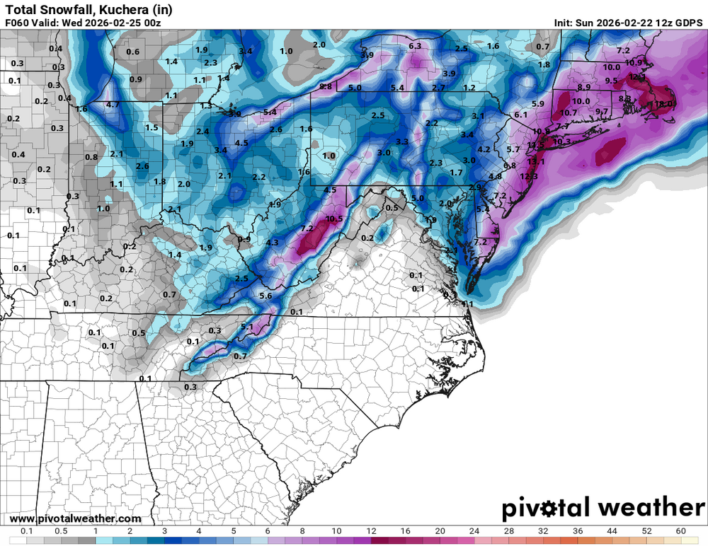
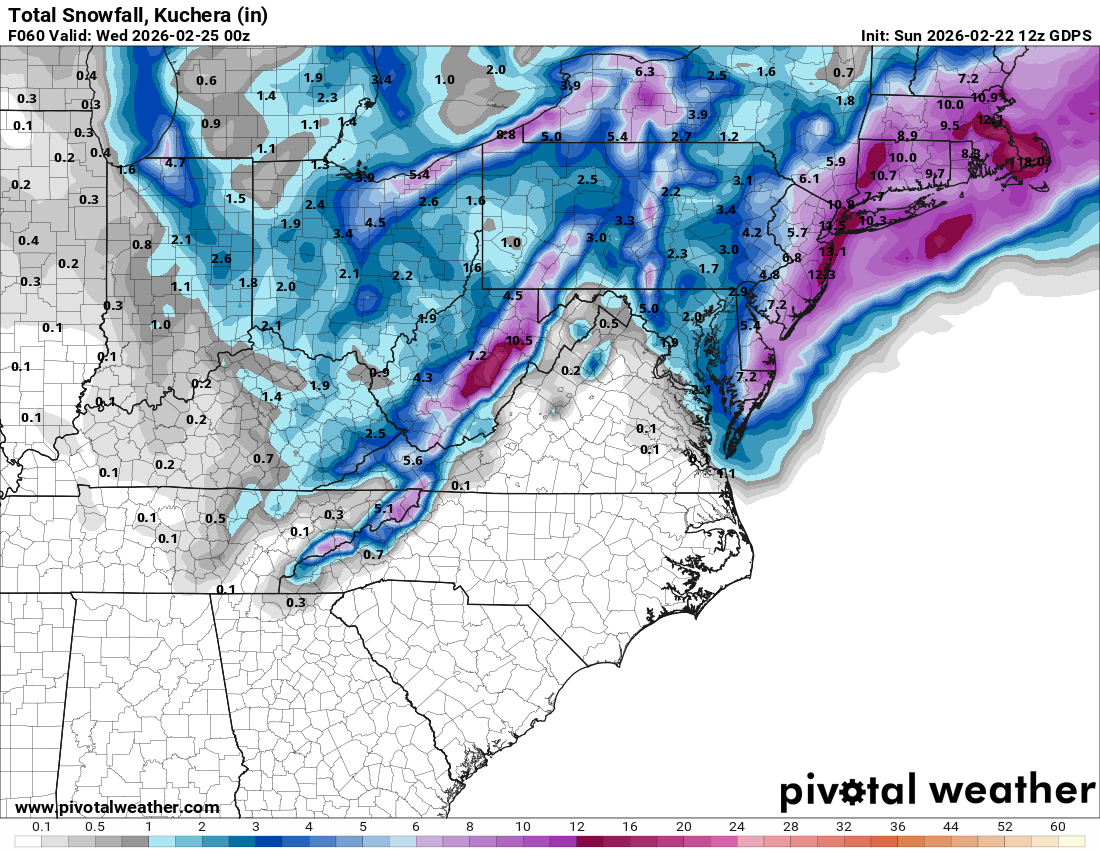
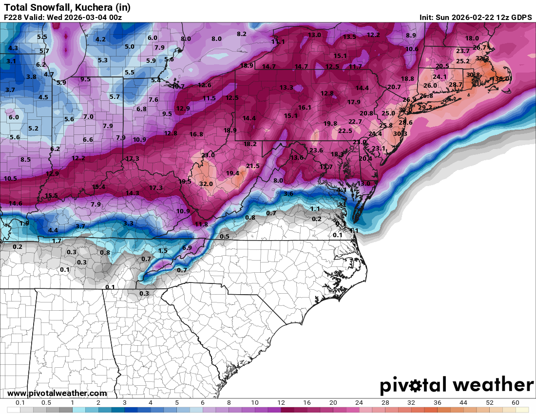
The Canadian never was big on today's threat and it's 12z forecast is attached up top, which could be closer to the truth than other models, time will tell. But I'm willing to accept it's forecast for today if its forecast for next week comes true resulting in the combined total snowfall of the 2nd map. Anybody with me? P.s. It's a multi-day event starting next Monday. https://www.pivotalweather.com/model.php?m=gdps&p=prateptype-imp&rh=2026022212&fh=192&r=us_ma&dpdt=&mc=&pwplus=1

-
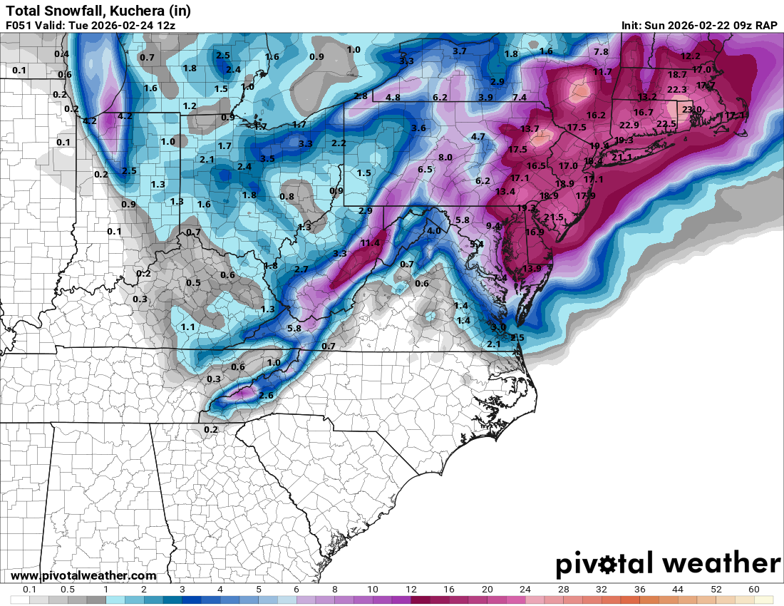
Icon has event in 5 days for northern crew.
-
Feb 22nd/23rd "There's no way..." Obs Thread
mitchnick replied to Maestrobjwa's topic in Mid Atlantic
Really rate dependent at this point outside of higher elevations. That should change by noon-1, hopefully sooner. -
Feb 22nd/23rd "There's no way..." Obs Thread
mitchnick replied to Maestrobjwa's topic in Mid Atlantic
I would be too, but who knows if it will. -
Feb 22nd/23rd "There's no way..." Obs Thread
mitchnick replied to Maestrobjwa's topic in Mid Atlantic
Me too. The latest long range (God help us) Rap has been fairly consistent along these lines.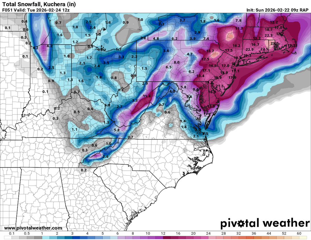
-
Feb 22nd/23rd "There's no way..." Obs Thread
mitchnick replied to Maestrobjwa's topic in Mid Atlantic
That's an excellent one. If you want one a little more basic, try this one. The top map can be zoomed into different sectors. https://cyclonicwx.com/sat/#radar -
Feb 22nd/23rd "There's no way..." Obs Thread
mitchnick replied to Maestrobjwa's topic in Mid Atlantic
Just go to Salisbury. They're under a blizzard warning too. Rt 50 will be cleared first. -
Feb 22nd/23rd "There's no way..." Obs Thread
mitchnick replied to Maestrobjwa's topic in Mid Atlantic
Steady light, but not yet accumulating, snow -
Feb 22nd/23rd "There's no way..." Obs Thread
mitchnick replied to Maestrobjwa's topic in Mid Atlantic
You're next. -
Feb 22nd/23rd "There's no way..." Obs Thread
mitchnick replied to Maestrobjwa's topic in Mid Atlantic
The traffic cam at Rt 15 and St. Anthony's road in Emmitsburg showed mixing when I looked 10 minutes ago. -
Feb 22nd/23rd "There's no way..." Obs Thread
mitchnick replied to Maestrobjwa's topic in Mid Atlantic
Idk, I am all snow now. 35 per close Wunderground station. -
We may have one or 2 more shots/threats looking at this Euro 6z 144hr 500mb anomaly map so long as that cold pool in Canada can push far enough south. Decent blocking over the Pole.
.thumb.png.472304e5af960de1386f582e89763726.png)
-
Feb 22nd/23rd "There's no way..." Obs Thread
mitchnick replied to Maestrobjwa's topic in Mid Atlantic
You should be seeing the random flakes that have become not so random anymore. -
Feb 22nd/23rd "There's no way..." Obs Thread
mitchnick replied to Maestrobjwa's topic in Mid Atlantic
Just starting to get thick raindrops and the first wet, random snowflake or two. Visibility in the distance is dropping too. -
Feb 22nd/23rd "There's no way..." Obs Thread
mitchnick replied to Maestrobjwa's topic in Mid Atlantic
Lol. You just can't stop can you? What is wrong with you? The 2 major metro areas, Baltimore and DC, went from 12.9" to 8.3" and 9.1" to 6.7" respectively. That's not cherry picking. -
Feb 22nd/23rd "There's no way..." Obs Thread
mitchnick replied to Maestrobjwa's topic in Mid Atlantic
Moron, Pivotal maps are different and I said "some places COMPARED TO 0Z." Why have you become the belligerent jerk? You act like a hungry, tired child. Grow up.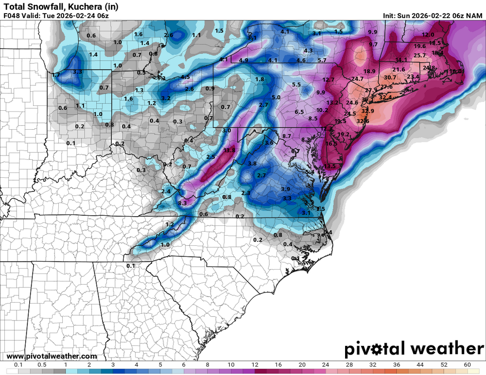

-
Feb 22nd/23rd "There's no way..." Obs Thread
mitchnick replied to Maestrobjwa's topic in Mid Atlantic
6z Nams looked better at first, but the slp moves out a little faster so accumulations are reduced from 0z in many places. Always something. -
Feb 22nd/23rd "There's no way..." Obs Thread
mitchnick replied to Maestrobjwa's topic in Mid Atlantic
6z Nam atv7pm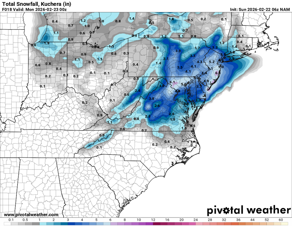
-
Feb 22nd/23rd "There's no way..." Obs Thread
mitchnick replied to Maestrobjwa's topic in Mid Atlantic
6z Nam twins aggressive with getting all snow in by 10-11am. -
Feb 22nd/23rd "There's no way..." Obs Thread
mitchnick replied to Maestrobjwa's topic in Mid Atlantic
I woke up at 2 and have been waiting to see precip type, but all virga in Hanover, PA so far. Not so sure I start as snow, in fact, I doubt it. -
Feb 22nd/23rd "There's no way..." Obs Thread
mitchnick replied to Maestrobjwa's topic in Mid Atlantic
Hopefully, but by the time the precip moves in there will be a lot of mixing and you have a warm air inversion in place that often, but not always, screws things up. As a result, temps rise and the model's forecast of 38 wins. -
Feb 22nd/23rd "There's no way..." Obs Thread
mitchnick replied to Maestrobjwa's topic in Mid Atlantic
You're the only one that can't spell. -
Feb 22nd/23rd "There's no way..." Obs Thread
mitchnick replied to Maestrobjwa's topic in Mid Atlantic
0z FV3 stinks for everyone compared to Nams and Hrrr


.png.f24dcdc96ddc2ba9cc5b2ee837758a63.png)