madwx
-
Posts
2,362 -
Joined
-
Last visited
Content Type
Profiles
Blogs
Forums
American Weather
Media Demo
Store
Gallery
Everything posted by madwx
-
Got down to 40 here this morning with patchy fog
-
NSIDC extent at 4.28 and area at 2.63 with some time to drop more, especially extent. Definitely have had some excitement to end the melting season
-

-
Family member took this in the NW corner of Dane County
-
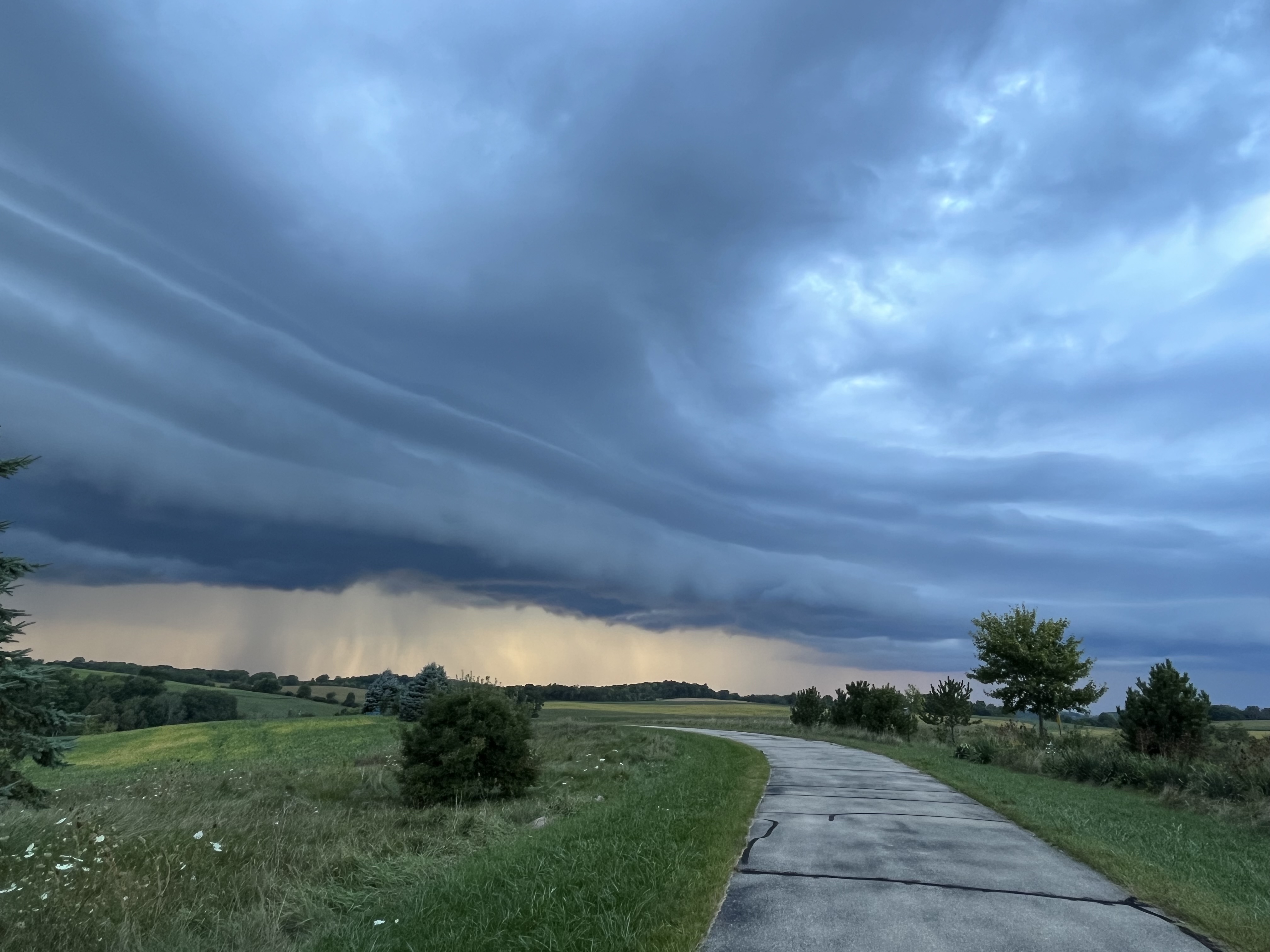
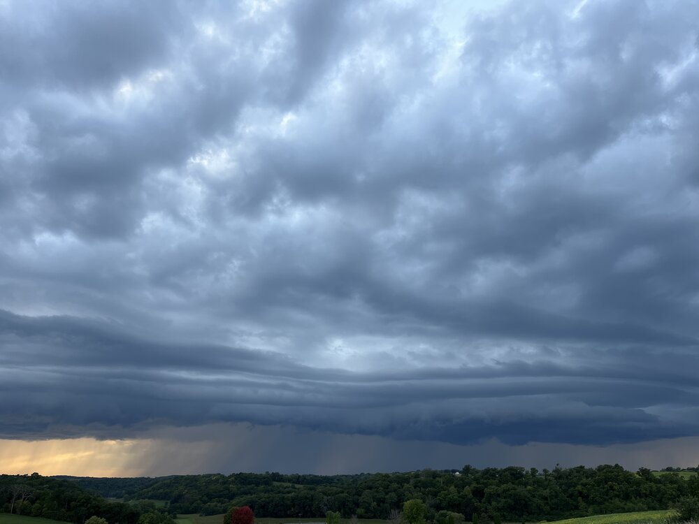
Had some pea sized hail with the initial round of storms. Nice line forming to our west and about to roll through now
-
Long range looking more active after the next 10 days
-
looks like we have the beginnings of an eye. also looks to be deviating a bit right of projected track
-
you had a few HRs in the past month but looks like you'll go down swinging this time.
-
Only got a few sprinkles last night. Hoping for a bit from some wrap around showers today. Otherwise drier air should be filtering in today, dews still in the upper 60s this morning
-
record of 94 today at MSN. beat the old record by 2 degrees.
-
is Baraga Plains the Peter Sinks of the UP?
-
already rocking 88/80/103 here. running a bit ahead of yesterday and the frontal boundary is hanging up about 3 counties to our north
-
Heat index hanging at 105 approaching 9PM
-
Heck yeah
-
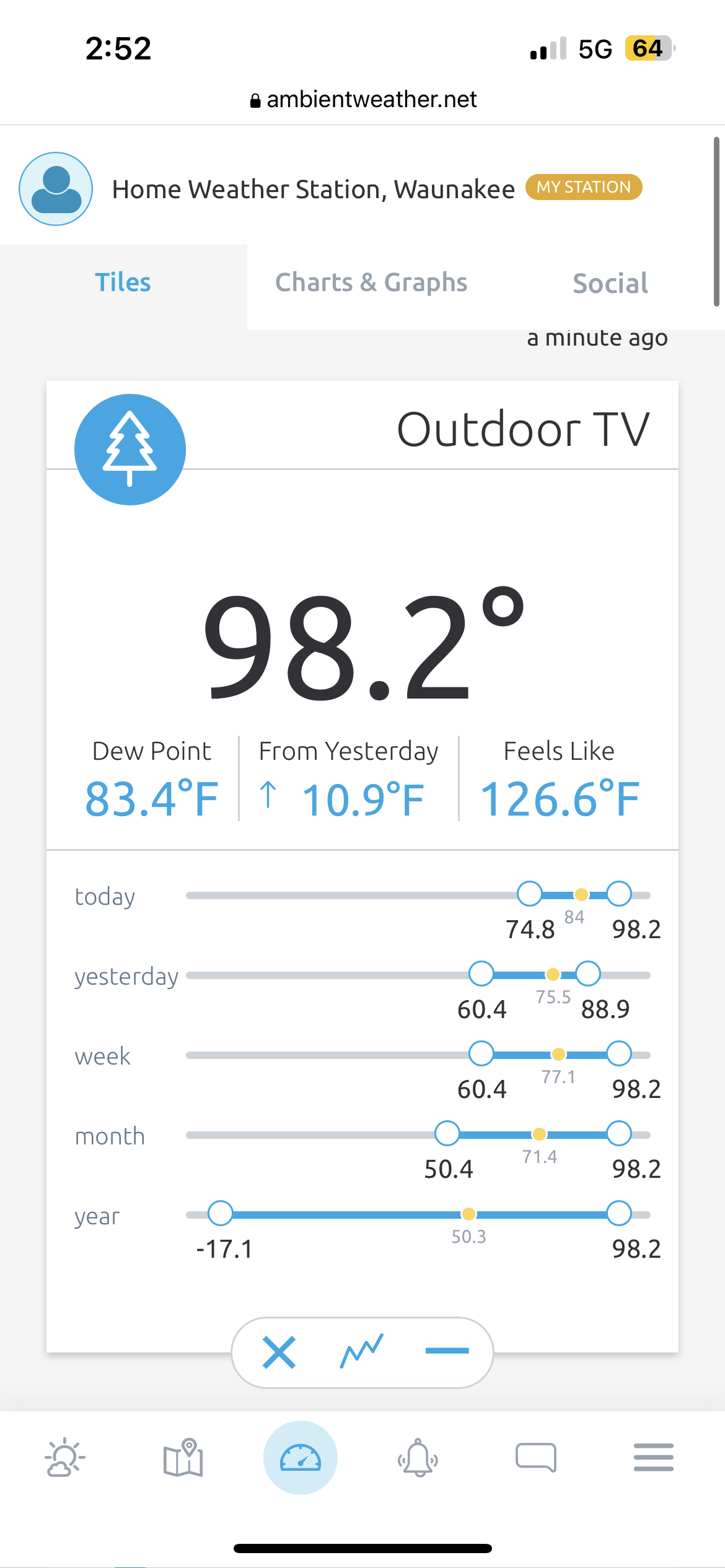
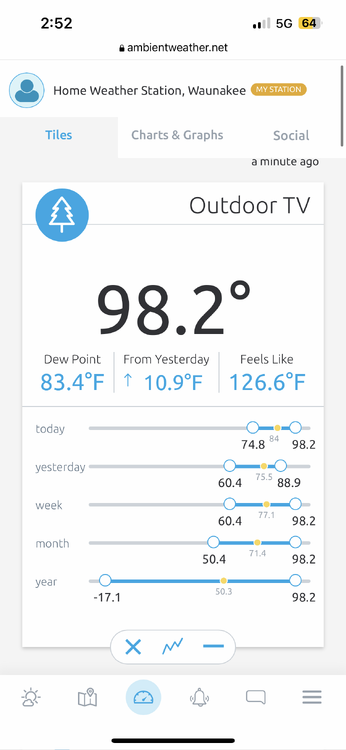
97/83/123
-
94/81/115 at my house right now
-
Only got down to 78 overnight. Today is our shot at hitting 100 IIRC the old benchmark was hitting 90 by 10 AM to be on pace for 100
-
The last Excessive Heat Watch for us was July 21-22, 2016 but that was only for 31 hours. July 17-20, 2011 we were under an EH Watch for 81 hours that was the last one longer than this. Those have been our only two in the past 15 years.
-
Finished with 3.07”. All the rain was done before noon, avoiding any major flood issues
-
up to 2.63" with heavy rain still ongoing. flood advisory put up for Dane County
-
1.25” already at my house. Flood watch seems well warranted
-

2023 Short/Medium Range Severe Weather Discussion
madwx replied to Chicago Storm's topic in Lakes/Ohio Valley
Reeling it in -
Japanese beetles are the worst, can't think of any other pest that can ruin a garden so thoroughly.
-
Estimating winds of about 60 mph here. Small branches and lots of leaves here. First crazy lightning show of the summer. Going to have about 1.4” inches when it’s all said and done. Can tell we’re coming out of the drought. Low spots in my backyard have standing water
-
out of all the MD ever written, that has to be top 10 in terms of mailing it in