madwx
-
Posts
2,362 -
Joined
-
Last visited
Content Type
Profiles
Blogs
Forums
American Weather
Media Demo
Store
Gallery
Everything posted by madwx
-
overperforming again today, up to the mid 50s. when as recently as yesterday it looked like we'd struggle to hit 50. Maybe a rumble of thunder Thursday evening
-
frost/freeze likely tonight, then it's up up and away from here
-
temps actually overperforming today. Was expected to stay in the low 40s but up to 48 already after the rain cleared out. Hope this bodes well for some 50s tomorrow.
-
Heard some sleet roll through around 5 AM. Otherwise it’s been all rain so far. Doubt we’ll escape this without some flakes
-
got down to 26 last night, 1 away from the record low. the rest of this week and weekend will have lows above freezing but it remains to be seen how cool it will get early next week
-
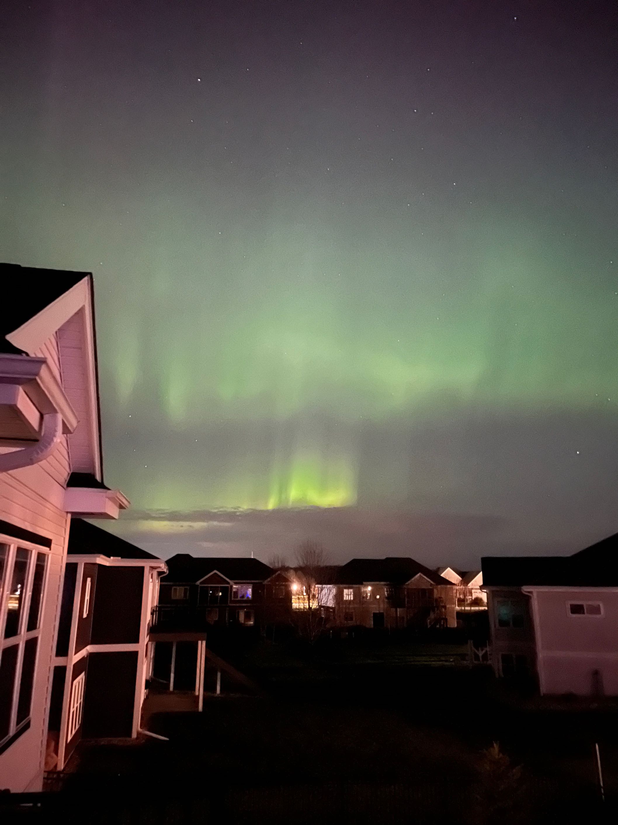
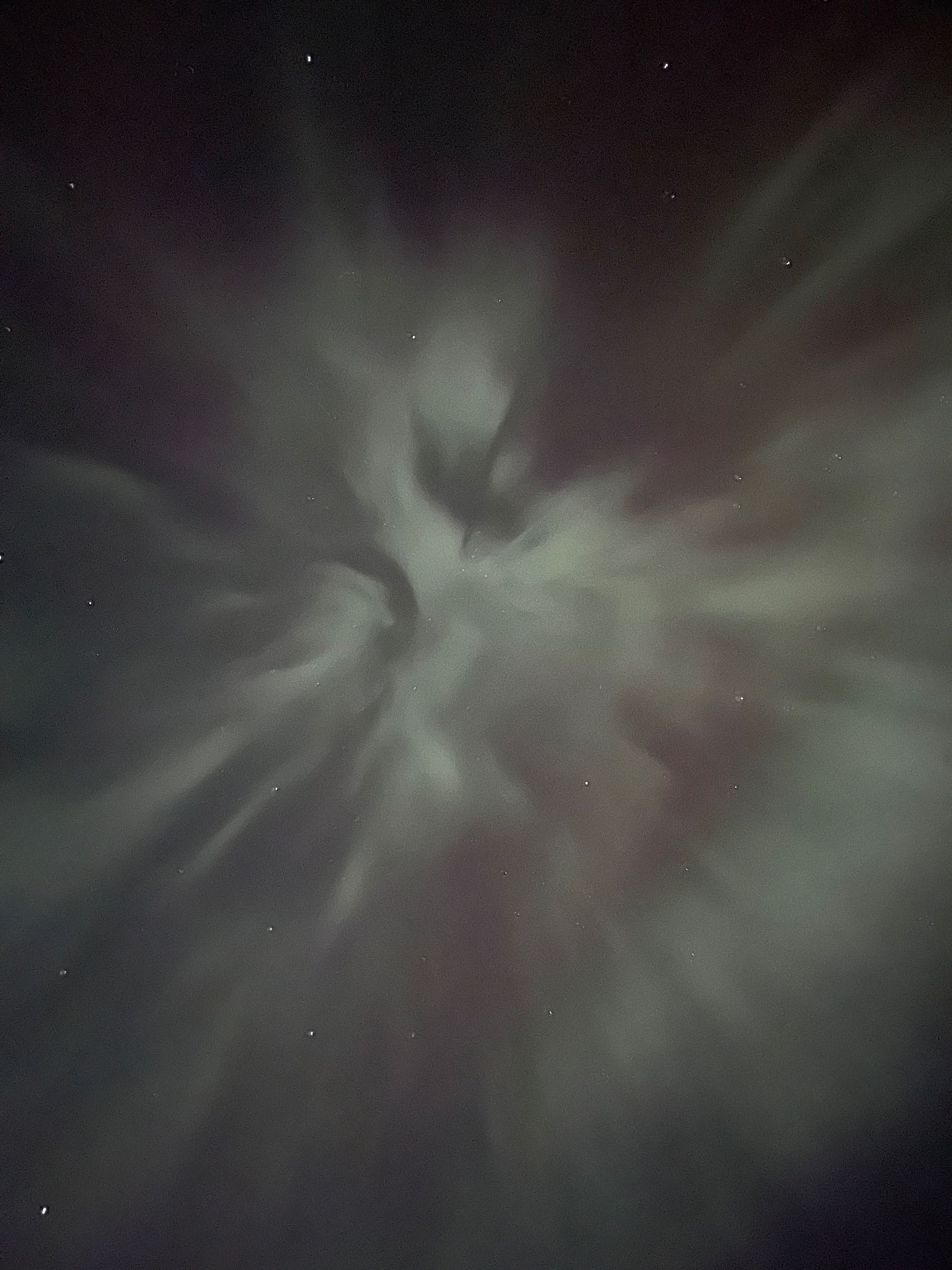
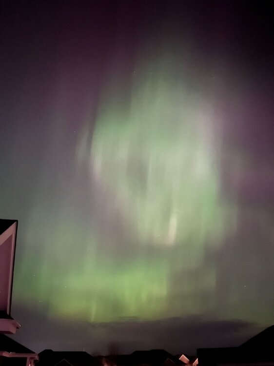
Last night was wild. Had a substorm come directly overhead at 1115 or so. Saw rapid pulsing of the lights throughout the entire sky


- 512 replies
-
- 11
-

-
Heads up for anyone with clear skies this evening. Looking good for a shot at an aurora display as big or bigger than we had last month
-

Spring 2023 Medium/Long Range Discussion
madwx replied to Chicago Storm's topic in Lakes/Ohio Valley
Around May 3/4 it looks like we'll transition to a warmer pattern -
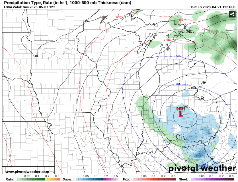
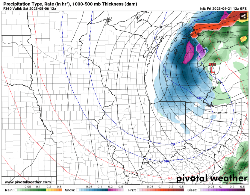
heck yes friends Bonus May 7 content for our Ohio users
-
2023 Short/Medium Range Severe Weather Discussion
madwx replied to Chicago Storm's topic in Lakes/Ohio Valley
had 8 diversions at MSN from planes that were bound for O'hare. Pretty neat seeing them parked all over the tarmac -
just want to add that these updates are great and appreciate you making them. Might have to go view the Mississippi later next week or the weekend afterwards.
-
2023 Short/Medium Range Severe Weather Discussion
madwx replied to Chicago Storm's topic in Lakes/Ohio Valley
make that 66/60. all gas no brakes -
2023 Short/Medium Range Severe Weather Discussion
madwx replied to Chicago Storm's topic in Lakes/Ohio Valley
Full sunshine here after the late morning round up to 63/58 -
2023 Short/Medium Range Severe Weather Discussion
madwx replied to Chicago Storm's topic in Lakes/Ohio Valley
The severe warned storms in Southern Wisconsin were occurring with temps in the upper 30s -
2023 Short/Medium Range Severe Weather Discussion
madwx replied to Chicago Storm's topic in Lakes/Ohio Valley
looks like a couple severe chances over the next two days. Elevated hailers tomorrow morning and a chance at some gusty storms along the front early Thursday afternoon -
we're really going to do the snow thing this weekend, aren't we
-
90 in La Crosse today
-
next week is going to be amazing. This is why April is the most important month to have Above Average temps each year
-
-
if this thing dynamically drills down to the surface and plants a wedge at 50/48, I'll be stunned Edit: Looks like it's trying to develop a rear inflow jet
-
that cell means business. just chucking out baseballs
-
-
The mid day elevated hailers are forming over south central Iowa. Should be up here in 4 hours or so
-
Looking like 3 potential rounds here. Mid day hailers. Potential surface based supercells around 7-10 pm and then a broken line of storms mid morning tomorrow