

frostfern
-
Posts
2,267 -
Joined
-
Last visited
Content Type
Profiles
Blogs
Forums
American Weather
Media Demo
Store
Gallery
Everything posted by frostfern
-
Definitely possible with the right setup. The main issue is the warm front position though. I think what mitigates things on this side of the state will be overnight convection slowing down the warm front rather than the lake. I think surface based cells or a line will probably move in from the SW ( not affected by the lake at all ) and affect the SE part of the state regardless. Have to see what happens tonight though with the elevated stuff.
-
Strong flow at 925 can mitigate negative effects over the lake. If there's enough surface backing there can be some enhancement. The southeastern side looks most favorable though. I get the feeling there will be broken initiation along the lake breeze, like right along 131, that then fills in and grows as it moves east.
-
I'm thinking it might end up more localized. The CAPE / shear combo is impressive, but if the warm sector is really that hot the greatest risk will be relegated to near the warm front. It's still a scary setup as the potential for an EF3 or EF4 happening somewhere is still significant. The southern zone over AR could be active again too.
-
So if I chase it's looking like Northern Illinois will be entirely after dark? I can get to Iowa after spending Monday night somewhere well south of Chicago, but it will be a long drive back to Michigan once it's over. Could be difficult driving in heavy rain too. I have obligations Wednesday. I will have to keep watching trends tomorrow morning. If the initiation is going to trend later in the evening and farther west than Eastern Iowa I might just forget it.
-
Its not quite as bad as Lake Michigan, but the Mississippi doesn’t have bridges everywhere. I also feel like you need the interstates to keep ahead of cells moving 50mph+. I don’t know if its the same everywhere but its definitely pothole season around here.
-
Rainfall over the next 10 days could be concerning with more than one strong system potentially tracking over the same area with multiple rounds of convection and stratiform precip as well. Even with snowpack long gone, pre-leaf-out rains will saturate the soil pretty quick. Flash flooding seems pretty much guaranteed some places.
-
Cells will be moving crazy fast though. I'd definitely study the road networks ahead of time in the target area.
-
It looks like a more of a cold-core setup that's more dependent on steep lapse rates than high dewpoints. If you can get large CAPE with surface temperatures only on the upper 60s, that's not a big dewpoint depression. I think early spring 70/58 ttd can be more of a tornado threat than 85/64 ttd late spring, given the same CAPE and shear.
-
Better to just hijack it with talk of sad palm trees. It's called NIMBYIDCS. Not in my backyard I don't care syndrome.
-
There's palm trees in Seattle, but they only really survive next to buildings and look pretty sad in the winter. Falling into the low 20s at night isn't uncommon at all with Fraser Valley outflows, even down to Tacoma. It tends to be even less modified by interaction with the Sound as you go north into Canada.
-
Worse. Rainer followed by CAD.
-
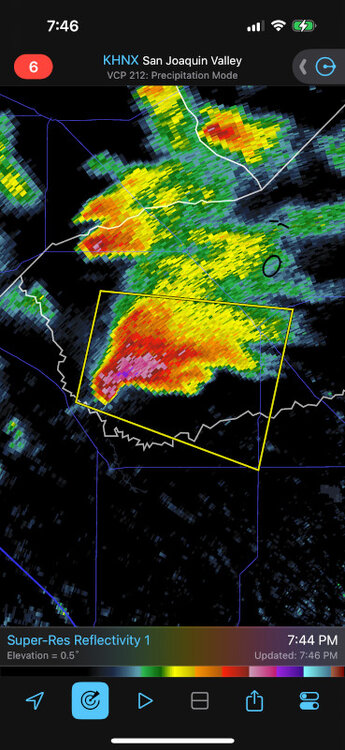
Anyone else watching the tornado warned supercells in California? Two cells are looking pretty impressive. Low topped but very high DBZ and VIL and occasional low level couplets appearing.
-
I saw my "pet" groundhog for the first time this morning, rooting around in the snow for bird feed. I thought maybe it moved away, but it's still here for the third spring. The burrow entrance is in the exact same place, but have no idea how far it goes.
-
Everyone focuses on severe weather, but I enjoy non-severe nocturnal storms as they are the best for recording thunder.
-
There was 9.5" in the grass right around daybreak this morning, but if you went out and measured now you'd never know it. It's already compacted and melted down to about 5" on the grass and 3" pure slush on sidewalks and driveways. Looking at the puddles I'd say probably 15% melting and 30% compacting. It seems the temperature had a huge impact on totals. When it was hovering around 30 it accumulated pretty efficiently, then it rose above freezing and instantly compacted to your standard 10:1.
-
About 9" here at peak fluff. I drops off a bit where I am, a bit NE from where you are. It's probably going to shrink some in the next few hours as it warms above freezing. The flakes are so large that it's not super dense, despite being a wet snow. It has that lake effect dendrite quality, despite being synoptic in nature. You could really see the elevated convergence zone just sitting over the line from just north of Holland to a little south of Lansing.
-
8” here and its still coming down pretty good.
-
Very heavy tree stickage with wet dendrites and not much wind. Radar has an interesting layered cellular pattern, like a checker-board from waves intersecting at right angles.
-
Okay. I brought that up. I don't think the purpose of winter storm warning is exactly the same as a tornado or severe thunderstorm warning. The threat isn't something so imminent that people need to be suddenly interrupted with whatever they are doing to be alerted. Yes, people will probably find out a storm is coming via hearsay or social media, but it's still good to have an official source that you can rely on for consistent wording. That is where NWS warnings are useful.
-
As much as people here take the piss out of NWS offices, I can't imagine relying on social media where people constantly spread hype and BS, whether knowingly or unknowingly. On a lot of platforms there's a monetary incentive to hype every event for clicks. Also, the general public is much stupider than you think. lol.
-
A snowstorm in Dallas is like a thunderstorm in Seattle. It's only noteworthy because it doesn't happen very often.
-
I don't mind *calm* bitter cold with a decent snowpack ( wind sucks tho ), but I concur with the clouds and 38-44 crap. It makes it really hard to want to get out of bed.
-
I remember December 2000. There was 60" here in that one month, and most of it was synoptic as opposed to lake effect. There was snow on the ground starting in the middle of November, and it didn't melt. The pack settled to a 12" glacier by the New Year, but it didn't fully melt until there was finally a major thaw in January. The rest of the winter was boring, but late 2000 was way better late 2022. There was one 20+" LE event, but the water content was about the same as the 6-9" slop that hit I-69 area yesterday. It melted so fast and there was nothing to follow it up.
-
It's pretty much over here. The first hour was grains and pingers that didn't accumulate to anything, then 90 minutes of fatties that accumulated to a little over 2". Now it's just spitting little grains again.
-
I don't think I will get more than 2-3" here. There's sleet mixing in again and the weenie band is shifting SE.


