

Carvers Gap
-
Posts
17,458 -
Joined
-
Last visited
Content Type
Profiles
Blogs
Forums
American Weather
Media Demo
Store
Gallery
Everything posted by Carvers Gap
-
 12z was flirting with something decent.
 -
My hoop house is up and ready. That guaranteed what the MJO shows this AM which is a potentially high amplitude rotation through phase 1. Beginning to see some modeling "feel" the MJO now as SLP tracks are now south of our area. Have a feeling that much colder air will insert itself into the pattern. I really don't disagree with the March looks that are AN. But embedded in that pattern may be a cold and stormy 7-10 day time frame...been that way almost all winter.
-
The 12z CMC ensemble mean is flirting with a trough around the 13th. So, that is the first model to maybe show some hint of a response to the MJO. We will see if that occurs in reality, but worth watching in the LR>
-
LOL...I don't envy having to release a March forecast for a living. I think we could see AN temps for March, especially the first 10-12 days. This kind of has the feel of the cold spell earlier this month where it go pushed back a few days, and a few more...then just finally arrived. Guessing a 7-10 time frame of abnormally cold temps gets sandwiched in there at some point. I don't see that on modeling at some point, but the MJO in phase 1 would flip modeling in a hurry without a lot of warning.
-
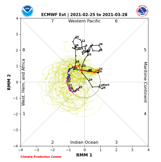
US modeling has now moved decidedly towards the EURO model suites in regards to the MJO moving into phases which correlate to early spring cold. Makes me think cold, maybe significant, might be lurking right past what operational models can reach with their 16 day range. If real, we should begin to see LR modeling over the weekend produce some cold solutions periodically from run-to-run and then get more consistently so by mid-week next week.
-
Here is the MJO...that is not warm for weeks 3. We will see if this verifies as US modeling is not really in support of that look right now. If the Euro verifies, we are currently in a reloading of the pattern very similar to what happened in January, and honestly, not sure many actually want to hear that cold might return. LOL.
-
Fortunately stuff around TRI is still well behind the last 2-3 years. Weeklies still hinting that some troughing is going to show up in the East around mid-March. Looks like the March 3 window will be a an amplifying trough into the OH Valley and deepens as it swings east which means just backside cold. The EMON MJO (connected to the Euro Weeklies which as just released this evening) is adamant that we rotate into very cold phases around the 15th. That would be jarring given the warm temps we are experiencing right now. IF that pattern is correct, I would not rule out a snowfall which is well out of normal climo for us in the valley. Man, I kind of like the weather today...MJO is just nasty around mid-March in terms of prolonged cool weather.
-
Half tunnel for the garden is about to go up! @Stovepipe, when are you starting your tomato seeds?
-
Definitely seeing bowling ball season commencing. Just need to get one below us and time it with a trough.
-
Short term, yes. Been saying the last week of Feb through March 3rd was going to be warm. If the MJO rolls to 1-3, the SER will be squashed at some point after that time frame. Seeing that scenario on some LR modeling operationals. Nothing a given at this point. Real question is does the MJO loop back to 7 or turn to 1-2. SER for the next week for sure. Going to be a swampy mess. I am of the opinion this is the same reset pattern that we have seen already twice this winter. I could be wrong...won’t be the first and certainly won’t be the last.
-
Rally cap...long shot stuff. I didn't feel like the 0z Euro was exactly benign centered on March 3. Also, the 12z para-GFS has a low which takes the low road, but with a less than optimal thermal profile around the same time frame. Cold is not exactly in play, but this is a ways out and things could change(for the better or worse).
-
The 12z EPS at 270 is textbook phase 8 for March. Trough tucked east of the Apps with ridging out West. Makes me think that ensemble may correct more.
-
Euro Weeklies 500 look looks like a very slow progression into spring. NAO refires and sends additional shots of cold into the East - at least two in March. Looks like a normal-ish spring time pattern. Keep in mind the 2m temps on the Weeklies are always warm. Have to actually look at the 500 pattern and temps at 850. Think we get a warm-up and more of the pattern from February. Looks very much like a pattern reload.
-
Still waiting for the warm-up! Cold rain here today - very cold. My summer forecast is easy this year...hot and getting hotter. Have seen several mets who have stated something similar, so that is nothing new. La Nina often means really hot summers IMBY.
-
Yes! Have a great time. Sunshine, is that even a thing anymore? LOL
-
My advice for folks is to pick a window which looks good, see if it has model support, look at the MJO for support, look for blocking, and see if modeling works back to your idea. MJO on US models this AM shows it migrating towards and into cold, very low amplitude background phases. I think we have a shot at snow right before the big warm-up, and then right as we get colder again as we should in early March if the MJO is only halfway right. Ensembles this morning don't look great for early March, but I am riding with the MJO right now and NAO block. We have seen this pattern all winter where models take some time to find the cold shot. Guess is that we see the NAO form on the east side of the block, retrograde back west in very early March, cold builds into Alaska, dumps down the front range, and then pours eastward for one last shot. It is not a certainty, but looks like a strong possibility. If the MJO cooperates, that could be a problem for the Eastern half of the country. Time will tell.
-
Off the top of my head(and I probably need to dig through the obs threads), I think my seasonal total is between 7-8" of actual events more than 1". I honestly have lost track of the nickel and dime stuff under 1". Rough calculation from the airport is 10" or so. That is probably pretty close for me. The airport for DJF has recorded 19 days with a trace or more. I have rarely scored so little while having so many days of recorded snow. LOL. But I am not complaining....Christmas Eve Storm along with the west/middle forum area event(and many other smaller events)...I have really enjoyed this winter. The Christmas Eve tracking will be one I will remember for a long time. Our mountains have had snow most of the winter which is kind of cool. @Math/Met, what is your total now? I think you might be running higher than me.
-
Snowed steadily for an hour or two here as well this AM - a trace in the grass. Reminds me of June out in Yellowstone. You kind of get the feeling that spring is waiting around the corner, but winter isn't quite giving up just yet.
-
Had yet another day running in the snow. I have never seen so many days of snow with so few inches of it! LOL.
-
It is crazy. We are in a pattern where we have a threat about every 7-10 days. I really like the March 3rd -15th timeframe. MJO is less hostile(unless it dives into 6). The EMON and Euro really like the MJO heading into background cooler/colder phases. US modeling is not there yet. Just get us some cold into this active weather pattern, and let's see what it can cook up! LOL.
-
Looks like another system for middle and west just glancing through the 192 panels. GFS is all E TN, but it really struggled with this current system.
-
So the 12z GFS and the Euro at 192 are trying to snow during the warm-up. That is a change.
-
We haven't had a load of snow at TRI this winter, but I decided to see how many days in the snow we have run. Double checked it with records at TR...looks like TRI has received 17 days of a trace or more. Talk about nickel and diming. It doesn't amount to a lot as there are a ton of dustings. We do a lot of running above 2,000', and that has been out of commission due to mud and snow during the past couple of weeks. Again, I "think" one last window awaits just after March 3rd. One word of caution, some of these warm-ups have actually had chances during those time frames. Wavelengths during spring can cause abrupt swings as you all know.
-
It is worth noting, and I can tell this due to my running journal, that we are getting events about every 7-10 days in NE TN. We have run in a lot of snow and slop this winter - more days than I have seen in some time. We have also run in A LOT of mud.
-
An upper South skiff of sleet IMBY this AM.

