Met1985
-
Posts
16,491 -
Joined
-
Last visited
Content Type
Profiles
Blogs
Forums
American Weather
Media Demo
Store
Gallery
Everything posted by Met1985
-
Bank on a little bit of everything at this point.
-
That's why I don't understand yesterday how so many Mets were mentioning the AI solutions. Been like that all season with them.
-
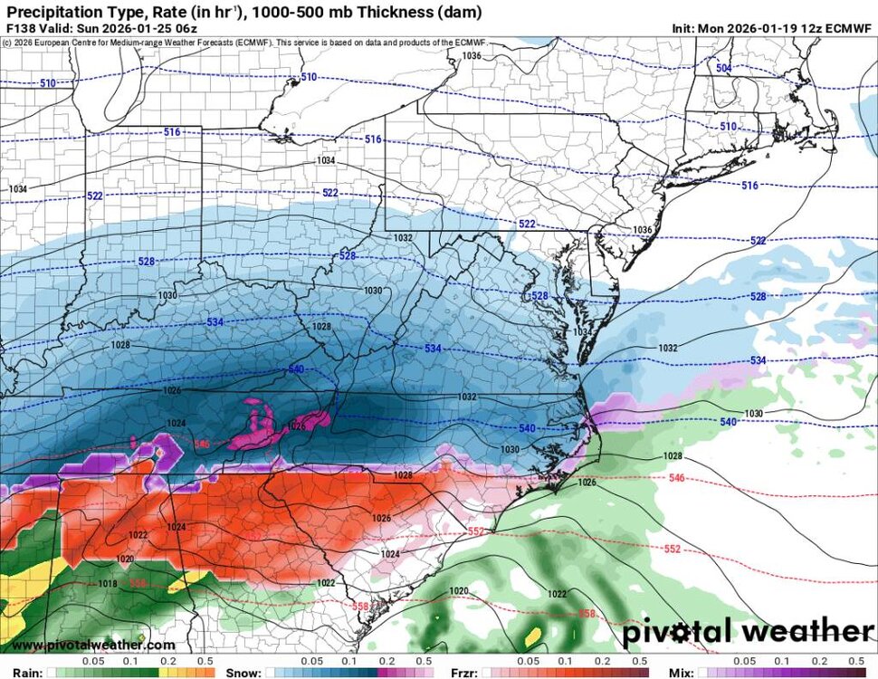
00z euro. Lots of snow then ice. Would be a nightmare. Sent from my SM-G998U using Tapatalk

-
WNC would be shut down for weeks.
-
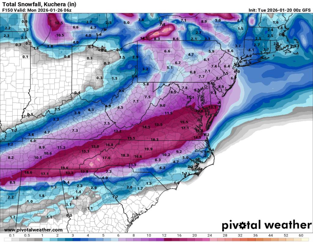
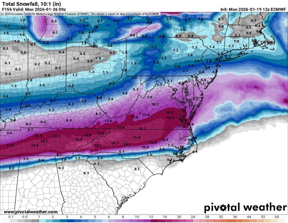
6z gfs. Absolutely smoked. We've not seen these modeled totals this close in several years. Sent from my SM-G998U using Tapatalk
.thumb.jpg.89d3343bd5993efc1b6b595bc7d97489.jpg)
-
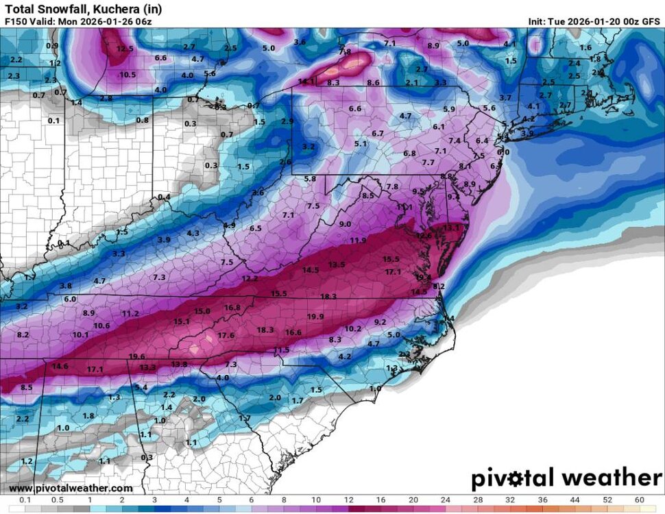
00z gfs Sent from my SM-G998U using Tapatalk
-
The models don't bring in the bulk of the precipitation in until either early Saturday morning or late Saturday morning currently.
-
He makes no sense otherwise than wishcasting and riding the AI solutions because they put his backyard in a better position.
-
The Euro alone would be blockbuster for the rest of the winter....
-
We are all feeling that.
-
Yeah a lot of bullshit on the socials today.
-
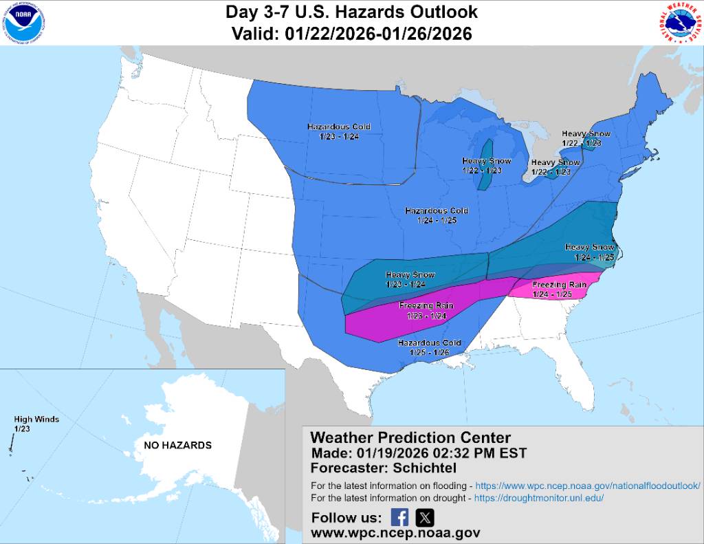
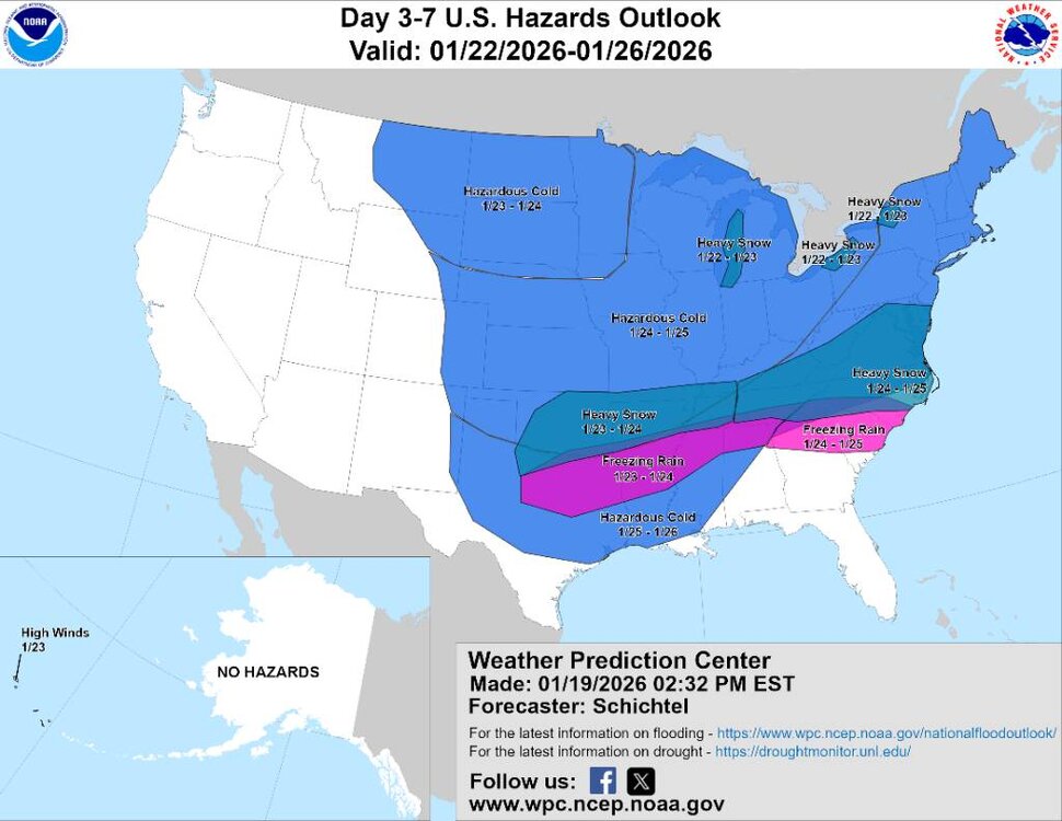
Wpc Sent from my SM-G998U using Tapatalk
-
Nice to look at. Sent from my SM-G998U using Tapatalk
-
He's riding the AI versions and saying this will cut. I mean the high pressing down would have to be weaker for that to happen.
-
I know everyone is excited about the possibility of a storm this weekend but the Euro is showing a very stable cold pattern the next 10 days as well.
-
He's leaning on the AI models which makes no damn sense.
-
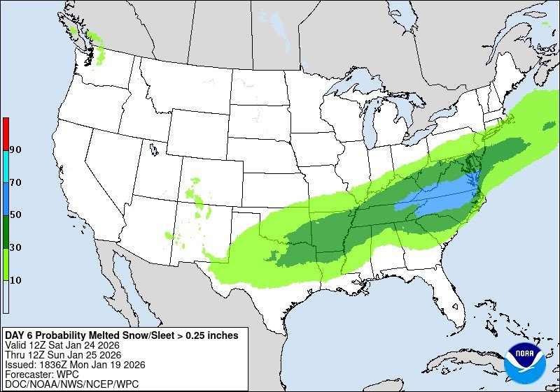
You are right! Between the snow, sleet and freezing rain for sure.
-
Lol we all posting the same thing. Anyways Euro was epic. I like it.
-
This would close the state down... Sent from my SM-G998U using Tapatalk
-
This would be absolutely puking snow here. Sent from my SM-G998U using Tapatalk
-
Huge run for us on the Euro.
-
Euro finally running.
-
Yeah they do. I've seen Franklin go from snow to rain we stay snow and Asheville mixes. Can get crazy in these setups.
-
I don't even look at the UK anymore.
-
This could be a real mess and Asheville will not be prepared if this comes.


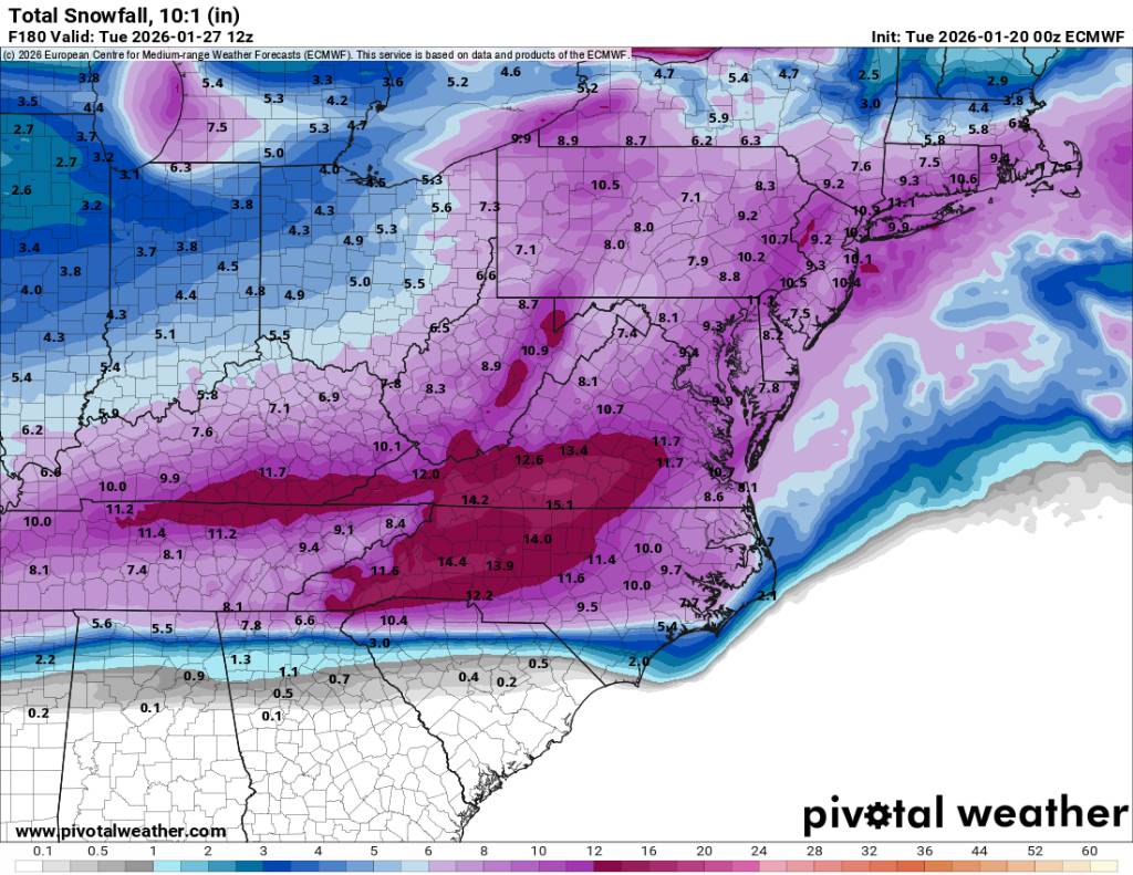
.jpg.1dec93d1965218754f2619a31b0c4d8e.jpg)