

Met1985
-
Posts
16,866 -
Joined
-
Last visited
Content Type
Profiles
Blogs
Forums
American Weather
Media Demo
Store
Gallery
Everything posted by Met1985
-
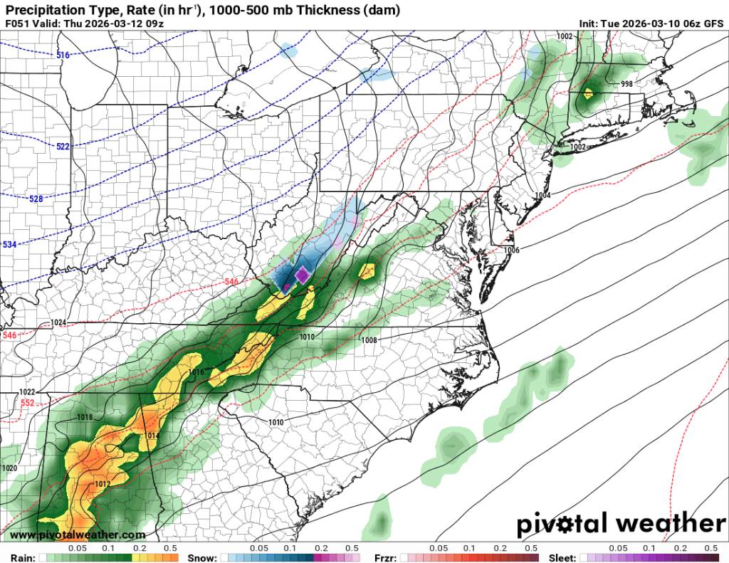
It's coming. Just taking It's time getting through. A ton of water on the road this morning with heavy rainfall.
-
Heavy rainfall currently. As im heading out down to 45 degrees.
-
Front seems to be lagging. Current temp is 47 degrees with rain. Looks like some heavy rainfall from the south is fixing to hit so well see.
-
We literally go from storms to snow. Must be crashing temps right around 5 and 6 because that's when it looks to hammer. For posterity measurements, it's currently 65 degrees at 9am... Sent from my SM-G998U using Tapatalk

.thumb.jpg.010392ab44981ec77f39d60bfed8b0c7.jpg)
.thumb.jpg.953221ed90deb1484dca0c1f79f44553.jpg)
-
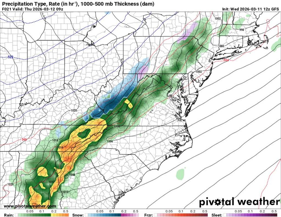
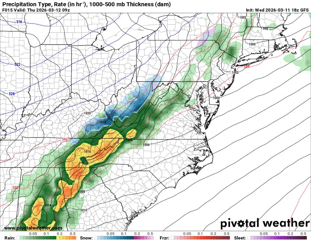
NAM says heavy rain to heavy snow. Sent from my SM-G998U using Tapatalk

-
Crazy. 80 degrees today and tracking snow for tomorrow and next week.
- 282 replies
-
- 4
-

-
- severe
- mountain snow
- (and 1 more)
-
GFS is steady as she goes. Sent from my SM-G998U using Tapatalk
.thumb.jpg.673d1ea3236a27ebd2aeec2750e36f20.jpg)
.thumb.jpg.0090f40edabd1a237b13b279715a2a9a.jpg)
-
NAM showing some love. Sent from my SM-G998U using Tapatalk
.thumb.jpg.5334c187395398fba9b412db08d7db27.jpg)
-
Yalls 24 hour temp change down east is going to be something else. Going to be a 40 to 50 degree temp drop.
-
I know everyone is enjoying the beautiful weather, but reality is about to hit again. Looks like we get some very heavy rainfall with storms tonight, then a quick changeover to possibly a heavy burst of snow with maybe some flow snow on the back end. Sent from my SM-G998U using Tapatalk
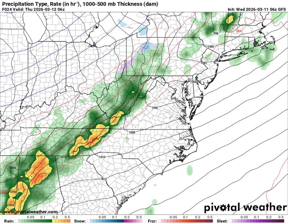
.thumb.jpg.47e5c390948a73396bccb49bda32e415.jpg)
.thumb.jpg.eb71ddf176ccabd3654ca0b70946827d.jpg)
.thumb.jpg.c5a21d960c85ed22af9106d4c1ff880a.jpg)
-
Yeah this heat wave is impressive. What's going to be really impressive are going to be the 24 hour temp changes and next week even colder with the cold air.
-
Short but will be stout. Currently looking at the low to mid teens here in the mountains with flow snow.
-
Whether snow or no snow the cold air is coming again.
-
Also lets wait to start our Spring/Summer thread the first of April.
-
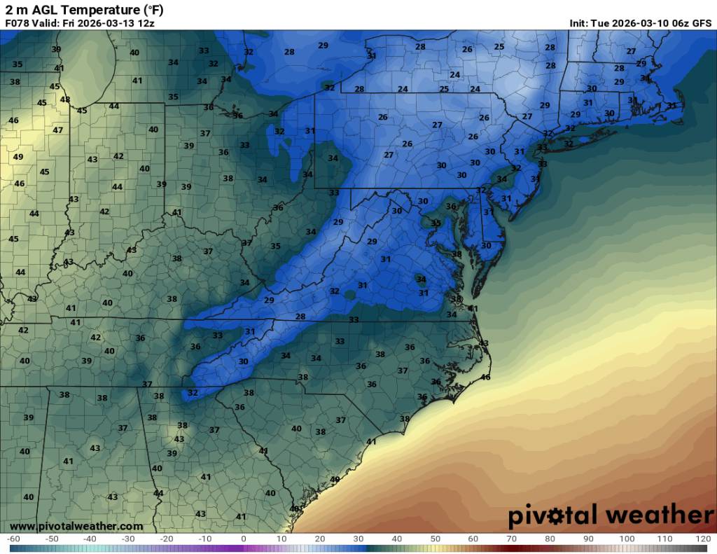
Next weeks cold shot is going to be a shock also. Highs around 30 with snow in the air and Tuesday morning lows, possibly around 10 degrees or lower... Sent from my SM-G998U using Tapatalk
.thumb.jpg.e8e6da0d16fa5b4324bf99091aef4050.jpg)
-
Lows in the 20s for a lot of us Friday morning. Actually temps will be probably be in range of 35 to 45 degrees for a high Thursday. That could be some 35 to 40 degrees temp change in 24 hours. Sent from my SM-G998U using Tapatalk

-
Speaking of one extreme to the next. This is as extreme as you can get. 90 1 day and possible flakes the next. Sent from my SM-G998U using Tapatalk
.thumb.jpg.11f002d39b5e5e8b5fe9b29dc4935b29.jpg)
-
Still looking like we go from storms to possibly some flakes Thursday in the high terrain. Sent from my SM-G998U using Tapatalk
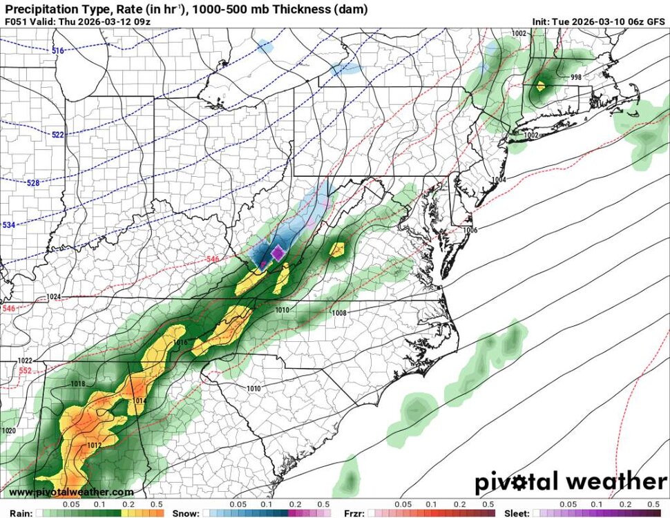
.thumb.jpg.5b4f280946967e25b8d3cc398bd01b19.jpg)
-
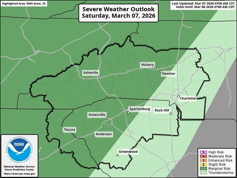
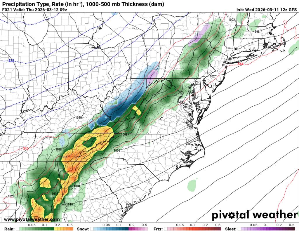
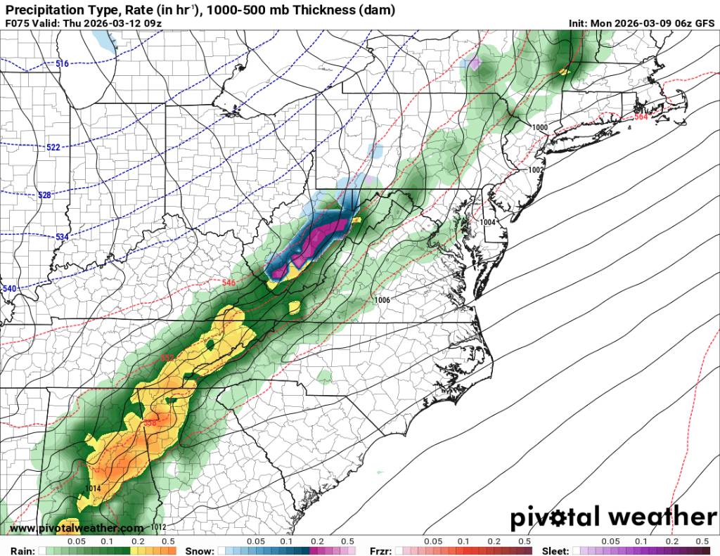
Looks like Thursday we could see a line of severe storms come through early in the morning then possibly some flakes on the back end of this cold front. Sent from my SM-G998U using Tapatalk

.thumb.jpg.db5b88d83797c454fbe88396cc78ae6b.jpg)
-
Yeah going to definitely get cold again.
-
Might be some severe storms this evening around the area. Sent from my SM-G998U using Tapatalk
-
For those thinking this weather is a bit early. Wait about 10 more days and things will definitely correct course.
-
Good thing the GFS can only be trusted from about 5 days out.
-
What a raw day today. After a high of 68 yesterday. I had a high of 45 today.
-
It'll come.

.jpg.1f2b4d5c68e25db403652831f0c24d01.jpg)
.jpg.17f4321e0fa85219375e866e56cc1f83.jpg)

.jpg.429b5582df5506ce4140edb8f57fcd34.jpg)
.jpg.886e8b520984dbee15b0d91b28decd8e.jpg)
.jpg.5e11fd7ff1ca5de5e803301ff54eb14a.jpg)

.jpg.bd30effb6cd84e916b5ff478271ed976.jpg)
.jpg.ae1e08c6592a2ac8c056e3487550d7aa.jpg)
.jpg.90263155a63fda7442d177b34f2b3ad3.jpg)

.jpg.ec5418e4e8a96c1eded725fa5712d1bd.jpg)
.jpg.8f64275c318b8fefb96d92eadb60dadc.jpg)
.jpg.e57f1d9c124923964fc5fd294d790283.jpg)
.jpg.fbea87da110e2e2ff5442e35443a4e6b.jpg)


