

Met1985
-
Posts
16,911 -
Joined
-
Last visited
Content Type
Profiles
Blogs
Forums
American Weather
Media Demo
Store
Gallery
Everything posted by Met1985
-
Also the wind is going to be cranking tomorrow afternoon into tomorrow night. We will probably see temps crash fast as the front blows through. Could see some dramatic temperature drops all at once with temps heading to the single digits and teens.
-
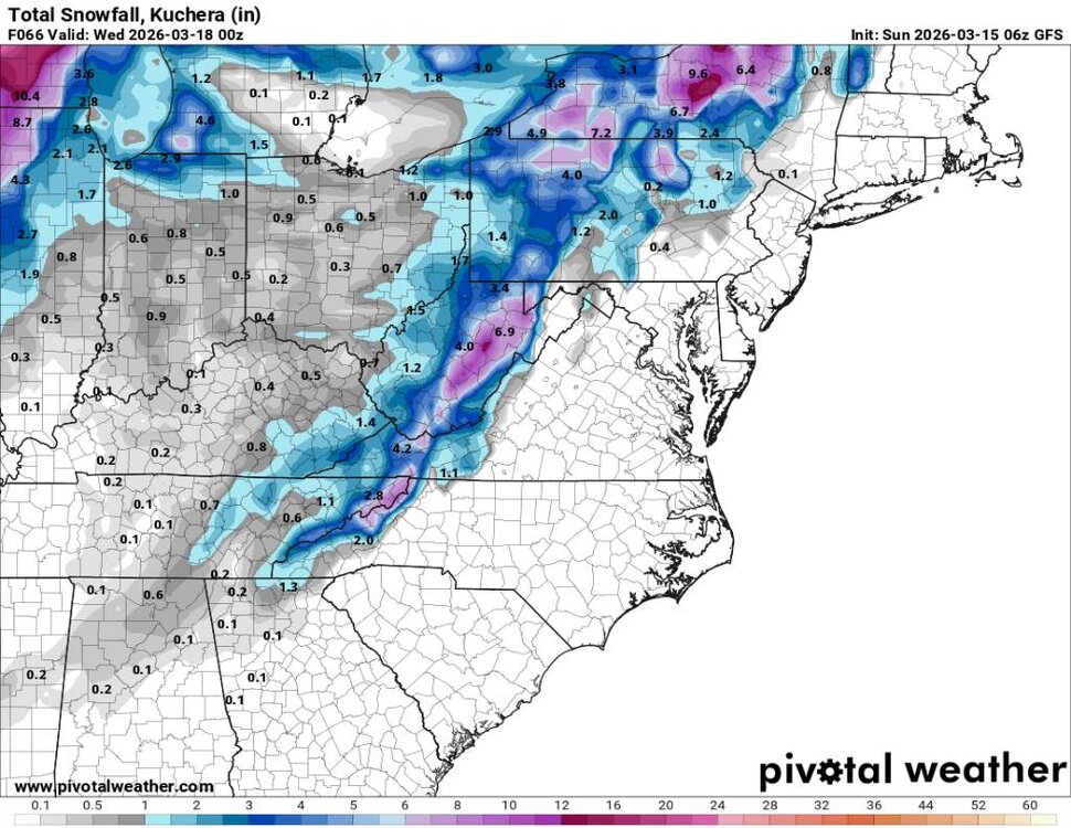
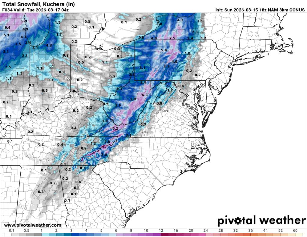
NAM 3k showing some very heavy snowfall tomorrow afternoon around the area as the low blows up over us. This could make for some fun times. Sent from my SM-G998U using Tapatalk
.thumb.jpg.5e80ec7bbdfd1854d1e7de1c81243492.jpg)
.thumb.jpg.72fc3829eaff57e6aa8cba020fe02542.jpg)

-
Yeah you are right about that. Merrill is pretty nice. I worked for Canadian National railroad as a freight train conductor when I was living there.
-
Lived in Wausau back in the day. That place is cold and snowy.
-
Going to be some back to back cold cold nights. Sent from my SM-G998U using Tapatalk
.thumb.jpg.34f6a8572c028dbaeeb0768f5c2a12a4.jpg)
.thumb.jpg.5ac50cc269ee8a9a4cf3ef9ba25ffd41.jpg)
-
Going to be a huge temp crash tomorrow during the day. Sent from my SM-G998U using Tapatalk
.thumb.jpg.1326cfe19d6d6e19b24f9d6c0285e7b8.jpg)
.thumb.jpg.c7bd2219262c397c7cda8d7afd5e481e.jpg)
-
Looks decent Sent from my SM-G998U using Tapatalk
-
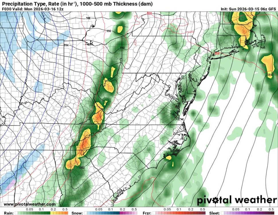
This is a more potent cold front and storm system coming in tonight and tomorrow. Again, we will go from heavy rainfall to snow on the backside, and it looks like we may see some flow snow into Tuesday now. Sent from my SM-G998U using Tapatalk
.thumb.jpg.d2126114b9b5f81b74effe55afe473be.jpg)
.thumb.jpg.f994f06e5e835ba0a6b15b34764ebc36.jpg)
.thumb.jpg.4cb669f2d0a32ddfe3354a7cb0bf0f5b.jpg)
.thumb.jpg.9853eb223d7be7bf344996e3da15a492.jpg)
-
North Georgia may see some flakes in the air. I wouldn't expect anything to lay down there this time of the year. But yeah some blowing snow sure.
-
Holy smokes this looks like one hell of a storm. Kind of reminds me of the Blizzard up in Wisconsin about 7 or 8 years ago.
-
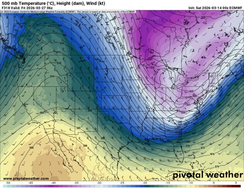
Obviously, this is out at range, but this will happen either by the end of this month or in April. Blocking will form again because of the cycle we've seen so far. Sent from my SM-G998U using Tapatalk
.thumb.jpg.1f59b804745893417d3a415af8a7c27b.jpg)
-
Low of 24 degrees this morning. Cold morning.
-
By by early buds. Temp down to 32 degrees already.
-
NW flow has commenced along the border. Also im getting legit light snow now with a temp of 36 degrees at work.
-
Blowing snow now near Enka Candler.
-
Yup getting a wintery mix here on Smokey park hwy. Snowing at home per reports. Not sticking but Snowing.
-
Snowing good at Cataloochee ski area with the ground turning white.
-
Got to love the weather in the mountains!
-
80 degrees yesterday here in the mountains and snow this morning.
-
Absolutely hammering the rain here in Buncombe and Haywood county currently.
-
It's coming. Just taking It's time getting through. A ton of water on the road this morning with heavy rainfall.
-
Heavy rainfall currently. As im heading out down to 45 degrees.
-
Front seems to be lagging. Current temp is 47 degrees with rain. Looks like some heavy rainfall from the south is fixing to hit so well see.
-
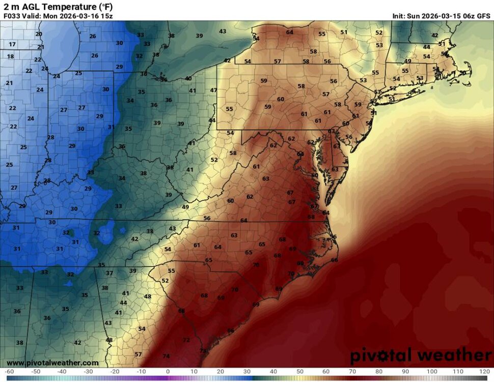
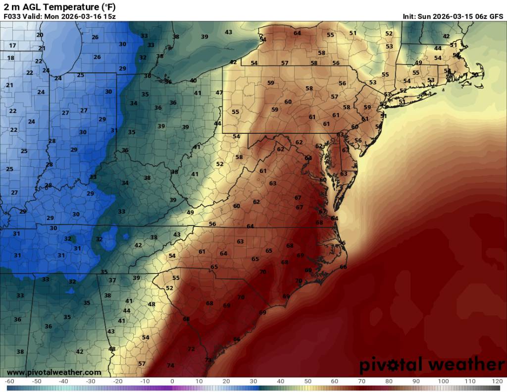
We literally go from storms to snow. Must be crashing temps right around 5 and 6 because that's when it looks to hammer. For posterity measurements, it's currently 65 degrees at 9am... Sent from my SM-G998U using Tapatalk

.thumb.jpg.010392ab44981ec77f39d60bfed8b0c7.jpg)
.thumb.jpg.953221ed90deb1484dca0c1f79f44553.jpg)
-
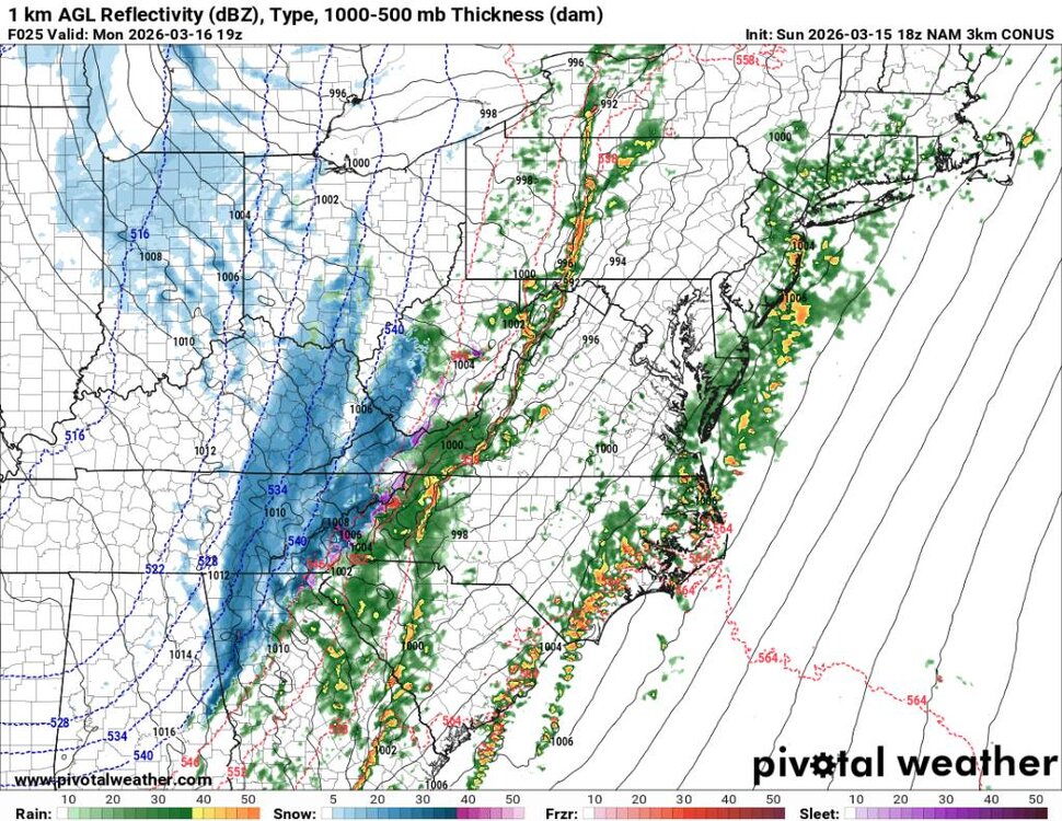
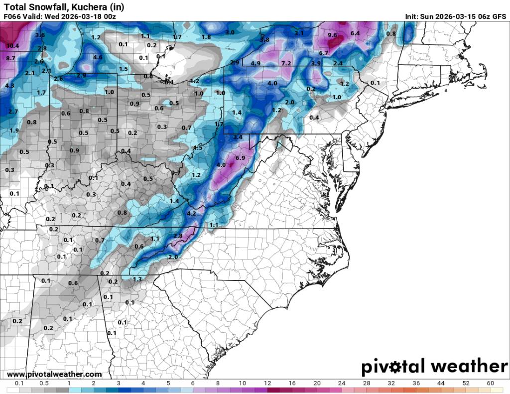
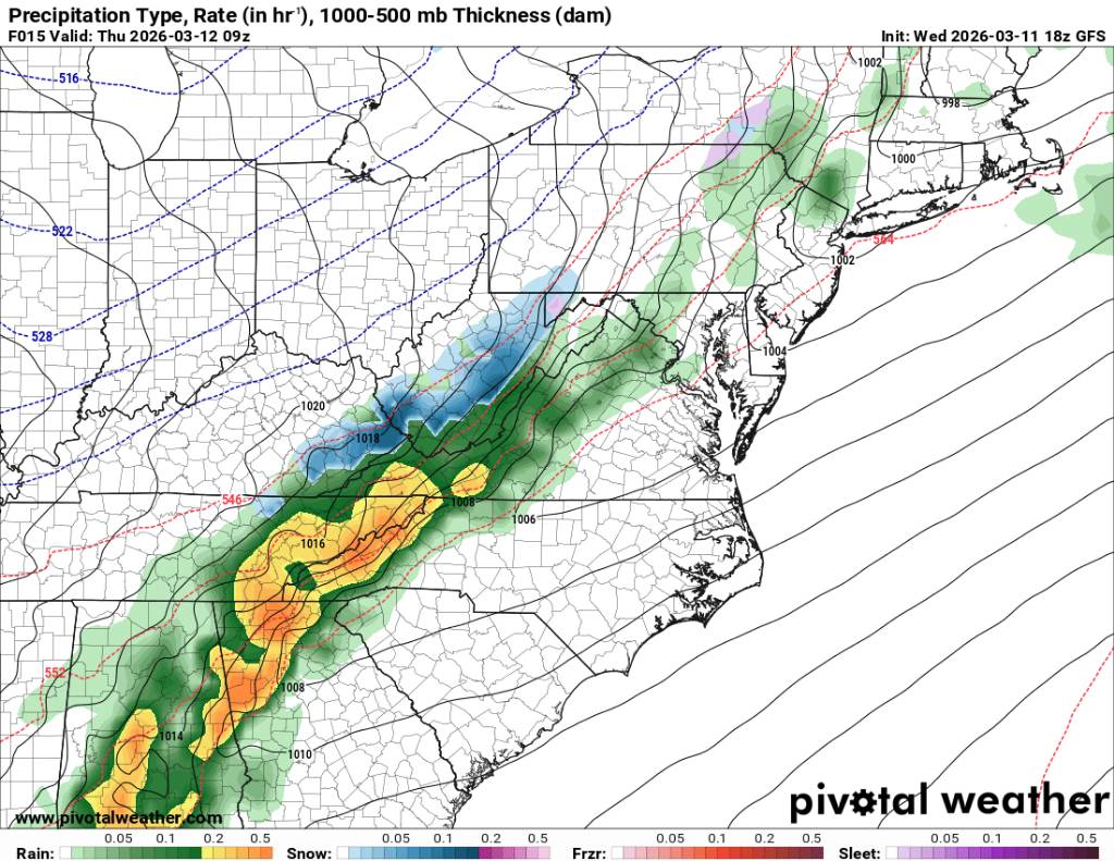
NAM says heavy rain to heavy snow. Sent from my SM-G998U using Tapatalk


.jpg.0b810301aadee02e295e6d2c61de9e6d.jpg)
.jpg.f5c12fd8f09739786a78b2c1412fbe7c.jpg)
.jpg.2600828088bfb137225aecca456ca9d4.jpg)
.jpg.f16e795eac6bd9d762c42fcc327f9ad4.jpg)
.jpg.8d79dd88ec4041e0674b41ecd6be1d47.jpg)
.jpg.e0713078267bf8fd67f6dc8536b67d75.jpg)

.jpg.2a3ff079b929b0c6e3a16d06ecf731f1.jpg)
.jpg.eb767b0de617b4fcd40175a60f9f0078.jpg)
.jpg.b18b52617949a54eae1f0230ac2a1ca5.jpg)
.jpg.69b34e63074e9b7fcc3da3e864e495de.jpg)


.jpg.927a60fbff36f3abec3b2a00524e3385.jpg)


.jpg.1f2b4d5c68e25db403652831f0c24d01.jpg)
.jpg.17f4321e0fa85219375e866e56cc1f83.jpg)
