Met1985
-
Posts
16,911 -
Joined
-
Last visited
Content Type
Profiles
Blogs
Forums
American Weather
Media Demo
Store
Gallery
Everything posted by Met1985
-
Had a high today of 34 degrees with a current temp of 31. Impressive for today.
-
Dang. Haven't seen you post in a minute. Was thinking you'd be buried.
-
25 degrees at work at noon. Very impressive for really any time of the season but especially in mid March when our average is 60 degrees.
-
Won't be much but as cold as it is a little light snow could cause some road problems tomorrow morning. Sent from my SM-G998U using Tapatalk

-
Another thing is don't look now but looks like the AO and NAO are looking to go negative towards the first of April. Also the PNA looks to ease up so don't get too excited for long term warmth.
-
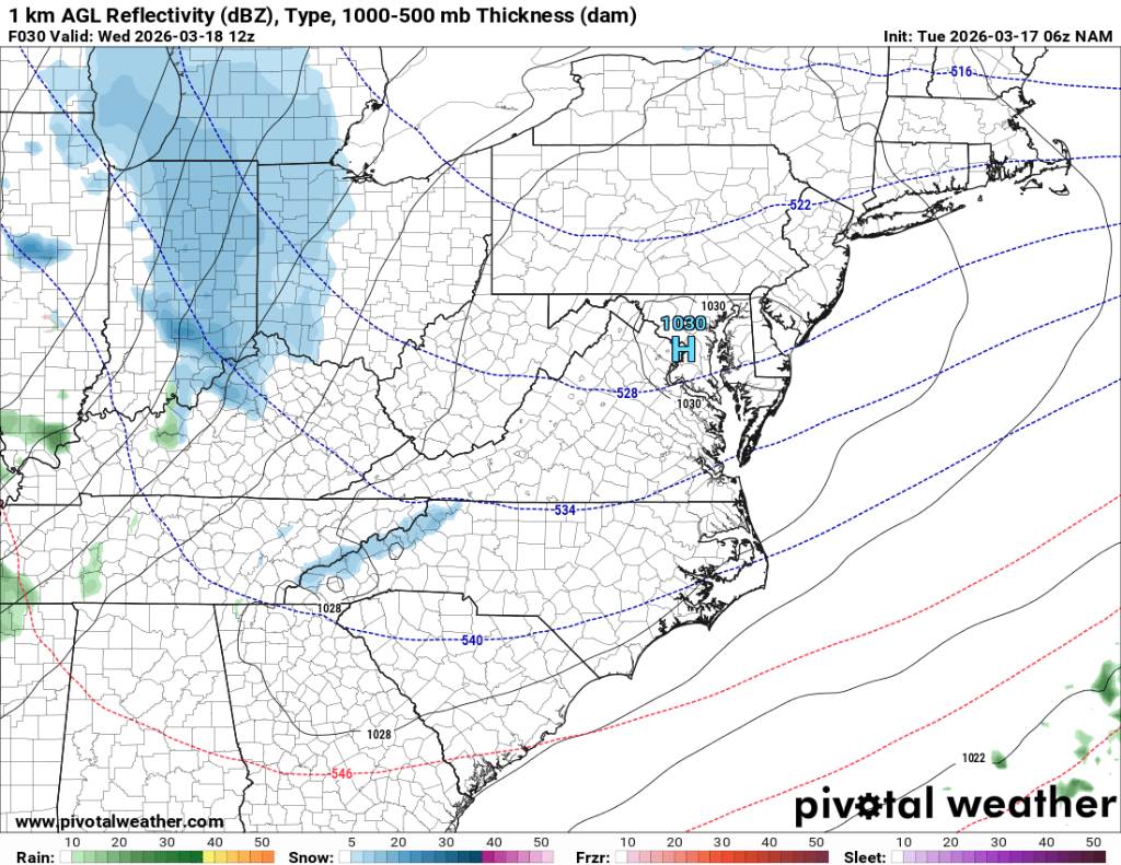
Also a lot of moisture still flowing in from TN along the border so there still should be some accumulation today in places.
-
Yeah no kidding. Both it and the Euro have had some big misses this season but the gfs has hanged tough for the most part.
-
Also this is impressively cold for this time of the year. At my place according to the almanac I hit a record low of 15 degrees and today's highs will be some 25 to 35 degrees below normal. Highs will range probably from the 20s to the 30s and teens again tonight.
-
Also the GFS did the best job on this again. The Euro wasn't even close.
-
Correction on my snow totals. I forgot about the last big snow. Currently im sitting at 30.5 inches for the year.
-
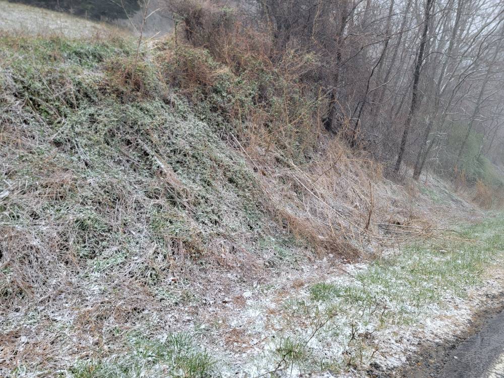
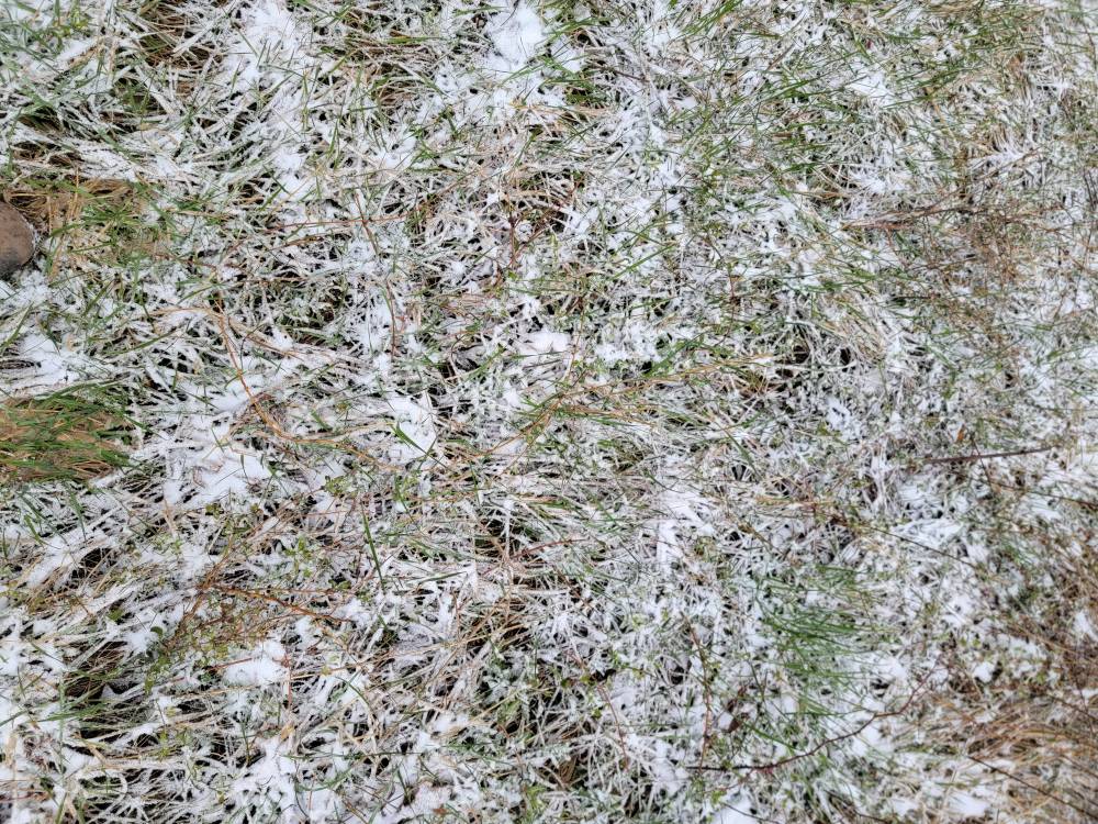
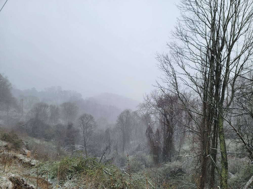
Looks like mid winter here at work. Half an inch on the ground and light to moderate snow. I was impressed with how easy the snow laid on the roads this morning after being in the 70 to 80 degree range last week.
-
Somehow I got back into the flow overnight. I have light snow this morning with an additional inch overnight. Current temp is a cold 15 degrees.
-
Looks like about a half inch does it for me. Blue skies and calm winds with a temp of 23 degrees. Should drop down really nice tonight.
-
You're doing better than me. I've had some blue sky this evening come through. This flow is prime for you.
-
Temp down to 27 degrees.
-
A clash of two seasons. Sent from my SM-G998U using Tapatalk


-
Hammering. Sent from my SM-G998U using Tapatalk
-
Just getting home and it's a whiteout.
-
Back end is coming around but then flow snow kicks in.
-
Moderate snow and sleet at work. Windy and really coming down.
-
Eh might squak out an inch overnight.
-
Sleet snow mix now.
-
Moisture looks great through TN.
-
Rain and 39 here in West Asheville.
-
Temps falling fast here in West Asheville. Down to 41 degrees.